Annual recession measurements were made, as has been the custom for
several years, on the Emmons, Nisqually, South Tahoma, Carbon and
Paradise Glaciers during the month of September. The first four named
are alpine or valley glaciers which are known to have a downward flow
and are thus know locally as "living" glaciers. The Paradise Glacier is
a cliff glacier or glacieret that has very little, if any, downward
movement and is therefore known locally as a "dead" ice field. The
Emmons and Nisqually have their origin in the neve field at Mt.
Rainier's summit while the Carbon and So. Tahoma originate in great
cirques or catch basins about the 10,000 foot elevation. The glaciers
measured were selected because of these facts, because of their position
on the flanks of "the mountain" and because of other minor factors that
may have a bearing upon glacial recession here. These figures then may
be considered as indicative of the recession of all glaciers of Mt.
Rainier.
These recession figures from Mt. Rainier Nat'l Park are of particular
interest in as much as this national park possesses the largest glacial
system radiating from a single peak in continental United States. There
are 28 named glaciers aggregating some 45 to 50 square miles of ice.
On Sept. 22nd, 1930 a metal marker was placed in a fissure on top of
a large boulder on the south side of the Emmons Glacier near its
terminus and a line bearing N. 30 degrees West was established. This
glacier is very difficult to measure with any degree of accuracy due to
its irregular and wide snout. The point from which the main stream
emerges is considered the terminus of the glaciers in the case of
recession measurements. This is to establish a definite point upon the
usually irregular snouts from which to measure in future years. In the
case of the Emmons the recession is tabulated by measuring from a point
on the established line to the place from which the main stream
emerges.
1930- Point, backsite and line established.
1930-1931 . . . . .
recession of 142 feet.*
1931-1932 . . . . . recession of 2-1/2
feet.**
1932-1933 . . . . . recession of 48-1/2 feet.
* The great recession figure noted in this case was due to the fact
that the ice above the stream had melted back in a deep and narrow cleft
or horseshoe. This was brought about probably by a more rapid downward
flow at the surface of the ice, causing it to shove out in the form of a
lip and then break off under its own weight. Lobes of ice flanked this
narrow cleft - the ends of these lobes being about 95 feet from the line
of site instead of 142.
** In October, 1932, it was found that the main stream had changed
its course beneath the ice and was emerging from a different place much
nearer the line of site than the point on the ice that was farthest
removed from the established line. The point of issuance of the main
stream, then, was but 2-1/2 feet farther back than the point of issuance
of the main stream in 1931. The farthest ice from the line of site was
161 feet, which would have exhibited a recession of 19 feet had we been
measuring from that point. These irregularities will occur in the
future, but the average recession over a period of years will exhibit a
true perspective of the rate of backward movement of this glacier. At
the end of 1933 the Emmons presented no great difficulty.
CARBON GLACIER: Lowest perpetual ice in continental United
States. Elevation, about 4,000 feet.
Markers were placed at different points both in 1930 and in 1931, but
each year they were destroyed or washed out in some manner. In October,
1932, a marker was placed in a position that was retained, and so this
year we have the first recession figure on this glacier.
1932- Marker from which recession measurements will be made in the
future established.
1932-1933 . . . . . recession, of 12 feet.
NISQUALLY GLACIER: Most accessible glacier in the United
States. Easy trail from highway to snout about one-third of a mile
distant. Annual measurements have been made since 1918 and previous to
that time reliable historical data furnishes an idea of the position of
the Nisqually's snout since 1857.
| Recession |
|
| Recession |
| 1857-1885 . . . | 760 feet. |
|
1925-1926 . . . | 86 feet. |
| 1885-1892 . . . | 140 feet. |
|
1926-1927 . . . | 43 feet. |
|
| 1892-1918 . . . | 1310 feet. |
|
1927-1928 . . . | 89 feet. |
| 1918-1919 . . . | 59 feet. |
|
1928-1929 . . . | 52 feet. |
| 1919-1920 . . . | 46 feet. |
|
1929-1930 . . . | 118 feet. |
| 1920-1921 . . . | 106 feet. |
|
1930-1931 . . . | 49 feet. |
| 1921-1922 . . . | 67 feet. |
|
1931-1932 . . . | 50 feet. |
| 1922-1923 . . . | 44 feet. |
|
1932-1933 . . . | 44 feet. |
| 1923-1924 . . . | 83 feet. |
|
1933-1934 . . . | ? feet. |
| 1924-1925 . . . | 73 feet. |
|
(Note: the sketch serving as the cover of this issue of Nature Notes
is of the snout of the Nisqually Glacier as it appears today.)
SOUTH TAHOMA GLACIER: Recession studies were begun on this
glacier in October, 1931 - at which time a large rock on the moraine
immediately in front of the glacier was marked. Recession data
follows:
1931- Point from which future recession measurements will be made was marked.
1931-1932 . . . . . recession of 27 feet.
1932-1933 . . . . . recession of 13 feet.
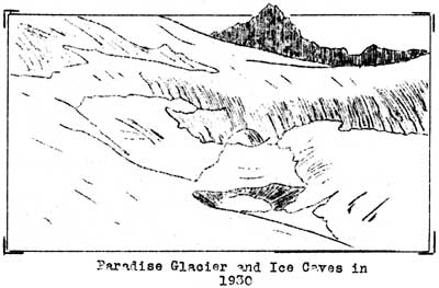
PARADISE GLACIER: A cliff or "dead" glacier famous for its ice
caves. As the front of this glacier is very broad, three points were
established in 1932, and measurements will be made from all three each
year in order to get a better idea of the recession of this ice field.
In the past it is quite evident that the Paradise has shrunk a great
deal in size. However, due probably to the heavy snow of the past two
winters, the Paradise has receeded little recently. Last winter's snow
did not entirely melt away and, in fact, one of our points was still
obscured from view by several feet of snow and was eliminated from the
tabulation thereby. It is possible that the ice at that point receeded
not at all and probably extended itself beyond the point of the previous
year. Tabulations follow:
| Year | Dist. from ice. | Recession. |
|
| 1932 | A-13 feet
B-38 feet
C-45 feet |
Points est.
in this
year. |
|
| 1933 | A-covered with snow
B-43 feet
C-52 feet |
-----
5 feet.
7 feet. |
|
NOTE: If these recession figures cause you worry lest the glaciers of
Mt. Rainier - one of the principal features of interest here - disappear
before you get another chance to see this park, just let it pass.
Figure it out for yourself. The Nisqually, for instance, is about five
miles long, and at the present average rate of recession, the Nisqually
will have the status of a glacier at least for about 5,000
years.


