Environment, Prehistory & Archaeology of Mount Rainier National Park, Washington
Greg C. Burtchard
Chapter 4:
THE 1995 MOUNT RAINIER ARCHEOLOGICAL RECONNAISSANCE
(continued)
THE NEW PICTURE, REPORTED PREHISTORIC SITES
AND ISOLATES 1991-1995
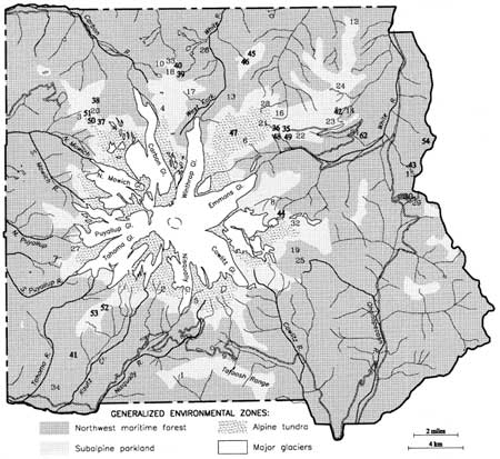
During the present reconnaissance, 28 new sites, isolates, and well substantiated but unverified sites were added to the total documented through 1990. Table 4.1 lists reported finds, sources and site or isolate number. Map Figure 4.1 shows the count of 62 reported prehistoric places, both documented and unverified, in Mount Rainier National Park at the close of 1995.
|
| Figure 4.1 Mount Rainier Prehistoric Localities Reported through 1995 Formally Documented Archaeological Sites in Mount Rainier National Park |
Table 4.1 Sites and Isolates, 1991-1995 (also see Appendix A)
| No. | Date | Reported Find | Source | Comment |
| 35 | 1995 | Lithic scatter | Burtchard & Hamilton 1998 | FS 95-03; Yakama Park, Sunrise Ridge |
| 36 | 1995 | Lithic scatter | " | FS 95-04; Yakama Park, Sunrise Ridge |
| 37 | 1995 | Lithic scatter | Carl Fabiani, pers com. 1995 | FS 95-05; Mist Park |
| 38 | 1995 | Lithic scatter | Burtchard & Hamilton 1998 | FS 95-06; Mother Mountain |
| 39 | 1995 | Lithic scatter | " | FS 95-07; Windy Gap |
| 40 | 1995 | Lithic scatter | " | FS 95-08; Windy Gap |
| 41 | 1995 | Lithic scatter | " | FS 95-10; Forgotten Creek (N of Kautz Creek) |
| 42 | 1995 | Lithic scatter | " | FS 95-11; Sunrise Lake |
| 43 | 1995 | Interior chert flake | " | IF 01-95; Deadwood Lakes |
| 44 | 1995 | Basalt flake | " | IF 02-95; Summerland |
| 45 | 1995 | Obsidian flake, basalt uniface | " | IF 03-95; Grand Park |
| 46 | 1995 | Chalcedony interior flake | " | IF 04-95; Grand Park |
| 47 | 1995 | Biface & uniface frags. | " | IF 05-95; Upper Berkeley Basin |
| 48 | 1995 | Chalcedony flake & core | " | IF 06-95; Yakama Park, Sunrise Ridge |
| 49 | 1995 | Chalcedony interior flake | " | IF 07-95; Yakama Park, Sunrise Ridge |
| 50 | 1995 | Jasper shatter fragment | " | IF 08-95; Spray Park |
| 51 | 1995 | Tabular stone manuport | " | IF 09-95; Spray Park |
| 52 | 1995 | River cobble manuports | " | IF 10-95; Copper Mountain |
| 53 | 1995 | Basalt reduction flake | " | IF 11-95; Mirror Lakes |
| 54 | 1995 | Chert thinning flake | Pam Cox 1995 | Unverified locality; Crystal Lakes |
| 55 | 1995 | Jasper projectile point | Carl & Denise Fabiani 1995 | Unverified; ridgetop near Tolmie Peak |
| 56 | 1995 | Jasper projectile point | Carl & Denise Fabiani 1995 | Unverified; Howard Peak |
| 57 | 1995 | Projectile point, hearsay accounts of Indian baskets | Carl & Denise Fabiani 1995 | Unverified; west end of Eunice Lake |
| 58 | 1995 | Point fragment and flakes | Carl & Denise Fabiani 1995 | Unverified; fire trail on ridgetop south of Mowich Lake near Park boundary |
| 59 | 1995 | Lithic scatter | Carl & Denise Fabiani 1995 | Unverified; ridge between Tyee Peak and Windy Gap |
| 60 | 1995 | Two flakes | Carl & Denise Fabiani 1995 | Unverified; trail east of Golden Lakes R.S. |
| 61 | 1995 | Two flakes | Carl & Denise Fabiani 1995 | Unverified; trail along top of Sunrise Ridge |
| 62 | 1995 | Yakama Trail Segment | C. Fabiani 1995, J. Morrison 1995, and R. Drake 1996 | Undocumented; eastern and southern flank of Sunrise Ridge |
Note: Two historic period sites (FS 95-02 and FS 95-11) were also documented during the 1995 reconnaissance. These sites are described in detail in Section 2 and included on Figure 4.2 below. In addition, two culturally peeled cedar trees were reported by Janet Liddle (pers. com. 1996) after compiling the information included here. One tree is situated on the southeast Park boundary north of Carlton Creek; the second north of Skate Creek Road, west of Bear Prairie, north of the Nisqually River. | ||||
Twenty-four of the 62 sites and isolated finds reported through 1995 and shown on Figure 4.1 have not been verified in the field or documented in a formal fashion. They are included here to help illustrate the Park's first slow then rapidly growing archaeological record, to show the subalpine and alpine bias in the location of prehistoric use areas, and to provide an organized database for continuing verification survey efforts. Clearly, the site database will continue to grow as verbal accounts and historic period cultural remains are added to the list, and new survey adds as yet unknown cultural remains.
As noted above, eight prehistoric sites had been formally documented in Mount Rainier National Park at the beginning of the present project. Five of these were reevaluated and documentation updated in 1995. In addition, 11 previously reported, but undocumented, sites (n=4) and isolates (n=7) were recorded during the current project. Newly documented archaeological localities include eight new prehistoric sites, two historic period sites and 11 isolated finds. [27] Combined with reevaluated sites, these results bring to 40 the number of formally documented archaeological localities in Mount Rainier National Park. Fold-out Figure 4.2 shows 1995 reconnaissance areas and the current set of formally documented sites and isolates in Mount Rainier National Park. Full descriptive documentation for these sites is included in Burtchard and Hamilton (1998). A tabular summary of results is included as Table 4.2.
It is important to emphasize, that sites and isolated finds included here represent a beginning effort at documenting the Park's archaeological record. The site count will increase further as other localities are investigated, as subsurface techniques are added to surface reconnaissance efforts, and as overall sample areas increase. Please note, too, that due to this study's focus on prehistoric remains, the results substantially under-represent the Park's historic period archaeological record. Finally, additional hearsay localities not reflected in written reports probably will be added as efforts to elicit such information from knowledgeable individuals continue.
The above considerations notwithstanding, the current sample reasonably characterizes the general distribution of prehistoric archaeological remains in Mount Rainier National Park. Many of the documented sites and isolates were found over a long period of time by individuals whose observations accommodate a variety of locations, terrain and environmental circumstances. Accordingly, sampled terrain is widely dispersed across the Park landforms and environmental zones. Prehistoric site distribution, however, is not comparably dispersed. As predicted by Smith's (1964) over 30 years ago, the tendency toward location of prehistoric remains in subalpine to alpine settings is clear and represented on all sides of the mountain.
Patterns appear in other aspects of the archaeological record as well. In the sections that follow, extant Mount Rainier data are reviewed and related to implications for long-term land-use practices in the Park. Results of field lithic analyses are considered first; emphasizing artifact classes, technological attributes and raw materials. The lithic assemblage is then discussed in terms of its relevance to functional site distinctions and temporal implications. The final section of the chapter builds on these analyses to propose a nine-part site type model for the park. The final section also considers site type and distribution patterns in relation to a series of specific environmental variables.
Table 4.2 Mount Rainier 1995 Archaeological Site and Isolated Find Summary
| Site/Isolate | Site Name | Location / Context | Site | Type Comment |
| 45PI043 FS 63-01 |
Fryingpan Rockshelter | NE quadrant near Fryingpan Creek / Forested valley floor setting | Shallow prehistoric cave shelter | [Documented 1963, Reevaluated 1995] Large north-facing rock overhang with prehistoric remains. Tested in 1964 by D. Rice (1965). Collections at WSU. Recommend excavation to improve faunal and temporal data, and potentially add floral information. |
| 45PI407 FS 86-01 |
Frozen Lake Site | NE quadrant W of Frozen Lake / Alpine tundra | Prehistoric lithic scatter | [Documented 1986, Reevaluated 1991 & 1995] Primary reduction site on exposed ridge west of the lake. Debris predominantly red jasper, with chalcedony and basalt. Materials on site and in MORA collection. Several collected bifaces illustrated, but lost. Tephra and debitage relationship suggests post 2,300 B.P. date. |
| 45PI303 FS 86-02 |
Berkeley Rockshelter | NE quadrant near Lodi Creek in Berkeley Basin / Subalpine parkland | Prehistoric & historic period rockshelter | [Documented 1986] Early 1900s historical artifacts and stratified prehistoric debris in double talus boulder rockshelter. Tested 1987 by Bergland (1988).14C dated 290 & 1,070 B.P. |
| 45PI406 FS 88-01 |
Tipsoo Lakes Site | Boundary NE & SE quadrants / Lakeside near subalpine parkland | Prehistoric lithic scatter | [Documented 1988, Reevaluated 1995] Moderate density lithic scatter concentrated from picnic and parking area to western end of lakes. Mixed late stage lithic debris. NPS tests in progress suggest shallow subsurface deposits. Temporal range presently unknown. |
| 45PI408 FS 90-01 |
Sunrise Ridge Borrow Pit Site | NE quadrant on Sunrise Ridge / Forested SW facing side slope bench | Prehistoric lithic scatter & modern borrow pit | [Documented 1990, Reevaluated 1995] Extensive lithic scatter with ground stone on or near Yakama trail to Sunrise Ridge. Tephra stratigraphy suggests 4,500-2,300 B.P. date. Damaged by road fill & tree planting excavation. Site erosion ongoing. Recommend data recovery excavation to establish site content, function and temporal range. |
| 45PI409 FS 90-02 |
Sarvant Glaciers Site | SE quadrant / Alpine tundra | Prehistoric lithic scatter | [Documented 1990] Low density scatter with arrow point & bifaces. May be a single use site. |
| 45PI410 FS 90-03 |
Windy Gap Site | NW quadrant on ridge saddle / Subalpine parkland | Prehistoric lithic scatter | [Documented 1990, Reevaluated 1995] Single source chalcedony debitage and dart-sized hafted biface. May be a single use site. |
| 45PI411 FS 90-04 |
Tum Tum Peak Quarry Site | SW quadrant on forested ridge saddle | Prehistoric chert procurement | [Documented 1990] Interior chert flakes percussion struck from several parent boulders. |
| 45PI438 FS 71-01 |
Buck Lake Site (a.k.a. Fawn Ridge) | NE quadrant on ridge overlooking lake / Subalpine parkland | Prehistoric lithic scatter & possible historic component | [Reported 1971, Documented 1995] Multiple lithic concentrations on ridge and bench landforms NE of Buck Lake. Probable sustained and/or reused site. Recommend test procedures to better establish site parameters, and survey of surrounding elevated ridge system toward Palisade Lakes. Buck Lake also may be suitable for paleoenvironmental core extraction. |
| 45PI433 FS 72-02 |
Mt. Pleasant Rockshelter | NW quadrant at cliff-talus interface/ Subalpine parkland | Shallow prehistoric & historic period cave shelter | [Reported 1972, Documented 1995] East facing shelter above Mist Park at the northern edge of Spray Park. Contains tertiary interior flakes and historic period materials including wood and what appear to be small detonator caps. |
| 45PI437 FS 74-01 |
Vernal Park Rockshelter | NW quadrant under boulder at talus base / Subalpine parkland | Prehistoric & historic period shelter | [Reported 1974, Documented 1995] Boulder forms a natural overhang on the SE side. Large, low interior space partially enclosed by stacked rock walls. Chalcedony & chert flakes found in 1974. Walls appear to be historical. |
| 45PI426 FS 95-01 |
Tipsoo Two | Boundary NE & SE quadrants /Lakeside near subalpine parkland | Prehistoric lithic scatter | Seven tertiary interior argilite flakes exposed in trail and under viewing bench. Appear to reflect a single reduction event. |
| 45PI427 FS 95-02 |
Camp Garcia (Historic Site) | Boundary NE & SE quadrants / Forested terrace above Fryingpan Creek | Historic period camp/ Maintenance area | A series of excavated tent platforms, privy & dump pits, central area with structural elements, and water by-pass ditch. Early to mid 1900s. Possible CCC camp or trail construction station. |
| 45PI436 FS 95-03 |
Upper White River Trail Site | NE quadrant / Subalpine parkland | Low density lithic scatter | Chalcedony and chert late stage reduction flakes with one quartzite manuport on rodent reworked sediments. Appears to predate pre-date Mount Rainier C tephra (i.e., >2300 B.P.) |
| 45PI435 FS 95-04 |
Yakama Park Rim | NE quadrant / Subalpine parkland | Low density lithic scatter | Chalcedony and chert late stage reduction flakes on ridge top overlooking White River canyon. |
| 45PI432 FS 95-05 |
Mist Park Overlook Site | NW quadrant / Subalpine parkland | Low density lithic scatter | Interior chert and fine-grained basalt flakes with associated bird gastroliths (gizzard stones); all exposed in social trail/picnic area at Spray Park rim overlooking Mist Park to the north. |
| 45PI431 FS 95-06 |
Mother Mtn. Lake 5554 Site | NW quadrant / Subalpine parkland | Lithic Scatter | Expedient polyhedral core and early stage gray chert reduction flakes. May be a single reduction event. |
| 45PI434 FS 95-07 |
Windy Gap Two | NW quadrant / on pass saddle in subalpine parkland | Lithic Scatter | Secondary to tertiary reddish brown chert manufacturing flakes; two with cortical facies. Probable manufacturing site similar to Windy Gap One (FS 90-03). |
| 45PI430 FS 95-08 |
Middle Spunkwush Lake Site | NW quadrant / Lakeside setting in subalpine parkland | Low density lithic scatter | Mid to late stage reduction of multiple chert material types scattered on rocky ridge west of small lake. Multiple materials suggest repeated low intensity use of the locality. |
| 45PI428 FS 95-09 |
Devils' Dream Cache & Cut (Historic Site) | SW quadrant / in Silver Fir - Alaska Cedar Forest | Cedar cutting area, historic cache, and log stockpile | Small rockshelter with circa 1915 cooking gear adjacent to area with multiple ax and saw cut cedars. Skid trail to Devil's Dream Creek. Probable associated stockpile near Squaw Lake. |
| 45PI429 FS 95-10 |
Forgotten Creek Site | SW quadrant / Headwater spring in patchy forest-beargrass zone | Lithic scatter | Mixed interior reduction flakes, dart-sized projectile point base, and edge battered milling stone located on flat ground near a perennial spring. Recommend testing and intensive survey of adjacent ridge and low gradient slopes. |
| 45PI439 FS 95-11 |
Little Sunrise Lake Site | NE quadrant / Lakeside setting in subalpine parkland | Lithic scatter | Late stage red jasper, chalcedony and grayish red chert exposed in game trail on small ridge adjacent to smaller Sunrise Lake. Pecked and battered stone base with minor grinding wear also present. Recommend intensive survey of Sunrise Lake vicinity and of parkland settings north to Buck Lake. |
| IF 02-63 | Bench Lake Trail head | Boundary SW & SE quadrant / Brushy forest cover | Dart point | [Identified 1963, Reevaluated 1995] Single leaf shaped (Cascade) projectile point, apparently at contact below St. Helen's-Yn tephra (circa 4000-5800 B.P.). |
| IF 01-68 | Yellowstone Cliffs | NW quadrant / Forested side slope bench | Arrow point | [Identified 1968, Reevaluated 1995] Large chalcedony corner notched triangular point and single flake on large side slope bench below Yellowstone Cliffs. Recommend subsurface testing to establish possible site parameters. |
| IF 01-70 (Unverified) |
Success Cleaver Isolates | SW quadrant / Alpine | Biface & Arrow point | Triangular basalt biface tip and chalcedony corner notched arrow-sized point. Reported by Jan Henderson, "lying on sandy pumice." |
| IF 01-72 | Sunrise Creek | NE quadrant / Subalpine parkland | Biface tip & flake | [Identified 1972, Reevaluated 1995] Chalcedony hafted biface tip and flake in/near Sunrise Creek near bridge. Probably displaced from general area use, especially FS 95-11. |
| IF 01-77 | Deadwood Lakes Pass | NE quadrant / Pass saddle, subalpine parkland | Flake (?) | [Identified 1977, Reevaluated 1995] Prehistoric item (not described) in trail at crest of the pass between Deadwood Creek and Rainier Fork of the American River. No additional materials found during reevaluation. |
| IF 01-84 (Unverified) |
Upper Palisades Trail Isolate | NE quadrant / Subalpine | Lanceolate Arrow point | Lanceolate gray chert projectile point with slight stem; 28 x 10 mm with 6 mm haft width. Found by Wendy Burman. |
| IF 01-87 (Unverified) |
Tokaloo Trail Isolate | SW quadrant / Alpine | Probable Dart Point | Triangular, contracting stem projectile point; 39 x 19 mm with circa 8 mm haft width. Red jasper. In trail to Tokaloo Rock at 6700 ft Reported by Chris Jensen. |
| IF 01-95 | Lower Deadwood Lake | NE quadrant / Lakeside subalpine parkland | Flake | Tertiary interior chert flake. On, but possibly reworked from below, Mount Rainier C tephra (> 2300 B.P.). Recommended subsurface testing to determine possible site presence. |
| IF 02-95 | Summerland | Boundary NE & SE quadrants / alpinesubalpine margin | Flake | Medium grained greenish-gray basalt flake contrasts with immediately available raw materials. Possible source material up slope near Panhandle Gap. |
| IF 03-95 | Grand Park One | NW quadrant / Subalpine parkland | Thinning flake & unifacial tool fragment | Obsidian biface thinning flake and unifacially worked andesite flake–possible awl fragment– in seasonal flood channel. Recommend subsurface investigation of surrounding terrain. |
| IF 04-95 | Grand Park Two | NW quadrant / Subalpine parkland | Flake | Chalcedony interior flake. May be reworked from below Mount Rainier C tephra. Recommend subsurface testing of surrounding terrain. |
| IF 05-95 | Upper Berkeley Park | NE quadrant / alpine-subalpine margin | Biface & uniface flake fragments | Chalcedony potlid fragment from probable bifacial tool and unifacially retouched chert flake. Near Lodi Creek headwaters at extreme upper Berkeley Park. Recommend subsurface testing of nearby side slope benches. |
| IF 06-95 | Yakama Park One | NE quadrant / Subalpine parkland | Flake & core fragment | Chalcedony flake and core fragment, possibly reworked from below Mount Rainier C tephra. Spatially associated with FS 95-3 & 4 and Is 7-95. Recommend testing surrounding terrain to better establish possible site parameters. |
| IF 07-95 | Yakama Park Two | NE quadrant / Subalpine parkland | Flake | Chalcedony flake on ridge top overlooking Is 6-95 and immediately east of FS 95-4. As above, general area should be investigated more thoroughly to establish possible site parameters. |
| IF 08-95 | Spray Park Shatter | NW quadrant / Subalpine parkland | Manuport | Large brownish red jasper shatter fragment on deflated flat parkland surface above Mt. Pleasant Rockshelter (FS 95-5). |
| IF 09-95 | Spray Park Slab | NW quadrant / Subalpine parkland | Manuport | Subangular, tabular, course grained metasediment manuport on small side slope bench above Mt. Pleasant Rockshelter (FS 95-5). Possible abrading stone. |
| IF 10-95 | Copper Mtn. Cobbles | SE quadrant / Alpine-subalpine boundary | Cobble manuports | Two river rounded cobble manuports among subangular natural elements on top of Copper Mtn. No obvious battering or other wear. |
| IF 11-95 | Mirror Lakes | SE quadrant / Subalpine lakeside setting | Flake | Fine-grained basalt primary reduction flake in outflow channel of lowest Mirror Lake. May have weathered from adjacent low ridge. |
Table Notes: FS and IF designations are field numbers used by Mount Rainier National Park to identify archaeological field sites and isolated finds respectively. Unverified isolates were reported and map plotted prior to 1995, but were not reevaluated directly during the present reconnaissance. Datum points for sites documented or reevaluated in 1995 are fixed by GPS receiver and entered into the Park's GIS system. | ||||

|
|
Figure 4.2 Documented Archaeological
Sites and Isolates, Mt. Rainier National Park (click on image for an enlargement in a new window) |
| <<< Previous | <<< Contents >>> | Next >>> |