

|
VICKSBURG National Military Park |
 |
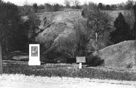
The terrain of the siege of Vicksburg—looking from the
Confederate line to the Union position on the far ridge.
The Siege of Vicksburg
THE CONFEDERATE DEFENSE LINE. From his assumption of command 7 months before, Pemberton had put his engineers to work constructing a fortified line which would protect Vicksburg against an attack from the rear. A strong line of works had been thrown up along the crest of a ridge which was fronted by a deep ravine. The defense line began on the river 2 miles above Vicksburg and curved for 9 miles along the ridge to the river below, thus enclosing the city within its arc. So long as this line could be held, the river batteries denied to the North control of the Mississippi River.
At salient and commanding points along the line, artillery positions and forts (lunettes, redans, and redoubts) had been constructed. The earth walls of the forts were up to 20 feet thick. In front of these was dug a deep, wide ditch so that assaulting troops which climbed the steep ridge slope and reached the ditch would still have a high vertical wall to climb in order to gain entrance into the fort. Between the strong points, which were located every few hundred yards, was constructed a line of rifle pits and entrenchments, for the most part protected by parapets and ditches. Where spurs jutted out from the main ridge, advanced batteries were constructed which provided a deadly crossfire against attacking lines. The Confederates had mounted 128 artillery pieces in these works, of which 36 were heavy siege guns; the remainder, field pieces.
Greatly strengthening the Confederate position was the irregular topography which resulted from the peculiar characteristics of the region's loess soil. Possessing an unusual tenacity, except when eroded by the action of running water, the loess had over the centuries been cut into deep gullies and ravines with abrupt faces separated by narrow, twisting ridges. This resulted in a broken and complicated terrain which would seriously obstruct the Union movement. To permit a clear field of fire and to hinder advancing troops, all the trees fronting the Confederate line were cut down. Several hundred yards away from the Confederate position and roughly parallel to it was a ridge system not so continuous and more broken than that occupied by Pemberton's Army. Along this line, the Union Army took position and began its siege operations.
On the scattered natural bridges of high ground, which spanned the ravines and provided approaches to Vicksburg, were located the six roads and one railroad leading into that city. Nine forts had been constructed overlooking each of these routes into Vicksburg, their guns completely commanding the approaches—Fort Hill on the river north of the city, Stockade Redan, Third Louisiana Redan, Great Redoubt, Second Texas Lunette, Railroad Redoubt, Fort Garrott (also known as Square Fort), Salient Works, and South Fort on the river below Vicksburg. (All but two of these works are well preserved today.) The Confederate divisions, left to right, were commanded by Maj. Gen. M. L. Smith, General Bowen, Maj. Gen. John H. Forney, and General Stevenson. The Army of Vicksburg, at the beginning of the siege, numbered about 31,000 men, of which Pemberton listed 18,500 effectives as available to man his defense line. Grant gave his strength, shortly after the siege began, as 50,000 effectives; his army was steadily enlarged during the siege by reinforcements from Memphis.

|

| History | Links to the Past | National Park Service | Search | Contact |
|
Last Modified: Mon, Dec 2 2002 10:00:00 am PDT |