

|
VICKSBURG National Military Park |
 |
(click on image for an enlargement in a new window)
The Bayou Expeditions:
Grant Moves Against Vicksburg— and Fails (continued)
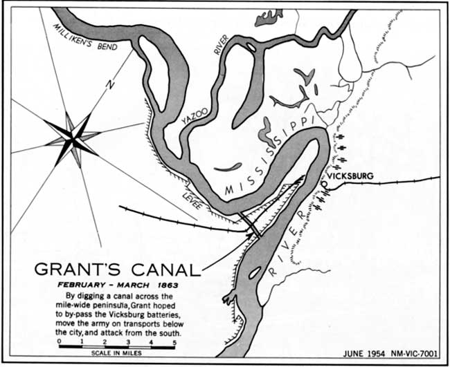
GRANT'S CANAL. Vicksburg's location on the horseshoe bend of the river had suggested a solution to the Vicksburg problem the previous summer. By digging a canal across the peninsula below Vicksburg and diverting the river through it, unarmored transports could bypass the city batteries and deliver troops safely to the bluffs below. In January, Sherman's Corps, assisted by dredging machines, began excavation of the mile-long canal. This project continued until March when a sudden rise in the river flooded the peninsula, driving the troops to the levees, and destroying much of their work.

|

| History | Links to the Past | National Park Service | Search | Contact |
|
Last Modified: Mon, Dec 2 2002 10:00:00 am PDT |