An Administrative History

|
GUADALUPE MOUNTAINS
An Administrative History |
|
CHAPTER I: INTRODUCTION (continued)
Physical Description
Included within the boundaries of the park are the sheer cliffs and peaks more than 8,000 feet high that make up the V-shaped southernmost extension of the Guadalupe Mountains. The mountain range is an uplifted segment of the Capitan reef, a limestone barrier reef that formed some 280 million years ago from algae in a shallow inland sea. The geological information revealed in the sheer escarpments and deeply incised canyons of the Guadalupe have made this exposed portion of the Capitan reef one of the world's best-known and most-studied fossil reefs.
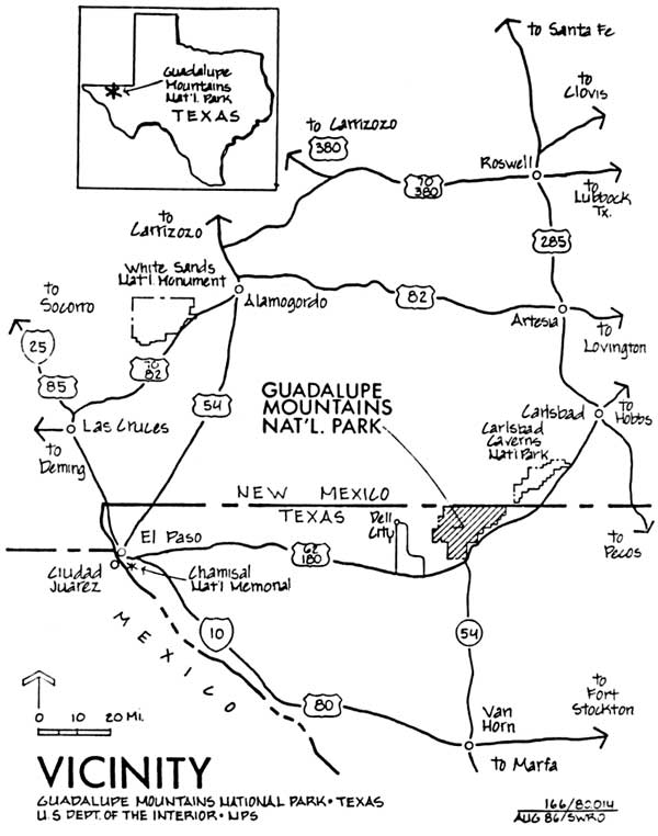
Figure 1. Vicinity of Guadalupe Mountains National
Park
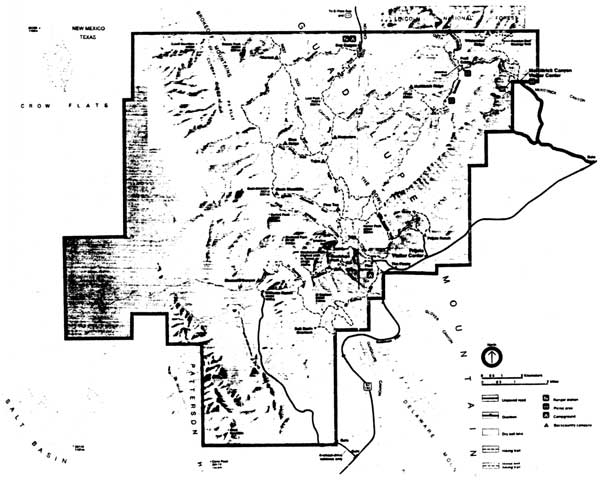
Figure 2. Map of Guadalupe Mountains National Park
The precipitous cliffs of El Capitan punctuate the southern tip of the Guadalupes and jut above the desert floor like the prow of a great ship (see Figure 3). In 1858, a traveler, seeing El Capitan for the first time, wrote: "It seemed as if nature had saved all her ruggedness to pile up in this colossal form. . . ." [1] Visible for many miles from both east and west, the peak has served as a landmark for travelers for unnumbered centuries. Northeast of El Capitan are the four highest peaks in Texas: Guadalupe Peak at 8,749 feet, Bush Mountain at 8,631 feet, Shumard Peak at 8,615 feet, and Bartlett Peak at 8,513 feet. The top of the escarpment offers unparalleled views of the Delaware basin to the east and the salt basin to the west (see Figures 4 and 5). Hidden between the escarpments that form the V-shaped terminus of the Guadalupe range are two other manifestations of the scientific and scenic values preserved in the park: the relict forest in the Bowl and the aquatic habitat of McKittrick Canyon (see Figures 6 and 7). The unique and fragile variations of plant life in these areas create a museum-like atmosphere, vestiges of a time when the climate of this land was less arid.
The park also includes desert lowlands. The western side of the park encompasses a portion of the salt basin lying between the Guadalupes and the next range of mountains to the west, the Cornudas. These lowlands contain flora and fauna typical of the Chihuahuan desert of which they are a part. They also exhibit the ecological changes caused by overgrazing of domestic livestock. Williams Ranch, one of the park's cultural resources, located at the base of the mountains on the west side of the park, gives visitors a sense of the isolation of a rancher's life. The ranch site also provides a dramatic point from which to view the steep scarp of the western side of the Capitan reef (see Figure 8). On the eastern side, the park does not extend far beyond the base of the mountains. The park lands there are characterized by deep and mostly waterless canyons that lead to the high country.
Although the variations in elevation in the park may produce extremes of temperatures, the climate of the park is generally mild. During the summer the pine forests of the high country offer a cool respite from the intense heat of the desert lowlands. In winter, the lower elevations and west side of the park remain comfortably warm even when snow blankets the mountains. Strong winds in late winter and spring and severe electrical storms accompanied by torrential rains during the summer pose some natural hazards for hikers.
The scarcity of water determines the patterns of life in the park lands. Although an extensive variety of animals, from large ungulates to the smallest mammals, make their homes in the park, the water available from small springs scattered throughout the park dictates their numbers and ranges. Similarly, the locations of these water sources became the camping places of nomadic peoples and the settlements of early ranchers. McKittrick Canyon contains the only perennial stream in the park. The rarity of perennial streams in this arid region has made McKittrick Canyon more than just "the most beautiful spot in Texas," as its former owner called it; the canyon is a showplace for biotic associations otherwise unknown in western Texas and southern New Mexico. [2]
CONTINUE >>>