
|
Washington Department of Natural Resources Geology and Earth Resources Division Bulletin No. 66 Geology of the Washington Coast between Point Grenville and the Hoh River |
PART II
Geologic Observations and Interpretations Along Segments of the Coast
TUNNEL ISLAND
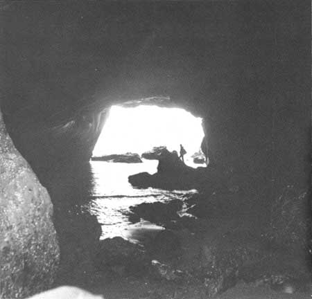
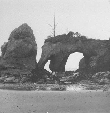
Tunnel Island (fig. 24) at the mouth of Raft River is accessible on foot during low tide, usually from the south side of the river. It consists of a relatively hard body of sandstone with a few less resistant strata of siltstone. Some very interesting erosional features have been formed largely by the differential effects of wave action on these rocks. Perhaps the most fascinating is the tunnel for which the island was named (fig. 47). From a relatively small entryway on the east side, the tunnel opens up into a large room beneath the island and extends to a fairly large opening on the west side. According to local residents, only in recent years has the eastern entryway broken through to form a true tunnel from what used to be a large sea cave with its only opening seaward. Wave action has further eroded a number of picturesque arches on the south end of the island, some of which form a shape resembling an elephant (fig. 50); and thus in the past the name "Elephant Island" has also been applied to this island.
|
| LOOKING WESTWARD THROUGH THE TUNNEL BENEATH TUNNEL ISLAND. The erosive power of the sea has carved this passageway through a less resistant part of the sandstone of the island. (Fig. 47) |
The sandstone of Tunnel Island and the nearby sea stacks (fig. 25), together with the sandstone and siltstone in the cliffs and along the beach immediately north of Raft River, are all a lower part of the Quinault Formation.
|
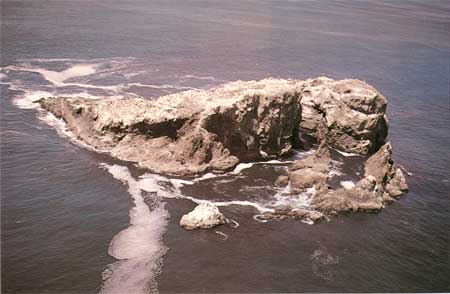
| SPLIT ROCK, a very large, relatively resistant erosional remnant from the Hoh rocks. It now rests on the Continental Shelf and protrudes as an island above the present-day sea level. (Fig. 48) |
|
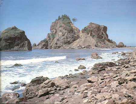
| LITTLE HOGSBACK, like other nearby headlands and offshore rocks, is a volcanic relatively resistant mass from deposits of jumbled Hoh rock. Erosion processes of the sea have removed the finer and softer parts of the deposit and left Little Hogsback as a headland, connected to land only during low tides. (Fig. 49) |
|
| ELEPHANT ROCK, at the south end of Tunnel Island, is among a group of fascinating arches and seastacks that were differentially carved from sandstone by erosional processes of the sea. (Fig. 50) |
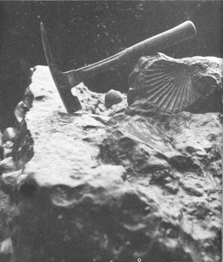
Macerated carbonized wood fragments are common in much of the sandstone, suggesting that when the materials were deposited millions of years ago a source of vegetation was nearby. Concretions, or relatively hard nodules, are scattered throughout, some of which are formed around fossils. The most common among these fossils is the relatively large pectenlike clam known as Lituyapecten sp. (fig. 51). Microscopic fossils are particularly common in the sandy siltstone strata exposed largely at low tide. Together, all fossils indicate to paleontologists that the sediments of the containing rocks were deposited in the sea during an early part of the Pliocene Epoch, some 5 to 7 million years ago (fig. 2).
|
| A PECTENLIKE FOSSIL in the sandstone of Tunnel Island. This form is relatively common among the various larger fossils contained in the sandstone of Tunnel Island and nearby outcrops immediately to the north. (Fig. 51) |
The younger overlying sand and gravel deposits of the Pleistocene Epoch, although relatively thin to the south of Raft River, are thicker northward reaching a thickness in places up to 50 feet.
| <<< Previous | <<< Contents >>> | Next >>> |
state/wa/1973-66/sec2-7.htm
Last Updated: 28-Mar-2006