
|
Geological Survey 8th Annual Report (Part I)
Geology of the Lassen Peak District |
HYPSOGRAPHY.
GENERAL HYPSOGRAPHIC FEATURES.
The belt of country lying between the Great Basin and the Pacific may be regarded as grouped naturally into two valleys and three mountain ranges. The Coast Range is separated from the Cascade upon the north by the valley of the Willamette, and upon the south from the Sierra Nevada by the broad depression drained by the Sacramento. Near the State line between Oregon and California the three ranges meet in common ground, among a group of ridges and peaks so complex as apparently to render the definition of the ranges a matter of considerable difficulty. It is true, nevertheless, that each range is sharply characterized by its geologic development, and everywhere within this mountain plexus its limits are clearly defined.
HYPSOGRAPHY OF THE LASSEN PEAK DISTRICT.
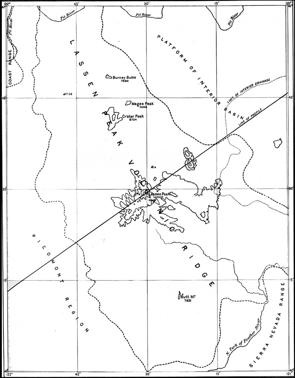
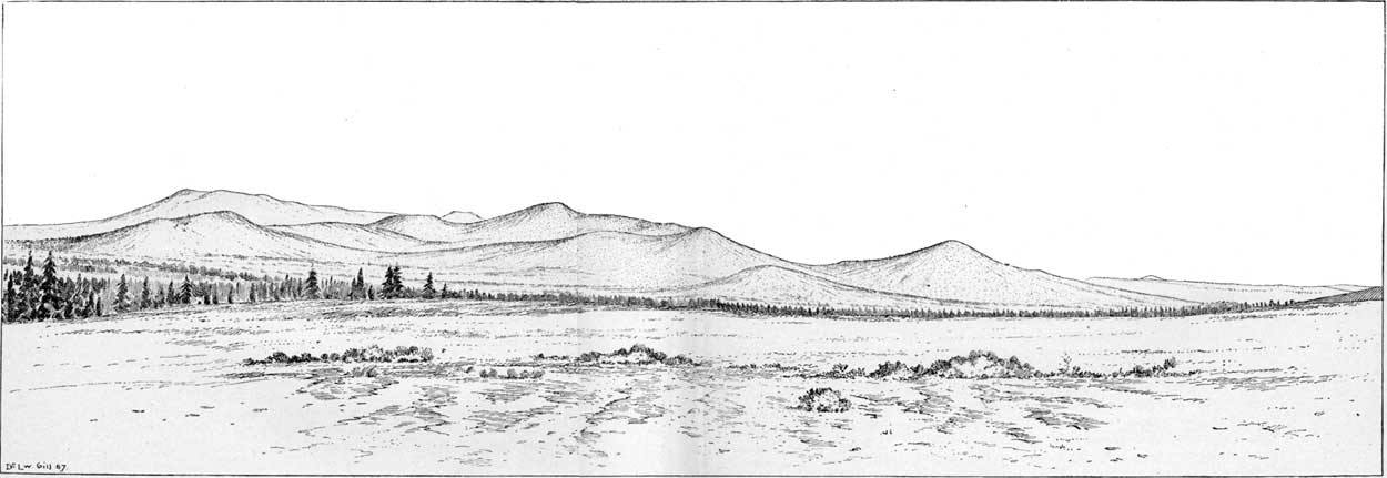
The position and boundaries of the Lassen Peak district are represented in Fig. 13. Its primary hypsographic features are the volcanic ridge, the Piedmont, and the Great Basin platform, all of which are outlined on the accompanying illustration (Pl. XLV). Lassen Peak stands in the midst of a belt of volcanic cones stretching from the north fork of Feather River to Pit River. The coalescent lavas from a multitude of vents join the bases of the cones in such a way as to form an irregular serrated ridge entirely unlike those of the Sierra Nevada range in form, composition, structure, and origin. The view in P1. XLVI may be seen from an elevation of 6,000 feet near Hat Creek, north of Lassen Peak, looking northwest parallel with the ridge. The whole width of the ridge is here shown from the Great Basin platform on the right across Crater Mountain, whose long gentle westward slopes reach the Sacramento Valley. To the northward the ridge becomes less prominent and narrowed by the impingement of the Great Basin platform, which is dotted over with small cones having no serial arrangement. Although it rests directly upon stratified rocks, the ridge, throughout a length of nearly seventy-five miles and a breadth of over twenty miles, is composed chiefly of accumulated lava and volcanic débris. By far the most majestic of this group of ancient volcanic piles is Lassen Peak, which, with its many prominent spurs, rises to an elevation of 10,437 feet, and bears large patches of perennial snow. The other prominent peaks of the belt, which attain an elevation of over seven thousand feet, are represented above that level in thousand-foot contours.

|
| FIG. 13. Position and boundaries of the Lassen Peak district. |
|
|
PLATE XLV.—HYPSOGRAPHIC DIVISIONS OF LASSEN PEAK
DISTRICT. (click in image for an enlargement in a new window) |
|
|
PLATE XLVI.—TRANVERSE PROFILE OF LASSEN PEAK
VOLCANIC RIDGE ACROSS CRATER MOUNT. Seen from Hat Creek, at an
elevation of 6,000 feet looking northwest. (click in image for an enlargement in a new window) |
The Piedmont region, lying at the western foot of the volcanic ridge, is most prominently developed in the southern portion of the district, where it is a broad, even platform of stratified deposits gently incliined westward to the Sacramento Valley, from which it is sharply separated, as represented in Fig. 14, by a prominent bluff. All of the mountain streams on their way to the Sacramento cut deep cañons across the Piedmont.

|
| FIG. 14.—Profile from the Sacramento Valley across the Piedmont of Lassen Peak into the Great Basin. (click on image for an enlargement in a new window) |
The volcanic ridge of Lassen Peak appears to be a continuation of the Sierras, but in reality, as we shall see in the sequel, it is the connecting link between the Sierras and the Coast Range, and itself belongs geologically to the Cascade Range.
| <<< Previous | <<< Contents >>> | Next >>> |
rpt/8-1/sec1.htm
Last Updated: 28-Nov-2006