
|
Geological Survey Professional Paper 729—B
Volcanic Stratigraphy of the Quaternary Rhyolite Plateau in Yellowstone National Park |
INTRODUCTION
This paper summarizes the stratigraphy of volcanic rocks which form the Yellowstone rhyolite plateau, a volcano-tectonic feature of Quaternary age which lies at an average elevation of about 2,500 m (meters), largely within Yellowstone National Park. Rock units which form parts of the plateau sequence but which lie entirely outside the national park are not discussed here except for one major ash-flow tuff which bears directly on the regional stratigraphy. Volcanic rocks of the plateau and its outliers cover more than 6,500 square kilometers in Wyoming, Idaho, and Montana.
Early work on rhyolitic rocks of the Yellowstone region, especially that by Iddings (1888; and in Hague and others, 1899), attracted wide attention. These rocks, however, have received surprisingly little modern study, considering their volume, youth, and potential regional and volcanological significance. The only detailed work of recent years directed specifically toward the rhyolite plateau was the excellent study by Boyd (1961). Other modern studies that have borne importantly on the volcanic rocks of the plateau include those by Howard (1937), Love (1956a, b), Hamilton (1960, 1963, 1964), and Brown (1961). In addition, detailed mineralogic and petrologic studies of single volcanic units include those of Bowen (1935), Fenner (1938), and Wilcox (1944).
Potassium-argon ages referred to in this paper are based on work still in progress by J. D. Obradovich and are stated approximately only in order to aid visualization of the stratigraphy. These ages and the K-Ar analyses will be discussed in a later paper. Terminology used for the features and relations of ash-flow tuffs follows Smith (1960a, b) and Ross and Smith (1961). Figures 1 and 2 identify major features of the area. Most localities referred to in this paper are shown in these figures. Features not shown in the figures can be found on the U.S. Geological Survey's topographic map of Yellowstone National Park, published in 1961 (scale 1:125,000).
|
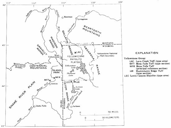
| FIGURE 1. — Index map of region around Yellowstone National Park, showing locations of type sections of formations in the Yellowstone Group, type area of Lewis Canyon Rhyolite, and features outside the national park referred to in text. (click on image for a PDF version) |
|
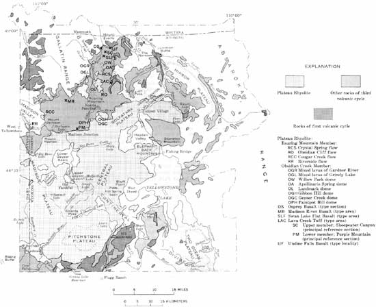
| FIGURE 2.—Index map showing major localities in Yellowstone National Park referred to in text. (click on image for a PDF version) |
| <<< Previous | <<< Contents >>> | Next >>> |
pp/729-B/intro.htm
Last Updated: 08-Sep-2008