
|
Geological Survey Circular 217
Preliminary Report on the White Canyon Area, San Juan County, Utah |
INTRODUCTION
Location
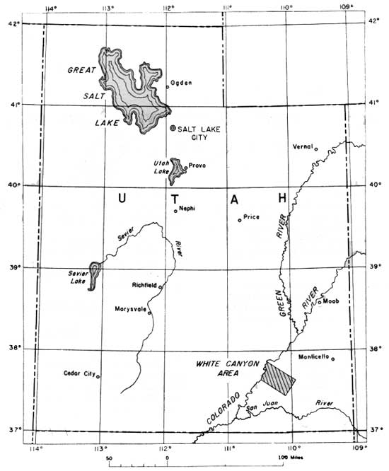
The White Canyon area is in the central part of San Juan County, Utah (fig. 1). It is bounded on the north by Dark Canyon, on the east by Elk Ridge, on the south by Red Canyon, and on the west by the Colorado River; it is about the size of two 15-minute quadrangles.
|
| Figure 1.—Index map of Utah. |
The area is accessible from the east and west by Utah Highway 95, a graded dirt road. Blanding, Utah, is 50 miles east and Hanksville, Utah, is 65 miles west across the Colorado River. A ferry at Hite, Utah, provides the only vehicular crossing of the Colorado River in the area.
Previous work
A reconnaissance of the White Canyon area was made between 1925 and 1929 by H. E. Gregory (1938, 123 pp.).1 Some of the uranium deposits in White Canyon were examined briefly by H. C. Granger and E. P. Beroni (1950) for the U. S. Geological Survey, and a report on the Happy Jack mine was made by P. H. Dodd (1950, 23 pp.) for the U. S. Atomic Energy Commission. Other reports on the uranium deposits of the area have been made by Fischer and King (1948), Smyth (1949), and Gruner and Gardner (1950).
1See literature cited.
Purpose of work
The principal objectives of the present investigation in the White Canyon area were (1) to map the general geology and determine the regional relationships of the uranium deposits; (2) to study the physical and mineralogic characteristics of the uranium deposits to establish ore controls and guides; and (3) to select areas favorable for exploration for concealed deposits in the Shinarump conglomerate and other Triassic formations. This work was done on behalf of the Division of Raw Materials of the U. S. Atomic Energy Commission. Field work for this report was done during the summer of 1951.
Field methods
Approximately 75 square miles have been mapped on a scale 1 inch=1 mile. The method used was an attempt to combine the advantages of a plane table with the advantages of aerial photographs. Triangulation control was established by plane table, and points on the geologic contacts were located by intersection. The contact lines were mapped on the aerial photographs and were transferred to the plane-table sheets by inspection.
Parts of the Gonway and North Point claims, a quarter of a mile east of the Happy Jack mine, were mapped by plane table on a scale 1 inch=20 feet.
| <<< Previous | <<< Contents >>> | Next >>> |
circ/217/intro.htm
Last Updated: 28-Aug-2008