|
Geological Survey Bulletin 707
Guidebook of the Western United States: Part E. The Denver & Rio Grande Western Route |
PREFACE
The United States of America comprise an area so vast in extent and so diverse in natural features as well as in characters due to human agency that the American citizen who knows thoroughly his own country must have traveled widely and observed wisely. To "know America first" is a patriotic obligation, but to meet this obligation the railroad traveler needs to have his eyes directed toward the more important or essential things within his field of vision and then to have much that he sees explained by what is unseen in the swift passage of the train. Indeed, many things that attract his attention are inexplicable except as the story of the past is available to enable him to interpret the present. Herein lie the value and the charm of history, whether human or geologic.
The present stimulus given to travel in the home country will encourage many thousands of Americans to study geography at first hand. To make this study most profitable the traveler needs a handbook that will answer the questions that come to his mind so readily along the way. Furthermore, the aim of such a guide should be to stimulate the eye in the selection of the essentials in the scene that so rapidly unfolds itself in the crossing of the continent. In recognition of the opportunity to render service of this kind to an unusually large number of American citizens, as well as to visitors from other countries, the United States Geological Survey has published a series of guidebooks1 covering four of the older railroad routes west of the Mississippi. The present volume is an addition to this series and covers one of the finest scenic routes of the continent.
1Guidebook of the western United States: Part A, The Northern Pacific Route, with a side trip to Yellowstone Park (Bulletin 611); Part B, The Overland Route, with a side trip to Yellowstone Park (Bulletin 612); Part C, The Santa Fe Route, with a side trip to the Grand Canyon of the Colorado (Bulletin 613); Part D, The Shasta Route and Coast Line (Bulletin 707). These bulletins are for sale by the Superintendent of Documents, Washington, D. C., at 50 cents a copy.
These books are educational in purpose, but the method adopted is to entertain the traveler by making more interesting what he sees from the car window. The plan of the series is to present authoritative information that may enable the reader to realize adequately the scenic and material resources of the region he is traversing, to comprehend correctly the basis of its development, and above all to appreciate keenly the real value of the country he looks out upon, not as so many square miles of territory represented on the map in a railroad folder by meaningless spaces, but rather as land—real estate, if you please—varying widely in present appearance because differing largely in its history, and characterized by even greater variation in values because possessing diversified natural resources. One region may be such as to afford a livelihood for only a pastoral people; another may present opportunity for intensive agriculture; still another may contain hidden stores of mineral wealth that may attract large industrial development; and, taken together, these varied resources afford, the promise of long-continued prosperity for this or that State.
Items of interest in civic development or references to significant epochs in the record of discovery and settlement may be interspersed. with explanations of mountain and valley or statements of geologic history. In a broad way the story of the West is a unit, and every chapter should be told in order to meet fully the needs of the tourist who aims to understand all that he sees. To such a traveler-reader this series of guidebooks is addressed.
To this interpretation of our own country the United States Geological Survey brings the accumulated data of decades of pioneering investigation, and the present contribution is only one type of return to the public which has supported this scientific work under the Federal Government—a by-product of research.
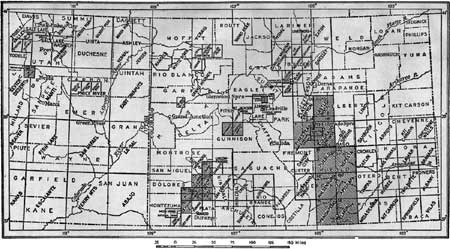
In the preparation of the description of the country traversed by the Denver & Rio Grande Western Route the geographic and geologic information already published as well as unpublished material in the possession of the Geological Survey has been utilized, but to supplement this material Mr. Campbell made a field examination of the entire route in 1915-1916. Information has been furnished by others, to whom credit is given in the text. Cooperation has been rendered by the United States Forest Service and the United States Reclamation Service, railroad officials and other citizens have generally given their aid, and other members of the Survey have freely cooperated in the work. For the purpose of furnishing the traveler with a graphic presentation of each part of his route, the accompanying maps, 10 sheets in all, have been prepared, with a degree of accuracy probably never before attained in a guidebook and their arrangement has been planned to meet the convenience of the reader. The special topographic surveys necessary to complete these maps of the route were made by W. O. Tufts.
| <<< Previous | <<< Contents >>> | Next >>> |
bul/707/preface.htm
Last Updated: 16-Feb-2007
