.gif)
A Survey of the Recreational Resources of the Colorado River Basin
MENU
Recreational Benefits of Reservoirs
![]() Canyon Lands of Southeastern Utah
Canyon Lands of Southeastern Utah
Conservation of Recreational Resources
|
A Survey of the Recreational Resources of the Colorado River Basin
|

|
Chapter VIII:
CANYON LANDS OF SOUTHEASTERN UTAH (continued)
OUTSTANDING AND UNIQUE SCENIC
SECTIONS (continued)
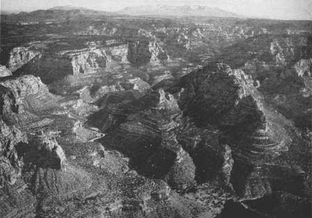
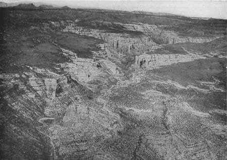
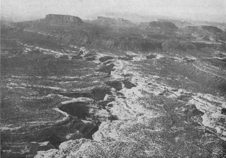
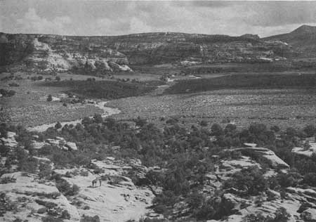
Elk Ridge.—On the east side of the Colorado, in the La Sal National Forest between Indian Creek on the north, and White Canyon on the south, and west of the Abajo Mountains, is a section which is certain to become nationally famous for its great variety of unusual scenic interests. Elk Ridge, running generally north and south at an average elevation of 8,500 feet, with high points at the north and south ends reaching over 9,000 feet, is the dominant topographic feature. From Elk Ridge great canyons start down toward the Colorado—White Canyon, Woodenshoe Canyon, Peavine Canyon, Dark Canyon, Fable Valley, and Gypsum Canyon. Near their junction, Dark and Woodenshoe Canyons are 2,000 feet deep, while the lower end of Gypsum Canyon is more than 2,300 feet deep, and at least one high point on the rim of Gypsum Canyon within a mile of the Colorado River is 3,527 feet above it. From the pine and aspen forested Elk Ridge there are grand views down into the canyons on all sides and out over Beef Basin and the Needles to Junction Butte to the northwest; over the Grand Gulch Plateau, Natural Bridges National Monument in White Canyon, the Tables of the Sun, and Red Rock Plateau to Navajo Mountain in the southwest; down 2,200 feet into Cottonwood Canyon which separates Elk Ridge from the Abajo Mountains and up 2,600 feet to Abajo Peak, elevation 11,357 feet. Elk Ridge is a delightfully cool forest island in a rough iridescent sea of deserts and canyons.

|
| Figure 88.—Dark Canyon—looking east over Elk Ridge to the Abajo Mountains. (Air photo) |

|
| Figure 89.—Arch Canyon—looking northwest over Elk Ridge. (Air photo) |

|
| Figure 90.—White Canyon, Tables of the Sun, and Navajo Mountain from vicinity of Natural Bridge National Monument. (Air photo) |

|
| Figure 91.—Beef Basin. Horse Mountain, the north end of Elk Ridge, is at upper right corner. |
NEXT >>>
Last Modified: Mon, Sep 6 2004 10:00:00 pm PDT
http://www.cr.nps.gov/history/online_books/colorado/chap8b.htm
![]()
 Top
Top