|
Capitol Reef
Cultural Landscape Report |

|
EXISTING CONDITIONS

| |
|
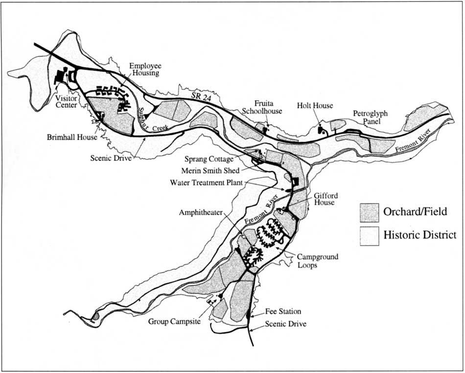
Location Map, 1998 (click on image for an enlargement in a new window) | |
SITE CONTEXT
Capitol Reef National Park is located in south-central Utah, within portions of Emery, Garfield, Sevier, and Wayne counties, and encompasses 241,904 acres. The park contains a variety of spectacular geological features, including the Waterpocket Fold, with a crest that rises more than 2,000 feet above the surrounding landscape. Other features include at least 15 exposed sedimentary formations; igneous dikes, plugs and sills; a Pleistocene mud slide; gypsum plugs and sinkholes; arches, natural bridges, domes, hogbacks, cuestas, mesas, and fins; and eroded sandstone cliffs.
The park also contains cultural resources relating to both prehistoric and historic times. Prehistoric resources include evidence of the Desert Archaic Culture, dating from about 8,500 to 2,000 years ago. The Fremont people occupied and used areas throughout the Fremont River gorge and Pleasant Creek drainages in the central portion of the park. These areas contain Fremont habitation sites, temporary campsites, and a rich collection of rock art. The Fremont people were the first to use the area at the junction of the Fremont River and Sulphur Creek. Historic resources relate primarily to exploration, settlement, agriculture, and mining enterprises on the Colorado Plateau.
The three administrative districts in the park are the Waterpocket (south), the Cathedral (north), and the Fremont River (central). The Fremont River district includes the primary automobile access to Capitol Reef, State Highway 24, which parallels the Fremont River and bisects the park. The majority of the park facilities, developed areas, and cultural resources are within this district at Fruita, which is the focus of this report.
| |
|
Fruita Rural Historic District, 1998 (click on image for an enlargement in a new window) | |
SITE DESCRIPTION
The Fruita Rural Historic District (the district) encompasses the site of the historic community of Fruita and covers approximately 200 acres in the Fremont River district of the park. It is physically defined by, and contained within, two canyons that intersect at the confluence of the Fremont River and Sulphur Creek. One canyon tends west-east and the other north-south, following the Fremont River corridor through Fruita. Views and perceptual qualities are restricted within the district by the canyon cliffs. Two roads through the district control access and act as boundary elements: State Highway 24 on the north (through the east-west canyon) and the Scenic Drive on the east (through the north-south canyon). Primary development in the district occurs on the bottom lands.
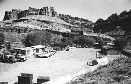
Fruita functions as the primary visitor contact point in the park, is the location for the majority of visitor services, and serves as the location for park headquarters and operations. The visitor center, park administrative offices, and maintenance facilities are located within a cluster of buildings on the west edge of Fruita. The superintendent's office and museum storage are located in the historic ranger station (1940). The visitor center and maintenance facilities were built in 1968 as part of the Mission 66 master plan for the park. Residences for park staff are concentrated in a cul-de-sac across from this complex. The majority of these structures were constructed between 1962 and 1964. Five new residences have been added to this area since 1993. Three other buildings in Fruita have provided housing for park staff: the Holt house (1895), Sprang house (1957), and the Brimhall house (1959). The Brimhall house is used as quarters for seasonal volunteers; the Sprang and Holt houses are currently vacant.
| |
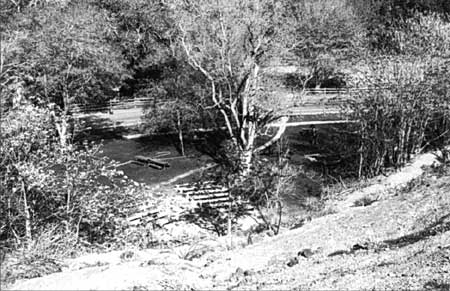
| View of maintenance area, looking north, 1993. | |
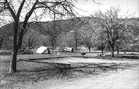
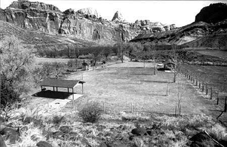
There are two campgrounds in Fruita. One campground was constructed in 1964 with 53 sites (Loops A and B). This area was expanded in 1987 to include an additional 18 sites (Loop C). The group camping area (which accommodates 10 to 40 people) was built south of the Cass Mulford Orchard in 1987. Two picnic areas are located in the central portion of the district. These areas, accommodating both group and individual parties, were constructed in the late 1960s; one, the Doc Inglesby Picnic Grove, was enlarged in the 1970s.
| |
| View of campground, 1993. | |
Vegetation in Fruita is dominated by the agricultural lands along the canyon bottom lands. Approximately 2,500 orchard trees on 40 acres, and 25 acres of open fields and pasture lands fill out the agricultural landscape of the historic district. Riparian vegetation along the Fremont River and Sulphur Creek is characterized by cottonwood. tamarix, and Russian olive, reflecting years of disturbance by flooding, grazing, irrigation works, and other impacts associated with farming practices dating from the 1880s.
| |
| View of group campground, 1993. | |
STUDY BOUNDARIES
Boundaries for this report follow the boundaries of the historic district, as defined in the Cultural Landscape Assessment: Fruita Rural Historic District (September 1992). In addition, this report also takes into account landscape resources south of Hattie's Field, following the Fremont River to the settling pond, and west of the visitor center, following Sulphur Creek to the Sulphur Creek lime kiln. This area is referred to as the study area. In addition, landscape resources outside this boundary were considered as part of this report, including significant viewsheds and historic land use practices on the slopes and mesas. This area is referred to as the historic landscape context.
| |
| View of group picnic area, 1993. | |
SITE MAP
(See fold-out map pocketed at the end of this report.) Web Edition Note: Omitted from the online edition.
| <<< Previous | <<< Contents >>> | Next >>> |
http://www.nps.gov/care/clr/clr2.htm
Last Updated: 01-Apr-2003