|
GLACIER
Guidebook 1941 |

|
Glacier National Park, in the Rocky Mountains of northwestern Montana, established by act of Congress May 11, 1910, contains 984,309 acres, or 1,537 square miles, of the finest mountain country in America. Nestled among the higher peaks are more than 60 glaciers and 200 beautiful lakes. During the summer months it is possible to visit most of the glaciers and many of the lakes with relatively little difficulty. Wildlife abounds; the profusion of wild flowers is one of the charms of Glacier. Horseback and foot trails penetrate many sections of the park. Conveniently located trail camps, operate at a reasonable cost, make it possible for visitors to enjoy the mountain scenery without having to carry food and camping equipment. In and adjacent to the park are numerous concentration centers where various facilities for visitors are provided. They are located at Glacier Park Village, Two Medicine, Cut Bank, Red Eagle, East Glacier, Going-to-the-Sun, Many Glacier, Lake McDonald, Sperry, Granite Park, Goathaunt, Fifty Mountain, St. Mary, Belton, and Apgar.
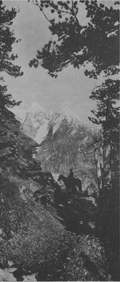
MOUNT JACKSON FROM TRAIL ABOVE LAKE ELLEN WILSON. Hileman Photo

WHISTLING MARMOT Grant Photo
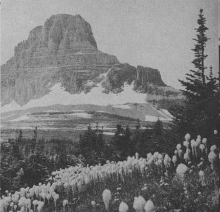
BEARGRASS IS ABUNDANT THROUGHOUT THE PARK. MOUNT CLEMENTS IN
THE BACKGROUND.
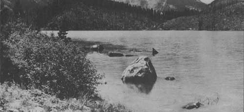
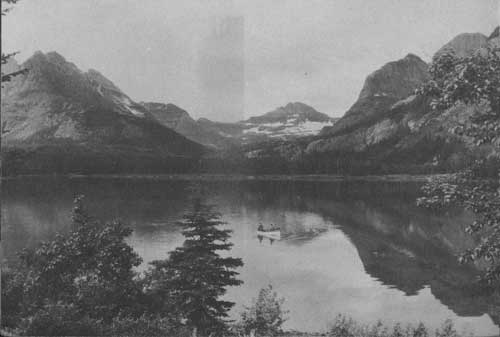
UPPER END OF SWIFTCURRENT LAKE. Hileman Photo
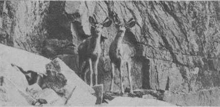
DEER IN THE VELVET.
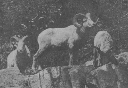
BIGHORN ARE AMONG THE INTERESTING ANIMALS TO BE SEEN IN GLACIER. Hileman Photo
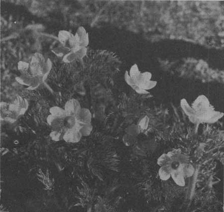
WIND FLOWER IN BLOOM Hileman Photo
NATURAL FEATURES
Geology.—Glacier National Park reveals a fascinating story of the hardening, uplifting, cracking, and erosion of rocks which were once deposited as mud on the bottom of an ancient sea. Here a great block of the earth's crust was raised and thrust eastward over the Great Plains for 20 miles. The mountains, lake basins, and valleys were carved from this rock by erosional agents, principally glaciers.
Flora.—The floral display is most striking in early July, but throughout the season there are always some flowers, be it early beargrass or the delicately colored alpine gardens found later on at higher altitudes. The lush forests of lower altitudes are red cedar and hemlock; intermediate forests are larch, fir, spruce, and pine.
Fauna.—Along the roads and trails a keen-eyed visitor may spy big game such as bear and deer, or upon the rocks a mountain goat or bighorn. Innumerable smaller animals and birds can be seen at almost every turn.
GLACIER PARK VILLAGE
The village of Glacier Park is on the plains at the foot of the front range of the Rocky Mountains. It is on the Great Northern Railway and U. S. Highway No. 2, which follow the southern boundary of the park to the west entrance at Belton. It is the southern terminus of U. S. Highway No. 89, (the Blackfeet Highway), which parallels the east boundary of the park and connects with the Alberta, Canada, highway system, and also the southern end of the Inside Trail to Two Medicine, Cut Bank, Red Eagle, and Going-to-the-Sun.
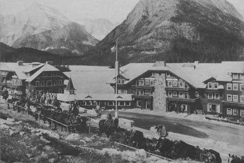
The commodious Glacier Park Hotel, several smaller hotels, auto camps, stores, post office, and park ranger station are located here. An encampment of the Blackfeet Indians is on Midvale Creek; the Indians dance, sing, and tell stories every evening at the hotel.
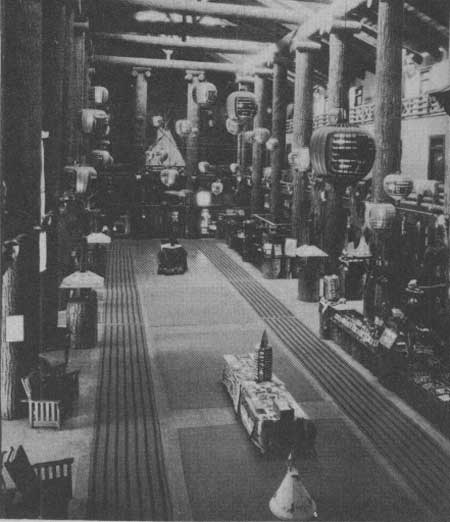
LOBBY OF THE GLACIER PARK HOTEL. Hileman Photo
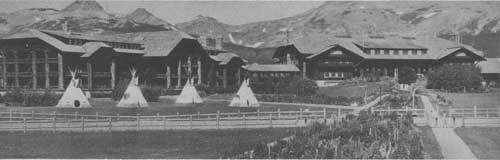
GLACIER PARK HOTEL Hileman Photo
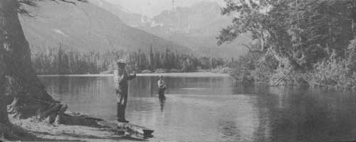
GLACIER NATIONAL PARK IS A PARADISE FOR FISHERMEN. THIS
SCENE IS AT TWO MEDICINE LAKE.
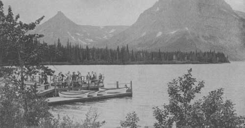
NO VISIT TO TWO MEDICINE IS COMPLETE WITHOUT A LAUNCH RIDE.
TWO MEDICINE
Two Medicine Valley presents a mountain lake surrounded by majestic peaks separated by deep glaciated valleys. A road leads into it from the Blackfeet Highway. A most inviting camp site is immediately below the outlet of the lake.
The cirques and mountain valleys above timber line are studded with lakes and carpeted with beds of flowers. Mountain goats and bighorn are frequently seen in these higher regions. Beaver colonies are located at the outlet of Two Medicine Lake and elsewhere around it, making this one of the best regions in the park to study these interesting animals. An abundance of brook and rainbow trout makes it a favorite spot for fishermen.
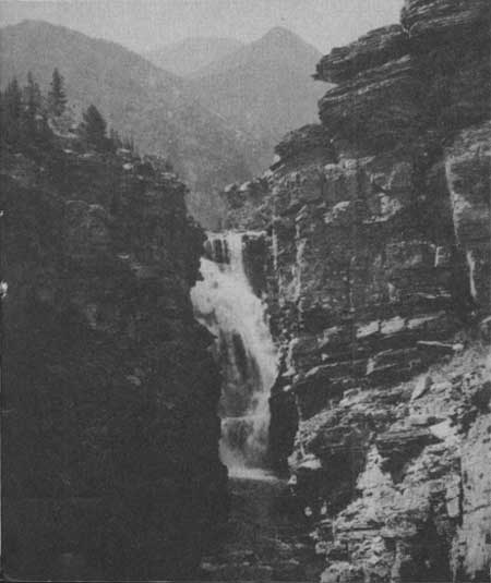
Trails for hikers and saddle horse parties radiate to adjacent points of interest. Trick Falls is readily accessible and should be visited by every one entering the valley. A launch crosses Two Medicine Lake every afternoon to the foot of Sinopah Mountain where a short footpath leads through a dense forest to Twin Falls.
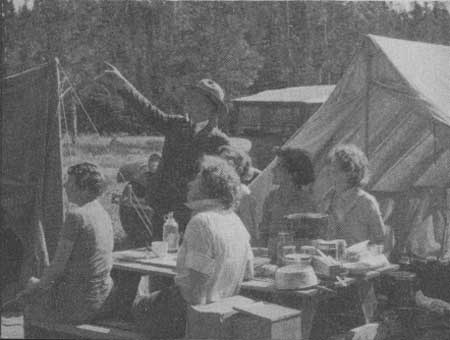
CAMPING AT TWO MEDICINE CAMPGROUNDS. Grant Photo
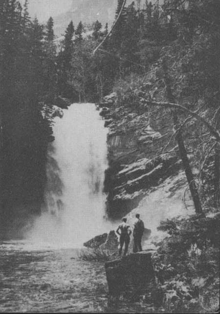
TRICK FALLS ON TWO MEDICINE RIVER. Great Northern Railway Photo
CUT BANK
Cut Bank is a primitive, densely wooded valley. Six miles above the Blackfeet Highway are a quiet chalet and a small camp ground which are reached by a spur lane from the Blackfeet Highway. The popular approach is on horseback over Cut Bank Pass from Two Medicine Valley or over Triple Divide Pass from Red Eagle Lake.
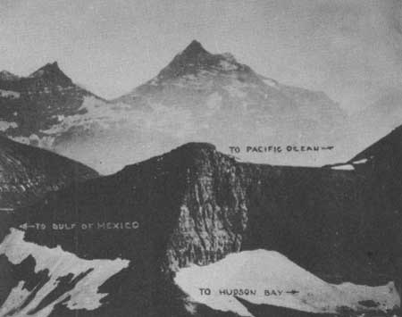
At the head of the Valley is the Triple Divide Peak (8,001 feet) which drains into the three oceans surrounding North America: Through the Missouri-Mississippi to the Gulf of Mexico (Atlantic); through the Saskatchewan to Hudson Bay (Arctic); and through the Columbia to the Pacific.
RED EAGLE
Red Eagle Lake is reached only by trail from Cut Bank over Triple Divide Pass, from St. Mary Chalets, or from Going-to-the-Sun. It is a favorite spot for fishermen, as large gamey cutthroat abound.
Accommodations are available during July and August at the Red Eagle tent camp.
TRIPLE DIVIDE PEAK FROM MOUNT JAMES.
MOUNT STIMSON IN BACKGROUND. Glacier National Park Photo
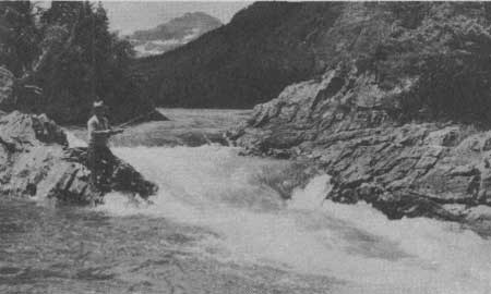
FISHING AT THE OUTLET OF RED EAGLE LAKE. Hileman Photo
RED EAGLE LAKE. Hileman Photo
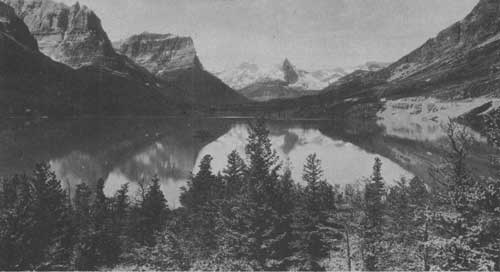
VARICOLORED PEAKS SURROUND ST. MARY LAKE. Hileman Photo
ST. MARY ENTRANCE AND VALLEY
St. Mary Lake is the most sublime of mountain lakes. From its foot the plains roll northeastward to Hudson Bay and the Arctic; on either side peaks rise majestically a mile sheer.
The Going-to-the-Sun Highway from St. Mary to Lake McDonald runs along the north shore of the lake. Trails radiate from Going-to-the-Sun Chalets; horseback riding and hiking are especially popular.
At East Glacier, 3 miles below the chalets, free campground and moderate-priced cabin accommodations are located. A camp store and lunchroom are operated in connection with the cabins.
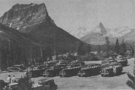
BUSSES STOPPING AT GOING-TO-THE-SUN CHALETS. Hileman Photo
ON A ROCKY SLOPE ABOVE THE LAKE ARE THE CHALETS.
(click on image for a PDF version)
MANY GLACIER
Swiftcurrent Lake is the hub of points of interest. From it branch numerous deep glacial valleys. It is reached by a spur from the Blackfeet Highway at Babb, or by trail from Going-to-the-Sun, Granite Park, and Waterton Lake.
At Many Glacier are the largest hotel in the park, an auto camp, and housekeeping cabins. The hotel has telegraph and telephone services, an information desk, swimming pool, photograph shop, a first-aid station, and other services. A garage and gasoline station are situated near the hotel. A store with an ample line of campers' needs, including fresh meat, bread, butter, and eggs, is located in the auto campground. Adjacent is a coffee shop, serving meals at moderate prices.
Excellent trails lead to Morning Eagle Falls, Cracker Lake, Grinnell Lake, Grinnell Glacier, Iceberg Lake, and Ptarmigan Lake. Footpaths go around Swiftcurrent and Josephine Lakes, to the summit of Mount Altyn, and to Appekunny Falls and Cirque. Many Glacier is a center for fishermen; wildlife is seen frequently. Launch trips are made daily on Swiftcurrent and Josephine Lakes.
GRINNELL LAKE AND GLACIER. Hileman Photo
HORSEBACK PARTY LEAVING MANY GLACIER HOTEL. Hileman Photo
BELLY RIVER COUNTRY
Though similar to Swiftcurrent Valley in topography, the Belly River district is wilder and more heavily forested. It is accessible by trail only from Many Glacier over Ptarmigan Wall or from Waterton Lake over Indian Pass. A tent camp on Crossley Lake provides food and lodging to hikers and trail riders. Fishing is good in the lakes. The 33-mile trip from Many Glacier to Waterton is one of the finest to be taken in the park. Crossley Lake Camp is approximately midway.
MOUNT WILBUR AND PTARMIGAN CREEK. Hileman Photo
MICHE WABUN FALLS, NORTH FORK OF THE BELLY RIVER. Glacier National Park Photo
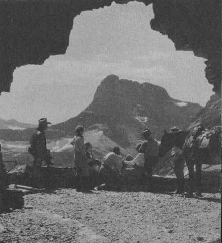
HORSEBACK PARTY RESTING AT PORTAL OF PTARMIGAN TUNNEL. Hileman Photo
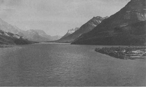
WATERTON LAKE, LOOKING SOUTH INTO GLACIER NATIONAL PARK.
INTERNATIONAL PEACE PARK
The Waterton - Glacier International Peace Park was established in 1932 by an act of the Canadian Parliament and by Presidential Proclamation.
"The dedication of the Waterton-Glacier International Peace Park is a further gesture of the good will that has so long blessed our relations with our Canadian neighbors, and I am gratified by the hope and the faith that it will forever be an appropriate symbol of permanent peace and friendship." (From the President's dedicatory address.)
Waterton Lake extends northward for eight miles across the International Boundary. A townsite is located at the foot of the lake which is reached by highway from Glacier National Park, Babb, Cardston, Lethbridge, Calgary, and points in the Canadian Rockies. The modern Prince of Wales Hotel, several other hostelries, cabin camps, garages, stores, and other facilities are located here.
Trails lead from Waterton Townsite to principal points of interest in the Canadian park, as well as up the west shore to Goathaunt Camp at the head of the lake. Launch trips to Goathaunt are available 3 times each day.
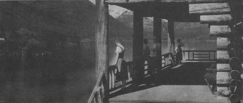
SCENES SUCH AS THIS MAY BE ENJOYED BY
VISITORS TO THE ADJACENT REMOTE SECTIONS OF THE PARK.
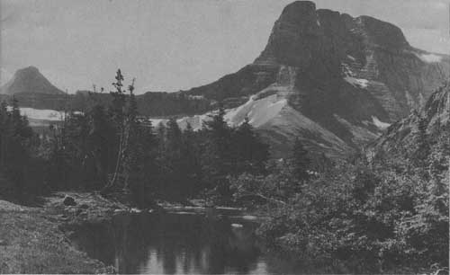
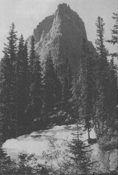
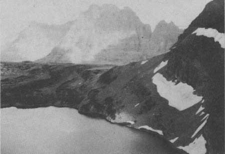
FIFTY MOUNTAIN-GRANITE PARK
Granite Park is a paradise of alpine boundary two parallel mountain ranges. The eastern range extends from the Canadian boundary to New Mexico. The western range rises at the head of Lake McDonald, becomes the front range beyond the International Boundary, and runs northwestward to Alaska. Between these two ranges in the center of the park is Flattop Mountain whose groves of trees are open and parklike, wholly unlike the dense forests of the lowlands.
A trail leads south from Waterton Lake over Flattop to Fifty Mountain Tent Camp and to Granite Park Chalet built on a great mass of lava that once welled up from the interior of the earth and spread over the region, then the bottom of a sea. The tent camp and chalet command a fine view of the mountains around Logan Pass, of the Livingston Range to the west, and of systems far to the south. The chalet may also be reached by trail from Going-to-the-Sun, Logan Pass, Avalanche Camp, Lake McDonald, and Many Glacier.
Animal life is varied and easily studied. Bear and deer are common. Mountain goats linger near Flattop Mountain and Ahern Pass; bighorn graze on the slopes of the Garden Wall. Ptarmigan should be looked for, especially above Swiftcurrent Pass.
Granite Park is a paradise of alpine flowers. On the Garden Wall, the connoisseur should seek the rare, blue alpine columbine. Here also are expanses of dryads, globe flowers, alpine fireweed, and a wealth of others. Early July is the best time for floral beauty.
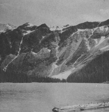
SUE LAKE AND MOUNT MERRETT. Glacier National Park Photo
MOUNT VAUGHT FROM MCDONALD CREEK. Glacier National Park Photo
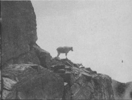
ROCKY MOUNTAIN GOAT. Glacier National Park Photo
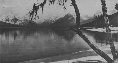
LAKE MCDONALD. Hileman Photo
LAKE McDONALD VALLEY
Lake McDonald is the largest lake in the park. Its shores are heavily forested with cedar, hemlock, white pine, and larch. At its head impressive rocky summits rise 6,000 feet. The Going-to-the-Sun Highway runs along the southeastern shore. Near the upper end of the lake are Lake McDonald Hotel, a store for general supplies, a gasoline station, and all modern facilities. Trails radiate to Sperry Chalet and Gunsight Pass, Upper McDonald Valley, the summit of Mount Brown, and Arrow Lake. There is good fishing in Arrow and Snyder Lakes.
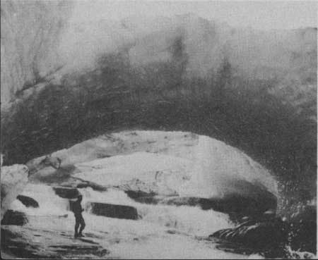
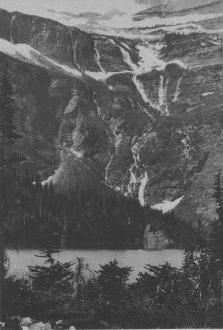
ICE BRIDGE AT THE FOOT OF A GLACIER. Glacier National Park Photo
A well-equipped public auto campground is at Sprague Creek, near Lake McDonald Hotel. Ranger services are available at the hotel and in the campground.
Avalanche Creek Valley, which leads into McDonald Creek just above Lake McDonald, is the site of Avalanche Campground, located in a grove of cedars and cottonwoods at the mouth of Avalanche Creek. From the campground, a self-guiding nature trail follows this creek to Avalanche Lake, 2 miles distant.
SPERRY
Sperry Chalets are located in a high mountain cirque, with precipitous, highly colored Edwards, Gunsight, and Lincoln Peaks hemming it in on three sides. They are reached by trail only from Lake McDonald and from Going-to-the-Sun via Gunsight and Lincoln Passes.
Twice daily, an experienced Alpine guide, with rope and alpenstock, takes parties from the chalets to Sperry Glacier, where visitors may safely explore the icy surface and crevasses under his guidance.
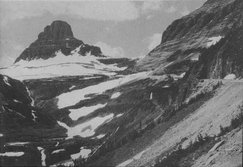
GOING-TO-THE-SUN HIGHWAY OVER LOGAN PASS
AVALANCHE LAKE, 2 MILES BY TRAIL FROM THE HIGHWAY.
Although Glacier is primarily a trail park, and every visitor who wishes to know the real Glacier National Park should plan to take at least one hike or saddle trip, the 53-mile Going-to-the-Sun Highway provides for motorists a sample of the park's most spectacular scenery.
The highway begins at the West Entrance, near Belton, and follows Lake McDonald and McDonald Creek to the Garden Wall, a precipitous knife-edge which carries the Continental Divide at its highest point. Gradually the highway ascends the Garden Wall to Logan Pass, with magnificent panoramic views of McDonald Valley and the Livingston Range.
From the pass it descends into the valley of blue St. Mary Lake to its eastern terminus, passing Blackfoot and Sexton Glaciers, which may be seen from the vicinity of Going-to-the-Sun Chalets.
At Logan Pass naturalists are on hand to answer questions and lead short walks afield, chiefly to Hidden Lake, 2 miles distant, which occupies a basin only recently occupied by ice.
ON GOING-TO-THE-SUN HIGHWAY, LOOKING TOWARD LOGAN PASS, ACROSS
THE CONTINENTAL DIVIDE, AND MOUNT REYNOLDS.
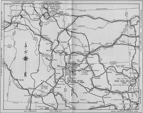
HOW TO REACH THE PARK
BY RAIL
The park is on the main transcontinental line of the Great Northern Railway. For information regarding fares and service, apply to ticket agents or address A. J. Dickinson, Passenger Traffic Manager, Great Northern Railway, St. Paul, Minn. A regular bus schedule is maintained by the Glacier Park Transport Co., to accommodate persons arriving by rail.
BY BUS
The Intermountain Transportation Co. operates busses to Belton from Missoula on the south, and to Glacier Park Village from Shelby, Great Falls, and the east. The Great Falls Coach Lines Co. also serves the park from Great Falls where connections are made to eastern points. On the north the authorized park operator connects at Waterton Lake with the Central Canadian Greyhound Lines from Lethbridge or McLeod.
BY AIRPLANE
Planes of the Western Air Express and Inland Air Lines stop at Great Falls, and those of the Northwest Air Lines stop at Missoula. Western Air Express also has a landing field at Cut Bank, 52 miles from the park. Connections to the park may be made by bus, rail, or privately chartered plane.
BY AUTOMOBILE
Glacier National Park may be reached by motorists over a number of modern highways, including United States Highways Nos. 2, 89, and 93. From both east and west sides, highways run north to the Canadian national parks.
ACCOMMODATIONS
There are comfortable accommodations in the park to fir the purse of everyone. Cabins, tent camps, chalets, hotels, and free auto campgrounds are so situated that one may easily make an extensive tour in the park by automobile, saddle horse, or foot without worry about food or shelter. Bus, saddle horse, and boat services are available.
The minimum rate in hotels, American plan, is $6.50 per day for single occupancy of a room, $5.50 each for three persons in a room. The American plan rate in tent camps is $5 per day; the minimum rate in chalets is $4.50; cabins scale from $1.25 per day upward. Rooms and meals at hotels and chalets may be obtained on the European plan.
The park season is May 1 to October 15. Hotels, chalets, and bus service within the park are available between June 15 and September 15; from May 1 to June 15 and from September 15 to October 15 accommodations may be obtained adjacent to the park. Logan Pass is usually closed to traffic until June 15.
| <<< Previous | <<< Contents>>> | Next >>> |
1941/glac/sec1.htm
Last Updated: 20-Jun-2010