|
BIG HOLE
Commemoration and Preservation: An Administrative History of Big Hole National Battlefield |

|
Chapter Five:
Administration Under Yellowstone National Park, Later Years (1956-1977)
Mission 66
NPS Director Conrad L. Wirth conceived of Mission 66 as a means of summoning administration and congressional support for massive federal investment in the national parks. Instead of going to the Bureau of Budget and Congress for development funds in two- and three-year increments, Wirth proposed to submit a comprehensive plan for the renovation of the national park system over a ten-year span. The completion of the program in 1966 would coincide with the fiftieth anniversary of the establishment of the National Park Service. [1]
Wirth was helped in his endeavor by individuals and organizations in the conservation movement whose writings in the mid-1950s brought about a heightened public awareness of the state of the parks. For example, Bernard DeVoto's scathing article in Harper's Monthly, "Let's Close Our National Parks," described the decaying infrastructure and demoralizing working conditions in the national parks, and an article in Reader's Digest by Charles Stevenson, titled "The Shocking Truth About Our National Parks," warned prospective visitors of the unsanitary, even slumlike conditions that were typical of the hotels and campgrounds.
First and foremost, Wirth persuaded President Dwight D. Eisenhower and the key committees in Congress to support Mission 66 because it would rectify nearly fifteen years of neglect resulting from budget cutbacks during World War II and the Korean Conflict. It would also restore the parks to a condition that would satisfy the growing millions of Americans who visited the national park system each year.
Of greatest importance to Big Hole Battlefield National Monument, Wirth also conceived of Mission 66 as an opportunity to rethink concepts of national park design. As Wirth remembered his instructions to his staff years later in his book Parks, Politics, and the People, the Mission 66 staff and steering committee were to question any elements of park design that they thought had outlived their usefulness: "nothing was to be sacred, except the ultimate purpose to be served. Men, method, and time-honored practices were to be accorded no vested deference." [2]
Big Hole Battlefield faced the Mission 66 era as an under funded and underutilized stepchild of Yellowstone National Park. [3] Here, "time-honored practices" were limited to making do with too little funding, too little land, and too little foresight. Those who guided the monument through the Mission 66 planning process accorded this practice little deference. [4]
Big Hole Battlefield National Monument: Mission 66 Prospectus for Development
On July 7, 1956, Historian Roy E. Appleman – a hard nosed, dedicated professional – inaugurated the Washington office's involvement in the Big Hole Mission 66 planning process when he toured the battlefield with seasonal ranger Michael Sedar and Assistant Yellowstone Superintendent Warren Hamilton. Neither Appleman nor Hamilton had been to the site before. The day was bright and warm, displaying the "gorgeous scenery" of the Big Hole Valley to full advantage. A steady trickle of visitors, drawn to the area (Sedar guessed) by the good fishing on the Big Hole River, walked the trails that criss-crossed the Siege Area. They seemed, to Appleman, to be interested in what they saw.
|
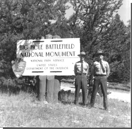
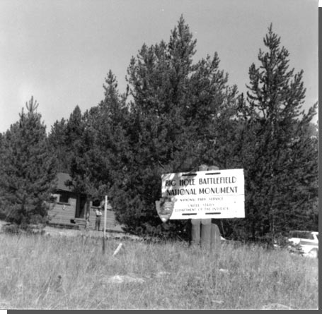
| New entrance sign. Mission 66 promised to give Big Hole Battlefield National Monument a higher profile. Courtesy National Park Service, Big Hole NB, n.d. |
| 1957 | 6,600 |
| 1958 | 7,600 |
| 1959 | 9,100 |
| 1960 | 10,700 |
| 1961 | 9,600 |
| 1962 | 13,800 |
| 1963 | 15,200 |
| 1964 | 18,800 |
| 1965 | 17,500 |
| 1966 | 21,100 |
| 1967 | 18,200 |
| 1968 | 34,100 |
| 1969 | 34,600 |
| 1970 | 39,700 |
| 1971 | 40,300 |
| 1972 | 45,850 |
| 1973 | 35,100 |
| 1974 | 34,800 |
| 1975 | 40,500 |
| 1976 | 47,500 |
| 1977 | 51,600 |
Despite Appleman's enthusiasm for the monument's setting and potential, he described the current condition as intolerable and could remember no other service area that showed "more neglect over a long period of years than Big Hole Battlefield." Visitor facilities were limited to pit toilets, a drinking fountain of good water, an incoherent collection of poorly displayed artifacts, and the old log museum that transgressed upon the Siege Area. A registration book rested on a shelf outside the museum. A "large number" of signs related to the soldiers of Gibbon's Command and to the Bitterroot Volunteers were incised with outdated text developed during the Forest Service's tenure. Markers related to the Nez Perce dated to McWhorter's investigations of the 1920s and 1930s. The signs and pedestrian trails were in good condition only if one considered the serious lack of help and funds availed the seasonal ranger. These developments neither adequately served visitors' needs nor adequately reflected the importance of the site. [5]
The draft Mission 66 prospectus or "master plan" submitted to Washington in late 1956 addressed these needs in gross abstractions. The Park Service promised to preserve battle remains for posterity and to interpret the battle and its relation to the broad sweep of western American history. To this end it promised construction of trails and walkways; water, sewer, power, and communication systems; a visitor center and administration building with exhibits; a residential and utility compound; new directional and informational signs and markers in the battlefield area and on the approach roads; and a boundary fence. These improvements would not include overnight accommodations or additional camping facilities: Big Hole Battlefield would remain primarily a day-use area, with recreational use encouraged on adjacent forest service land; the air of quiet dignity appropriate to a memorial would therefore be preserved. Details of design, resource placement, and interpretive focus would be resolved over the course of the next pivotal decade in Big Hole history. [6]
Park Service officials agreed that the success of this development scheme hinged on immediate road improvements to the monument site. In 1956 (and despite the improvements anticipated by Assistant Chief Ranger B. R. Finch in 1949), the 12 miles of State Highway 43 northwest of Wisdom to the battlefield remained unpaved, as did the 24 miles between the monument and the Bitterroot Valley. The road could not be fairly classified as all-weather. In encouraging Montana State Highway Commission support for highway reconstruction, the Park Service reminded the state of the economic advantages of increased tourism and promised a well-funded commitment to the development and improvement of the battlefield as part of Mission 66. The Park Service also negotiated with the Bureau of Public Roads (BPR) for an alignment that would place the new road "as near the [historic] monument entrance as possible" and that "exploited the views" toward the monument. In deference to topography, curve slope, and the water rights associated with private ditches, however, BPR routed the highway approximately two-miles west of the historic alignment. In 1962, the state of Montana and the U.S. Forest Service completed improvements to Highway 43, linking U.S. Highways 91 and 93. Visitation increased dramatically, from 9,600 in 1961 to more than 20,000 in 1966. [7]
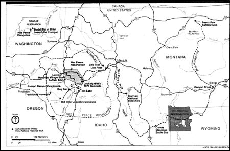
Park Service officials also insisted that proper development of Big Hole Battlefield National Monument depended on an extension of the boundaries. Overcoming two decades of ambivalence on this issue, the proposed master plan established that acquisition of the Twin Trees, the howitzer capture site, and the Nez Perce Encampment Area was essential if the monument was to be interpreted to Park Service standards and if significant resources were to be protected. Continued discussion of these acquisitions focused not on need or merit but on determination of the eastern and southern limits to the Encampment Area. This discussion was informed in part by a cursory metal detector survey of the area completed by Custer Battlefield
|
Historian Don Rickey in July 1959 and by the battle-related details provided in a historical research report completed by Dr. Merrill D. Beal (see Research and Interpretation). [8] In large part, however, the Park Service based its boundary expansion objectives on the staking completed by McWhorter and Yellow Wolf in 1937; "we seriously question whether any evidence could be more precise or authoritative." [9] Ultimately, the service acquired the W??? NE??? of Section 24, Township 2S, Range 17W. Historians from Region II and Yellowstone National Park voiced confidence that those 80 acres encompassed the camp and initial-attack area. [10]
|
| Robert Burns, seasonal ranger and management assistant at Big Hole in the late 1950s, and first superintendent of Nez Perce National Historical Park, established in 1965. Courtesy National Park Service, Yellowstone NP, n.d. |
Finally, there was little discussion as to the need for additional administrative staff at the park. In 1959, Robert L. Burns was appointed "Management Assistant, Big Hole Battlefield National Monument," assigned to the Yellowstone Superintendent yet responsible for the day-to-day administration of the battlefield. Following Burns' transfer to Perry's Victory and International Peace Memorial National Monument in October 1960, the post was filled briefly by Yellowstone Park Ranger Lloyd R. Hoener and then by Yellowstone Law Enforcement Officer Howard Chapman. There is no evidence that either Hoener or Chapman were actively involved in monument administration during their brief tenures. In April 1961, Yellowstone Ranger Jack R. Williams assumed the management assistant position. Williams was followed by Clyde Maxey, Aubrey Haines, Elroy Bohlin, David Stimpson, and Al Schulmeyer. In June 1961, staff was further expanded with appointment of a seasonal maintenance man, a first in the history of the site. The seasonal ranger position was redesignated "Seasonal Interpreter/Historian" and two interpreters were assigned to the site each summer season. Together this team was responsible for site administration, interpretation, research, and protection. ("Complete separation of functions," Williams wrote, "[was] difficult in a small area.") These tasks were designed to meet two overriding goals: first, to tell the story of "those dreadful days in August of 1877" without bias and second, to "channel and control" visitor use in a manner that minimized physical impact. [11]
The relative equanimity of the Mission 66 planning process ended when officials debated the location and extent of visitor services. [12] In 1957, landscape architects Sanford "Red" Hill and Frank Mattson of the Branch of Plans and Design proposed to locate park headquarters and a visitor center one-half mile south of the estimated southern end of the Encampment Area, on a flat bench that provided a panoramic view of all phases of the conflict without intruding on the battlefield. This "Ruby Bench" site was also, Appleman criticized, "more than ??? mile from any point of interest" (demanding that visitors make two stops or hike a substantial distance) and was on private land (necessitating costly purchase of an estimated 143 acres). Appleman proposed a sagebrush slope 200 yards northwest of the Siege Area as an alternative. It provided immediate visitor access to the battlefield and could be acquired from the Forest Service at no cost. Like Ruby Bench, the north slope offered a view of the army's initial approach route, the Nez Perce Encampment Area, and the Siege Area. Unlike the bench, Appleman and others argued, this view was more "intimately" associated with the battlefield proper and its construction would not disrupt the middle-distance view from the river bottom toward the crest of the hill. Staff residences could be located in the forested swale west of the proposed visitor center, where they would be sheltered from public view. Park Service officials debated these two sites for the next five years, weighing the "economy and efficiency" of the north-slope site against the panoramic view of the bench. [13]
| 1959-60 | Robert L. Burns |
| 1961 | Lloyd R. Hoener |
| 1961-63 | Jack R. Williams |
| 1963 | Clyde Maxey |
| 1964 | Aubrey Haines |
| 1965-68 | Elroy Bohlin |
| 1969-72 | Dave Stimson |
| 1973-87 | Al Schulmeyer** |
| **(position redefined as Superintendent ca. 1973) | |
Ultimately, Park Service officials determined that neither the howitzer site nor the Twin Trees could be easily seen from the north-slope site. The Siege Area "showed as tree tops." Inadequate level land was available for parking and building construction and, finally, the access road would require construction of a visually intrusive hillside cut. The final Mission 66 master plan and associated boundary status report recommended purchase of the Ruby Bench building location. The plan identified the bench as the site that best conformed to Park Service goals not to infringe upon the battlefield, as the site most "handy" to the revised alignment of State Highway 43, as the site that best facilitated interpretation, and as the site most vulnerable to "adverse use" if left in private ownership. [14]
Administrative tasks outlined in the master plan included construction of housing for all uniformed permanent and seasonal personnel; maintenance of the fire-fighting agreement with the Beaverhead National Forest; [15] "cooperation" with the state of Montana in the management of fishing; and inclusion in the NPS omnibus bill of the $664,895 required to complete the monument development plan in one package unit. [16]
|
For the immediate future, the battlefield was to be managed within the framework of this master plan and under the supervision of the Yellowstone National Park superintendent. As early as 1962, however, the Park Service foresaw a time when the monument would be sufficiently developed and would attract sufficient visitation to be established as an autonomous unit, without the constraints imposed by a "coordinating" superintendency. [17]
Initiation of the plan required only congressional approval of the boundary modifications and land purchase.
"At Long Last": Public Law 88-24
Park Service officials who sought to acquire the additional land and funding assumed the challenge of presenting the Nez Perce people and their story as worthy of the proposed memorialization. Their careful effort to clarify the tragic cost of westward expansion (beyond a "regrettable footnote to an otherwise happy story") contradicted the patriotic fervor that defined Park Service interpretive efforts and public response to Custer Battlefield. [18] Their cause was aided by the sympathy that Anglo-Americans had long accorded the Nez Perce and by the ease with which the Nez Perce could be categorized as "good" Indians, "civilized," and historically respectful of America's move West. As described by Park Service officials in written testimony to Congress, the Big Hole Battlefield Siege Area and historic War Department monument "rightly served" as testimony to the "high military qualities" of the Frontier Army. Park Service control of the Nez Perce Encampment Area, Howitzer Capture Site, and Twin Trees simply "expanded" the tribute to include the military skill of the Nez Perce and expanded the interpretive potential to include "white encroachment on the Nez Perce lands and a continuing series of mistreatments of the Indians." One official enthusiastically compared the epic Nez Perce flight with Xenophon's March of the Ten Thousand in the Persian wars of antiquity. Chief Joseph was lauded as a humane man "without the ferocity and savagery expected of Indian leaders of his time," a remarkable military strategist, and the "highest type of Indian that General Nelson A. Miles had ever known." [19]
On May 17, 1963, the 88th Congress approved Public Law 88-24, authorizing the addition of 160 acres of national forest land and 295.6 acres of private land to the monument boundaries. [20] The private land included the visitor center building site on Ruby Bench, right-of-way for an access road to the new alignment of State Highway 43, and the Encampment Area as defined by the McWhorter survey and subsequent investigations. Shown through "recent" studies to be significantly associated with the battle, the acreage also included the Horse Pasture/Twin Trees Area and the Howitzer Capture Site, both on national forest land. The Forest Service had agreed to this transfer and the land would be acquired at no cost. (This degree of cooperation between two agencies that often competed for control of federal lands runs through the history of Big Hole National Battlefield. In September 1963, Garrison thanked Region I Regional Forester Boyd L. Rasmussen and commended his staff: "a hearty thanks to you for your helpfulness in the matter of the land for Big Hole National Battlefield. . . . Over the years, the Forest Service has been mighty helpful and constructive with Big Hole matters and we are indeed grateful for this. We find continuing cooperative assistance from all of your men.") [21] The bill also redesignated the monument a national battlefield, a title more descriptive of the historic events and in keeping with NPS policy to designate uniform and appropriate administrative titles to units in the national park system (P.L. 88-24). Finally, it laid the groundwork for concurrent jurisdiction with the state of Montana over petty offenders in the national monument area (see Appendix A). [22]
Upon passage of the Big Hole expansion bill, a jubilant Jack Williams (recently transferred to Aztec National Monument) wrote local historian Thain White:
[I] imagine you are aware of the good news regarding Big Hole? It became Big Hole National Battlefield on May 17. One of five such areas in the country. Now, at long last, there is within the boundaries the site of the Nez Perce camp (McWhorter can now rest in peace); the Twin Trees; and the howitzer capture site. A couple of years should see it really nice I do believe with a good museum and so forth. [23]
Williams' jubilation was premature. The National Park Service did not secure legal title to the development site until 1966 and did not secure title to the Encampment Area until 1972.
Land Acquisition
In 1958, with Park Service encouragement, Mark and Tom Clemow had denied the Forest Service right-of-way access across the Encampment Area; the proposed Forest Service timber-haul road, the NPS argued and the Clemows agreed, would threaten the integrity of the historic scene. Although the Clemows' most immediate objection to the road was potential disruption of their irrigation system, they also voiced support for NPS plans to develop the monument. Yellowstone Superintendent Lemuel Garrison reported
the Clemow brothers expressed great interest in our plans, and gave the impression they were far more interested in seeing the Monument developed, along with improvements of access through rebuilding of State Route 43, than they were in seeing the development of forest products processing plants in the Wisdom and Big Hole Valley areas. . . . They assured me they would not sell the land to anyone other than the National Park Service until we had more time to develop a method of acquisition, and if we would stake out the minimum area we required, were willing to explore the possibility of an exchange for public domain lands of the Bureau of Land Management.
Immediately upon this vote of support from the Clemows, Garrison had the Encampment Area staked – it covered an estimated at 80 acres within the W1/2 NE1/4 Section 24 – and NPS officials approached the Bureau of Land Management about the possibility of a land exchange. This exchange was approved in principle by the BLM and the Clemows in June 1959. Subsequent land appraisals, however, failed to find suitable BLM land of equal value to the choice bottomland of the Encampment Area. In June 1960 the land-exchange scheme was abandoned and the Park Service established a "fair-market value" of $4,400 for the 80 acres. Negotiation over the dispensation or continuance of water rights appurtenant to the land and over the land's fair market value continually delayed purchase. A $20,000 congressionally imposed ceiling to the land-purchase budget at Big Hole further complicated the negotiations. This entire amount, once deemed adequate for the full extent of private land, had been expended on purchase of the development site in 1966 (see below). In March 1969, the Park Service successfully established an 18-month purchase option on the 80-acre Encampment Area plus 40 acres earlier excluded from the development site acquisition. Passage of the law (86 Stat. 120), which increased the acquisition ceiling at Big Hole National Battlefield, secured these funds and the Park Service acquired the Encampment Area in 1970, 33 years after Hill's initial report recommending its purchase (see Appendix A). The Clemows retained rights of use and maintenance for the single ditch that passed through the property. [24]
|
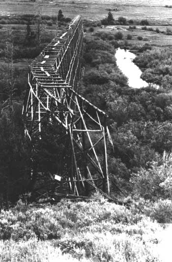
| Old water flume trestle shortly before it was removed in 1967. Photo by Elroy Bohlin. Courtesy National Park Service, Big Hole NB. |
Acquisition of the Ruby Bench development site (redefined as 175.718 acres) also proved more difficult than anticipated. Assured as early as 1958 of the Clemows' willingness to sell, the Park Service proceeded to make "numerous studies" of the "possibilities of interpretation" from the bench site. This process of "studies, moves, and counter-moves" continued for four years, to Mark and Tom Clemows' father's apparent frustration. In July 1962, Yellowstone Superintendent Garrison wrote a conciliatory letter to Martin Clemow, apologizing for the delays in land acquisition and for the continued uncertainty as to Park Service plans. "It must seem to you," Garrison wrote, "that the National Park Service is intolerably slow and confused in their approach." [25]
In August 1964, the assistant director of specialized services reported that Mark and Bessie Clemow had declined Park Service offers made "at or near" the appraised value of $14,500. In addition, the Park Service had been unable to reach agreement with the owner of mineral rights underlying the land, Bruce Risley. Of greatest concern, however, was Clemow's anticipated sale of much of the development site to a private party who proposed construction of a gas station, restaurant, motel and trailer park.
On October 6, 1964, the Secretary of the Interior filed condemnation proceedings for 175.718 acres of land owned by Mark Clemow of Mark Clemow Ranches, Inc., and for mineral rights. At the time of filing, the Park Service deposited $14,500 in the Registry of the Court for the taking of the land and $1 for the taking of the mineral rights. The jury defined just compensation at $18,300 for the land, counter to the Park Service's offer and despite Clemow's testimony that its value approached $40,000. Risley, meanwhile, failed to answer the court summons and the jury found the Park Service offer of $1 to be full, fair, and just compensation for the mineral rights. The final deed reserved the private use of four irrigation ditches and the right of access to maintain and repair them. [26]
Upon conclusion of the proceedings, the Park Service was able to advance development plans on the bench site. "Good will" among the service's Big Hole Valley neighbors, however, was significantly compromised. In a request for assistance from Senator Mike Mansfield of Montana, Risley wrote: "you probably do not realize how little respect the various government agencies have for the property or rights of the taxpayer. . . . The attitude seems to be – to hell with you as an individual. . . . If the Park Service takes over this land, how could I do any mining? I could not touch land that is under the Park Service so where are my rights?" Current Big Hole Superintendent Jon James reports that many in the Big Hole Valley shared Risley's sentiment and that the Park Service continues to repair the damage caused by the condemnation proceedings. [27]
Visitor Center Construction
On August 26, 1967, the Park Service broke ground for Williams' "good museum." Hill had initiated the visitor center design process in February 1964, with submittal of the "Advance Preliminary Drawing, Visitor Center and Utility Building," NM-BHB-3002. In conformity with a service-wide Mission-66 trend, the building was titled a "visitor center" rather than a museum and served multiple functions, providing administrative, museum, and utility space. In this initial and in all subsequent design proposals, the panorama of the battlefield served as the major display. Artifact collections and informative panels were intended to be "minor in extent," with exhibits related to Nez Perce culture and the political and military underpinnings of the campaign to the left of the panoramic windows and those related to the Nez Perce flight from Big Hole to Bear's Paw to the right. [28]

|
|
The visitor center was completed in 1968. Courtesy National Park Service, Big Hole NB. |
A diorama of the Nez Perce camp would show women and children fleeing as soldiers attacked and "a few" warriors returned fire. From the observation deck overlooking the battlefield, visitors would listen to a taped narrative. A ranger, stationed at a central information desk, would have an unimpeded view of all public spaces and would establish personal contact with the visitors as they entered. The west-display structural component mimicked tepee design. Truck storage and administrative offices were incorporated in the east wing of the structure. Additional infrastructure was limited to a four-unit employee apartment building, set back from the overlook site, outside the viewshed of the battlefield. The planned superintendent's residence was excluded from the final construction package, as a cost-saving measure. [29]
Access from the visitor center to the battlefield interpretive trails was provided by a new "return road," completed in 1967, that led across the wash and down the slope to a point on the historic museum access road. This road diverted from within the monument boundaries rather than branching directly from the new Highway 43 realignment. Although longer and more expensive to build and maintain, this route allowed the limited monument staff to better monitor visitors.
|
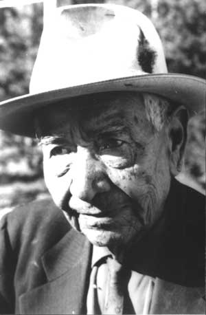
| Josiah Red Wolf, last survivor of the War of 1877. Courtesy National Park Service, Big Hole NB. |
The Park Service announced completion of the visitor center in July 1968 and in August Garrison authorized destruction of the old USFS museum and residence at the Siege Area. The Park Service celebrated this momentous transition with pomp and circumstance. Tepees erected in the Encampment Area represented the expanded scope of the memorial effort and visually "placed" the encampment site – coveted but not yet owned by the NPS – within the monument. An estimated 400 people attended the dedication ceremony, where Congressman Arnold Olsen of Montana was the principal speaker. Joseph and Ida Blackeagle and their daughter Norma (descendents of Chief Joseph) were in attendance. Josiah Red Wolf, the last survivor of the battle, cut the ceremonial ribbon. Midwest Regional Director Fred C. Fagerson commended Nez Perce National Historical Park Superintendent Bob Burns for his efforts to bring Red Wolf to the site: "I understand it took a lot of coaxing on your part before he would condescend to do this. . . . His being there was one of the most significant parts of the entire program." For Red Wolf, five years old in 1877, it was a first and final return to the site where his mother had been shot and killed while fleeing the attack with Red Wolf and his infant sister. When asked at the last moment to speak extemporaneously, Red Wolf declined – a moment that Burns remembers as a profound but awkward testimony to the lasting personal scars of the Nez Perce War and to the continued challenge of effective communication between two cultures. [30]
|
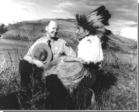
| Nez Perce National Historical Park Superintendent Robert Burns and Josiah Red Wolf. Courtesy National Park Service, Big Hole NB, circa 1965. |
Research and Interpretation
Research and interpretive efforts increased commensurate with increased staffing; for the first time, Williams remembers, Big Hole staff had the "funds and the wherewithal" to accurately and objectively interpret the details of the battle. [31] During the summer of 1962, park staff constructed a new circular trail from the historic parking area, around the Siege Area, to the Nez Perce Encampment/Horse Pasture overlook. [32] By the end of the 1962 season, Williams and Haines had installed new trail markers, in one of four designs: a routed outline of Chief Ollokot on brown, designating Nez Perce actions; a routed outline in white of a trooper hat designating army or volunteer actions; a white black-tipped eagle feather showing where a Nez Perce was killed or wounded; and a white cross designating the same for the troops and volunteers. Additional markers were added over the years, as new sites were revealed. They corresponded to a guide leaflet, "mimeo-graphed and hand assembled" during the first seasons and professionally printed (with minor modifications) by the Government Printing Office from 1963 until 1975. These leaflets were distributed from a new ten by fifteen-foot visitor center constructed by Williams at the Siege Area trailhead. [33]
Marker placement was based in large part on Williams' 1961-1962 effort to indicate the location of all known artifact finds on a master base map. Although Williams and his staff relied primarily on McWhorter's work (1937) they also included the results of Sherill's 1917-1918 survey; Don Rickey's 1959 metal-detector survey of the Siege Area and initial attack area, reported in "Field Research, Big Hole Battlefield National Monument, July 16-22, 1959"; and O.W. Judge's 1961 survey of the Encampment Area, reported by Williams in "Metal Locator Search – Nez Perce Indian Camp Area . . . August 21, 22, and 25, 1961." This data base was expanded in 1964 with Seasonal Ranger Kermit Edmonds' discovery of several important sites near the Howitzer Capture Area. This discovery "located and authenticated beyond any doubt the site of the howitzer episode" and was reported in "Field Research Project Report, Big Hole National Battlefield, June, July, August 1964" and associated grid maps NB-BIHO 8813 and NB-BIHO 8814. In 1964, Haines surreptitiously conducted a survey of the privately owned Nez Perce Encampment Area, tying in all artifact finds to McWhorter's stake locations on base map NB-BIHO 8812. Late in the fall of 1964, when the tourists had left and his family had returned to Yellowstone and he found himself with "nothing to do," Haines also surveyed two previously uninvestigated portions of the Encampment Area, locating evidence of Gibbon's left-wing charge, led by Lieutenant Bradley; the right-wing charge, led by Captains Logan and Rawn; and a probable battlefield burial. He reported his significant finds in "Report on Historical Research Accomplished at Big Hole National Battlefield During 1965." [34]
Interpretive Ranger Kermit Edmonds defined protection of these archeological artifacts as one of the most important tasks confronting park personnel in the early 1960s. The Park Service undertook these surveys not only as a means of increasing understanding of the details of the battle, but also as a means of protecting buried artifacts – and their information potential – from relic hunters. In off hours and late evenings, Edmonds also assumed responsibility for cataloguing all artifacts collected in the field, creating the Big Hole National Battlefield study collection. [35]
Haines attributes these early efforts to make Big Hole National Battlefield "a reasonably well interpreted site" to Jack Williams. These were "no-cost," "take-the-initiative," "grab-your- instruments-and-head-on-over" projects that inspired little controversy and generated an only modest paper trail. "The higher-ups in Yellowstone," Haines notes, "saw Big Hole as a nuisance site. There was no controversy because Yellowstone didn't really care." [36]
Formal development of an Interpretive Prospectus waited passage of Public Law 88-24 and expansion of the monument boundaries. Written by Clyde A. (Al) Maxey, this prospectus concentrated on the design of the visitor center, the logistics and location of the trail networks, and the tone and content of the interpretive signage. Typical visitor characteristics, as altered by the increased out-of-state traffic that followed reconstruction of Highway 43, informed these three primary development themes. [37]
Maxey reported that increasingly few visitors selected the battlefield as their primary destination; Big Hole provided a side trip and a rest stop – often made on impulse – for those traveling through the Big Hole Valley. These visitors were generally unfamiliar with the battle or the Nez Perce campaign and were wholly dependent upon Park Service interpreters for gripping explication. Increased numbers of out-of-state visitors diluted the impact of descendents of the Bitterroot Volunteers, who, prior to road completion, were an important constituency at the site. Edmonds remembers that, to the discomfort of park personnel and at variance with the interpretive focus, "these people wanted to celebrate the bravery and victory of the citizen volunteers . . . where most people came to contemplate the tragedy of the battle." [38]
Nez Perce occasionally visited the battleground, placing flowers, ribbons, and pendants at the Nez Perce death-site markers. The Park Service made no effort to remove the memorials, heightening the battlefield's dual role as historic site and sacred ground. American Indians of other tribal affiliations also came to Big Hole to draw inspiration or to pay their respects, moved perhaps by pan-Indian sentiments growing out of the civil rights movement and American Indian activism. [39]
The interpretive prospectus assumed that most visitors would proceed from the visitor center along a modified road system down to the battlefield area. The road would provide reasonably direct access to the battlefield, without unnecessarily disrupting the historic scene. Formal trails for the more "ambitious, energetic, and inspired visitor" were designed to provide a self-guided introduction to the battle, in chronological sequence, from the Army's approach, to the Horse Pasture, then to an overlook from the point where Gibbon's command made its initial assault on the Encampment Area, and finally to the Siege Area and the post-battle memorials. [40] The memorials were to be treated as cultural resources, representative of evolving public response to the battle and the Indian Wars. Through this chronological telling – initiated in the visitor center with the pre-battle interpretive displays – Park Service planners hoped to avoid the errors made at Custer Battlefield. There, the story was "literally told in reverse," beginning at the point of Custer's defeat and the soldiers' burials and forcing inordinate and inappropriate attention on the battle and the Seventh Cavalry rather than on the "long and bitter struggle between the white man and the Indian." (Historian Edward Linenthal argues that in books and movies, through the 1950s and 1960s, "the Indians' plight did not register as a human tragedy but served instead as the backdrop for the celebration of the westward march of Anglo-American civilization. Injustices done to the Indians were regrettable footnotes to an otherwise happy story." Since the 1870s, the Nez Perce saga had struck a different chord in the American public and the interpretive program and visitor response at Big Hole National Battlefield differed from those at other Indian War sites, most notably at Custer Battlefield.) [41]
|
| The improved highway over Chief Joseph Pass increased visitation at Big Hole National Battlefield. Courtesy National Park Service, Big Hole NB, n.d. |
According to the interpretive prospectus, interpretive text and battlefield signage would heighten the visual experience with a sense of the "excitement, the valor, the confusion, the cruelty of war and ultimately the futility of many of these conflicts." During normal working hours, monument staff would also present information. Monument gates were to stay open, however, during early morning and evening hours when full staffing was not practicable. Self-guided trails were to fully convey the broad details of the years prior to the battle, as well as the years that followed.
|
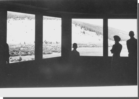
| The "main exhibit" – a panoramic view of the battlefield. Courtesy National Park Service, Big Hole NB, n.d. |
This focus on audio-visual and written materials not only accorded with the limited staff at the monument but also with changes in the service-wide interpretive program. In 1964, a Museum Study Team under the authority of the newly created Division of Interpretation and Visitor Services completed a management survey of the NPS Museum Branch. The team proposed a number of guidelines on exhibit design and preparation. Ralph Lewis reports that one guideline – that "the narrative story should, generally, be presented through publications and audiovisual means" – marked a turning point in the role of park museums. No longer would personal contact with a seasonal ranger define most visitors' national park experience. [42]
The NPS had intended to base their interpretive program and development plans at Big Hole on Historian Merrill D. Beal's monograph "The Nez Perce Campaign, 1877" (prepared under contract to the NPS and published in 1963 by the University of Washington Press as 'I Will Fight No More Forever'; Chief Joseph and the Nez Perce War). Reviewers in the academic press criticized the work as rife with minor errors, inconclusive in its analysis of controversial details of the military conduct of the campaign, and "failing to rise above its forerunners." Theodore Stern of the University of Oregon noted "[Beal's narrative] marks a regression from Fee's provision of battle maps, Haines' treatment of the events leading up to the war, and the special insights offered by McWhorter from Indian participants." [43] Park Service opinion was mixed. Regional Historian Mattes roundly criticized methodology and content. Haines, though more circumspect, also voiced concern that the study provided little new knowledge of the battle or the campaign." Yellowstone Superintendent Garrison, however, maintained that NPS reviewers had failed to acquaint themselves with the limits to the contract and had missed the opportunity for timely review. Garrison ruled that Beal had adequately fulfilled the terms of his contract and ordered that he be paid in full. Negative assessments of the work, however, prevailed and the monograph was not widely used by park staff. In 1967, Haines' "Historical Research Management Plan for Big Hole National Battlefield & Bibliography of the Nez Perce War, 1877" superseded Beal's document as the park's basic planning and interpretive document. [44]
|
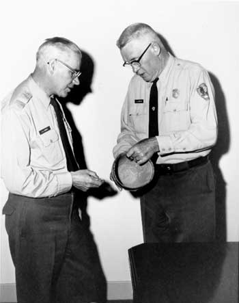
| Aubrey Haines, management assistant, and Lemuel Garrison, superintendent of Yellowstone National Park. Courtesy National Park Service, Yellowstone NP, n.d. |
Although Haines' work provided an effective management document, the Park Service continued to work without a definitive history of the Battle of the Big Hole. In his enthusiastic review of the "Historical Research Management Plan," Robert M. Utley requested that a "documented history of the battle of Big Hole" be added to the Summary of Research Proposals. "There is no one authoritative study on the subject, and . . . [one] should [be] available as soon as possible." This goal was not realized until the 1991 publication of Haines, An Elusive Victory – The Battle of the Big Hole (West Glacier, Montana: Glacier Natural History Association, 1991).
Since the 1930s, park interpreters had struggled to balance accurate presentation of the tragedy inherent in the battle with tribute to the Army Regulars and Bitterroot Volunteers. They had also struggled between a close focus on the details of the battle and a broad view of the Indian Wars and the cost of western expansion. In his "Statement of Historical Significance," Haines struck that balance and defined the dual focus as mutually inclusive. The details of the battle as revealed through careful research and testing – the location of a tepee, or a line of attack, or a death chant, or a burial – brought into immediate relief the lessons of the larger war. These details were reduced to minutia only when the larger story was excluded from the telling:
As a focal point in one of the least justifiable of all our Indian wars, the Big Hole National Battlefield is both a memorial to the courage and tenacity of the men of two disparate cultures, and a reminder of a dark phase in the Indian-White relationship. In the first sense – as a memorial – this battlefield provides an insight into the purposes and feelings of the individual participants . . . because it is so well documented from the particular viewpoint of each side, and because there is such a wealth of supporting physical evidence. The strong sense of duty and steadiness of the white soldier is as apparent as the Indian warrior's resolve to protect his own. . . . The travail of both, and the Indian non-combatants as well, stands out in bold relief.
In the second sense – as a reminder – the battle of the Big Hole illustrates the bitter end product of misguided policy. . . . In few other incidents does the injustice and futility of settling a dispute by force of arms appear more plainly than in this battle. [45]
Thirty years later, as he contemplates the length of his career and his contribution to Big Hole National Battlefield, Haines remembers "It is the best recorded battlefield of all the western Indian wars. Soldiers, volunteers, and the Nez Perce have contributed information. That makes it a more powerful story. . . . [Visitors] would go quietly around the area, like they were in a cathedral. I have never been in a Park Service area where people were so interested and so respectful." [46]
Natural Resource Protection
The Park Service Administrative Manual extolls: "through interpretation, understanding; through understanding, appreciation; through appreciation, protection." [47] Efforts to educate, therefore, merged with efforts to preserve and protect. The Branch of Interpretation maintained that "not the least of the fruits of adequate interpretation is . . . that it leads directly toward the very preservation of the treasure itself, whether it be a national park, a prehistoric ruin, a historic battlefield or a precious monument of our wise and heroic ancestors." [48] Of Big Hole National Battlefield's treasures, the sweeping historic scene was of greatest concern. The Mission 66 master plan established that "an awareness of the values in the natural setting will govern the preservation, development, and grounds maintenance policies." [49]
Immediately upon passage of P.L. 88-24, newly appointed Management Assistant Al Maxey initiated a flora restoration policy designed to return battlefield vegetation to its condition in 1877. Secondary historic and biological studies suggested that the Big Hole beaver would have been all but destroyed during the fur trade of the early to mid 19th century and that the population had not sufficiently recovered by 1877 to impact the landscape through flooding and the creation of willow habitat. Large numbers of grazing ungulates would have further controlled willow growth. Adverse landscape impacts associated with the introduction of cattle included over-grazing and the raising of the water table through extensive flood irrigation.
This analysis was substantiated by verbal, photographic, and unpublished accounts, including Herbert Lord's 1882 description of an open grassy hillside near the twin trees, mature lodgepole pine in the Siege Area, and isolated clumps of willow at the river bottom. By 1962 the Park Service managed a significantly different landscape: Sagebrush had increased on the overgrazed hillside. A solid mass of willows covered the bottom land. A 1920s beetle epidemic had killed the historic bullet-scarred trees and opened the Siege Area to second-growth timber. And fire-prevention efforts had altered the transition between forest and steppe. [50]
Maxey advocated careful photographic documentation by a range-plant expert to provide base-year data against which the Park Service could measure its efforts. He also encouraged completion of a dendrochronological study to determine the age of the Siege Area stand in 1877; removal of encroaching sagebrush, lodgepole, and the beaver population; and continued maintenance of the bullet-scared trunks with a petroleum-based preservative. By 1964, excavation of the battle trenches to their original depth had been added to the resource maintenance plan. [51]
Aubrey Haines and Yellowstone's Chief Park Naturalist John M. Good objected to Maxey's plan on only one significant account. Continuation of the on-going and marginally successful effort to preserve the trunks was not worth the limited interpretive benefits. "Better to save a few stumps for the museum and let the others go the way of all flesh," Good wrote. Haines agreed, suggesting construction of concrete cast replicas that could be erected within the Siege Area to "provide a few examples both of the manner in which lead was flying about at that time and the enthusiastic carving done by tourists attempting to salvage souvenirs at a later date." Haines also suggested that the bottom-land vegetation-restoration program include controlled grazing along Trail Creek (at times of minimal tourist use), to control the willows and other vegetation. [52]
Despite early realization of the importance of the landscape to the interpretive and preservation effort, implementation of Maxey's plan was delayed until the 1970s when Superintendent Al Schulmeyer lobbied for action.
Post Mission 66
In October 1972, Pat H. Miller of the NPS Operations Evaluation Team submitted his "Evaluation Report of Big Hole National Battlefield." The report was timely: the visitor center had been in operation for four years and the land-acquisition program had been completed, culminating the two primary components of the Mission 66 planning effort.
|
| Staff housing inherited from the U.S. Forest Service. Courtesy National Park Service, Big Hole NB, n.d. |
Although audio equipment was of poor quality and the audio-visual narrative contained some factual error, Miller voiced general approval of the visitor center layout and of the audio-visual presentation. The Siege Area Trail, however, he described as antiquated, rambling, and marked with "too much detail" that distracted from the more important circumstances of the battle. The trail leaflets could be "qualitatively improved" with assistance from the NPS Harpers Ferry Center. [53]
Deficiencies in monument administration demanded a more dramatic response. Incumbent Management Assistant Dave Stimpson complained to Miller of too little autonomy from Yellowstone. Within this most basic constraint, Big Hole Battlefield personnel were not provided with sufficient training in Yellowstone procedures or the administrative requirements relating to the battlefield. Nor were they provided with basic planning, programming, or budgetary documents and forms. There was no imprest cash fund, no copy machine, and no procedure to file or retain records. Staffing was insufficient during the off-season: when the full-time Management Assistant was compelled to travel, the monument was left unattended.
Infrastructure concerns included the decayed bridge across the North Fork of the Big Hole River, an overworked sewage leach field, and a noisy and inefficient ventilation system in the top of the visitor center "tepee." Security and fire-protection systems were meager. The battlefield staff depended on a cooperative agreement with the state of Montana for snow removal and, when snow clogged the valley and taxed the state's limited resources, the staff often had to wait a frustratingly long time for access road clearance. [54]
Alfred W. Schulmeyer, assigned to the battlefield in 1973 (as "Superintendent" rather than Management Assistant, a title that he insisted upon as a condition of employment), inherited these deficiencies in the physical plant and in the interpretative and administrative programs.
In Anticipation of the Centennial Year: 1974-1977
As Schulmeyer began his long tenure at Big Hole – he would serve as Management Assistant/Superintendent from 1973 until 1987 – he was aware that the centennial of the battle lay just four years away and would coincide with the national Bicentennial. This timing presented new opportunities for Big Hole National Battlefield, as record numbers of Americans were expected to visit historic sites. As in the past, NPS interest in increased visitation to the battlefield coincided with local interest in increased tourist dollars, providing an opportunity for a public/private partnership and for an effective "Public Relations" campaign. Most specifically, Schulmeyer served as co-chairman of the Heritage Subcommittee of the Beaverhead Bicentennial Commission and as Vice President of the Magicland Council ( the "travel-vacation-tourist arm" of the Chambers of Commerce for Beaverhead and adjoining counties), responsible for realizing the Bicentennial's potential to increase tourist awareness of Montana's historic sites and to increase tourist revenue. [55]
The timing of the centennial also presented new challenges. In a time of growing Indian militancy and awareness by non-Indians of the historic injustices perpetrated against Indian peoples, any commemoration of the battle was likely to be controversial. Park Service planners were vividly aware of recent events at Wounded Knee, Pine Ridge Reservation, South Dakota, where members of the American Indian Movement (AIM) seized and occupied the town near the site of the infamous massacre of 1890 and demanded radical changes in Indian affairs. Criticism of the centennial observances at Custer National Battlefield in 1976 heightened Park Service officials' mood of caution in approaching the centennial at Big Hole. (In response to the invitation to attend the centennial memorial program, Aubrey Haines wrote: "Dear Kermit: Wilma and I will be there at noon on the 9th. . . . I heard a rumor from the Southwest that Indians are contemplating some sort of demonstration. You may have heard of this already, and it may be purely talk – let's hope so." [56]) The Park Service carefully defined the Big Hole centennial program. Site improvements were to meet NPS development goals without committing the Park Service to a substantial role in defining the tone or the tenure of any commemoration: "It is our feeling that the National Park Service involvement in the centennial should be low key and should center around having the park in good physical condition." [57]
Interpretive Folders
The centennial reconstruction program resulted in a modified "mini-folder," initially written by Schulmeyer and edited and designed by Nancy McCaslin of Harpers Ferry Center (HFC). In conformity with the 1964 interpretive plan, the folder was to address events prior and subsequent to the battle, setting the Nez Perce campaign within the larger context of westward expansion. The discussion of the battle itself was to focus on those elements that made the battle significant and unique from others of the Nez Perce War. The primary objectives were also unmodified: to heighten public awareness of frontier history and Indian/White relations in general and the Battle of the Big Hole in particular, while instilling an appreciation of both Nez Perce and non-Indian combatants "caught in the much broader context of two mutually misunderstood ways of life." To these, HFC added another goal: to foster an appreciation for the role of the National Park Service in protection of the natural and cultural resources of the battlefield. [58]
Editing of the new brochure revealed the sensitive nature of the battlefield story. Schulmeyer's sympathy for the Nez Perce was obvious to those who reviewed the text, underscored by statements such as "the orders were to take no prisoners"; ". . . fleeing from the relentless U.S. Army which was under orders to herd them onto a reservation" . . . "sneaking up on . . . the unwary Nez Perce." [59]
In his review, Chief Historian Harry W. Pfanz complained primarily of the lack of objectivity. "Most of those reading it who know something of this phase of our history will be sympathetic to the Nez Perce," Pfanz noted. "However, this natural sympathy should not be intentionally encouraged (or discouraged) by the personal attitude of the writer." Pfanz also suggested increased focus on the fate of the Nez Perce after their surrender, based upon Robert Utley's recently published The United States Army and the Indian, 1866-1890. [60]
Schulmeyer, for his part, protested Pfanz's general comments and line edits, complaining that the modified text was "too passive" and read "like a historical journal." [61] Ultimately, Schulmeyer and Paul Sweringen, Interpretive Specialist at the newly established Rocky Mountain Regional Office (RMR), "sat down together" and revised the mini-folder text, line by line, removing the text that Pfanz had found most objectionable while retaining "sensitivity to the Indian point of view." [62] The final folder, described by Schulmeyer as of high-quality and worth the wait, arrived at the park in November 1975. [63]
A revised Siege Area trail folder, also written by Schulmeyer, arrived in the park in time for the 1976 season. This folder was paired with a new Siege Area Interpretive Trail (minus the "rocks, gravel, and stumps"). The absence of discussion regarding the text and presentation of the new folder suggests that it was not substantially different from the folder developed by Haines and Williams in the 1960s. The 1960 edition had relied heavily upon McWhorter's investigation and had rejected the soldier/volunteer focus of the Sherill markers and text. This incorporation of the Nez Perce story accorded with the formal interpretive plan pursued during the 1970s. [64]
To a degree not seen since McWhorter's work of the 1930s, Schulmeyer and Chief of the Rocky Mountain Region's Division of Interpretation, Wes Wolfe, also attempted to incorporate the Nez Perce "voice" in the Encampment Area Interpretive Trail folder. On June 20, 1977, Wolfe, with Schulmeyer's concurrence, petitioned for publication of a pamphlet "that revealed the Nez Perce experience of the Big Hole battle." The detail in the presentation, Wolfe maintained, would be less important than the insight on a subject that "goes deeper than the facts of battle." Wolfe and Schulmeyer recommended that Phil George, a poet and scriptwriter, or Alan Slickpoo, Nez Perce tribal historian, be asked to write the pamphlet. Both men wrote well, were knowledgeable of the subject, and through their close affiliation with the contemporary Nez Perce would bring credibility to the narrative. Wolfe further recommended that the Park Service refrain from debating style or content and not "saddle" the author with any restrictions other than a 2000-word limit: "it is the Nez Perce view we want to share with visitors." Efforts to contract with George were unsuccessful. Slickpoo, as tribal historian, contributed to the final text, written by Schulmeyer. [65]
Interpretive Displays and Archival Collection
For the museum, the Rocky Mountain Region secured $10,000 for artifact acquisition and repair and for redesign of the museum cases. With some of these funds, technicians at Harpers Ferry Center's Museum Lab repaired the shrinking, loose fitting, and checking wood of the mountain howitzer spokes and repainted the howitzer and limber. A "magnificent" eagle-feathered chieftains headdress [66] donated by Dr. Ralph Hubbard of Pine Ridge, South Dakota, formed the centerpiece of the redesigned Indian Life exhibit. In January 1976, the battlefield received a collection of artifacts from the General Gibbon estate. Edmonds described this collection as a "rare and spectacular [find] for the western military historian" and also of significant value to the battlefield by virtue of its association with Gibbon. [67]
|
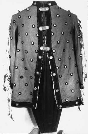
| Chief Joseph's coat with ermine tails, loaned to the NPS from the U.S. Military Academy at West Point soon after the visitor center opened. Courtesy National Park Services, Big Hole NB, n.d. |
Schulmeyer's final assessment of the nine new display cases was less than enthusiastic (although clearly representative of his frustration with the "collaborative relationship" with HFC): "the cases have a scant relationship to the preliminary plan presented to the park and region for review. If there are interpretive themes in the cases, they are too far-fetched for anyone to perceive." "Luckily," visitors devoted "scant time" to the display cases. [68]
In contrast, Schulmeyer was pleased with the historic portrait photographs and quotations that formed a "frieze" in the exhibit room. This successful presentation he attributed to his own and historian Paul Hedren's weekend and evening review of manuscript sources for quotes and photographs of "soldiers and warriors not just officers and chiefs." Schulmeyer and staff compiled information not used in the photograph display into biographical files housed in the visitor center. The photograph display, Schulmeyer reported, delighted visitors while the biographical files of the "common men" significantly added to the historical record of the battle. [69]
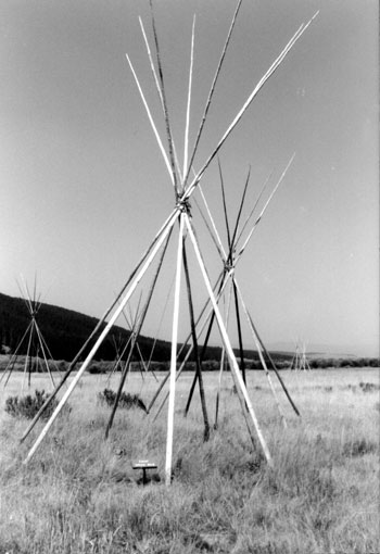
Schulmeyer was equally pleased with the tepee frames established in the Encampment Area prior to the centennial year. The frames had been approved in the 1964 interpretive prospectus as a means of conveying the extent and the size of the Indian camp. Completion of the visitor center had heightened the need for the display: Schulmeyer reported that those viewing the battlefield from the overview site often asked "where was the Indian camp?" Erection of 10 to 20 frames of 4 to 8 poles each, he argued, would visually place the camp while still "challenging" the visitor to "fill in the details" of a much larger populated camp of 87 hide-covered tepees of 20 to 40 poles each. Accurate, quality re-creation of the camp site was "out of the question financially" as each tanned tepee hide would cost more than $2,000. Although the Nez Perce had used canvas covers, the transition did not occur until the 1880s and their use would be not only inaccurate but a sign of a "lack of imagination" on the part of the Park Service and a lack of faith in visitors' ability to recognize symbols and to respond appropriately. [70]
|
|
Tepee frames, Encampment Area. Superintendent
Al Schulmeyer had the tepees installed before the centennial. Courtesy National Park Services, Big Hole NB, September 1998 |
Encampment Area Interpretive
Trail and Nez Perce National Historical Trail (Nee-Me-Poo)
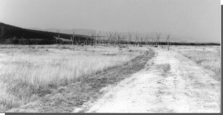
Also in anticipation of the centennial, Denver Service Center and HFC officials concurred on Schulmeyer's request for an interpretive walking trail to the newly acquired Encampment Area. As built in the spring of 1977, the encampment trail was 4' wide and extended 3,000 feet from the existing trail parking area to the camp site. Any visual intrusion to the historic scene, the Park Service argued, paled in contrast to the current "indiscriminate tracking" created by the estimated 10,000 visitors who wandered the meadow. Construction of the trail marked completion of the NPS interpretive trail program. All five principal battle areas as described by Landscape Architect "Red" Hill in 1939 – the howitzer capture site, the Siege Area, the initial assault, the Horse Pasture/Twin Trees, and the Indian Camp – could be easily accessed by visitors. [71]
This interpretive trail system was slightly modified in 1977 with designation of the Big Hole Battlefield National Recreation Trail, a component of the proposed Nez Perce National Historical Trail, also known as Nee-Me-Poo. Designated by Secretary of the Interior Cecil Andrus in time for the Centennial Program, the 22??? mile recreation trail extends from the Sula Basin in the Bitterroot Range, across the Continental Divide, and along Trail Creek for 16 miles to the western boundary of the national battlefield. The trail enters the battlefield along the abandoned USFS access road and ends one-half mile later at the confluence with the Siege Area Interpretive Trail. In 1977, the Park Service anticipated that impacts of trail designation would be limited to possible increased use of the interpretive trails by hikers. Trail designation did not alter NPS plans to restore the abandoned 6 to 8-foot graveled roadway through contour reconstruction and revegetation. [72]
|
| Tepee village and access trail. September, 1998. Courtesy National Park Service, Big Hole NB. |
|
Audiovisual Program
Despite Miller's general approval of the audiovisual (AV) program, the Denver Service Center and HFC officials concurred on Schulmeyer's request for correction of the more jarring factual errors. While Schulmeyer described the commissioned chalk and crayon drawings as "well done, imaginative, and aesthetically pleasing," he regretted that "technical aspects . . . [had not been] researched more thoroughly." Technical errors related to both the U.S. Army and the Nez Perce and included confusion of General Howard and Captain Perry ("if the officer being portrayed is meant to be Howard he has one arm too many"). A slide portrayed the Big Hole Valley as strewn with aspen or poplar, rather than willow. Another showed a Nez Perce warrior on foot. It was considered a shame in Nez Perce culture, Schulmeyer argued, to be caught dismounted. In addition, trenches were shown as too wide and too deep, tepees were inaccurately fastened, and all U.S. troops were shown in the decorative (and easily recognizable) uniforms of the cavalry. In fact, few cavalry had participated in the battle. Schulmeyer regretted these errors on two grounds: one, they contradicted the NPS focus on education and, two, battlefield staff were likely to be "caught up short" by an increasingly educated public. [73]
Schulmeyer reported that the first revised AV program received from HFC eliminated some errors while adding new ones. He also deemed the "contemporary female narrator" inappropriate. Wes Wolfe, Chief, Division of Interpretation in the Rocky Mountain Region, agreed and suggested that HFC "modif[y] the female voice to reflect a strong characterization which might include the use of an Indian accent." An approved program was submitted in time for the centennial season. [74]
The Historic Scene
Schulmeyer also called for a more concerted effort to return the North Fork and the battlefield to its historic appearance. The preeminence of the historic 1877 landscape in Schulmeyer's tabulation of Big Hole cultural resources was consistent with the 1962 Master Plan. Efforts to restore this landscape had included removal of the historic Ruby Ditch trestle (1964), [75] of the Soldiers' Monument fencing (1967), of the Forest Service complex (1968), and of the large edging rocks along the Siege Area Interpretive Trail (1971). Through the 1960s, the NPS also participated in a beaver transplant program with the state of Montana; four to thirty beaver were removed per year, depending on the time spent trapping. In December 1973, Schulmeyer directed removal of a driftwood and beaver dam that had caused the North Fork of the Big Hole River to abrade into the Indian Encampment Area. In 1974, a Yellowstone maintenance crew spent a week on a partial restoration of the old road cut to the Siege Area. Their effort included application of excelsior matting and the distribution of sagebrush seed. [76]
These stop-gap efforts, however, fell far short of the more expensive and technically difficult projects demanded if the Park Service were to effectively address the "natural resource problem." Echoing Maxey's 1964 report, Schulmeyer's 1977 "Statement for Management" identified the meandering river bed, the oversized willow, the uncontrolled beaver population, and the visual impact of abandoned roads and ditches as primary concerns. [77]
Schulmeyer also attempted to extend restoration of the historic scene to protection of the viewshed. When determining the boundaries of the Encampment Area and the limits to NPS land acquisition, Park Service historians had focused on the physical limits of the camp. In 1973, one year after purchase of the 80-acre Encampment Area, Schulmeyer reported that "the Clemow land adjacent to the Indian Camp site is still grazed while the Battlefield side is lush grass. The contrast after one summer already is an aesthetic eyesore." Schulmeyer proposed a revised boundary along the Ruby Bench contour until it joined with the willows of the river. He also recommended adjustment of the national battlefield/national forest boundary, to follow topographic/hydrographic boundaries at the limits of the battlefield viewshed, thereby protecting the battlefield from the visual intrusion of clearcutting on Battle Mountain: "at present we have nothing but verbal promises from the USFS that they will not cut timber up to the Battlefield boundary." Schulmeyer directed his boundary revision suggestions only to the Assistant Superintendent of Operations, Yellowstone, noting that the matter was one of "policy" rather than of immediate need (and that he had no real desire for a formal negative response from Region!). [78]
Administrative Restructure
Administrative changes initiated in the 1970s addressed some of the problems identified in Pat Miller's 1972 Operations Evaluation Team report. On July 1, 1975, the battlefield received an Imprest Fund. No longer were staff required to expend their own funds on minor purchases and then wait for reimbursement. In February 1975, Rocky Mountain Regional Director Dave Thompson designated the Yellowstone Library and Museum Association as an official cooperating association for Big Hole National Battlefield. The association assisted in artifact, photograph, and document acquisition, including the battlefield's large collection of pension records. Finally, by 1976 the battlefield had been provided with a ¾-ton, 4 x 4 pickup truck and blade plow for winter snow clearing. [79]
A service-wide "belt-tightening" directive issued in 1974 ("a year of fuel shortages, high prices and a troubled economy,") [80] stymied efforts to increase staff. The staff remained at a permanent superintendent, a subject-to-furlough maintenance man, two seasonal interpreters, and a seasonal laborer. Schulmeyer augmented this small staff with use of the Volunteer in the Parks program and he had the seasonal laborer double on occasion as an interpretive ranger. Without these adjustments, Schulmeyer maintained, "visitor services would [have] . . . suffered." This crew was not only inadequate in number but also in experience. "Seasoned" interpreters Kermit Edmonds and Dale H. Annis did not return for the 1975 season. While the new seasonals adapted quickly, Schulmeyer missed the "exceptionally high quality" that Edmonds and Annis brought to the interpretive program. For the 1976 season, Schulmeyer successfully "prevailed" upon Edmonds to return. [81]
In 1977, the maintenance position was reclassified as full-time permanent and the battlefield was authorized its first full-time historian, Paul Hedren, on a career-seasonal appointment. This position was reclassified as permanent upon release of the hiring ceiling. Ironically, immediately upon receiving authorization for a permanent maintenance position, maintenance man Steve Winters was transferred to Grand Canyon National Park. Schulmeyer was unsuccessful in recruiting a qualified replacement and the position was vacant for the last quarter of 1976. Qualified seasonal interpreters also remained scarce. In 1976, Schulmeyer reported that applicants from the newly instituted Rocky Mountain Region Seasonal Hiring and Rating System had "no background in history." Those secured through the regional Equal Employment Office were only "minimally qualified" and were most-often still in school and therefore unavailable for the spring and fall months. [82]
Centennial Memorial Program
In the years leading to August 9-10, 1977, the Park Service had focused on "cleaning house" at Big Hole, assuring that the facilities were adequate and interpretive material accurate and appropriate. As late as 1974, the Interpretive Planner, Division of Planning, Denver Service Center, had advised against active involvement in defining the tone of the centennial memorial. In fact, the Park Service carefully orchestrated the ceremony, weighing the needs of a diverse constituency and factoring the increased demands of an increasingly militant American Indian community as revealed at the Custer Battlefield centennial ceremony and at the Return to Wounded Knee. Despite initial proposals to center the story upon the Nez Perce, Acting Rocky Mountain Regional Director Glen Bean deemed it appropriate to invite a representative from the military: "since this war is portrayed as a clash between lifestyles and as a consequence of westward expansion, we can hardly present an all-Indian program in good conscience." In the interest of "enhancing relations" with the state, Bean also requested that a Montana speaker, rather than a "Federal employee from Denver," represent the military; if no local representative could be found, former Big Hole ranger and NPS military historian Don Rickey was "not a bad" choice. Although Bean did not consider it "inappropriate" for the treaty Nez Perce to assume high-profile positions in the program, he also expressed "strong-concern" that "Joseph's people" be represented. The Park Service stood between the demands of disparate constituents. They planned accordingly and then held their breath as the memorial service proceeded. [83]
|
|
Soldier's Monument on the right, Chief Joseph monument on
the left (background). In 1967, the cage around the Soldier's Monument was removed. Later the Chief Joseph monument was placed in the visitor center. Courtesy National Park Service, Big Hole NB. |
An estimated 2,500 people attended the event, drawn by word of mouth, telephone calls, formal invitations, and press release. The Dillon chapter of the Daughters of the American Revolution assisted with local arrangements and the Wisdom Women's Club sold coffee, soft drinks, and sandwiches. Yellowstone provided six rangers to guard against demonstrations. Master of Ceremonies Bean welcomed this crowd to the Big Hole National Battlefield, a place, he said, where "amity flowered where blood had flowed." [84] Nez Perce ceremonial dancers began the program. [85] They were followed by the Rev. Frank Andrews, who provided an opening invocation, and by Nez Perce Tribal Historian Allen Slickpoo. Rickey spoke only briefly on the "life and attitudes of the soldier." Upon conclusion of the formal program, members of the Looking Glass band set up a tepee and other Nez Perce women displayed traditional crafts. NPS Historians Doug McChristian and Bill Henry dressed as soldiers of the 1870s and mingled with the crowd. Rumored protests proved false and Schulmeyer described the event as a "colorful, honest, dignified event which brought credit and compliments to the Service, the park, and the participants". [86]
One man's assessment of the memorial was less optimistic. Edward Parks, writing for the Smithsonian, reported that the white visitors seemed "festive, talkative, reminiscent" but that there was "no forgiveness in the older Indian faces." The speech by Slickpoo "fell like ice water on the balmy mood of the crowd":
This battle represents in the hearts and minds of the Looking Glass [band] one of the saddest days in the tribe's history. . . . Many of the stories told of this place are sorrowful ones. . . . One hundred years later that memory may have dimmed a little but today that memory is sharp, and tears are felt in the hearts of the Looking Glass [band] today. [87]
| <<< Previous | <<< Contents>>> | Next >>> |
adhi/chap5.htm
Last Updated: 22-Feb-2000