Select Item below to DOWNLOAD - Once item is selected, right click and choose 'save as'
The National Park Service is committed to making its electronic and information technologies accessible to individuals with disabilities.
If you require assistance or wish to report an issue related to the accessibility of any content on this website, please email NPGallery@nps.gov
If you require assistance or wish to report an issue related to the accessibility of any content on this website, please email NPGallery@nps.gov
cd253093-6813-471e-9d16-042c2a373a97
Map Symbols - Harpers Ferry Center
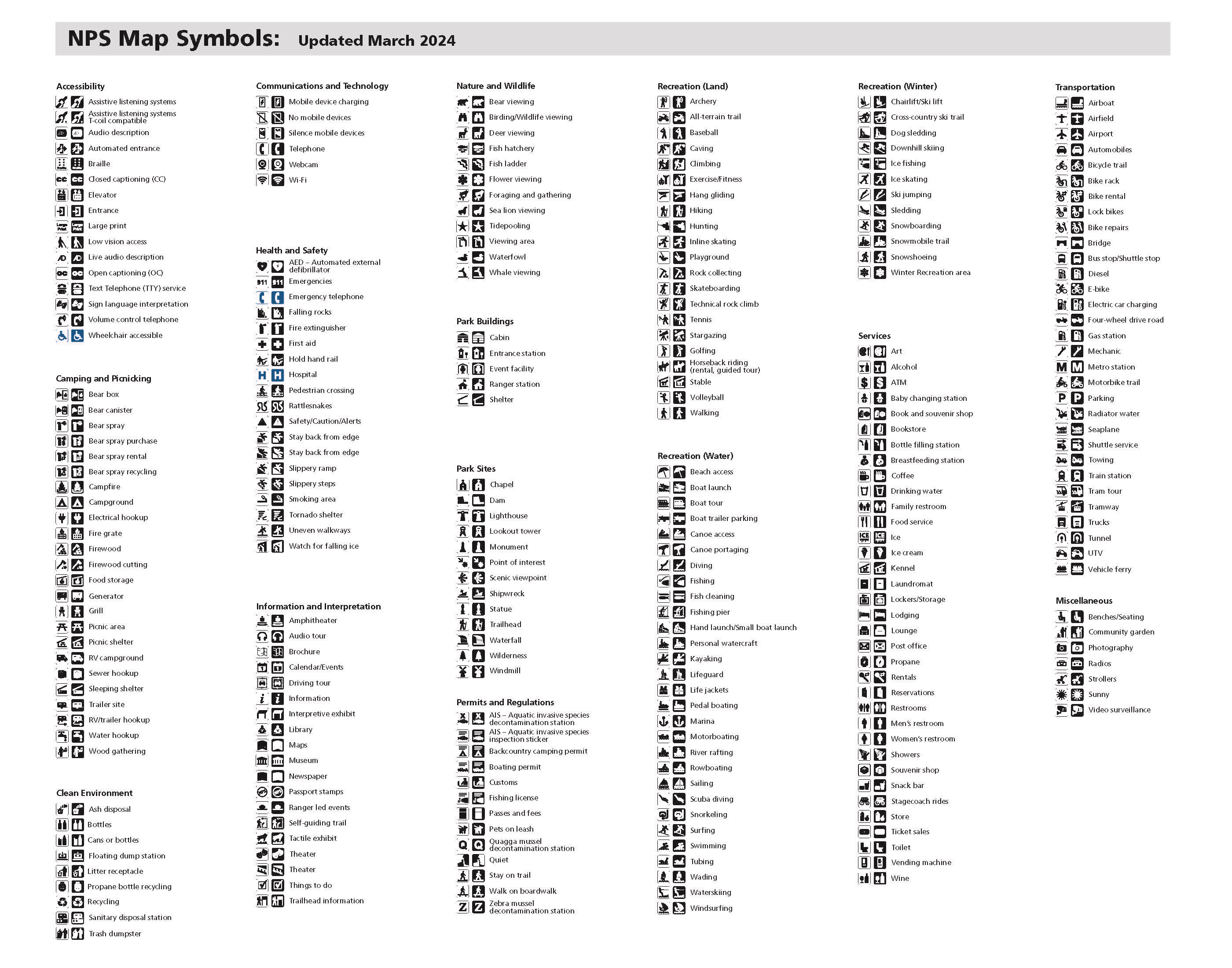
NPS Map Symbols. Seven columns made up of sixteen sections illustrate hundreds of symbols.
Screen-viewable file; Adobe print production files can be downloaded from the Compressed zip Version link
Map Projection: Other; Map Type: other
U.S. National Park Service
The National Park Service maps are government produced and are in the public domain. Anyone may, without restriction under U.S. copyright laws: Reproduce the work in print or digital form; Create derivative works; Perform the work publicly; Display the work; Distribute copies or digitally transfer the work to the public by sale or other transfer of ownership, or by rental, lease, or lending. Please note, a user who modifies and/or republishes National Park Service maps are responsible for any problems encountered with the maps, due to their change or modification.
Public domain
Document
NPS-wide, Code: NPS
Harpers Ferry Center, Code: HFC
Harpers Ferry Center, Code: HFC
NPS-wide
Harpers Ferry Center, Jefferson County, West Virginia
Latitude: 39.3233108520508, Longitude: -77.7410736083984
Harpers Ferry Center, Jefferson County, West Virginia
Latitude: 39.3233108520508, Longitude: -77.7410736083984
06/24/2026 | 2026/24/06
2024-03-01
Public Can View
Person: Harpers Ferry Center
Organization: US National Park Service
Address: Harpers Ferry Center, Harpers Ferry, WV
Email: HFC_Cartography@nps.gov
Organization: US National Park Service
Address: Harpers Ferry Center, Harpers Ferry, WV
Email: HFC_Cartography@nps.gov
Wednesday, December 4, 2024 10:10:10 AM
Wednesday, June 24, 2026 5:51:56 PM
map_symbols1.pdf
pdf
1.3 MB
Map