Select Item below to DOWNLOAD - Once item is selected, right click and choose 'save as'
01ba984d-9433-43ba-8bcb-e1f699d9385e
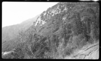
Chaparral Plant Community (Ecotone), Type Map 5000'. 1 1/4 mi West of Oriole Lake.
SEKI Historic Image
Chaparral Plant Community (Ecotone), Type Map 5000'. 1 1/4 mi West of Oriole Lake.
National Park Service
D.F. Schlobohm, 361023, Oriole Lake area, SNP, Chaparral Plant Community (Ecotone), Type Map 5000'. 1 1/4 mi West of Oriole Lake.
Permission must be secured from the individual copyright owners to reproduce any copyrighted materials contained within this website. Digital assets without any copyright restrictions are public domain.
Public domain
Image
Oriole Lake area, Tulare County, California
10/23/1936
option 1
Public Can View
Tuesday, January 10, 2017 12:59:28 PM
Tuesday, January 10, 2017 12:59:28 PM
08259.tif
Monday, January 1, 0001 12:00:00 AM
tif
15.0 MB
Scenic
,
Historic