)
Figure I-1. Alternatives Study Schedule (revised)
(click to view larger version)
Ice Age Floods |
|
s u m m a r y |
|
|
The process developed for the Floods Study was intended to provide an opportunity for the scientific community, community leaders, local stakeholders, and the general public to become actively involved. A Study Team, whose role was to provide guidance, was organized, and the Floods region was divided into four Study Zones. Volunteers within each Study Zone took responsibility for inventorying Floods features. Extensive successful efforts were made to encourage public participation. |
1. Project Approach
Collectively, the project consultants worked with representatives of the National Park Service, the Ice Age Floods Institute (IAFI), and the Ice Age Floods Task Force to make decisions regarding the Floods study. The National Park Service served as the lead project manager. Jones & Jones was responsible primarily for process, organization, and final product development. The IAFI represented the private sector while the IAF Task Force represented the public sector.
The Ice Age Floods Study of Alternatives focused on three major subjects:
Process
2. Project Schedule
The Ice Age Floods Study of Alternatives was initiated in Fall 1998, with the final report scheduled to be completed by February 2001. Upon completion, the report was submitted to the Secretary of the Interior, and then transmitted to Congress.
Figure I-1 shows the original timeline for the project. The timeline for the study was tied directly into the project contract with the National Park Service, and was developed specifically to meet the objectives for the project.
Some flexibility was built into the project because of the complexity and scope of work, and because much of the work was to be completed by volunteers. Volunteer organizations have their own needs, time demands, and schedules, and it was important to ensure that participation would not be excluded because of time conflicts.
With minor exceptions, the project closely followed the defined schedule. Deadlines for having inventory forms completed were extended because of difficulties in getting some of the Study Zones organized and because there were more identifiable Floods features than anticipated.
|
|
|
Figure I-1. Alternatives Study Schedule (revised) |
3. Formation of Study Team
The common goal of the Study Team was the development of a coordinated interpretive and educational approach to tell the Ice Age Floods story throughout Montana, Idaho, Washington, and Oregon.
The Study Team included members of the original Ice Age Floods Task Force, members of the Ice Age Floods Institute, chairs of the four Study Zone Working Groups, National Park Service representatives, and the design and planning team from the consultants, Jones & Jones. The role of the Study Team was to offer suggestions, recommendations, and alternatives to the project consultants, who synthesized the information and produced the Final Report for submission to the National Park Service.
Study Team Meetings
The first meeting of the Floods Study Team was April 15, 1999, in Spokane, Washington. The purpose of this meeting was to present the study process and the concept of Study Zones, and to organize the Study Team.
On Wednesday, October 13, 1999, members of the Ice Age Floods Alternatives Study Team met in Moses Lake, Washington, for the second planning workshop. The main purpose of this meeting was to develop recommendations from the Study Team and, in essence, create a “collective vision” of how the study region would be managed, interpreted, and designated. There was an overview of zone activities and the status of the inventory as well as reports on IAFI and Task Force activities. The morning session ended with discussions about putting the inventory into database format, the use of GIS for the project, development of graphics and final output, and the need for continuing outreach efforts. The afternoon was devoted to discussions about the timeline, report outline, suitability and feasibility, possible interpretive routes, and management options. Members even reached a consensus of what this “area” should be called: the Ice Age Floods Geologic Region. Later that evening, the Ice Age Floods Institute conducted its regular quarterly meeting. And on Thursday the Study Team participated in an all-day field trip of the Grand Coulee and Drumheller Channels.
On February 9, 2000, the Study Team met in Vancouver, Washington, to review the draft Alternatives Study. This meeting was the first time that the Study Team members had an opportunity to voice their suggestions for improvement and to review the Draft for potential problem areas. Each section of the Draft was reviewed in detail and discussed. Each Study Team member had his or her own copy of the Draft which was turned in, along with handwritten comments from each team member. The meeting was followed by an Ice Age Floods Institute meeting and a tour of the Portland-Vancouver Basin the following day.
The Glacial Lake Missoula Study Zone Working Group and Dale Middleton, Jim Sipes, and Reed Jarvis participated in a video-conference on February 18, 2000. This meeting gave the Missoula group the opportunity to share their opinions. Because of the distance and cost involved, many of the Missoula group could not attend the Vancouver meeting. Their suggestions included expanding some sections, using more graphics and sidebars, changing the reference to “spurs” into “loops” where possible, and sensitivity to the use of certain words that could be misunderstood.
The next Study Team meeting was held in Missoula, Montana, on April 17, 2000. The Study Team reviewed the second draft, which was also the public agency review copy. They made a number of suggestions to improve the study and clarified points the study was trying to make. This was a critical step in preparing the public review draft. The next day the Study Team participated in an all-day field trip of the Glacial Lake Missoula resources, tying many of J. T. Pardee’s calculations and field research to the actual sites.
The Study Team met again in mid-November 2000 to be briefed on the recommendations from the public workshops prior to sending the study to the Director of the National Park Service.
4. Study Zone Working Groups
Because the Floods path covers more than 16,000 square miles, the study area is too large to function as a single entity. To make the project easier to manage, it was organized into four Study Zones based upon geopolitical considerations:
The Study Zone Working Groups had five major responsibilities:
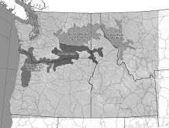
Four Study Zones through Montana, Idaho, Washington, and Oregon |
A chairperson was elected for each Study Zone. The primary responsibilities of the chairperson were to coordinate the inventory, manage the outreach programs, help shape the plan, and serve as the key contact for the Study Zone.
Three meetings were scheduled for each Study Zone. The first meeting was used to identify interested individuals, get each Study Zone organized, elect a chairperson, and begin the process of inventorying Floods features. The second meeting continued to focus upon the inventory process, and also included planning for future activities and community outreach efforts. The third meeting provided each Study Zone member an opportunity to review the draft report of the Study of Alternatives and to offer suggestions on ways to improve the report. Each meeting lasted two to three hours, with most being held on weekday nights to provide the greatest opportunity for public participation. The Study Zone meetings were open to the public, and efforts were made to publicize the meetings and to invite key individuals, including media representatives.
5. Public Participation and Outreach
A key concern of the National Park Service was to make sure there was a high level of public participation in the planning process for this project. As stated in PL 105-391, Congress has strengthened the planning process in an effort to address specific issues and concerns. Public input for the Study of Alternatives began at the Study Zone level. One of the purposes for creating the Study Zone Working Groups was to provide a mechanism from which close ties with local citizenry could be established in order to obtain their views and suggestions.
Since the story of the Floods is still not widely known in many areas, each Study Zone Team was encouraged to develop an interpretive team for informing the public of the Ice Age Floods and the Study of Alternatives. The task of the interpretive team was to work with local schools, organizations, and civic groups such as the Rotary, Lions, and Elks.
An outreach program was developed for local elected officials, decision-makers, and the local media in an effort to raise their interest in the Study and its potential. Each Study Zone received a slide program developed by the National Park Service’s Lake Roosevelt National Recreation Area as well as a 30-minute and 6-minute videotape of a recent PBS television special of the Floods. Oregon Public Broadcasting in Portland, in the fall of 1998, produced this television special.
Some of the products developed for the outreach program of the Study of Alternatives include:
The general consensus of public input from both meeting attendance and written comments was that people generally supported the notion of some National designation to commemorate the Ice Age Floods, either along a designated National Geologic Trail or Floods Pathways. There was considerable support for National Park Service management of the Trail. There was also a strong support for a coordinated regional approach that includes a wide use of partnership and collaborative efforts to tell the Floods story throughout the region. Several reviewers urged that any Congressional designation not authorize the NPS or other entity to have any new land acquisition or regulatory authority in the establishment of the Trail. This concern has been underscored as a recommendation in the final study report.
Many reviewers suggested that various Floods features be afforded additional protection for public appreciation and further scientific study. Several reviewers stressed that hiking trails, horse trails, and water trails be utilized, in addition to auto tour routes, to view Floods features. Many reviewers were enthusiastic about the educational opportunities to expand school earth science curricula to include the Floods topic. Finally, several reviewers suggested specific actions to enhance the project, including the development of new interpretive centers related to the Floods in places such as Missoula, Montana, and Portland, Oregon.
Outreach Efforts
The following is just a sample of some of the outreach efforts of the Study Team:

|
|
|
What Is A Varve? Varves are the individual layers in the layer-cake stratigraphy commonly found in lake deposits. For many lakes that freeze over the winter, the super-still water allows deposition of all the fine clays and organic material that were swirling around the lake during the past summer, thus forming a dark layer. In the spring and summer, when lake currents keep things more stirred up, only sand and silt are deposited—forming a light coarser layer. Thus each year, a couplet of layers forms—a dark-clay and organic-rich winter layer, and a light-silt and sand-rich summer layer. These couplets can be counted, like rings on a tree, to measure the time represented by the sequence of varves. |
|

|
6. Inventories
One of the first tasks the Ice Age Floods Study of Alternatives was to complete a Floods resource inventory that covered features in all four states. The inventory located the most significant Floods features and provided a basis for developing an interpretive route of the Floods. It was important to determine critical information regarding accessibility and interpretive potential; this information could become the basis for future planning and management of an Ice Age Floods geologic region.
The inventory process was structured so that the public, landowners, students and professionals could participate in the project as well as individually develop an appreciation and understanding of the Ice Age Floods resources.
Blank inventory sheets, along with a completed sample form, were sent to each of the four Study Zones. The inventory sheets offered instructions on how to fill them out and the process was fairly straightforward. Each Study Zone Working Group determined how it was going to accomplish the tasks necessary to complete the inventory forms.
Once the inventory forms were complete, the information was input into FileMaker Pro (FileMaker, Inc.), a popular stand-alone desktop database software application for Macintosh and Windows users. Once completed users will be able to query, generate reports, and analyze data, as well as seamlessly import and export data from programs such as Oracle 7, or Microsoft SQL Server, Microsoft Access 97, or Microsoft Excel.
The inventory of the Ice Age Floods resources was also used to help determine Floods interpretive routes. To date, more than 350 Floods resources have been inventoried, and additional inventories are still being conducted. The Study Zone Working Groups, after identifying the resource sites, were asked to rank their Floods resource sites whenever possible, and those sites were located on a map of the study area. Using existing public roads, the sites were then connected into Pathways.
Additional inventories will be completed over the next few years to cover sites not included in the first analysis.
GIS Component
A Geographic Information System (GIS) dataset of Floods-related information was used during the planning phase of the Study of Alternatives, and will be available for other uses as well. The basic idea was to pull together existing GIS data, input new information collected as part of the study, and create a set of digital tools that can be used for future floods-related projects. The locations of floods features were taken from the inventory forms and used to define points in the GIS data layers. This process was useful for overlaying floods features on maps with such information as roads, land ownership and municipal areas.
The Floods Study Team identified pertinent thematic data layers of information as well as available sources for the information. These layers include information such as the major roads and highways, lakes and rivers, geopolitical boundaries, parks and recreation areas, visitor centers and museums, major trails, extent of flooding and glacial cover, and Ice Age Floods features.
Much of the GIS data used was developed as part of the Interior Columbia Basin Ecosystem Management Project (ICBEMP). The ICBEMP, which is chartered by the Chief of the Forest Service and Director of the Bureau of Land Management, covers eastern Oregon and Washington, Idaho, western Wyoming, western Montana, and portions of northern Utah and northern Nevada.
The final GIS data set was created with ArcInfo, the industry standard GIS program from ESRI, and viewed and manipulated primarily with ArcView.
Because the project covers a four-state area, most floods features, visitor centers, and even cities appear as dots, and roads and rivers appear as simple lines. The GIS data is small-scale for Phase I of this project, but recommendations are to add more detail and resolution in Phase II.
The inventory information eventually will be linked to ArcView, stored as tabular data in a series of rows and columns, and then saved as attributes. The link between map features and their attributes is the basic principle behind how a GIS program works, and is the source of its power. When the map features and attributes are linked, users will be able to access the attributes for any map feature or locate any feature from its attributes in a table.
The entire GIS database and associated attributes for the Floods is intended to be available to interested individuals once it is completed.
Bretz traversed the entire region first on foot and later in his trusty Dodge 4, an early enclosed-body car. He did this with parties of students and his wife, son, daughter, and collie dog.
Vic Baker, “Joseph Thomas Pardee and the Spokane Flood Controversy”
7. Phase II for Inventory and GIS
The next phase of the inventory, contingent upon funding, would expand upon this initial work and provide a much greater level of information and accuracy. This phase would build upon the initial inventory and would involve revisiting sites, locating them more accurately, improving the description, and reevaluating the resource in terms of interpretive potential.
This additional information could be obtained by revisiting sites and locating them more accurately on the ground by using the Global Positioning System (GPS). Larger floods features could also be measured on-site.
Each GIS thematic layer was categorized according to priority. The highest priority layers will be completed first for Phase I of the GIS development, with lower priority layers being finished as time permits. It is anticipated that less-critical data layers will be completed as part of Phase II. Phase II also recommends a much greater level of detail than was completed in Phase I because of time constraints.
The information obtained from the second inventory would be used to expand the scope and depth of interpretation and would allow development of a more complex route within the four Study Zones.
|
|