
NPS / Jo Suderman The landscape of the Greater Yellowstone Ecosystem is the result of various geological processes over the last 150 million years. Here, Earth’s crust has been compressed, pulled apart, glaciated, eroded, and subjected to volcanism. All of this geologic activity formed the mountains, canyons, and plateaus that define the natural wonder that is Yellowstone National Park. While these mountains and canyons may appear to change very little during our lifetime, they are still highly dynamic and variable. Some of Earth’s most active volcanic, hydrothermal (water + heat), and earthquake systems make this national park a priceless treasure. In fact, Yellowstone was established as the world’s first national park primarily because of its extraordinary geysers, hot springs, mudpots and steam vents, as well as other wonders such as the Grand Canyon of the Yellowstone River. What Lies BeneathYellowstone’s geologic story provides examples of how geologic processes work on a planetary scale. The foundation to understanding this story begins with the structure of the Earth and how this structure shapes the planet’s surface. Earth is frequently depicted as a ball with a central core surrounded by concentric layers that culminate in the crust or outer shell. The distance from Earth’s surface to its center or core is approximately 4,000 miles. The core of the earth is divided into two parts. The mostly iron and nickel inner core (about 750 miles in diameter) is extremely hot but solid due to immense pressure. The iron and nickel outer core (1,400 miles thick) is hot and molten. The mantle (1,800 miles thick) is a dense, hot, semi-solid layer of rock. Above the mantle is the relatively thin crust, three to 48 miles thick, forming the continents and ocean floors. In the key principles of Plate Tectonics, Earth’s crust and upper mantle (lithosphere) is divided into many plates, which are in constant motion. Where plate edges meet, they may slide past one another, pull apart from each other, or collide into each other. When plates collide, one plate is commonly driven beneath another (subduction). Subduction is possible because continental plates are made of less dense rocks (granites) that are more buoyant than oceanic plates (basalts) and, thus, “ride” higher than oceanic plates. At divergent plate boundaries, such as midocean ridges, the upwelling of magma pulls plates apart from each other. Many theories have been proposed to explain crustal plate movement. Scientific evidence shows that convection currents in the partially molten asthenosphere (the zone of mantle beneath the lithosphere)move the rigid crustal plates above. The volcanism that has so greatly shaped today’s Yellowstone is a product of plate movement combined with convective upwellings of hotter, semi-molten rock we call mantle plumes. 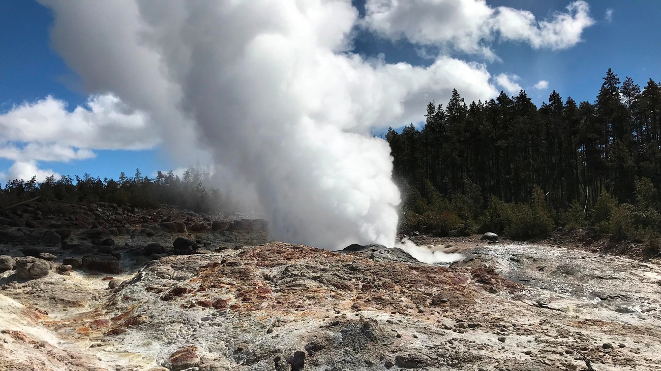
Steamboat Geyser
Unpredictable and dormant for years, Steamboat Geyser has been quite active in 2018 and 2019. At a GlanceAlthough a cataclysmic eruption of the Yellowstone volcano is unlikely in the foreseeable future, real-time monitoring of seismic activity, volcanic gas concentrations, geothermal activity, and ground deformation helps ensure public safety. Yellowstone’s seismograph stations, monitored by the by the University of Utah for the Yellowstone Volcano Observatory, detect several hundreds to thousands of earthquakes in the park each year. Scientists continue to improve our capacity to monitor the Yellowstone volcano through the deployment of new technology. Beginning in 2004, scientists implemented very precise Global Positioning Systems (GPS), capable of accurately measuring vertical and horizontal groundmotions to within a centimeter, and satellite radar imagery of ground movements called InSAR. These measurements indicated that parts of the Yellowstone caldera were rising at an unprecedented rate of up to seven centimeters (2.75 in) per year (2006), while an area near the northern caldera boundary started to subside. The largest vertical movement was recorded at the White Lake GPS station, inside the caldera&#’;s began to subside during the first half of 2010, about five centimeters (2 in) at White Lake so far. Episodes of uplift and subsidence have been correlated with changes in the frequency of earthquakes in the park. On March 30, 2014, at 6:34 AM Mountain Daylight Time, an earthquake of magnitude 4.8 occurred four miles north-northeast of Norris Geyser Basin. The M4.8 earthquake was felt in Yellowstone National Park, in the towns of Gardiner and West Yellowstone, Montana, and throughout the region. This was the largest earthquake at Yellowstone since the early 1980s. Analysis of the M4.8 earthquake indicates a tectonic origin (mostly strike-slip motion) but it was also involved with unusual ground uplift of 7 centimeters at Norris Geyser Basin that lasted 6 months. Energy and groundwater development outside the park, especially in known geothermal areas in Island Park, Idaho, and caldera Springs, Montana, could alter the functioning of hydrothermal systems in the park. External Resources
ResourcesAnderson, R.J. and D. Harmon, eds. 2002. Yellowstone Lake: Hotbed of Chaos or Reservoir of Resilience? Proceedings of the 6th Biennial Scientific Conference on the Greater Yellowstone Ecosystem. Yellowstone Center for Resources and George Wright Society. Christiansen, R.L. 2001. The Quaternary and Pliocene Yellowstone Plateau volcanic field of Wyoming, Idaho, and Montana. Reston: U.S. Geological Survey. Professional Paper 729–6. Fritz, W.J. and R.C. Thomas. 2011. Roadside Geology of Yellowstone Country. Missoula: Mountain Press Publishing Company. Good, J.M. and K.L. Pierce. 1996. Interpreting the Landscapes of Grand Teton and Yellowstone national parks: Recent and Ongoing Geology. Moose, WY: Grand Teton Natural History Association. Grotzinger, J.P. and T.H. Jordan. 2014. Understanding Earth. New York: W.H. Freeman and Company. Hamilton, W.L. Geological investigations in Yellowstone National Park, 1976–1981. In Wyoming Geological Association Guidebook. Hendrix, M.S. 2011. Geology underfoot in Yellowstone country. Missoula, MT: Mountain Press Publishing Company. Lillie, R.J. 2005. Parks and plates: The geology of our national parks, monuments, and seashores. New York: W.W. Norton Smith, R.B. and L.J. Siegel. 2000. Windows Into the Earth: The Geologic Story of Yellowstone and Grand Teton national parks. New York: Oxford University Press. Tuttle, S.D. 1997. Yellowstone National Park in Geology of national parks. Dubuque, IA: Kendall–Hunt Publishing Company. 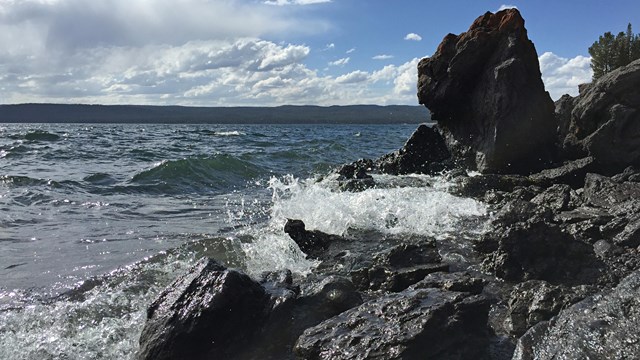
Volcano
At the heart of Yellowstone is a large volcano. 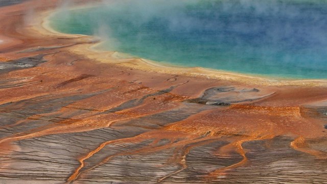
Hydrothermal Systems
Yellowstone's hydrothermal systems are the visible expression of the immense Yellowstone volcano. 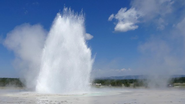
Hydrothermal Features
More than 10,000 hydrothermal features are found here, of which more than 500 are geysers. 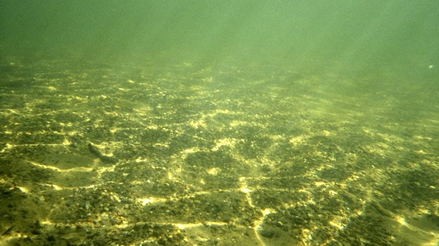
Yellowstone Lake Geology
Discover a bit of what dynamic processes are going on below the lake's surface. 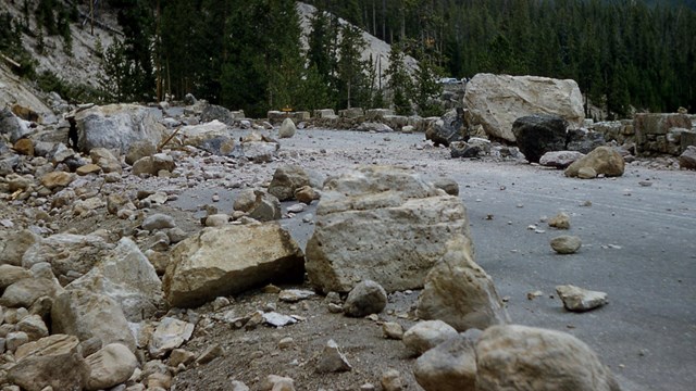
Earthquakes
Yellowstone is one of the most seismically active areas in the United States. 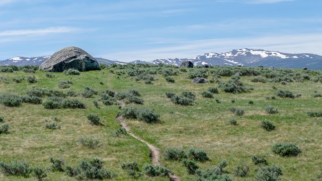
Glaciers
Glaciers sculpted the volcanic landscape of Yellowstone. 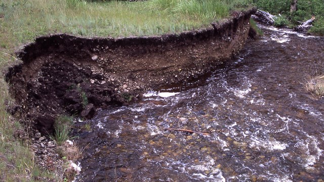
Sedimentation and Erosion
The erosion of rock and the deposition of geologic material has created some stunning landscapes. 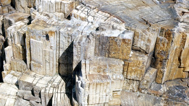
Fossils
Fossil of plants, invertebrates, vertebrates, and trace fossils found within Yellowstone document 540 million years of life. 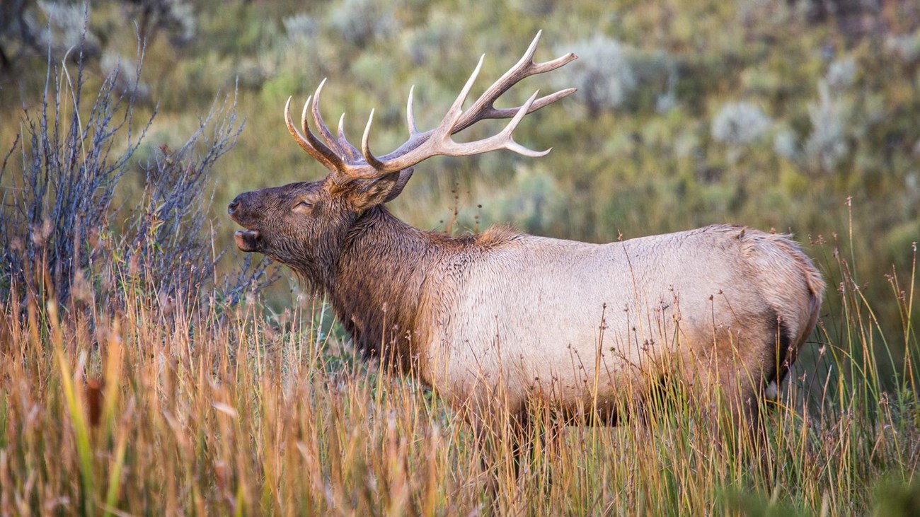
Nature
Discover the natural wonder of Yellowstone and our role in the conservation of wildlife. |
Last updated: April 18, 2025