National Park Service LogoU.S. Department of the InteriorNational Park ServiceNational Park Service
National Park Service:  U.S. Department of the InteriorNational Park Service Arrowhead
Whitman Mission National Historic SiteBackhoe digging new streambed
view map
text size:largestlargernormal
printer friendly
Whitman Mission National Historic Site
A New Bed for Doan Creek
Map showing proposed location of
NPS image
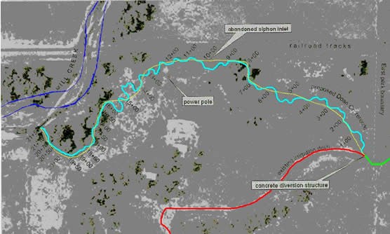
The restored creek travels a new path in a different location from the irrigation ditch it had become. The turquoise line shows the proposed path for the restored channel; notice the large number of curves. Doan Creek will now flow into Mill Creek, which is highlighted with dark blue lines. The red line shows the location of the diverted Doan Creek, a relatively straight irrigation ditch that follows the base of the park's hill.
 
Drawing showing location of Doan Creek the irrigation ditch and where the new restored channel will be.
NPS
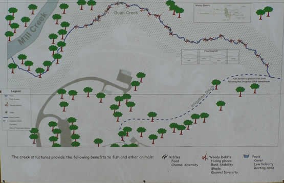
This map is used to orient visitors at the park to the old and "new" locations of Doan Creek.
Brass compass which belonged to Dr. Whitman  

Did You Know?
In the fall of 1842 Dr. Whitman decided to travel from Waiilatpu to Boston. He wanted to convince the board members to keep his mission station open. Dr. Whitman was in such a hurry when he left that he forgot his compass.

Last Updated: October 22, 2008 at 17:47 EST