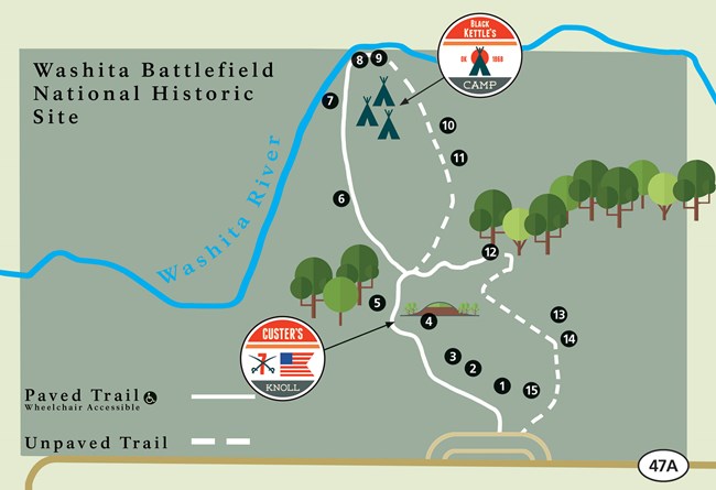
The park trail system allows visitors to experience and learn about the events that took place along the Washita River. The 1.5 mile long trail contains 15 stops along trail describe key points about the 1868 conflict. Half of the trail is paved and wheelchair accessible while the other half is an unimproved dirt and grass trail. Mud can accumulate from recent snow or rain in the dirt and grass sections. |
Last updated: December 19, 2020
