
The Salado built their homes into naturally formed caves that offered shelter from the heat, predators, neighbors, and seasonal monsoons. These caves were formed over a period of hundreds of thousands of years by water passing through and over the rock, slowly and consistently carrying away its binding agents. This leaves cracks which expand until the rock spalls, or breaks off, and shatters into multiple smaller rocks. This happened many times until what was left were the harder, more resistant rocks known as Dripping Spring quartzite and the "natural cement," known as caliche. The Salado people were very particular with which caves they resided in, and chose the few that face east. This gave them sunlight during the long winter mornings and shade during the hot summer afternoons. Although there are only a couple caves with Salado architecture inside, there are many cave formations all over the Tonto Basin area that have formed and continue to grow. The Tonto Basin is surrounded by immense mountain formations with the Mogollon Rim to the north, the Sierra Ancha to the east, the Superstition Mountains to the south, and the Mazatzal Mountains to the west. About one billion years ago, seas covered the current Arizona landscape. When they receded, they left sedimentary and igneous rock underneath folded and riddled with faults. As thousands of years passed, these rocks were buried, broken, and some eventually pushed back up to the surface. There is much that still lays hidden underneath today's rock surface and mountains. In addition to all that lies under the surface of these mountain ranges, there is much that remains on the visible terrain. In this basin and range topography, plants and wildlife flourish. As adapt and resilient as the flora has to be, there are some areas where particular plants cannot grow. This is mainly due to the differing amounts of daily sunlight and different moisture levels in the soil. This specifically happens on mountain sides facing northeast where there is minimal sun exposure. When the distinctive climate of a small-scale area differs from its surroundings, it is called a microclimate. Saguaro, ocotillo, mesquite trees, cholla, and many other types of Arizona vegetation are dependent on the harsh sunlight the desert provides and do not grow in the colder microclimates. 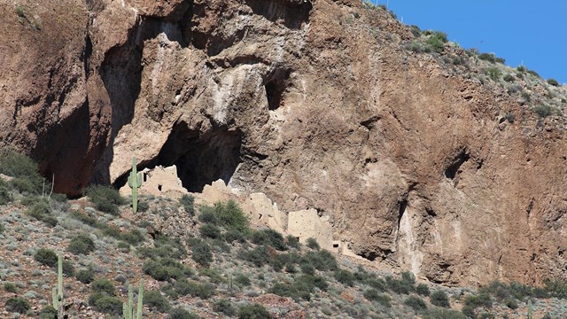
Geology
Geologic processes created the shallow caves that shelter the Upper and Lower Cliff Dwellings. 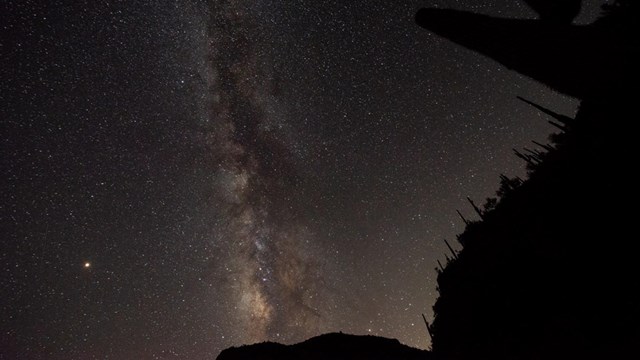
Night Sky
Tonto National Monument was designated as an International Dark-Sky Park in 2019. 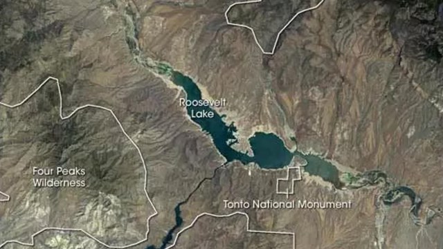
The Tonto Basin
The Tonto Basin lies about 50 miles east of Phoenix, Arizona, in an environmental transition zone. |
Last updated: June 22, 2022