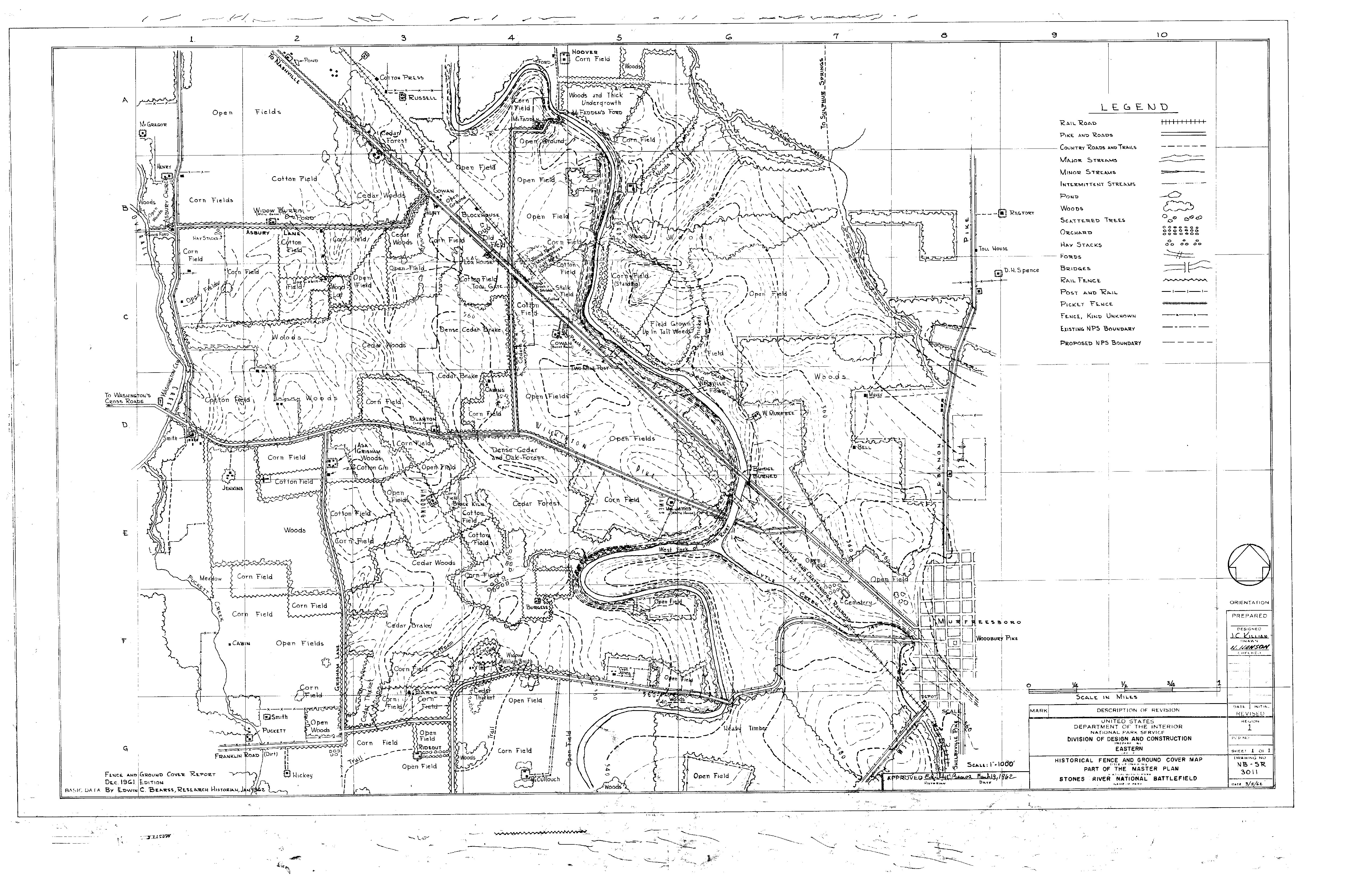
National Park Service LogoU.S. Department of the InteriorNational Park ServiceNational Park Service
National Park Service:  U.S. Department of the InteriorNational Park Service Arrowhead
Stones River National Battlefield Confederate Soldiers Firing Muskets
view map
text size: largest larger normal
printer friendly
Stones River National Battlefield
Maps
1863 of the Battle of Stones River
This 1863 map of the Battle of Stones River was created by Captain Nathaniel Michler, Chief Cartographic Engineer of the Union Army of the Cumberland. Click on the image to see more historic battlefield maps.

You are exiting the National Park Service website

Thank you for visiting our site.

You will now be redirected to:

We hope your visit was informative and enjoyable.

Prescribed Fire at the Slaughter Pen

Did You Know?
Stones River National Battlefield uses prescribed fire to preserve the battlefield landscapes. Fire also helps eliminate invasive exotic plants and encourage the growth of native grass species.

Last Updated: February 25, 2008 at 10:20 MST