|
Visit our keyboard shortcuts docs for details
Be prepared. Plan like a Park Ranger. Do you know what you need to hike in the dunes? Are you aware of rip currents in Lake Michigan? Distance Terrain Vegetation Comments 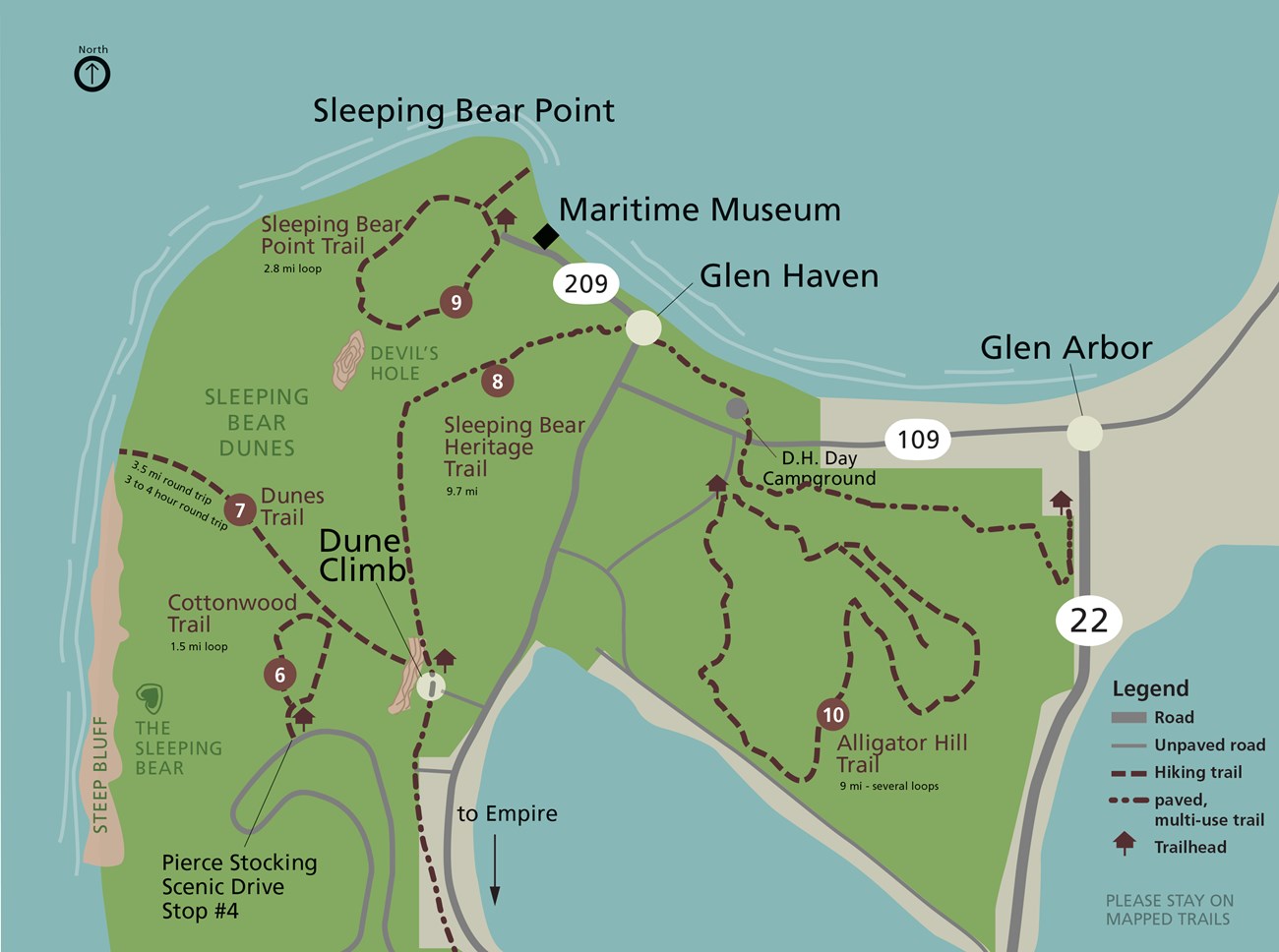
NPS Map 2006 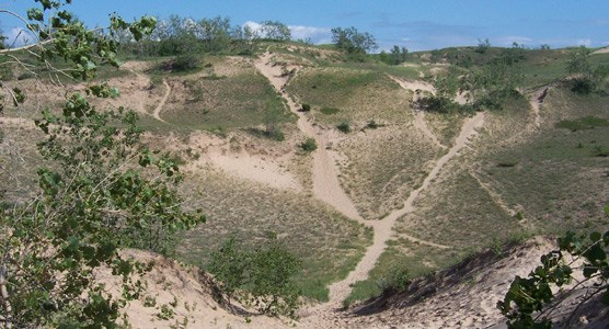
Kerry Kelly 2005 |
Last updated: June 2, 2022