National Park Service LogoU.S. Department of the InteriorNational Park ServiceNational Park Service
National Park Service:  U.S. Department of the InteriorNational Park Service Arrowhead
Sleeping Bear Dunes National LakeshoreHIking Trail on North Manitou Island
view map
text size:largestlargernormal
printer friendly
Sleeping Bear Dunes National Lakeshore
Popple Campground

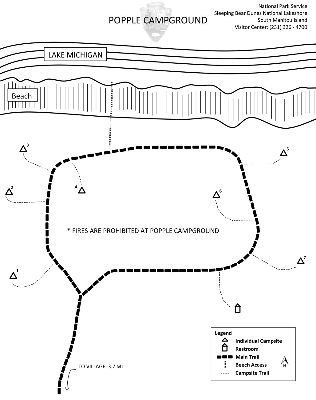
The Popple campground is located on the north end of the island, about a 3.5 mile hike from the Ranger Station near the Lake Michigan shore.  Bring water filtration equipment and beware of poison ivy - there is a lot of it in this area.  Those seeking seclusion, who enjoy a bit of a challenge will enjoy this campground.  You get a great view of North Manitou Island and great access to the beach.

There are 7 Individual Sites at this campground.

Click to download a map in pdf format.

 
Popple Campground Map
NPS Map 2006
Popple Campground Map
Port Oneida Rural Historic District  

Did You Know?
The Port Oneida Rural Historical District is a 3000 acre farming area preserved as it was in the early 1900's. This area was farmed for over 100 years and is now part of the Sleeping Bear Dunes National Lakeshore
more...

Last Updated: September 19, 2006 at 18:13 EST