NPS 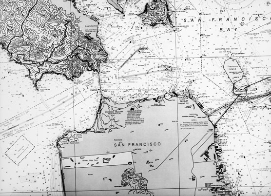
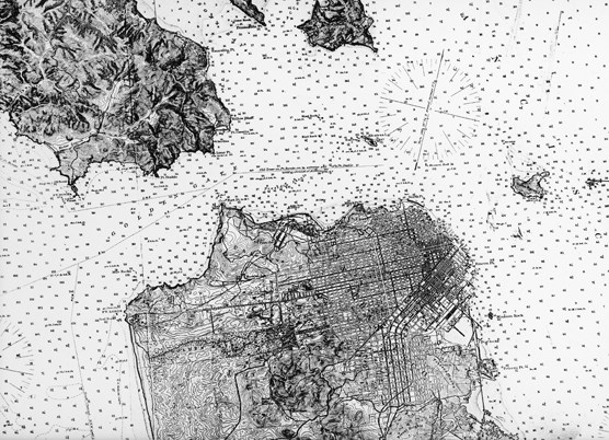
NPS Do you use maps? Have you ever drawn a map of your house or bedroom? Have you ever used a treasure map and found where X marked the spot? You might even be holding a small rectangle in your hand that can connect you to a digital map of anywhere in the world. Maps are made to serve different purposes. These charts were drawn to assist mariners piloting their craft in the waters around San Francisco. Here are two small sections of nautical charts showing the entrance to San Francisco Bay. The one on the top was published in 1883, and the one on the bottom was published in 1983, 100 years later. Of course maps and charts of the same place change over time. But a quick look at these two charts suggests that they look pretty similar, but look again. See if you can spot at least ten differences.
|
Last updated: March 1, 2015