
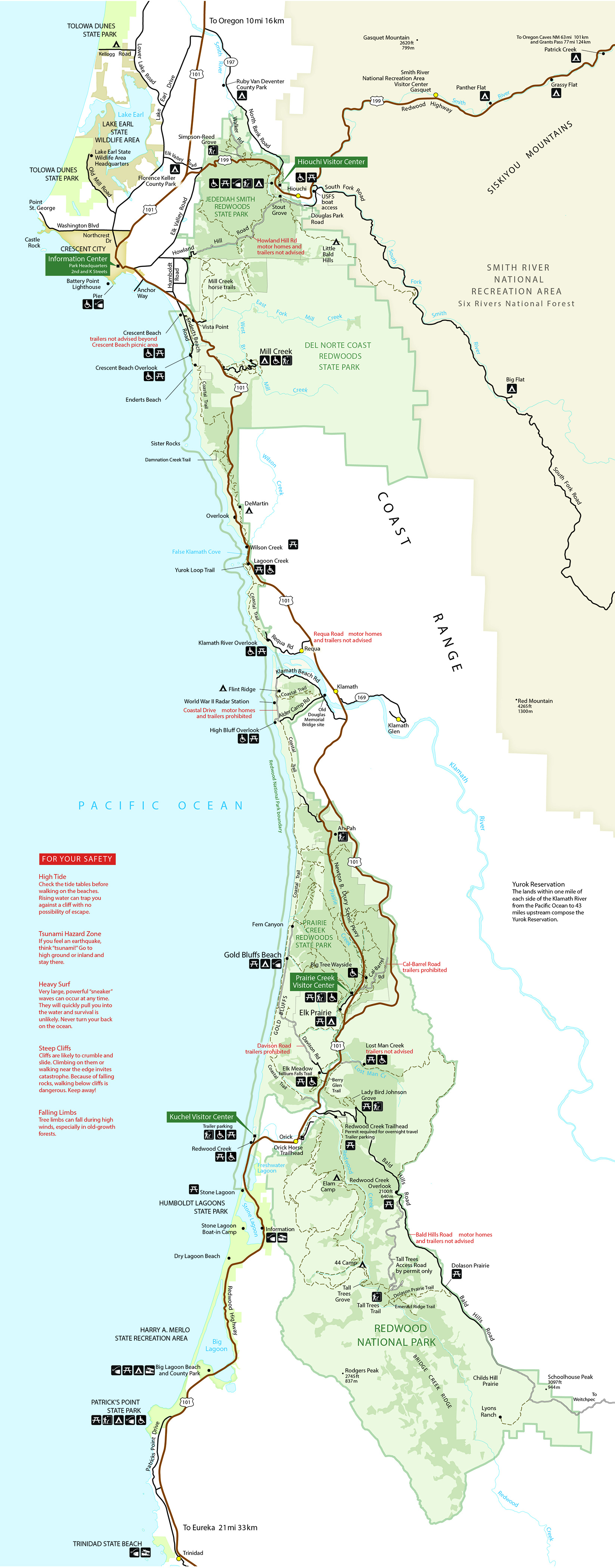
Frequently visitors trying to reach specific locations in the parks have been misdirected by GPS to islolated towns, logging roads in adjacent forests, or onto private property. We recommend that people use a printed map and have a good idea of their travel routes before heading the parks. Do not use the "Bald Hills Road" as a way to get to Redwood National Park. Highway 101 runs north & south through the middle of the Parks. Highway 199 is good for access from the north-east, and Highway 299 is good access from the south-east. Once here, be sure to drive the Newton B. Drury Scenic Parkway to experience heart of the Parks. You can also visit our online map collections found at Find A National Park Service Map.
ADA Accessible Park Map We also offer text only, audio described, and braille versions of the parks' offical map. 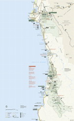
Prints at 8.5" x 14" (Legal size). From the official brochure for Redwood National and State Parks. Also see pages 6-7 of the Visitor Guide for a similar map but with recommended scenic drives and short walks. The Klamath River cuts across the middle of the Parks. 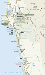
Park Map - Northern Half (JPEG) 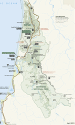
Park Map - Southern Half (JPEG) Campground Maps Jedediah Smith Campground (in Jedediah Smith Redwoods State Park) Pack Animal and Overnight Camps. (PDF 4.6 MB) |
Last updated: July 18, 2023