NOAA Geologic Setting — Earthquakes — Soils — Rocks — Tsunami —Rivers — Ocean — Prairies Geologic SettingThe North Coast region, which includes RNSP and the adjacent offshore area, is the most seismically active region in the United States. As a result of frequent earthquakes, rapid uplift rates have led to landslides, actively braiding and shifting rivers, and rapid coastal erosion. The reason for all this activity is the geologic setting of the North Coast region. Three tectonic plates (thin pieces of the Earth's crust which float above the mantle) known as the North American, the Pacific, and the Gorda contact each other at the Mendocino triple junction. This junction lies offshore near Cape Mendocino, which is about 100 miles (160 km) southwest of RNSP. Each of these plates slide against each other as they slowly move in opposing directions. Movement may be as much as two or three inches (5-6 cm) a year. Many times, this movement comes in the form of earthquakes, when built-up energy is released along fault lines that border the plates. Although the majority of these earthquakes are too small to be noticed, larger quakes are not uncommon. In the 1990s, at least nine magnitude 6.0-plus earthquakes jolted the North Coast. This amount of large quakes was higher than in any other decade within the last century. Most of these quakes occurred offshore, resulting in one death and major financial losses. Because the Gorda plate is subducting beneath the North American plate, there is the possibility of a "great earthquake" occurring in the future. Scientists believe that the two plates are partially locked together along a contact known as the Cascadia subduction zone. The frozen boundary between the two plates is called the megathrust. The megathrust is broken from time to time, but usually along small parts of the fault, resulting in small quakes. However, if a larger part is broken, a magnitude 8.0-plus quake is possible. SoilsSoils are composed of living and non-living matter, oxygen and water. Soils play an important role in regulating oxygen, carbon, nitrogen and hydrologic cycles, act as a filter by filtering out and storing contaminants, and provide habitat for billions of organisms, many of which are still unknown to science. EarthquakesStudies have shown that the last great subduction zone earthquake took place 300 years ago. Intervals between such quakes are in the hundreds of years, so predicting the next one is difficult. But research suggests that eventually such a quake will occur. Disastrous effects are possible when visiting the redwood region; be prepared by following these precautions:
RocksMost of RNSP is underlain by rocks of the Franciscan asemblage, which is primarily composed of sandstones and mudstones. This rock unit is best seen along the coast from Enderts Beach to the mouth of Redwood Creek and in road cuts on the way to the Tall Trees Grove trailhead. Much of the Franciscan assemblage consists of rock that has been sheared and lifted from the ocean floor as a result of the plate action along the Cascadia subduction zone.

NPS TsunamiA tsunami is a series of ocean waves most commonly caused by an earthquake beneath the ocean floor. They can be caused by local quakes, such as in 1992, when a Cape Mendocino quake produced a tsunami that hit Humboldt Bay within 20 minutes. Tsunamis can also be caused by quakes in far away areas, such as in 1964, when an earthquake in Alaska produced a destructive tsunami that inundated Crescent City. Tsunamis have killed in the past. They are always a possible threat in the seismically active North Coast region, however, destructive tsunamis are rare and shouldn't ruin your visit to the beach. In the event that you do find yourself near the coast when an earthquake hits, be aware of the following guidelines:
|

NPS Rivers and StreamsRivers at RNSP are world-renowned for fishing and no less loved for recreation and sheer beauty. The Smith River, named for explorer Jedediah Smith, arises in the Siskiyou Mountains and flows through the parks' north section. It is now California's last major free-flowing river and is famous for salmon and steelhead. The Klamath River, also a salmon and steelhead river, crosses the midsection of these parks. Redwood Creek flows through the parks' southern section. The three large river systems within the park — the Smith River, the Klamath River, and Redwood Creek — have cut deep gorges through the forest and mountainous terrain. Redwood Creek follows the Grogan Fault northwest, with many small tributaries. The Klamath River, the largest in the North Coast region, provides important habitat for wildlife along its banks and in its estuary. The Smith River is also important for wildlife and has been named a Wild and Scenic River. Stream flow depends on the amount of rainfall in the parks. The rainy season usually stretches from October through April, but the Smith and Klamath rivers also receive water from snowmelt in the mountains to the east. Warm rains combined with snowmelt have caused floods, including the large flood of December 1964 which caused the highest record peak flow on Redwood Creek. Though there are no natural ponds or lakes in the parks; there are lagoons and marshes, results of oceanic and tectonic processes. Also within the parks' boundaries are the estuaries at the mouths of the Klamath River and Redwood Creek. These estuaries provide several uses for humans and wildlife: a transition and nursery area for fish, valuable habitat for fresh and saltwater species, recreational area for park visitors and nearby communities, and a supply of water for farming and ranching. Salmon and steelhead populations were severely diminished by past logging activities within Redwood Creek's watershed. Increased sediment loads as a result of increased erosion has altered the habitat of Redwood Creek. Today, these fish are attempting to maintain their presence in the creek, but very few of these fish are able to adapt to the ecological imbalance. 
NPS OceanRocky and jagged, the RNSP coastline is a meeting place of ocean and continent where a unique collection of life has adapted to the harsh environment. Buffeted by the salty sea winds, salt-tolerant vegetation springs up among the beaches and steep cliffs that dominate this stretch of California's North Coast. Among the seastacks, brown pelicans and seals find a comfortable home; crabs and colorful anemones crowd the tidepools along the sea's edge. Despite the extreme nature of fierce ocean winds, pounding waves, and geologic instability, visitors will find this pristine coastline an enchanting, unexpected part of the RNSP experience. Intertidal ZoneTides rise and fall twice daily on a 25-hour lunar cycle. In the zone between high and low tide, life forms arrange themselves vertically. Just where depends on their tolerance for exposure to air and/or water and to heat and wave shock. Other biological limits apply, too, such as predators and competing organisms. A splash zone above the high tide line receives the powerful shock of pounding waves. Inhabitants here are more attuned to life on land than on sea, but they are at the same time transitional. Learn more about the curious lives of inter-tidal creatures. TidepoolsTidepools form in rocky beach outcroppings and shelter many forms of ocean life in these environments. Tidepool dwellers cope with great changes in water temperature, salinity, and oxygen content. BeachesLife on sandy beaches is also subject to wet and dry zones because of tides and waves. The lower beach is often wet, while upper beaches are like a desert between the sea and lush coastal forest. SeastacksThe rocky islands in the sea are common — and commonly known as seastacks. They are erosional features in which sandstones and mudstone wear away and cherts and greenstone are left behind. More than 40 percent of California's seabird population nest on these seastacks, which provides a world of protection from predators. When you see a crowd of birds on these rocks — and there can be thousands of them on one house-sized boulder — think of them as seastack cities! 
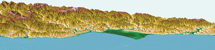
PrairiesUnbeknownst to many visitors to RNSP are the parks' prairies, grasslands that provide important habitat for elk, black-tailed deer, and other inhabitants of the biological community. For thousands of years, Native Americans routinely set fires in the prairies to keep them free of encroaching trees, to make the land more productive, and to attract elk, which were an important food source. The regularity of fire in the prairies has limited what kind of trees grew there. Oaks gained a foothold in places and big-leaf maples thrived along stream courses, but for the most part, fires killed tree seedlings before they had a chance to take hold and turn grassland into forest. In more recent times, the suppression of fire has resulted in the spread of Douglas-fir, a species well suited for growing in hot, dry places like the Bald Hills. The open grasslands have dwindled, now replaced by fir forests. Today, park staff is again using prescribed fire to maintain the oak woodlands, grasses, and other native plants found in this diminishing natural community. Fire not only helps preserve the natural values of these grassy expanses, but the cultural values as well. Values represented by the historic barns, relict stands of oak, and the openness of the land itself. |
Last updated: November 23, 2022