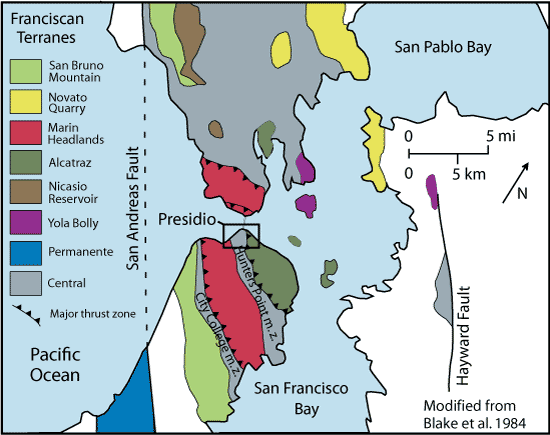
Modified from Blake et al. 1984. Tectonostratigraphic terranes of the San Francisco Bay Region. P. 5-22, in Blake, M. C. Jr., ed., Franciscan Geology of Northern California. Pacific Section SEPM, volume 43.
This map shows the eight tectonic terranes of the Franciscon Complex in the San Francisco Bay area, as well as the important San Andreas and Hayward faults. Each terrane is characterized by a specific history of rock deposition and degree of metamorphism.
|
Last updated: February 28, 2015