Last updated: June 19, 2020
Place
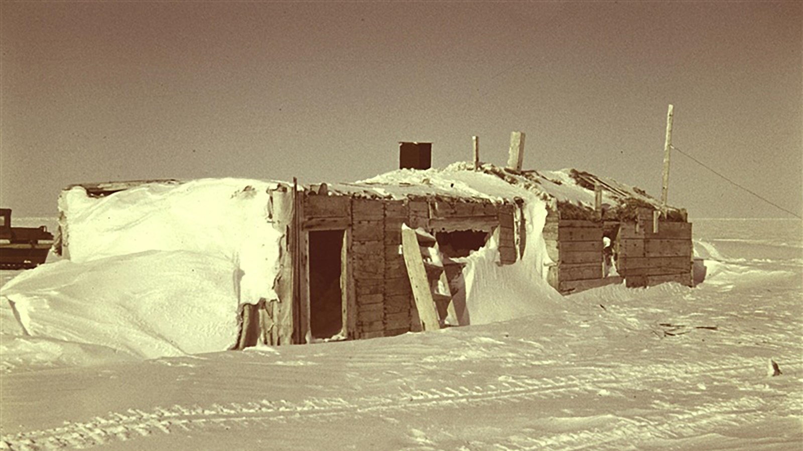
Leffingwell Camp Site National Historic Landmark
Rear Admiral Harley D. Nygren. NOAA Corps
Quick Facts
Location:
Flaxman Island, Alaska
Significance:
Ernest de Koven Leffingwell, geologist and arctic explorer, conducted his pioneer scientific research and explorations here.
Designation:
National Historic Landmark designated on June 2, 1978
OPEN TO PUBLIC:
No
MANAGED BY:
An Artic Geologist in the Early 20th Century
In 1906, geologist Ernest de Koven Leffingwell landed on Flaxman Island, three miles off the northern coast of Alaska. Leffingwell and Ejnar Mikklesen, a Danish sea captain and explorer, were the co-commanders of a small, privately financed scientific expedition. They were to investigate the rumors of land north of the Alaskan arctic coast.
The team disbanded a year later, but Leffingwell stayed on at Flaxman Island to conduct his own research in geology, geography and cartography. During this time, he produced the first accurate map of the Alaskan coast between Point Barrow and Demarcation Bay near the Canadian coast.
He was the first person to study the details of ground ice that is known today as permafrost. He stayed at Flaxman Island until 1914. His pioneering research and discoveries have contributed greatly to the knowledge of the arctic today.
Additional Information
Ernest Leffingwell, scientist with a fan club. By Ned Rozell, University of Alaska Fairbanks.
National Register of Historic Places - Official Nomination Form