Last updated: March 12, 2021
Place
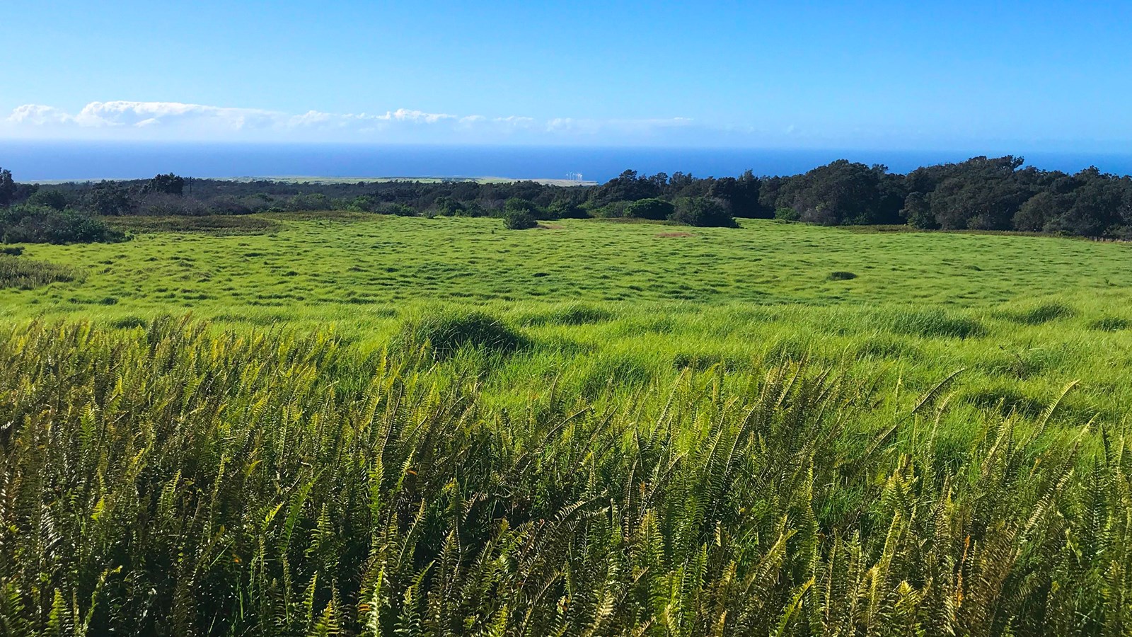
The Kaʻū Field System
NPS Photo/J. Provance
Quick Facts
Amenities
1 listed
Scenic View/Photo Spot
Early Hawaiians most likely farmed any lowland area that received at least twenty inches of rain annually. They used fire to clear the land of native forest, brush and grass before planting the subsistence plants like sweet potato (ʻuala), banana (maiʻa), breadfruit (ʻulu) and sugar cane (kō) that they’d brought from Polynesia. There are places in the Kahuku Unit of Hawaiʻi Volcanoes National Park where the fields and agricultural instruments used to grow these critical foods are still visible today.
Agricultural landscapes called field systems - important, permanent, and “intensively managed” farming areas – were designed to maximize food production. In the district of Kaʻū, these were exclusively rain-fed. Since the field system had to feed the people and support the chief, mitigating issues with poor soil and less-than-optimal rainfall for the best production was imperative. Farmers developed innovative ways to increase the yield even in marginal farming areas: they built walls (kuaiwi) and planting mounds to regulate moisture and warmth.
Although now covered in non-native grasses planted during the Kahuku Ranch era, these walls and mounds are visible in Kahuku as long ridges running through the pastures. As you look at this landscape itʻs easy to imagine garden plots of ʻuala, kō and maiʻa cultivated by ke kini mahiʻai o Kaʻū (the multitude of Kaʻū farmers) to feed the people of Kahuku.
In Kahuku, the kuaiwi were built mauka-makai, parallel to the slope of the land, in order to maintain moisture by blocking wind and reducing evaporation. Smaller cross-slope walls were also built to reduce erosion and mark boundaries. Planting mounds were constructed in places with shallower soil to retain moisture, regulate heat and provide deeper soil for plants like ʻuala (sweet potatoes), which appears to have been the dominant crop in the area.
Volcanic eruptions have covered some of the Kaʻū Field System so an accurate measurement of the actual agricultural area is difficult. The University of Hawaiʻi archeological study of the Kaʻū Field System estimates that it was approximately 150 square kilometers, or 37,066 acres.
There are many places in the Kahuku Unit where remnants of the field system are visible, but look for them in particular along the Puʻu o Lokuana and Kamakapaʻa trails.