
NPS / Emily Novack Tectonic Forces and the Formation of Pinnacles National ParkGeological OriginsPinnacles National Park lies near the San Andreas Fault, along the boundary of the Pacific Plate and the North American Plate, showcasing the impact of tectonic plate movement. The Pinnacles Rocks are remnants of the Pinnacles-Neenach Volcanic Field, which erupted 23 million years ago near present-day Lancaster, California, approximately 195 miles (314 km) southeast of the park. As the San Andreas Fault split the volcano, the Pacific Plate carried the Pinnacles northward. Over time, water and wind erosion shaped these volcanic rocks into the unique formations seen today, providing habitats for diverse plant and animal species. Talus Caves and EarthquakesFault action and earthquakes are also responsible for the park's famous talus caves. These caves formed when massive boulders fell from above into narrow gorges or shear fractures, becoming wedged before hitting the ground. These boulders now form the ceilings of the caves, attracting both visitors and several species of bats. Diverse Topography: A Landscape of ContrastsPinnacles National Park offers more than just towering rock spires and dramatic crags. The park’s elevations vary significantly, from 824 feet along the peaceful South Chalone Creek to 3,304 feet atop the majestic North Chalone Peak. This variation creates a rich and dynamic landscape, featuring not only steep cliffs and talus caves but also gently rolling hills and serene valleys. These diverse environments support a wide range of plant and animal life, offering habitats from sunny, open meadows to shaded canyon floors. To explore and learn moreTake a look at the images below, which highlight the park's unique terrain and ecosystems. Click on each image to go to that page. 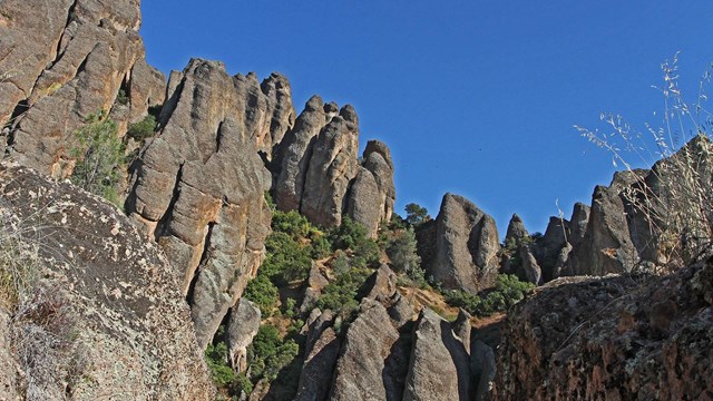
Geologic Formations
Learn more about the different formations and rock types at Pinnacles. 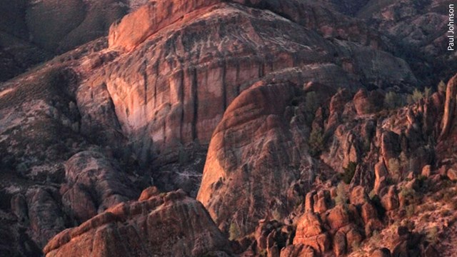
How Pinnacles Formed
Dive in to the origin story of the formations that the park is named after. 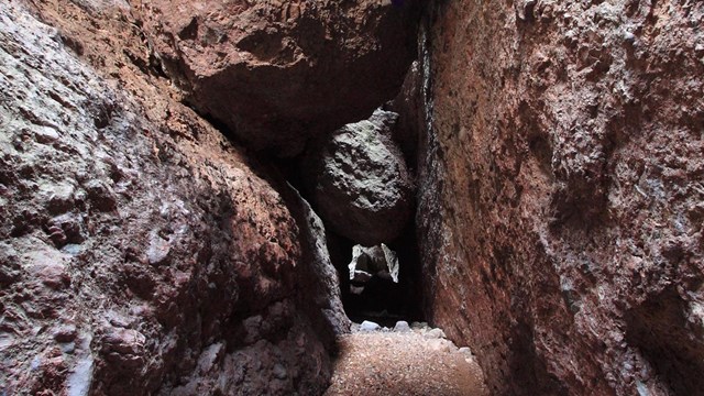
Cave & Karst Systems
Pinnacles is known for its rare talus caves. Discover the geology that underlies these unique cave and karst systems at Pinnacles. 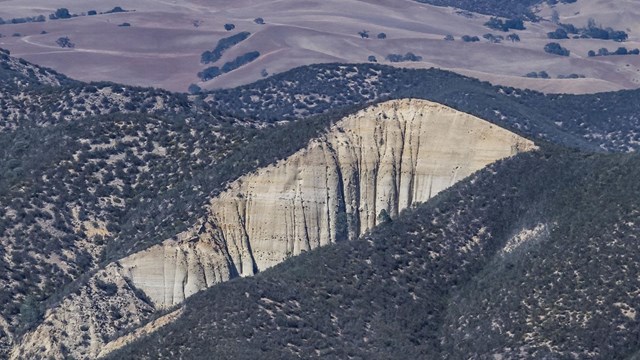
Faults
Pinnacles is a hotbed of volcanic and seismic activity. Discover the faults that have shaped the park for millions of years. |
Last updated: October 18, 2024