|
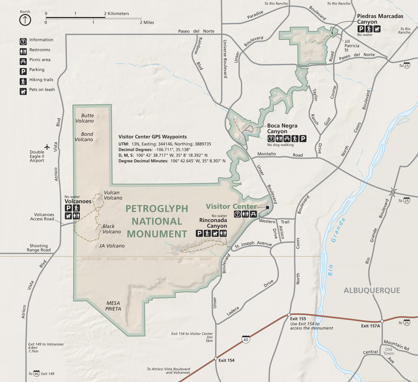
GPS Coordinates to Trails If you prefer to drive directly to any of our four trail systems, please use the following GPS coordinates: For Boca Negra Canyon use Lat: 35.161 Long: -106.719 For Rinconada Canyon use Lat: 35.127 Long: -106.725 For Piedras Marcadas Canyon use Lat: 35.1887 Long: -106.6856 For Volcanoes Day Use Area (no petrogyphs) use Lat: 35.1306 Long: -106.7803 The Monument's visitor center is located on the west side of Albuquerque, New Mexico. It is important to know that there are no petroglyph viewing trails located at the visitor center. Each of the petroglyph viewing trails are a one-mile to a 6.5 mile drive from the visitor center. If you are being dropped off at the visitor center, have your driver wait for you as you will need to be driven to the petroglyph viewing trail of your choice. Directions to the Visitor Center: Public Transportation: At this time, the City of Albuquerque does not offer bus transportation to Petroglyph National Monument. We suggest that visitors without a car seek another means of transportation to the monument such as a taxi, a transportation service (such as Uber), or renting a car. Attention GPS Users: Degrees, minutes and seconds:
Datum: WGS84 35° 8'20.18" N 106°42'40.31" W Decimal degrees: Datum: WGS84 35.138939° -106.711197° Decimal minutes: Datum: WGS84 35° 8.336' N 106° 42.672' W Universal Transverse Mercator (UTM): Zone: 13 Datum: WGS84 344106.94 m E 3889791.15 m N 
NPS |
Last updated: November 30, 2017