|
Theodore Roosevelt
Administrative History |

|
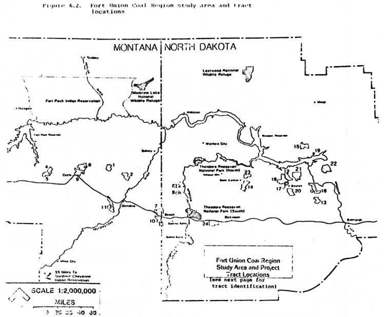
Figure 6.2. Tract identification Fort Union Coal Region
| Tract | Distance to nearest unit of National Park Theodore Roosevelt in miles (kilometers) |
| 1. Bloomfield | 76 (122) |
| 2. Burns Creek | 57 (92) |
| 3. Central Bloomfield | n/a |
| 4. Circle West I | 118 (190) |
| 5. Circle West II | 125 (201) |
| 6. Circle West III | n/a |
| 7. North Wibaux-Beach | 22 (35) |
| 8. Redwater I | 95 (153) |
| 9. Redwater II | 100 (163) |
| 10. South Wibaux-Beach | 24 (39) |
| 11. Southwest Glendive | 63 (101) |
| 12. Antelope | 75 (121) |
| 13. Center | 104 (167) |
| 14. Dunn Center | 43 (69) |
| 15. Garrison | 89 (143) |
| 16. Glenharold | 100 (161) |
| 17. North Beulah | 74 (119) |
| 18. Rennet | 66 (106) |
| 19. Sakakawea | 93 (150) |
| 20. Schoolhouse | 79 (127) |
| 21. Truax | 83 (134) |
| 22. Underwood | 107 (172) |
| 23. Werner | 40 (54) |
| 24. Zenith | 10 (16) |
n/a—not available
SOURCE: Air Quality Information Supplemental to the Fort Union EIS
| <<< Contents >>> |
thro/adhi/fig62.htm
Last Updated: 15-Jan-2004