|
ICE AGE
Geology of Ice Age National Scientific Reserve of Wisconsin NPS Scientific Monograph No. 2 |

|
CHAPTER 10:
St. Croix Dalles Interstate Park
Introduction
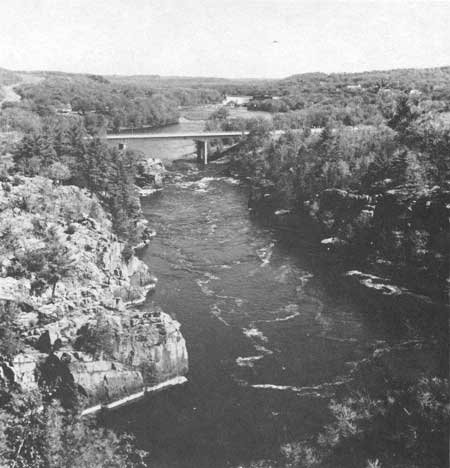
"The most beautiful gem of scenery in the states of Minnesota and Wisconsin is the Upper Dalles of the St. Croix River, which forms a part of the boundary between these states. (Upham 1905:347.) Tourists come to the St. Croix Dalles mainly to see the gorge (Figs. 95, 120-122) and its supersize potholes—mute testimony to the accomplishments of vast torrents of running water during glacial times. Potholes are circular and irregular depressions in rock, produced by the grinding action of silt, sand, and small stones swirled in initially minor depressions by strong currents of water. They are not to be confused with "potholes" in earlier colloquial usage or even today, which are kettle ponds in moraine. The potholes of the St. Croix Dalles . . . are unsurpassed by any other known locality in respect to their variety of forms and grouping, their great number, the extraordinary irregularity of contour and the much jointed diabase in which they are eroded, and the difficulty of explanation of the conditions of their origin." (Upham 1900:26).
|
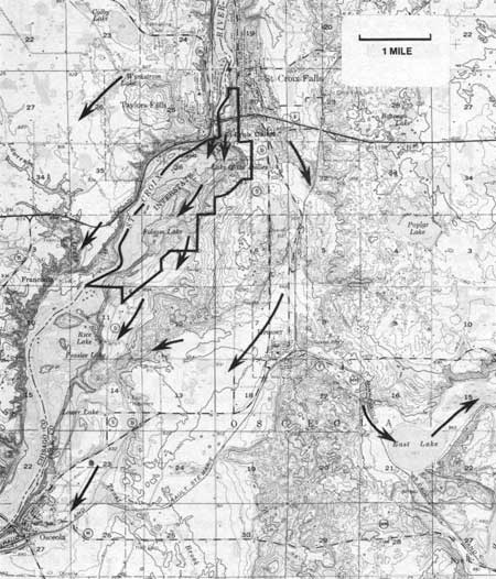
| Fig. 120. Part of U.S. Geological Survey Topographic Quadrangle—St. Croix Falls, showing boundary of the recommended area and some arrows indicating directions of former water flow, both glacial and post-glacial undifferentiated. |
|
| Fig. 121. Gorge of the St. Croix River at the Dalles, looking northward from Summit Rock. |
|
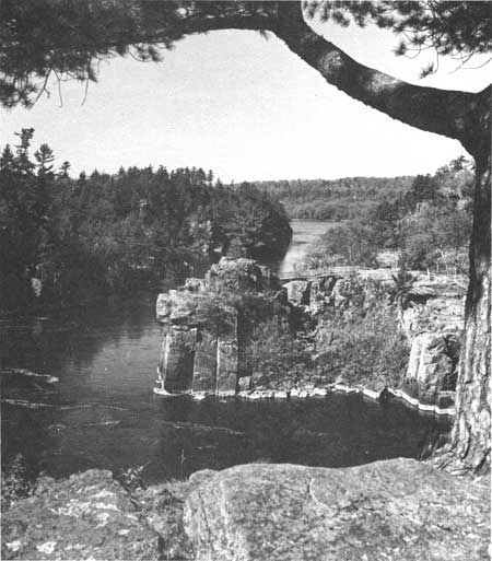
| Fig. 122. Gorge of the St. Croix River the Dalles, looking southwestward from the "elbow." |
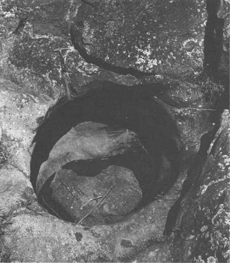
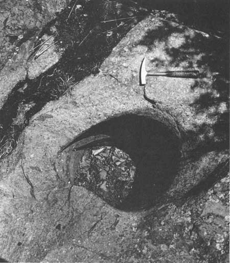
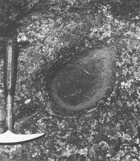
Potholes are much larger and more numerous on the Minnesota side of the St. Croix River, but those in Wisconsin are good (Figs. 123-127). The Wisconsin potholes are as much as 6 by 10 ft across and 15 ft deep. Those in Minnesota are many tens of feet deep. Potholes of such tremendous size cut into hard basalt up to 100 ft above the river are unusual features. This was recognized decades ago by the governments of the states of Wisconsin and Minnesota, and in 1900 each state set aside areas on both banks of the St. Croix River in order to preserve them. Although each park operates independently, together they are known as Interstate Park.
|
| Fig. 123. Large pothole near the Old Man O' the Dalles. Geologic hammer for scale. |
|
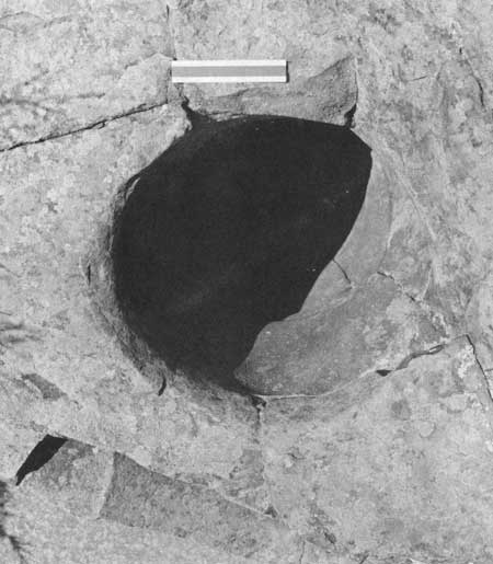
| Fig. 124. Pothole, showing large crystals of feldspare in basalt. |
|
| Fig. 125. Circular pothole. |
|
| Fig. 126. Small shallow pothole. |
|
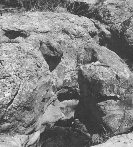
| Fig. 127. Compound potholes. |
No definitive detailed account of the geology of the park has been brought together since that of Berkey (1897). Upham (1900) provided detailed descriptions of the potholes and a possible origin. Upham (1905), Chamberlin (1905), and many others contributed to the knowledge of the history of the area, but strong differences in interpretation continued. Martin (1932:364-366) provides a simplified outline of part of the story. Leverett (1932) expanded the glacial history considerably. Cooper (1935) outlines in some detail the general history of the Upper Mississippi River. Sardeson (1936) attempted to summarize his own interpretation of the Pleistocene of the St. Croix River, but the story continues to be changed (Wright and Ruhe 1965:29-41).
I will not attempt a detailed review of the extensive literature available nor report on all aspects of the geology of the park and its surroundings. Reevaluation of the older works can only be done satisfactorily in the field, and for purposes of this report is not necessary. All who have ever seen the gorge of the St. Croix Dalles Interstate Park and its huge potholes are outspoken in their desire to preserve them uncommercialized. Inclusion in the Reserve of one of the most unusual collections of glacial phenomena in Wisconsin, or the world, is only fitting. Only slight enlargement of the existing park—extending it southward along the bluffs of the St. Croix River—is needed now to provide more room for the vast number of tourists who each year make use of the park's facilities.
General Description
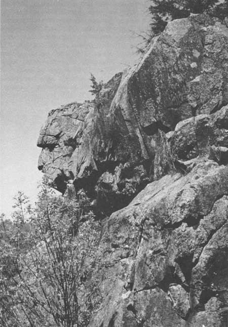
The St. Croix Dalles is a 100-ft deep gorge cut in Precambrian basalt (Fig. 3) (several areas of Upper Cambrian sandstone lie uncomformably on the basalt in and adjacent to the park) of which seven individual flows have been recognized, rising like giant steps above the river (Martin 1932:364). The lava is well-jointed (Fig. 122). This aids in its removal by water, frost, and gravity and in formation of unusual pinnacled forms (Fig. 128). Large white or light gray feldspar crystals in the rock stand out against the black background but are ground smooth as is their host by pothole drilling (Fig. 124). Composition and texture of the flows in part, but particularly the structures of the rock, have controlled the location and irregularity of some potholes. They are particularly common along joint cracks and are elongated in them. Irregular sides at various levels in the potholes presumably also reflect variations in the rock, but no detailed studies have been made. Some small potholes are on smooth rounded shoulders of rock with no clue visible in the rock reflecting a weak point. I wonder (as did Upham 1900) whether some of them may have originated subglacially, for they are in anomalous positions for surface streams to start them. Such have been recorded in Norway (Gjessing 1965-66).
|
| Fig. 128. Old Man O' the Dalles, resulting from fracturing and frost action. |
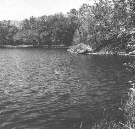
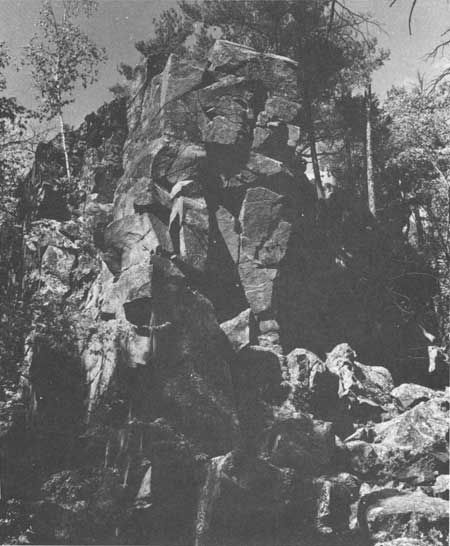
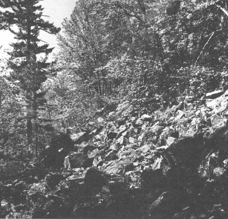
The main gorge obviously was cut and is being cut by running water. Former torrential discharges during glacial wastage and glacial lake drainage sought the weakest route through the lava and partly excavated many other weak points as well. Excavation seems in large part to have been accomplished by physical removal of large joint blocks by the rushing waters. Lake O' the Dalles (Fig. 129) was at the receiving end of water that passed southward on the east and west sides of Summit Rock, the high point 0.2 mile northeast of the lake between the two short arrows shown on Fig. 120. Berkey (1897:352) considered the depression now occupied by Lake O' the Dalles to have been part of a gigantic whirlpool and as such to be one of the more striking features in the park. The west arrow is in Echo Valley (Fig. 130) where water excavated fractures in the rock, leaving broken cliffs (Fig. 131) and talus (Fig. 132) to develop in post-late Woodfordian (Cary) times. The east arrow is in Canyon Valley, a similar weak zone extending southward from the north-trending gorge of the Dalles. Both Echo and Canyon valleys were vacated when the southwest-trending part of the gorge was cut below their level. The fracture zone on which that part of the gorge developed may be traced northeastward on the Wisconsin side of the river as a distinct trough. Part of the deepening and removal of rock in the park area can be attributed also to ice action for striae are found at upper levels, but the quantitative effects of ice versus water are not known.
|
| Fig. 129. Lake O' the Dalles, looking downstream. |

|
| Fig. 130. Echo Valley trail. |
Lake O' the Dalles was formerly much larger, extending both eastward and westward. It is reported (Howard S. Kunsman 1937, unpublished report) that filling on the east side of 32 ft of clay, marl, and vegetable matter included wood with beaver teeth marks, plant seeds, leaves, and branches with the bark on. These came from excavations at what is now the parking lot for the lake. In addition, in the upper part of the deposit a copper pike or awl, 10.75 inches long, was found in peat with two flint weapon points and bones and horns of extinct bison (Palmer 1954). Lake O' the Dalles lies in part of only one of the earlier drainageways. Other routes of temporary water flow are shown by arrows in Fig. 120. Not all were occupied at once; some show by later development of kettle holes that water was flowing over buried ice blocks and are glacial rather than postglacial.
The washed areas along the St. Croix River are part of an extensive system of terraces of which five have been distinguished (Berkey 1897:352-354). Some are determined by rock ledges. The main street of the town of St. Croix Falls is on the next to the highest terrace. None of the terraces up to 920 ft elevation continue below the Dalles (Chamberlin 1905:256). Now that more detailed and accurate topographic maps and aerial photographs are available, these terraces need to be restudied along with the other drainage changes in the area.
The original map of Strong (1880:365-428) showed one set of glacial striae at the Dalles, with southeasterly trends and one major end moraine, and the inner part of the St. Croix or Kettle Moraine which originated from the Superior Lobe. Later Chamberlin (1905:249-250) increased the number of sets of striae to three in order of age—southerly, southeasterly, and east-northeasterly—and the number of drift sheets to four (Chamberlin 1910). The oldest drift was correlated with the Kansan Stage, but the same drift to the south is radiocarbon dated at about 30,000 years (Black 1959a). Obviously the Pleistocene history of the area is complicated (Wright and Ruhe 1965:29-41; Frye et al. 1965:43-61), and I have not done sufficient field work in the area to work out details or adjudicate differences of opinion. For purposes of this report this does not seem vital.
|
| Fig. 131. Cliff of jointed basalt in Echo Valley. |
|
| Fig. 132. Talus from well-jointed basalt in Echo Valley. |
However, for full appreciation of the formation of the main features in the gorge an understanding of the sequence of events is vital. Unfortunately that sequence is not understood or at least agreed upon. Many geologists believe that the potholes can be attributed to torrential drainage from glacial lakes to the north. Recent work (Elson 1957; Zoltai 1965) now suggests that Glacial Lake Agassiz existed more than once and that it has drained into the Lake Superior basin to add its enormous discharge to the glacial waters which at different times have gone down the St. Croix River. It is not clear to me just how many times nor when such discharges have come down the St Croix River, nor the effect each discharge has had in the formation of the particular features remaining in the Dalles region.
During late Woodfordian time the Grantsburg Glacial Sublobe, named for the town of Grantsburg in Burnett County, flowed northeasterly across the St. Croix River and established a moraine along a front from that town to the Dalles. It dammed Glacial Lake Grantsburg on its north side (Cooper 1935:23-38; Wright and Ruhe 1965:29-41) which also received the drainage of the Mississippi River from the area to the north and that of the Superior glacial lobe as well (Cooper 1935:34). Water from Glacial Lake Grantsburg flowed around the edge of the ice and through the Dalles, shifting its course as the ice retreated. Wright and Rubin (1956) date organic matter in the bottom of kettles and in the Anoka sand plain associated with the Grantsburg sub-lobe as 11,800-12,700 years old. Zoltai (1965:268) has Lake Agassiz draining into the Superior basin as recently as 8610-9530 years B.P. I suspect that some of the potholes are related to these late glacial events. However, how many times during the Woodfordian or Altonian substages glacial drainage affected the Dalles region seems to be speculation at this time.
Thus, much of the chronology of events for the Dalles must await detailed field studies in the area and the correlation of late Pleistocene events from Wisconsin to Lake Agassiz basin of North Dakota and Manitoba.
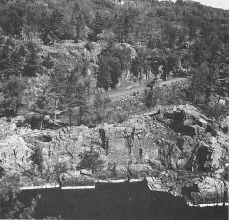
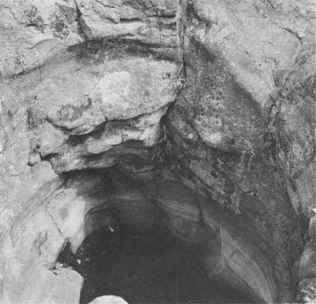
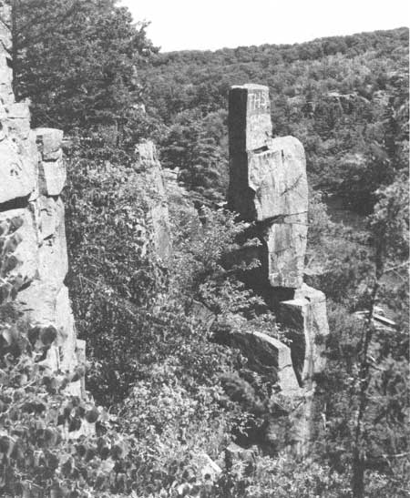
Because of the greater degree of development of potholes (Figs. 133, 134) on the Minnesota side of the Dalles, it would seem appropriate to include that area in the Reserve as well. There, individual potholes attain depths as much as 60-80 ft and are 15-25 ft in diameter. Compound potholes also are much larger and more varied than their counterparts on the Wisconsin side. In addition, Devils Chair (Fig. 135) is a rock monument produced since late Cary times by frost action and gravity movements in the well-jointed basalt. It may be seen on the cliff between the two highway overlooks to the south of the pothole area. It is analogous to the Devils Doorway (Fig. 63) at Devils Lake.
|
| Fig. 133. Potholes on the Minnesota side of the Dalles, looking down from Summit Rock. |
|
| Fig. 134. Large pothole on the Minnesota side of the Dalles. |
|
| Fig. 135. Devils Chair, a post-glacial stack of loose joint blocks of the basalt on the Minnesota side of the Dalles. |
Conclusion
Although this note by its brevity may seem to do an injustice to the Interstate Park, this is purely coincidental. To me an Ice Age Reserve in Wisconsin would axiomatically include the St. Croix Dalles gorge and potholes. No other comparable area is known in the world.
| <<< Previous | <<< Contents >>> | Next >>> |
chap10.htm
Last Updated: 1-Apr-2005