|
NORTH CASCADES
Historic Resource Study North Cascades National Park Service Complex, Washington |

|
MARKETING THE WILDERNESS: DEVELOPMENT OF COMMERCIAL ENTERPRISES
Commercial development of the land now designated as North Cascades National Park has a long and varied history. From the fur-trading era of the nineteenth century, this wilderness area has provided abundant resources from which to profit. Water, wood, and minerals were all utilized and exploited at various times and to different degrees. The generally inaccessible nature of these mountains was not enough to prevent people from seeking opportunity there. Enterprising individuals marketed fruits and vegetables, grazed sheep and cattle, logged timber, mined minerals, and harnessed rivers all for economic gain. This chapter identifies chronologically the most significant kinds of commercial activity in the North Cascades, considers how these human enterprises have impacted the natural resources, and records what tangible evidence remains of these human efforts.
Trapping and the Fur Trade
Fur trapping in the North Cascades represents the earliest commercial use of the area's resources. Hide and fur for shoes, hats, and clothing were in demand in European fashion circles long before the Cascade Range was known to exist. Decades of trapping by British and French fur companies forced the trade westward from the North Atlantic coast where it had its origin, and by the beginning of the nineteenth century, fur trappers and traders had discovered the Columbia River basin and its untouched wealth of fur pelts. [1] It was only a matter of time before trappers penetrated the remote North Cascades.
Although the early trappers directed most of their attention to securing beaver pelts, other animals were trapped as well. Bears, wolves, lynx, fishers, muskrats, and foxes all furnished marketable pelts. [2] The skins of animals trapped along mountain streams and forests were transported to trading posts and forts established by various fur companies, including the dominant Hudson's Bay Company. Taking advantage of the Indians' knowledge of the vast region, white traders encouraged Native Americans to trap animals in exchange for goods and weapons.
Whether the early white trappers habitually trapped the region that is today's park is not known, but it seems unlikely that they did. The Hudson's Bay Company's Brigade Trail lay north of the area passing through Forts Hope and Langley enroute to the Thompson River. [3] The same company had a small trading post on what is today Ten Mile Creek, along the Nooksack River well to the west of present-day park boundaries. [4] The only major fur trading post in the vicinity of the park was Fort Okanogan, located near the confluence of the Okanogan and Columbia Rivers. This post was erected in 1811 and used by the Pacific Fur Company, the North West Company, and the Hudson's Bay Company, until the 1850s. Although some individuals have speculated that cabins extant in the Bridge Creek drainage on the east side of the divide may be trappers cabins associated with the Hudson's Bay Company, it seems unlikely that they date from this early period, given our knowledge of how the company's fur traders operated. Employees of fur companies stationed at these backcountry outposts rarely trapped themselves. Instead, they typically taught local Indians how to use trapping equipment and bring the pelts to the trading posts for exchange. [5]
There is only one documented account of a white fur trader entering the North Cascades at an early date. Alexander Ross, a Scotsman employed by the Pacific Fur Company, traveled up the Columbia River in 1811 and, with others, established Fort Okanogan. Basing his operation out of that post, Ross was able to collect more than 1500 beaver pelts in a single season. He explored the surrounding country during the summer of 1814 in search of new areas to trap. But Ross' larger purpose was to determine whether a feasible route existed between the inland trading posts and those located on Puget Sound. This journey led Ross through the area that is today's park, over the Cascade summit, and down the Skagit River. [6] From Ross' account, it appears that the North Cascades were generally unknown to the majority of traders operating in the territory. However, Hiram C. Chittenden, in his American Fur Trade of the Far West, stated that "the streams of the Cascade range...were thoroughly exploited by the Hudson Bay Company, and were as rich a field as the west afforded." [7] It is assumed that the Indians, particularly those who traded at Fort Okanogan, made their way along streams on the eastern slope of the Cascades in search of pelts for trade. [8]
The three major fur companies operated along the Columbia River for more than three decades, from approximately 1811 to 1846. After 1846, trapping activity slowed as the number of traders and active trading posts decreased and the number of over-trapped streams grew. In the late nineteenth century, however, as people began locating homes along the Skagit and Stehekin Rivers, a new type of fur trapper emerged as many of these early settlers and miners turned to trapping as a means of supplementing their meager wilderness existence.
Trapping was a seasonal activity and a strenuous one. Each winter hardy individuals working alone or in pairs would set up trap lines along ridges and in river bottoms. Out for weeks at a time in the cold and snow, these men usually returned with pelts that translated into substantial income. Beaver, mink, otter, marten, and lynx were some of the animals whose pelts were sold for cash. [9] Usually the pelts were prepared by the trapper and then shipped through Marblemount and Chelan (via Stehekin) to larger urban areas. Seattle, New York, and St. Louis were just a few of the cities with furriers who willingly accepted, graded, and sold pelts for a commission.
Trapping remained a viable activity for the settlers for many years. As administrator of the land, the USFS did not discourage settlers from earning an income in this manner. They issued permits enabling trappers to build cabins in the backcountry for use during the trapping season. These permits sold for $5 and were good for a single season, usually lasting 4-6 months from October through April. [10] A Cascade Mountains Study, completed in 1940 by the Washington State Planning Council, indicated that more than 200 trappers were operating in Chelan, Skagit, and Whatcom Counties. But a number of factors resulted in a decrease of this commercial activity in the North Cascades. Over-trapping, low prices brought by lack of demand, and a rise in the business of fur farming made trapping impractical. [11]
Since the establishment of North Cascades National Park in 1968 trapping has become a prohibited activity and is no longer a legal means of income for present residents.
A number of individuals trapped on the west side of the Cascades, along tributaries of the Skagit River. John McMillan, a miner who settled on Big Beaver Creek, was one of the first to run trap lines in the winter along that drainage and along the Skagit River in the late nineteenth/early twentieth century. [12] McMillan built a log cabin on Little Beaver Creek between today's Perry and Stillwell hiker camps. [13] After McMillan died in 1922, friends continued to live on his ranch. One was Miles Garrett, who attempted to box-trap marten there for two to three years; his venture proved unsuccessful. [14] Frank Oakes was a homesteader along Bacon Creek who trapped for a living up that drainage. He too had a trapping cabin which was built farther up Bacon Creek. Other individuals known to be seasonal trappers in the early days included Jack Durand, who trapped Thunder Creek and the Cascade River; Gilbert Landre; Isaac La Rush, who trapped Thunder Creek extensively for several winters; and Milt Hickerson. [15]
In the 1930s only one or two people were trapping in the upper Skagit valley. A man named Frank O'Brien trapped in the vicinity of Hozomeen Creek and Lightning Creek during this time. [22] More than likely Seattle City Light (SCL) personnel working on the Skagit hydroelectric project trapped along the upper Skagit periodically. This area was once known to contain many beaver but in later years poachers decimated the animal population. The State Game Department made an effort to revive the lost beaver population by live-trapping beaver (in other areas) and transplanting them. At an earlier time beaver had been transplanted from the east side of the mountains in Canyon Creek (near Slate Creek) and made their way down into Ruby Creek. [23]
Gaspar Petta first came to Marblemount in 1912 to settle and make a life in the North Cascades. Both a rancher and logger in hard times, Petta spent many winter days trapping in the backcountry. In 1920 he bought a cabin four miles up Goodell Creek on the east side of the stream. The split cedar log cabin had been built the year before by another Marblemount trapper. [16] Petta also had a cabin 12 miles up Goodell Creek at the foot of Jaspar Pass. [17] If not near one of his cabins, Petta simply camped beneath the trees of the forest. One of the few who made a decent living trapping, Petta ran lines along the Baker River, Goodell Creek, and probably countless other drainages in the North Cascades. [18] Old receipts spanning the years 1913 through 1949 reveal that Petta shipped his pelts all over the country. J.S. Lodewick Company of New York, "buyers and exporters of Raw Furs and Ginseng," paid Petta $18 for two large mink and one medium one; later that same year two large mink, one medium, two small, a marten, and a weasel (worth only two cents) brought Petta a check totalling $21.06. Other companies he dealt with were J.L. Prouty's Sons, New York; Montgomery Ward and Company, Portland, Oregon; Northern Fur Company, St. Louis; Olaf Swenson, Seattle; New York Auction Company; and Sol Rubin, Seattle. [19] Petta retired from trapping in 1956. [20]
John Dayo was another Marblemount resident who arrived in the upper Skagit valley in 1920 and began working seasonally for the USFS and trapping to make a living. He ran trap lines along Bacon Creek, the Cascade River, Thunder Creek, and Fisher Creek. Dayo's name can be found carved into the logs of Rock Cabin, located on the north side of the Fisher Creek trail: "John Dayo Xmas Day 1927" and "John Dayo and Ethel Dayo [his wife] Xmas Day 1928-29." Rock Cabin is a unique log structure built against an enormous rock. Constructed with materials found on site, except for the windows which were packed in, this small cabin housed Dayo's furs during trapping season. Each fall he packed the bulk of his food and supplies into this cabin and one known as Meadow Cabin along Thunder Creek. Come winter, Dayo used snowshoes to reach his caches and numerous trap lines. Over the course of two months he was able to catch marten, coyote, fox, and an occasional lynx. [21]

|
| Built against an enormous monolith, Rock Cabin was used as a shelter, primarily by trappers. (Photo by G. Luxenberg, NPS, 1984) |
Miners, settlers, and others trapped on the east slopes of the Cascades as well. From the 1890s until the 1940s, Stehekin valley residents and tourists transported furs downlake to be sold. The Chelan Leader reported on June 18, 1897: "Among the bales of fine furs, goat, bear and linx [sic] skins which Red Pearl is getting ready to ship from the head of the lake, is a monster mountain lion skin which measured eight feet in length." Miner and horse packer Dan Devore was trapping the Bridge Creek drainage in 1906 and may have been responsible for building one or more of the backcountry log trapping cabins erroneously attributed to the Hudson's Bay Company. [24] The Weaver Brothers trapped and operated a taxidermy business at the head of the lake, capitalizing on the local tourist market in the early twentieth century by preparing pelts and skins for the visiting hunters.

|
| Weaver Brothers' cabin, displaying an assortment of animal pelts trapped in the Stehekin River drainage, n.d. (NOCA-Stehekin photo file) |
Other individuals trapping on tributaries of the Stehekin River included Hugh Courtney who worked seasonally for the USFS and spent winters trapping marten. It is believed he built a log trapping cabin in the rarely traversed Butte Creek drainage, and remnants of this structure exist today. [25] Hugh's son Ray accompanied him for many years and continued the activity long after his father died. Both Hugh and Ray were known to have trapped Company Creek as well. [26] Another Courtney son recalled shipping the furs to Silbermans in Chicago and J.L. Prouty's Sons in New York. [27] Barney Zell and Fred Bowan were two Stehekin residents who trapped in the 1920s. Zell trapped Agnes Creek and together with Bowan trapped the Rainbow Creek drainage. [28] The two used and possibly built a trapping cabin up Rainbow Creek near Bowan Creek. Today all that remains of this structure are foundation logs. [29]

|
| Remnants of a trapper's cabin in Butte Creek drainage, north of Lake Chelan. (Photo by J. Hammett, NPS, 1984) |
By the 1930s few people were trapping in the Stehekin backcountry. The USFS noted that fur trapping was controlled fairly well in the Chelan District because of the trapper cabin permit system and that:
Very few permits are issued and seasons staggered. Beaver are lacking and there is little chance for their introduction, as nearly all the streams of any size fall rapidly through narrow canyons. [30]
Agricultural Enterprises
Agricultural activity in the North Cascades began shortly after the arrival of settlers into the area. A prerequisite for living off the land included at minimum, the cultivation of a garden and raising a few head of beef or dairy cattle. For the permanent settler it was of vital importance to work the land and produce crops. With the extreme and unpredictable mountain weather there was no guarantee crops would grow from one season to the next. As a result, settlers depended heavily on each other and often exchanged foodstuffs and goods for the equivalent in similar goods or services. Both cash and the barter system were an acceptable means of obtaining needed items.
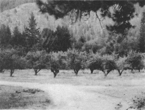
The exchange of produce never developed commercially beyond the local market. The only commercial agricultural venture of any size that operated in the area of today's park was an apple orchard on the eastern slope of the North Cascades, in the remote community of Stehekin. Continuing where the original owner left off, the Buckner family of California moved to the head of the lake in 1910 and developed 149 acres into a sizable and profitable enterprise. Over several decades the Buckners cleared their land, cutting timber and pulling stumps, increasing the size of the orchard. A large network of hand-dug irrigation ditches throughout the orchard brought water from nearby Rainbow Creek to the trees in the dry summer season. The near absence of harmful insects coupled with good soil and climatic conditions resulted in a prolific orchard of approximately 50 acres. Several Stehekin valley residents were employed seasonally by the Buckners to help harvest the crop each year. Initially packed in crates by hand, and later by machine, the apples were sent downlake via barge to Chelan valley markets.
|
| With successive plantings the orchard at the Buckner Homestead grew to cover about 50 acres and include 700 trees. (Photo by C. Gilbert, NPS, 1985) |

|
| Diversion ditch from Rainbow Creek forming the main irrigation channel watering the entire orchard. (Photo by C. Gilbert, NPS, 1985) |
For nearly half a century the Buckner Orchard remained a profitable commercial operation. A number of circumstances however, caused the family to retire from the business. It was difficult to secure pickers and packers for the apples, transportation costs were high, and the labor required to maintain the tree stock proved burdensome for the family. By the 1960s the agricultural enterprise which had allowed the Buckner family to reside comfortably in the remote Stehekin valley for so many years was no longer functioning as a profitable business. [31]
Ranching, specifically cattle and sheep grazing, was another agricultural activity which occurred historically in the North Cascades. Although the number of animals grazed in this region seems minimal relative to other ranching areas in the state, this activity had a significant impact on the forest lands of the North Cascades.
Most of the grazing activity in the North Cascades occurred on the eastern slope of the mountains. The 1880s brought an expanding wool-growing industry eastward across the Cascade Range as sheep herders vied with cattle ranchers for the rapidly diminishing public grazing lands. [32] Between 1890 and 1910, millions of acres in the Northwest were set aside as forest reserves, and the year 1898 brought a moratorium on all grazing activity in these newly-protected areas. The Washington Forest Reserve, established in 1897 and encompassing a vast region spanning both sides of the North Cascades, escaped this restriction. Grazing was permitted in that forest reserve on the belief that rainfall in the northwest was sufficient enough to withstand grazing pressures there. [33] After careful study and consideration, the federal government announced a grazing policy for the region which outlined the location and general restrictions for acquiring a permit. Sheepherders were allowed to bring their animals into the forest reserve in limited numbers and:
to enter that part of the southern portion of the reserve, in Okanogan County, which is bounded on the west by the Cascade Mountains, and on the north and east by the Stehekin River and Lake Chelan; but none to be allowed in any other portion of the reserve. [34]
Other restrictions included that the individual applying for a grazing permit be a citizen of the United States and a resident of the State of Washington.
Permits were issued sparingly, for even though the government clearly authorized grazing, it was not a popular activity with some:
The grazing of sheep in such a region as this is much to be deplored and should be prohibited so far as possible. These animals crop the grass so closely that no other stock, with the possible exception of goats, can follow in a tract over which they have grazed and find enough to subsist on, and the roots of the grass are left so exposed that in the dry summers of this region much of it is destroyed. On the hillsides and mountain slopes the effects are still worse. There not only are the grasses cropped as closely as if devoured by locusts, but the sharp hoofs of the animals so trample the steep slopes that it takes years for a tract over which they have grazed to recover its original capacity to support other stock. [35]
The problem of erosion later became a consideration in allowing sheep to graze on forest lands. Trampled slopes associated with repeated grazing were prone to erosion by melting snows. But the government felt the erosion problem to be a "trifling injury compared with the irreparable damage resulting to the forests from the fires which follow the sheep herder and his omnivorous band as constantly as foam follows in the wake of a steamer at full speed." [36] The USFS also recognized the scenic value of the region and knew that sheep and tourists did not necessarily mix:
A large portion of the Chelan National Forest [created from the Washington Forest Reserve] at the northern end of the Lake, extending to the summit [Cascade Pass], should always be reserved for the use of campers. It is a great summer resort on account of the magnificent scenery to be found there and any effort on the part of the Forest Service to place sheep on areas which are the frequent camping grounds of the tourists would certainly lead to a revival of the agitation to have the whole Forest thrown into a national park with sheep grazing excluded. [37]
USFS grazing regulations chiefly controlled sheep not cattle. The latter were not a problem in the high country on the east side. Despite a generally negative attitude toward grazing, permits were issued and the local newspaper, the Chelan Leader, was full of references regarding sheep herds on the forest in the early part of the twentieth century.
Getting sheep into the high country was no easy task. The most expeditious way to get the animals from the lowlands into the mountains was to load them on barges traveling up Lake Chelan:
During the past two years [1916-17] a good deal of range formerly inaccessible has been opened up by use of the barge now operating on the lake [1918]. This barge in 1917 carried up and down the lake about 75,000 head of sheep . . . The sheep can be carried up the lake in a day, and a very difficult drive to the summit ranges is eliminated. [38]
From the head of the lake, sheepherders, many of whom were of Spanish or Basque descent, led the animals up the Stehekin River to Bridge Creek, Maple Creek, McAlester Creek, Rainbow Creek, and other drainages where the sheep were allowed to graze until fall. As winter approached, the sheep were herded back to the head of the lake for the barge ride downlake. Usually the sheep were in the vicinity of Stehekin only one or two days while awaiting the boat. [39]

|
| Loading sheep at boat dock on Lake Chelan, n.d. (NOCA-Stehekin photo file: L.D. Lindsley photo) |
Both sheep and cattle were periodically grazed on the western side of the Cascades. The sheep grazing activity, however, originated on the east side, the herds being brought down from the summits to feed on the moist western slopes. Cattle were grazed in the upper Skagit region for a few years beginning in 1915, when a Mr. Truedell grazed his stock in the national forest. [40] In 1916 cattle were grazed on Jack Mountain, east of Ross Lake. [41] In 1917 the USFS noted that "a small portion of range up the Skagit River is being used by cattle belonging to settlers in the Skagit Valley," but in general, demand for rangeland in this region was not great. [42] Even during World War I, when the number of animals grazed in the national forests increased (in an effort to protect the United States meat supply), demand for rangeland was low. Furthermore, government funds needed to open driveways for the animals were not available. By 1921 not a single permit was issued for grazing cattle on the west side of the divide:
The reason for this lies in the fact that there are no stock animals to be grazed . . . [T]he small farmers residing within reach of the Forest keep a small herd of dairy animals but do not raise beef stock that might be profitably grazed during the summer months on National Forest lands. . . .Failure to use the grazing privilege is entirely due to the class of farmers who live near the Forest and their preference for small dairy herds is governed by the necessarily small amounts of agricultural lands in any one locality. [43]
The 1940s and 1950s did see a renewed interest in grazing on the west side at Jack Mountain, Fisher Basin, Monogram Lake, and Hidden Lake. [44] On the east side, sheep were grazed in the high country of today's park until the 1950s when the USFS changed its grazing policy. Today, on both sides of the Cascades, only backcountry hikers can be found using the meadows that once provided animals with feed.
Timber Resources: Logging
Timber was recognized at an early date as a valuable resource of the North Cascades. For more than eighty years trees were cut from the forests on both sides of the divide and used in a multitude of ways. But several serious obstacles prevented the widespread exploitation of timber resources in these mountains. Logging never developed into a major industry in today's park and consequently did not have the tremendous economic impact that it has had elsewhere in the Pacific Northwest.
The story of logging in the North Cascades begins far from the present-day boundaries of protected parkland. Dense timber along the shores of Puget Sound was closer to markets, easily accessible, and thus was the first to fall. Enterprising settlers constructed sawmills along the coast, producing much-needed lumber for a California market. By the early 1860s, mills along the waterways of Puget Sound had produced more than 70 million board feet of lumber. [45]
The search for accessible timber stands continued as the lumber industry expanded in the Pacific Northwest and throughout the country. Lumbermen examined navigable waterways, rivers, and sloughs, and felled the marketable timber along their banks. Teams of oxen and horses provided the power to move logs to the shore. The gargantuan old-growth timber was maneuvered down greased skid roads to the water, where the logs were rafted and floated downriver to sawmills. Where the terrain was uncomfortably steep, chutes and flumes were constructed to get the wood out for processing.
Logging on the eastern slope of the North Cascades would not occur until the land became open to settlement in the late 1880s. As early as the 1870s, however, the business of cutting timber was underway along the Skagit River. Once the natural log jams along the lower Skagit were cleared in the late 1870s, logging activity quickly expanded upstream. No longer limited to the shores of Puget Sound, sawmills began to appear inland, along the river. By 1878 the first sawmill in Skagit County had been built. Logging camps were growing in number and a decade later the Skagit News reported sixteen logging camps along the Skagit River, employing 400 men and producing 80 million feet of lumber a year. [46] While some of these camps were temporary, lasting only as long as the timber stand, others developed into small communities and towns centered around a shingle or sawmill. [47]
Harvesting timber was no easy task in the North Cascades. Early loggers armed only with axes felled trees and hauled the wood to water by ox team. Axes gave way to crosscut saws, unwieldy tools with two rows of cutting teeth and designed for use by two people. [48] Improvements in transportation escalated the growth of the commercial logging industry. Steam power replaced the log-hauling animal teams in the 1880s. The newly developed donkey engine, as it was called, did the work of many oxen and horses in bringing the valuable northwest forests to market. [49] The completion of a transcontinental railroad in 1883, the Northern Pacific, allowed spur rail lines to penetrate some of the more accessible forests, guaranteeing that the logged timber would reach a market quickly and efficiently. Shortly after the turn of the twentieth century, the development of the high-lead logging system (a method of dragging logs with one end suspended from a high cable attached to a lead or spar tree) provided a more efficient means of removing timber. [50] Gasoline-powered donkeys were introduced in the 1920s. and the 1930s brought in the gasoline truck, still in use today. [51]
Despite these improvements and developments in logging technology, too many deterrents existed in the North Cascades to encourage any substantial harvesting of the timber. Even the Timber and Stone Act of 1878, wherein the federal government sold to individuals 160-acre parcels of timbered land unfit for cultivation was not enough to promote the widespread harvest of timber in these mountains. [52] The most obvious hindrance in the North Cascades remained the lack of a complete transportation system. The upper Skagit River was not navigable 16 miles above Marblemount because of rock-walled canyons and gorges. Swift river currents often prevented the extraction of even the easily-reached timber alongside the river's banks. A government report from 1899 noted that large-scale logging operations in this vicinity
might be carried on with some profit, even by driving logs in the streams, but none of the streams within the reserve [today's park] may be considered good for floating logs. Numerous obstructions, both shifting and fixed, and frequent and sudden changes in the stage of water make the driving of logs, and even of cedar [shingle] bolts, very difficult and subject to losses. [53]
Logging railroads penetrating formerly inaccessible inland forests simply could not surmount the ruggedness of the steeper North Cascade terrain on either the western or the eastern slopes.
In addition to physical obstacles was the political fact of the Washington Forest Reserve created in 1897. Predecessors of the present-day national forests, the forest reserves were established across the nation in part to limit unrestrained cutting of timber on public lands. [54] The sizable Washington Forest Reserve was no exception. By 1905, however, the forest reserves were no longer under the careful watch of the Department of the Interior. The federal government transferred all authority to the Department of Agriculture which in turn created the United States Forest Service (USFS). The forest reserves became the national forests in name, and, along with their new title, came new policies regarding timber resources. The emphasis shifted to use, and as long as streams, soils, and remaining forests were safeguarded, "timber could be sold and cut to meet "actual need." No upper limit was placed on timber sale size. [55]
In actuality, however, the demand for timber from North Cascadian forests was low simply because plentiful stands elsewhere had not yet been exhausted. Early harvesting in this region was limited and localized, undertaken primarily by settlers in need of wood for homes, outbuildings, fences, and boats, and by miners requiring lumber for their operations. In an 1899 report on the Washington Forest Reserve author H.B. Ayres noted:
At present the local demand for timber within the reserve is very small. Two small sawmills have been operated, one at Monte Cristo, the other at the 45 mine, near Silverton [both outside park]. But a few thousand feet of lumber has been or can be sawed by either. No logs have been driven down the stream from the reserve. Timber has been cut and driven down Sauk River from near the reserve line, and down Skagit River from the mouth of Bacon Creek [today's park boundary], but none from within the lines. The logging operations nearest the reserve at present are on the North Fork of the Stilaguamish, some 3 miles west of the reserve line. [56]
Fourteen years later, logging conditions had not changed drastically on the west side of the Cascades:
The upper reaches of the Baker and Skagit River have as yet had little development done in the way of logging and millions of feet of virgin timber awaits the touch of the woodsman's axe to turn it into the riches for the men of the valley who are fortunate enough to own timber claims. [57]
Some commercial logging of the wilderness did occur in the twentieth century despite the difficulties and challenges of the area. Along the Skagit River within today's park, several companies harvested timber either by outright land purchase or through USFS timber sales. The Sauk Timber Company was logging the valley by 1907. [58] They purchased all the remaining merchantable and accessible red cedar along the Bacon Creek drainage in 1916 and began logging it in 1920. A total of 20,000 cords of the old-growth wood was harvested. About the same time, the log jam and drift timber on the upper Skagit between the mouth of Ruby Creek and the international boundary was examined by the USFS after the Rockport Timber Company applied to remove it, but no actual logging occurred there at that early date. [59] In the 1920s the Jennings and Nestos Company also logged along the Skagit River. Their operation took in both sides of the river and required the construction of a bridge in later years to facilitate transportation of their logs. Only the concrete piers of this structure remain today. By the 1940s, a large percentage of land along the river banks between Bacon Creek and Newhalem was owned by the Sound Timber Company (Scott Paper today) and the Bradsberry Logging Company. [60]
The 1920s were a time of both utilization and conservation for the timber resources in the USFS Skagit District. In an effort to "preserve the many attractive spots along the river," the USFS placed new restrictions on the cutting of live trees along the Skagit's banks. Between the north line of Goodell's Landing (Newhalem) and the Davis Ranch at Cedar Bar (near Diablo), trees could not be removed. [61] The USFS also became concerned about the rapidly diminishing supply of cedar in the forest. Western red cedar was the most important timber sale in the Washington National Forest, but the USFS determined by 1922 that they could no longer allow selective harvesting:
The Mt. Baker [national forest, formed from the Washington National Forest] has contributed its share to this industry—the necessary forerunner of the agricultural prosperity which has followed [once timber was cleared the land was available for homesteading]. About 100,000 cords of shingle bolts, representing a stumpage value of $110,000 have been sold from the forest since its creation [1905] . . . But as the curtain descends upon the shingle industry new activities appear. It is no longer the policy of the government to sell cedar timber alone, and only loggers who are able to take all species may operate on Government lands . . . [62]
The greatest physical impact upon the North Cascadian wilderness, of which logging was a direct result, was Seattle City Light's (SCL) initiation and implementation of its Skagit River hydroelectric project. In the late 1910s SCL began working on the first of three dams to be constructed on the upper Skagit. The tremendous influx of SCL employees and supplies resulted in an immediate need for a sawmill. This would be the only large-scale sawmill ever to operate in the upper Skagit valley. Originally steampowered and later converted to electricity, this mill produced lumber for houses, offices, and storage buildings, as well as rough lumber for the concrete forms used to construct the dams. [63] No longer in existence, the sawmill was sited just west of Goodell Creek, on the north side of the river. [64]
In connection with the construction of its hydroelectric dams, SCL built a railroad from Rockport where the tracks of the Great Northern Railroad terminated, to Newhalem, the site of SCL's first work camp. This rail route was located along the north bank of the river, and a swath of land was logged before rails were laid down. A few years later the railroad extended as far as Diablo, necessitating additional logging along that route.
The Skagit valley did not see much logging activity again until the construction of the SCL third dam was under way in the late 1930s. The projected 1725-foot height of Ross Dam would inevitably flood the upper Skagit River past the Canadian border, inundating an estimated 340 million board feet of marketable timber. [65] In 1945, SCL awarded a contract for the sale and removal of that timber to what eventually became the Decco-Walton Logging Company of Everett, Washington.
The harvesting of this tremendous amount of wood required careful consideration. Decco-Walton planned to fell the timber, float it as the Skagit River backed up (forming Ross Lake) and then boom it together and haul it out through Canada on a road from Hope, British Columbia. From there the timber would be towed down the Fraser River to a commercial sawmill in Anacortes. [66] Anywhere from 70 to 200 men were employed by the Everett company to remove the trees from the old shoreline to the anticipated new shoreline. [67] The company established a floating log camp which provided housing for employees and an office for a timekeeper. These small, wood-frame structures could be relocated easily as water level in the basin fluctuated and as logging operations progressed. [68]

|
| Skagit basin above Rose Dam site, prior to flooding, n.d. View from Little Jackass Mountain near Hozomeen, looking south. (Thompson Collection, Washtucna, WA) |

|
| Skagit River basin logged, n.d. (Thompson Collection, Washtucna, WA) |
Clearing was a slow and tedious process. Nearly ten years after the award of the contract approximately thirty million feet of good timber remained to be brought down. [69] By 1958, essentially all of the cutting that would ever be done was complete, leaving much timber to be permanently covered by Skagit waters. [70] Evidence attesting to this enormous logging effort can be seen today. Though most of the stumps are submerged beneath Ross Lake, whenever the level of the lake drops below full pool, stumps along the rim of the lake can be seen. The haul road through Canada built for this operation extended about a mile past the international boundary, and today it is still in use as an access to the lake and northern section of the national park. Two of the wood-frame buildings from Decco-Walton's floating camps remain in use by the National Park Service as seasonal guard stations. Ross Guard Station is moored in proximity to Ross Dam, and the Lightning Creek Guard Station is tied up at the confluence of that creek and Ross Lake. Other Decco-Walton buildings remain at Hozomeen, still in use and presently owned by Seattle City Light. Another structure was moved north of the international boundary and lies in ruins.
The timber resources of the eastern slope were utilized only after the territory was open for settlement. As in the Skagit River valley, the initial demand for wood was based on local needs. Between the years 1890 and 1910 the local newspaper made numerous references to rafts of logs assembled at the head of Lake Chelan. [71] At the foot of the lake both Chelan and Lakeside boasted sawmills, the latter began operation in 1893. Kingman and Sullins were known to have operated a sawmill in Chelan for many years. A 1900 survey of north central Washington forests stated:
Fifteen sawmills are located on the eastern slope and these are mostly small plants operated during the summer season to supply the local demand. This includes the materials for the construction of irrigation flumes and fences and for the manufacture of fruit boxes and crates to supply the demands of the enormous fruit growing industries of the Yakima, Wenatchee, Entiat and Chelan Valleys. [72]
The same report noted that "most of the logs are brought down from the head of the lake and are handled with very little waste." [73]
At the head of the lake, in the developing community of Stehekin, the earliest loggers were settlers and miners who removed timber from their own land as needed for their cabins and homesteads. In the 1880s, some of these settlers cleared their land with the intention of making profits downlake. This required hauling the logs to the lake shore, rafting them together, and arranging for a steamer to tow the raft to sawmills in Chelan. William Buzzard, a Stehekin homesteader who arrived at the head of the lake in 1889, had a contract with the steamboat company operating on the lake at the time. The first boats on the lake burned cordwood and Buzzard agreed to keep them well-supplied. Taking the timber off his claim, Buzzard paid local boys to cut the wood with a crosscut saw. Buzzard would then haul it from his property to the boat landing. [74] Merritt Field was another early settler in Stehekin who on several occasions sent hundreds of thousands of board feet of timber downlake for processing. [75]
The lake provided an easy means of transporting the cut timber to the sawmills. Early in the twentieth century the Chelan Box Factory sent crews of men to the head of the lake to drive rafts of logs down the Stehekin River to the lake. The Chelan Leader of May 3, 1907, reported that "the company has nearly a million feet of logs in the valley and about two weeks' time will be required to drive them down to the lake." Once at the lake, rafting the logs down to Chelan often could take an additional ten days of travel. [76]
For the next five decades logging would continue in the lower Stehekin valley. All along the Stehekin valley road from Boulder Creek to the Courtney Ranch selective logging occurred on private lands. [77] A number of sawmills once operated in the valley. The Chelan Leader reported on February 1, 1895, that "a sawmill will be in operation at Stehekin within from 60 to 90 days . . . Messers. Robert Pershall and Charles Baron are the promoters of the scheme . . ." In 1917 a settler named Lesh started a small sawmill operation in the valley. He ultimately produced nearly everything the valley needed in the way of lumber for the years he remained in business. At Bridge Creek, the remains of an old sawmill (ca. 1940s?) are in place near the National Park Service's ranger station. This mill may have cut wood for mining operations active during that time in Horseshoe Basin; it may date from earlier mining ventures at Bridge Creek. [78]
When the level of Lake Chelan was slated to rise 21 feet in the late 1920s with the construction of a hydroelectric dam on the Chelan River, hundreds of acres of land in Stehekin were to be inundated. This necessitated the removal and relocation of buildings at the head of the lake as well as the clearing of timber. Upwards of 500 acres were logged in 1926 by Grant Smith and Company, prime contractors for this substantial job. [79] The last sizable logging operation in this vicinity occurred three decades later in the 1950s, when the Chelan Box Manufacturing Company came to Stehekin to make a final but lasting impact in the valley. In 1956 the company purchased the old Maxwell place, which surrounded the Courtney family ranch. The property contained approximately two million board feet of timber, and a crew was sent uplake that summer to begin the harvest. Operations ceased on July 30, 1957, and the company departed the valley leaving the land heavily logged. [80].
Commercial logging is not permitted within the boundaries of North Cascades National Park. In the Stehekin valley, within Lake Chelan National Recreation Area, the limited cutting of trees by residents for firewood is allowed.
Mineral Resources: Mining
The history of mining in the North Cascades is a complex story of great hopes and shattered dreams. As early as the 1850s prospectors searched for gold along the banks of the Skagit River. When the "mother lode" proved illusory they turned their attention to other minerals, leaving the river for the hard rock of the high country. Over the course of ninety years both placer and lode mining were undertaken to extract the ores. In the long run, however, short working seasons, unpredictable weather conditions, difficult transportation, accessibility, and lack of working capital combined to inhibit the large-scale development of mines in the area of today's park.
Mining activity did nevertheless have a considerable impact upon the North Cascades. Indeed, this struggling industry had a tremendous effect on the physical landscape. Mining brought hundreds of people into the region, many of whom stayed to settle in the upper Skagit and Stehekin River valleys. Cabins and other structures necessary for mining operations were constructed and strategically sited throughout the backcountry. Bridges were built to span dangerous water crossings, and a network of trails for horse and foot traffic gradually evolved, linking remote areas throughout the mountains. Tunnels and adits were blasted out of hard rock and remain permanent fixtures on the landscape today. The tangible evidence of this commercial activity attests to the fact that mining played a significant role in the human history of today's park land.

|
| Lake Cheln miner's camp, n.d. (L.D. Lindsley Collection, University of Washington Photo Collection) |
From the very beginning, miners in the North Cascades were confronted with a multitude of cultural and natural obstacles. One of the greatest challenges was learning to be a successful prospector: "A good prospector is one who is ever optimistic and always on the verge of a rich strike; if he is not so constituted he will not long remain a prospector." [81] Although living on dreams, their lifestyle nevertheless was full of hardships, as noted by Lawrence K. Hodges in his 1896 "How a Prospector Lives":
They work year after year, shut themselves off from civilization and live on rough fare in isolated cabins far off in the mountains hoping that some man will come along and pay them a fabulous price which will enable them to live at ease the rest of their days. They scorn all smaller offers and, like a child, reach out for the moon. [82]
Perhaps even more challenging than the lifestyle of the prospector was the physical difficulty of reaching the mines. The backcountry of the North Cascades was not easily accessible. Miners navigated water routes as far as possible before setting out on foot with supplies and tools on their backs. Following rivers and streams it was the prospectors who established the first trails into the backcountry. On the west side of the range the steep-walled canyon of the Skagit River above Goodell's Landing proved impassable, and early miners were forced to hike over Sourdough Mountain to reach the Ruby Creek placer mines. Most others traveled overland to Hope in Canada and then headed south about 50 miles on the Skagit-Hope trail, a route established, in part, by Native Americans, and extended by miners in order to reach Ruby Creek. In the 1880s miners petitioned the state for funds to improve the trails. After much publicity the government granted the necessary funds to miners who had offered their volunteer labor to improve the existing trail along the Skagit. Their intent was to run a trail along the north bank of the Skagit River, as this was the most expeditious way into the mining country. Construction of this route required dynamiting a ledge along the canyon walls and building several wooden suspension bridges over open gorges. The route, known by all who traveled it as the Goat Trail, had one particularly dangerous section appropriately christened the Devil's Corner. High above the Skagit waters, on an extremely narrow and precarious ledge, miners and their heavily-laden pack trains gingerly crossed a hanging puncheon bridge suspended beneath a blasted section of rock wall. Although extremely deteriorated, sections of the Goat Trail, including the Devil's Corner, can still be located today hugging the river s north bank.
 
|
| Top: Section of the Goat Trail called Long Bridge, 1898. Bottom: Section of trail bridge at "Jacob's Ladder" along the Goat Trail, 28 January 1928. (Callahan Collection, Seattle, Washington) |
 
|
| Top: Bridge across Skagit River at Ruby Creek, n.d. (Callahan Collection, Seattle) Bottom: Remnants of the Goat Trail near Devil's Corner. (Photo by G. Luxenberg, NPS, 1984) |
Hand-in-hand with the problem of accessibility was the challenge of getting the ore to market. Once in the backcountry, miners could work their claims with packed-in tools and equipment, but transporting the extracted ore from the mine to the marketplace was difficult. Packtrains were costly, time-consuming, and an impractical means of carrying ore out for processing. No railroad line existed for miles. The cry for a mine-to-market road was heard on both sides of the Cascades from the 1890s until mining ceased to be a viable industry in the 1940s. Government parties responded periodically by exploring feasible routes for wagon roads. It was eventually determined that the best route for transporting ore to market and connecting east- and west-side mines was through Cascade Pass and Bridge Creek. More survey work was completed and road construction was actually begun. Over the course of 50 years, sections of road along this selected route were completed but never connected. The road up the Cascade River terminating several miles below Cascade Pass, and the rough road along the Stehekin River from Bridge Creek to Cottonwood Camp, are both direct results of the mine-to-market road building effort in the North Cascades.
The mining industry had a direct impact on the economy as well as the physical landscape of the North Cascades. With the prospectors came those individuals who made their living providing miners with supplies and services. Horse packing quickly became a profitable business. Packtrains twenty horses long were a common sight heading into the backcountry along the Stehekin and Skagit drainages. Miner and settler John McMillan began packing in the 1880s along the Skagit. He brought supplies into the mines by way of Hope to avoid the Skagit River's canyons. Herman Rhode (also spelled Rohde), one of the area's best known packers, began packing out of Marblemount in 1904. Rhode served private miners, large mining companies, and the USFS for many years. Hotel owner Merritt Field ran a packing business in the early twentieth century, carrying supplies and machinery over Park Creek Pass to mines on Thunder Creek. [83] Beginning in the 1880s, Dan Devore became famous throughout the Chelan country packing miners and supplies into Horseshoe Basin and Bridge Creek mines.

|
| USFS horsepacker Fred Berry at Gilbert's cabin, ca. 1930s. (Thompson Collection, Washtunca, Washington) |

|
| Stehekin Valley horsepacker Dan Devore, his horse "Old Bill," and his dog "Whiskers," n.d. (NOCA-Stehekin photo file: L.D. Lindsley photo) |
Another profitable business serving miners was the operation of roadhouses or inns. On both slopes of the Cascades individuals and families opened their homes, renting rooms and serving meals to weary prospectors. These roadhouses were the last bastions of civilization, providing miners with fresh food and clean beds before they headed out for weeks of isolation in the mountains. On the Skagit, Goodell's Landing, the Ruby Creek Inn, and the Davis family homestead at Cedar Bar all served miners and other travelers; at Stehekin, the Argonaut/Field Hotel, Mountain View House, and Rainbow Lodge operated.

|
| Confluence of Skagit River and Ruby Creek, 1906. Ruby Inn roadhouse complex in upper right. (Callahan Collection, Seattle, Washington) |
Historical Overview
The aftermath of gold rushes elsewhere in the Northwest brought prospectors to the North Cascades in search of minerals. Major gold rushes in the eastern plateau country of Washington Territory (1855 Colville rush) and in southern British Columbia (1858 Fraser River rush) produced their share of discouraged miners. The unsuccessful efforts of these gold-seekers led them back to Washington Territory where they explored other waterways accessible from Puget Sound, including the Skagit River, for signs of gold. Several accounts from 1858 describe men navigating up the "Skat-Skat" River, panning its banks along the way. In the summer of that year, a Whatcom (Bellingham) newspaper, The Northern Light (July 24), wrote that two men had recently returned from a trip on the upper "Skat-Skat" River. Simeon Sawyer and Joshua Jones reportedly ascended the main branch of the river, working their way past the natural log jams that were present in the lower river, and reaching a point 75 miles upstream. They panned for gold and found "several particles. Despite their glowing report that . . . the appearance of the hills and gulches on the Skat-Skat . . . look . . . favorable for rich deposits of gold . . . ," other prospectors did not rush to join them.
It was twenty years before another party of prospectors returned to the remote upper Skagit valley. When these men found gold in seemingly large quantities on Ruby Creek in the late 1870s, the news traveled fast, setting off the first official gold rush in the North Cascades. Hundreds of prospectors made their way into the Ruby Creek placer mines only to find that little precious metal existed. The gold rush was over by 1880, leaving the upper Skagit valley virtually abandoned. Several miners chose to remain in the area, continuing their efforts in the summers that followed, maintaining their belief that the "mother lode" would some day be discovered.
The 1890s brought a new wave of prospectors into the North Cascades, although many merely passed through en route to the developing Slate Creek Mining District east of Ruby Creek and outside today's park boundaries. [84]
This second rush was characterized by hard rock or lode mining instead of placer mining. Prospectors headed into the hills looking for ledges and outcrops showing signs of metal. By the late 1880s a few men had already examined and filed claims in the high country around Cascade Pass, Doubtful Lake, and Horseshoe Basin. By the 1890s, others were venturing up the Thunder Creek and Bridge Creek drainages searching for minerals. Silver and lead gained favor over gold, for they were present in greater quantities and their market price made mining profitable. Hundreds of claims were filed in Skagit, Whatcom, and Chelan County courthouses by individuals believing they had located a substantial deposit.
As the twentieth century approached, and through its first decade, mining in the North Cascades remained an active industry. It was a new era for mining as large companies replaced the individual miners and prospectors. Initially, men working alone or in small parties located and staked mining claims. Large companies often purchased these claims, with funds raised through the sale of stock. Shareholders were promised fabulous returns on their investments, reading glowing descriptions of the area's abundant minerals in their company's prospectus.
Throughout the region, large companies did actually begin substantial development work on their claims. Trails were extended far into the backcountry; log cabins were built to house miners on their way to and from the remote mines; sawmills produced lumber for structures; pipelines carried water, producing power to run mining equipment. Despite all this activity, there were still miners and promoters going home penniless. Overspent and bankrupt companies were taken over by wealthier companies which, in turn, failed and were bought out by others. Ultimately metal values dropped, mining became impractical, and activity in the North Cascades quieted down for many years.

|
| Major area of mining in the vicinity of today's park including Ruby and Slate Creeks to the north, upper Thunder Creek, Cascade River and Bridge Creek, and Railroad Creek further south. (click on image for a PDF version) |
The demand for metal during World War I renewed mining companies' interests in the Cascade Range. In 1942, however, a governmental war order closed all gold mining operations until after the war. [85] The 1940s and 1950s marked the last futile efforts to develop mines in these mountains, although valid mining claims still exist today in the park Almost 6000 unpatented claims formerly blanketed the wilderness, and as of 1970, nearly 2000 acres of patented claims remained. [86] Today there are approximately 225 acres of mining claims in private hands within the National Park.
Ruby Creek
No tangible evidence remains from the first Ruby Creek gold rush of the 1870s. This is chiefly because of hydroelectric activity along the Skagit River which flooded the mouth of Ruby Creek in the 1940s, inundating a large portion of this early mining district.
The first party of prospectors made its way into the Ruby Creek area in 1872, in search of gold along the river's banks. Although no contemporary account of that journey exists, local tradition holds that John Sutter, George Sanger, and John Rowley traveled up the Skagit, panning its banks as far as present-day Ruby Creek. It was during this trip that the creek received its name from Rowley, who found a sizable ruby in his pan while washing gravel along the water's edge. Rowley faithfully returned to the upper Skagit in 1875 and two years later, in 1877. [87] By 1878 and 1879 it was rumored and believed that gold was present in significant quantities. The Washington Standard (June 27, 1879) noted "The Skagit gold mines are booming again" and "If reports are to be relied upon, the miners engaged on Skagit river have, at last, struck some paying diggings." [88]
The upper Skagit gold rush was underway. Local newspapers carried up-to-date information about "The Skagit Mines":
The mines are located in the Cascade Mountains on what is known as Ruby Creek, the union of several smaller creeks tributary to the Skagit river. . . .Gold has been found on the river thirty miles below the mouth of Ruby Creek and some exceptionally fine specimens of the precious metal have been taken from a bar in the river twenty miles below Ruby Creek, at what is known as Goodell's place. To reach the mines from Seattle, the gold seeker must take some one of the steamers on the Skagit route for Mount Vernon . . . From Mt. Vernon a party of three can charter a canoe, manned by Indians, to ascend the river to Goodell's trading-post for $30 dollars. All along the route the scenery is described as grand and picturesque in the extreme . . . [finally] you reach Goodell's "place." The remainder of the distance is traversed on foot. The trail follows the river for twenty miles, now at the water's edge at the foot of some towering rocky wall, again over a tortuous ascent to the edge of a precipice with the river thousands of feet below. [89]
Placer gold, particularly along Ruby Creek, drew hundreds over the course of the rush. Although a trail existed along the upper Skagit, most prospectors used the Canadian route to reach Ruby Creek. [90] By August, 1879, 62 prospectors were working along Ruby Creek and farther upstream. Miners and speculators filtered in, dug ditches, and built flumes and sluices. Albert Bacon, an early upper Skagit settler, put in a wing dam on Ruby Creek with the help of fellow miners. Located eight miles above the mouth of Ruby Creek, their "Nip and Tuck" claim reportedly produced $1500 in gold dust that year. [91]
The excitement carried through to the following year, and on March 5, 1880, the Washington Standard reported:
About 100 miners a week are now flocking to Skagit, and the number is constantly increasing. No matter how rich the mines prove to be, of this number a large proportion will return without having accomplished the object of their mission, and many will come down poor . . .
Indeed, it quickly became evident that available placer ground was limited, that streams were difficult to handle, that the cost of reaching the diggings was prohibitive, and that the trip in, particularly via the Skagit, was hazardous. Nevertheless, upwards of 600 claims were located along the Ruby Creek drainage and a Ruby Creek Mining District was formed. More than 2500 prospectors were said to have worked the diggings which eventually produced $100,000 of gold dust. [92] Within the year, however, before any substantial efforts were realized, the boom was over. Gold simply did not exist in quantities large enough to make placer mining profitable. [93]
Claims and equipment were abandoned along stream beds and only those with great faith in finding gold stayed and settled in the upper Skagit valley. For more than ten years the mining district was essentially deserted.
In the early 1890s, gold was discovered on Slate Creek and a second rush was underway. Eventually the Ruby Creek Mining District became the Slate Creek Mining District, with most mining activity moving eastward from Ruby's mouth to the new district. In his 1892 report on Skagit County Mines and Mining, Paul W. Law noted that, according to the auditor's record, 740 claims had been located during 1890 and 1891 along the Ruby Creek drainage "and some of them have made a good many prospectors happy of the rich finds of 'nuggets' they secured from their claims." Law mentioned that while most of the mining was done by "panning and rockers," several companies worked the ground using hydraulic systems, "as water is available on the both sides of the creek from numerous of [sic] mountain streams dashing down into the main creeks." [94]

|
| Ruby Mountain flume, built in the late 19th century was three miles long. (Callahan Collection, Seattle, Washington) |
About 1896 F.J. Scougale worked fourteen claims near the mouth of Ruby Creek. Using a small hydraulic plant he recovered $950 worth of gold nuggets. [95] These claims, totaling 420 acres, were later purchased by the Ruby Hydraulic Gold Mining Company with the intent to work the placer ground. The company constructed several miles of ditch and flume, building a sawmill to cut all the necessary lumber. The sawmill was located on the north side of Ruby Mountain and was powered by Happy Creek. The sawn lumber was transported from the mill down to Ruby Creek via a small dry flume, and was used to build a larger water flume on Ruby Creek. The Ruby flume carried water from a nearby creek to operate the company's hydraulic equipment. The sawmill site is still obvious today although the mill machinery has since been removed; cut lumber stacked adjacent to the creek, pieces of rusting metal and equipment, a hand-dug trench, and the remains of former structures are all evidence of the mill operation. Remnants of the dry flume can still be traced from upper Happy Creek down the mountainside in a northeasterly direction to the highway. Along with the flume and sawmill, the company erected a hydraulic plant, a cookhouse, bunkhouses, an office building, a tool house, and a blacksmith shop. [96]
Despite an investment of $300,000 in 1906, the company eventually faced failure. The buildings were abandoned and the original cookhouse burned. It was later replaced by a new structure which became the roadhouse known as the Ruby Creek Inn. [97]. All of the mining site was flooded by the backwaters of the Skagit River in 1947. [98]
Ruby Creek never regained glory after this failure. Only a few die-hard individuals continued to pan and sluice for gold along Ruby Creek. George Holmes, a mason by trade, was one such man. Holmes' name is first recorded in the Davis roadhouse register in 1899, although most authors of upper Skagit valley history contend he arrived in 1895. Legend has it that Holmes uncovered $7000 worth of gold from the "Nip and Tuck" mine. [99] He built a rough wood A-frame cabin on the south side of Ruby Creek, approximately a half mile west of Panther Creek. Attached to his cabin was a winch he devised for moving boulders from the creek bed. A cable car or "go-devil" spanned Ruby enabling Holmes to live quietly on the trailess side of the creek. [100] Although he was a loner, Holmes was known to visit his good friend John McMillan, a settler and miner residing on Big Beaver Creek, and, if needed, he left his cabin on Ruby Creek to assist the USFS in fighting fires. [101] Holmes' cabin no longer stands today. The site believed to be the location of his backwoods home lies immediately west of the present-day Ruby Creek bridge and is identified by a cleared depression in the ground. [102]
The foundation logs of another cabin remain intact to the west of the Holmes cabin site. This cabin may have been associated with the Himlock mining claims located by G.W. Holmes and F.E. Rautman on April 27, 1903. Years later, when this area was incorporated into the newly established national park, the unpatented claims were declared invalid and the already abandoned log cabin left to deteriorate. [103]
Cascade Mining District
Before the second gold rush was underway in the Ruby Creek Mining District, prospectors were traveling up the Cascade River in search of minerals. George L. Rowse (also spelled Rouse), John C. Rouse, and Gilbert Landre located the first mining claims in what became the Cascade Mining District. Following a rich ledge of ore above the headwaters of Boston Creek in 1889, Rowse and Rouse staked the "Boston" claim and Landre staked the "Chicago." [104] A fair number of miners made their way into the area and located claims along the numerous streams feeding the Cascade River. An 1891 inventory of the district lists approximately 26 claims; by 1897 the number had doubled. [105]
"Nature has done more for this district than sciences, brains and money could ever have accomplished." So stated Paul W. Law in his 1892 report on the Cascade and other mining areas in Skagit County. The sizable district was described as consisting of the north, middle, and south forks of the Cascade River and Thunder Creek, accessible from Seattle and Tacoma by a succession of steamers, railroads, and stages to Marblemount:
From here [Marblemount] the traveler will enjoy a good pack-horse-trail to Eldorado [Mineral Park?], a distance of 21 miles. Eldorado has a P.O. [Post Office] and also a miners supply store; and from this point it is 8 miles further to the summit. The trail leads all the way along the Cascade River through a rich growth of timber unequaled for density of wood suitable for mining and industrial purposes.
Along with the supply store at Eldorado, prospectors could rely on Gilbert Landre for supplies, food, lodging, and companionship. Landre, an early arrival in the area (1888), built a substantial cabin in the dense woods near the confluence of Boston Creek and the north fork of the Cascade River. For many years his cabin served as a hostelry for miners and travelers passing through the area. [106] At one time the building served as a post office. [107] Landre's deteriorated log home stands today despite the loss of its roof. Hidden in the forest near the old trail, the cabin is passed by many making their way up to Cascade Pass via the Cascade River Road. [108]
The most important mining developments in the Cascade River drainage centered around four groups of patented claims, the Boston, Soldier Boy, Johnsburg, and Midas. The Boston claim was located on one section of a rich ledge, and consequently other claim groups, like the Chicago (consisting of six claims), were staked on its various veins, or extensions. Promoted by its owners, Rowse, Rouse, and Sheckler, the Boston lode had "The greatest showing in the district":
In regards to the Boston mine in the Cascade Mining District . . . it being the leading silver galena property in the state . . .
C.E. Bogardus, Assayer and Chemist
Seattle April 4, 1892As requested I write about the Boston Mine, i.e. what I thought of the mine as a prospect when I saw it in the fall of 1889, before there had been any work done on it. I have spent thirty-five years in the mining business. Have examined mines in Colorado Mountains, New Mexico, Wash. & several of the mines in the Cascade Range, and will say this much for the Boston. It is the finest surface prospect I ever saw in any mining country . . . I have no interest in the Cascade Mining District; but I think when it is properly developed it will be the greatest mineral producing district in the U.S.
Richard Jennings, Mining Engineer,
Fairhaven Coal Mines
Sedro, April 4, 1892 [109]
Retrieving ore from the Boston mine was tedious work. In the Chelan Leader (August 31, 1894) George Rowse was noted as ". . . making one trip a week with ten horses, packing ore from the Boston mine to the head of the lake [Chelan]." The successful years for the Boston mine were short-lived, however, and the owners sold their interests in the mine to a succession of owners. The other three mining groups — the Soldier Boy, Johnsburg, and Midas — were owned and operated by the Silver Queen Mining and Smelting Company. [110] With a total of fourteen claims, this company had the largest single investment in the district at the time. [111] Their development efforts included the construction of adits hundreds of feet in length piercing mountainsides, and permanent quarters, "made in a substantial manner with a view to permanency" near the Johnsburg claims, about one-half mile from Gilbert Landre's cabin. [112] Among all the claims, the Midas group showed the greatest degree of development. By 1893, a 50-foot adit had been driven to extract silver. A spur road to the mine was built off the main Cascade road, and later a frame cabin was erected at the site, appearing to date from the 1920s or 1930s. Through the course of many owners and years, the Midas mine next became the Diamond, and finally the Valuemines, the latter operating well into the twentieth century. Although 625 feet of tunnel were added between 1968 and 1973, mining activity was greatly restricted subsequent to the establishment of the national park. Today, the site lies in ruins. The cabin is an empty shell, and remnants of this sizeable operation litter the land. The 1890s aspirations of large-scale commercial success were never fully realized in the mines of the Cascade District.
Thunder Creek Mining District
"We have in this part of the Cascades a mineral district of a character and richness to make another Butte, another Leadville and another Cripple Creek." [113] Originally considered part of the Cascade Mining District, the Thunder Creek Mining District came into its own as a district in the late 1890s. As elsewhere, silver rather than gold was found in paying quantities and by 1901 Thunder Creek was hailed as "a rich and important district." [114]
John Russner was the first prospector to reach the headwaters of Thunder Creek. In 1891 he and two associates traversed remote backcountry and crossed the Boston Glacier, dropping down into the upper Thunder region. The newly-staked claims were designated the Willis E. Everet (or Everett, Everette). [115] The fall of 1892 brought "quite a rush" to the new district and numerous claims were located along that rich mineral ledge. The Skagit Mining and Milling Company obtained control of Russner's original claims. After shipping several tons of ore to a smelter, the company determined that the high cost of packing the ore made their operation unprofitable. When silver prices dropped in the 1890s, the owners abandoned their efforts.
Although dozens of claims had been located, there were no profitable means of extracting the ore, and activity in the district slowed. By 1893 Russner had staked other claims and with associates Charles and Douglas Almond continued his work in the Thunder Creek basin. Undaunted by transportation difficulties, Russner made his way into the district from the eastern slope of the Cascades, as Rowse had done to reach his Boston claim:
Being practically barred from entering the district via the natural route in from the Skagit, they will go across to Wenatchee via the Great Northern [rail] road, thence up to the Chelan Country [via Lake Chelan] and in over the summit via Park Creek. [116]
Other prospectors followed this route over Park Creek Pass to work prospects on Thunder Creek until the trail along the Skagit River was improved and a bridge built across the river at its confluence with Thunder Creek.
The first decade of the twentieth century was a turning point for mining activity in the Thunder Creek district. New companies formed to purchase claims from miners without the capital to undertake full-scale development. One individual who did not sell was George W. Logan. Logan first staked claims at the headwaters of Thunder Creek and on Park Creek Pass in the summer of 1896. Leaving his winter home in the lower Skagit valley, where he earned money enough to prospect in the summers, Logan trekked over Park Creek Pass by way of Stehekin to reach his claims, and remained at the site until snow forced his retreat. Logan had a log cabin approximately two miles from the pass, sited along the timberline at the edge of the alpine meadows. A stone fireplace served as his cookstove and sole source of heat. Although Logan never realized any great profit, he worked his claim for 21 years. Eventually his abandoned cabin fell victim to the harsh climate of the mountains, and all traces of it have disappeared. [117]
By 1901 the Baker Mount Mining Company began development work on its nine claims in upper Thunder Creek across Park Creek Pass. [118] During the years 1903-4 a 300-foot tunnel was under construction. [119] Undoubtedly this company floundered, as so many did, for no mention of it is made again. Henry S. Volkmar, one of the company's associates, was impressed with the mineral resources of the district, and he became an ardent promoter of the Thunder Creek Mining Company. An important mining concern in the district, the Thunder Creek Mining Company was officially incorporated in 1904 with Minnesota and South Dakota capital. The company purchased William McAllister's group of five claims on upper Thunder Creek — the Silver Cliff. [120] McAllister was an early upper Skagit River settler and miner who lived near Marblemount. He maintained an interest in the property which was later renamed the Dorothy group and is still known by that name today.
Assessment work began there about 1905 and intensified in 1908. By 1910 the company could boast of many improvements to the five claims and the millsite under its control. A log cabin built by McAllister below Park Creek Pass served as camp headquarters. A warehouse built for the storage of tools and supplies also contained eight bunk beds. From these lower cabins, a good trail led approximately 600 feet up to the mine situated two miles west of the pass. Here, a "splendid bunk house," a "commodious blacksmith shop" complete with forge and tools, and a powder house for storing dynamite supplied the miners' working needs. Track for an ore cart was laid in the tunnel adjacent to the shop. [121]

|
| Prospectus of Thunder Creek Mining Company (1910) operating in Thunder Creek drainage. (Webster Collection, Minnesota) |

|
| Headquarters cabin of Thunder Creek Mining Company. William McAllister is sitting. |

|
| The first cabin along Thunder Creek trail from Marblemount, heading southeast. (Webster Collection, Minnesota) |
The Thunder Creek Mining Company was heralded as a great mining concern. [122] Patents to the Dorothy claims and a millsite were issued to the company in 1919 and in 1921. [123] In the years between 1913 and 1929 the company re-organized itself as the Thunder Creek Silver-Lead Mines. [124] Focusing all its efforts on the Dorothy claims, the company applied to the USFS in 1929 for a permit to convert the Thunder Creek trail to a wagon road to allow truck access to the property. They also considered the construction of a narrow gauge railroad from Diablo up Thunder Creek to the mine. [125] Although efforts to establish such a road continued, neither the road nor the railroad became a reality. Mining has long since ceased on the Dorothy claims and the structures which formerly housed hard-working miners are no longer standing today .
The North Coast Mining and Milling Company was another important mining concern in the Thunder Creek district. William H. McAllister, while maintaining interests in the Thunder Creek Mining Company, helped establish the North Coast Company, serving as its vice president and field manager. Incorporated in Tacoma in 1908, this company focused development on its claims along Thunder Creek, at the Mountain Meadow, North Coast, and Bornite groups. [126] At the Bornite group of claims, near the junction of Fisher and Thunder Creeks on the northeast slope of the mountain, a cabin was built for use by the miners. [127] The company's unsuccessful efforts forced them to halt operations and by 1919 the North Coast was only a memory. [128]
Other companies of significance in the district included the British Mining Company, The Standard Reduction and Development Company, and the Skagit Queen Consolidated Mining Company. The British Mining Company, operating by 1913, had claims in both Boston Basin and upper Thunder Creek and controlled a portion of the Willis E. Everet. [129] The Standard Reduction and Development Company was extracting silver and lead ore from the Liberty claim east of Skagit Queen Creek by 1908. [130] This company constructed a three-stamp mill along Thunder Creek and had twenty men working at the mine. [131] By 1913, however, the Standard had become the Silver Tip Mining and Power Company, but continued to develop the Liberty claim among others. [132]
The Skagit Queen Consolidated Mining Company probably had the greatest overall impact of any company operating in the district. Although short-lived, the Skagit Queen made considerable physical "improvements" to their property, some of which remain today in the backcountry. Incorporated in 1905, the Seattle, Massachusetts, and English-based company began with a stock portfolio worth one million dollars. Investor capital went toward developing the company s extensive holdings along Skagit Queen Creek, a tributary of Thunder Creek. By 1908, a substantial mining camp had been constructed below the claims on a flat along the creek. Bunkhouses, a cookhouse, a storehouse, powder house, and barn were built as support facilities for the operation. A sizable log power plant was constructed along the Thunder Creek trail to provide power for machine drills and lights in the mine and camp 5000 feet away. A hand-riveted metal pipeline ran several hundred feet from Thunder Creek to the plant to turn a 30-inch Pelton Wheel that powered an electric generator. [133] In addition to the mining camp and power plant, the Skagit Queen maintained a supply base and corral — large enough for forty mules — in Marblemount.

|
| Barratt's cabin in Silver Basin, along Skagit Queen Creek off Thunder Creek. Site of the Skagit Queen Mining Company's base camp, n.d. (Callahan Collection, Seattle, WA) |

|
| Early view of Meadow Cabin (west), showing rear addition, 1913. (NOCA-Sedro Woolley photo file) |

|
| Middle Cabin, 1893. Pictured from left: Harry Swettenam, Charley Marsh, Chas. E. Phoenix, C.D. Grove, and Remi (Jack) Durand. (Callahan Collection, Seattle, WA) |
The company owned its own animals, enabling it to keep its operating costs down while providing the miners with necessary supplies. The round trip from Marblemount to the backcountry camp required five days of travel. Following the Thunder Creek trail along the east side of the creek, the pack trains usually took a respite at Middle Cabin and at Meadow Cabins. Middle Cabin was a log structure built by Jack Durand in the 1890s. It served as shelter for hundreds of travelers in the backwoods until it was razed in the 1970s. Meadow Cabins, known by some old-timers as Swamp Cabins, were built at a later, yet to be determined, date. While it is possible that the North Coast Mining and Milling Company originally put up these sizeable, well-built log structures for its use, it seems more likely that the Skagit Queen — in its efforts to establish itself in Thunder basin — built the cabins as a halfway station to its mining camp. Still standing approximately ten miles from the present-day Thunder Creek trail head, Meadow Cabin West, the larger of the two, is a two-room structure with a sleeping loft; Meadow Cabin East appears to have been used for storage. As with Middle Cabin, Meadow Cabins have been used as backcountry shelters by miners, trappers, government personnel, and hikers. The relocation of the Thunder Creek trail to a higher elevation in more recent times has left the historic cabins intact and for the most part, undisturbed. [134]
The Skagit Queen Company worked its holdings until 1913 when it was absorbed by the British Mining Company. In 1915 the new owners received the patents to the extensive claims. By 1920 all of the buildings in the upper mining camp were said to be in poor condition. By 1975, the old camp had been leveled. The Meadow Cabins, the ruins of the power plant, and less noticeable remnants such as the pipelines, an ore cart, tracks, and rusting equipment abandoned at the mine, remain as tangible evidence of the hard work and monies spent by the enterprising developers and dream-seekers in these mountains. [135]
 
|
| Top left: Remnants of power plant along upper Thunder Creek. Top right: Meadow Cabin West. Bottom: Meadow Cabin East, used as a storage building. (Photo by G. Luxenberg, NPS, 1984) |
Another mining structure worth noting in the Thunder Creek District is the Fisher Cabin, near the headwaters of Fisher Creek on the north side of the water. This small log cabin was probably built by the Fisher brothers, who arrived in the basin about 1915 via nearby Easy Pass. That same year they filed claim for a millsite, apparently nearby but not located on mining maps. It is not known when these men abandoned their property, but John Dayo, a Marblemount trapper, was known to have used this cabin in the 1920s while trapping Fisher Creek. [136]
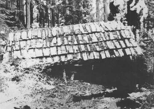
|
| Remains of the Fisher Cabin located in upper Fisher Creek Basin. (Photo by G. Luxenberg, NPS, 1984) |
Stehekin Mining District
On April 28, 1896, a handful of miners of the Chelan Mining District met at the post office in Stehekin and proceeded to organize a new district, calling it the Stehekin Mining District. [137] Discoveries made nearly a decade earlier had finally brought the upper Stehekin valley into the limelight, and these early miners wanted to protect their interests. Fortunes were sought primarily in three major areas on the eastern slope — at Doubtful Lake, Horseshoe Basin, and Bridge Creek. As elsewhere, only those who located prospects early and sold out to others left with money in hand. By the close of the 1910s mining activity had all but ceased in the upper Stehekin valley. Reactivated in the 1940s, the mines never regained their former status, and work developing these claims ceased in the 1950s.
The earliest discovery of any importance in the district was made by the same men who had located the Boston Mine in the Cascade Mining District. George Rowse and his associates (including Gilbert Landre) staked claims in the vicinity of Doubtful Lake ca. 1888. [138] These claims proved to be rich in lead and silver. [139] Calling the original prospects Quien Sabe, the miners staked a total of seventeen claims and later a millsite around the small mountain lake. The Cascade Consolidated Mining and Smelting Company took over the claims by 1904, and with more than $750,000 to spend, the company made many improvements to the mining operation. Two log cabins (14' x 18' each) were built near the outlet of the lake as early as 1899. [140] A log cabin (12' x 14') and frame house (14' x 20') were built on the millsite, and a sod house (12' x 12') with a shake roof sat on the northwest side of the lake. The millsite contained a water-powered sawmill, completed ca. 1908, which produced timber for the mines and cabins. A six-inch metal pipeline ran at a steep angle from Doubtful Creek to the Rowse millsite where a 48-inch Pelton Wheel was located. [141] Several hundred feet of tunnel were cut into the hard rock surrounding Doubtful Lake. One claim, the Dandy Lode, was located near the water's edge on the north side of the lake accessible only by boat or raft. Rowse was known to keep a double-ended scow on the lake to get around. [142] The company also put in a number of trails from Cascade Pass to the millsite and other claims.
Despite all these efforts, little ore was taken from Doubtful Lake — mainly because of the lack of adequate transportation. When a USFS ranger examined the claims for patent purposes in 1913 no ore was being removed and the structures had deteriorated considerably. [143] Nevertheless, the ranger did recommend that patents be issued and the company received title to the mining claims and millsite in 1915. [144] From all accounts, little or no mining activity around Doubtful Lake occurred after this time. Although the cabins no longer stand, a multitude of adits still pierce the mountain walls, and the site of Rowse's Mill can be located by following the old pipeline from Doubtful Creek down to the large Pelton Wheel in the woods. The sawmill itself has deteriorated and lost its blade, but its ruins remain to be studied.

|
| Pelton Wheel remains from water-operated sawmill near Doubtful Lake. (Photo by G. Luxenberg, NPS, 1984) |
Horseshoe Basin, in both its upper and lower sections, had the largest concentration of mineral claims of all three mining districts in the North Cascades. Beginning in 1889, minerals were traced from the Doubtful Lake mines to Horseshoe Basin by M. M. Kingman and the Pershall brothers. [145] By 1899 more than forty claims had been located in the upper and lower basin. [146] Of all the mines, the Black Warrior gained the most notoriety. Located in lower Horseshoe Basin, the Black Warrior was one of a group of three patented claims (the others being the Blue Devil and the Golden Gate), but only the Black Warrior could boast any major development work. The mine was discovered by Kingman and Albert Pershall in 1889, and was the second major mine to be located in the Stehekin valley (Doubtful Lake Mines being first). Two years later, the discoverers sold their holdings to a Markle and MacFarland of Portland, Oregon, for the unprecedented sum of $30,000, making this the largest sale ever for a mining property in the valley. [147]
The new owners of the Black Warrior operated under the name of the Horseshoe Basin Mining and Development Company. They developed the mine by drilling hundreds of feet into the hard rock ledge and constructing a mining camp. Lake Chelan photographer Lawrence D. Lindsley visited the Black Warrior camp in the early twentieth century and remarked how a cabin at the mine was wired to the rock to keep it in place; he remembered entering this cabin by way of a ladder through the floor. Lindsley also mentioned the large cabins at the bottom of Horseshoe Basin known as Pershall's. [148] This was originally a mining and supply camp, built prior to 1895, and used by miners on their way to and from Cascade Pass, Doubtful Lake, and Horseshoe Basin Mines. [149] In later years, this camp would be known as Rowse's Camp.

|
| Cabin on cliff at mine in Horseshoe Basin, 1910. (L.D. Lindsley photo, University of Washington Libraries Photo Collection) |
The Black Warrior received its patent in 1901, and was probably mined into the 1910s. Many factors, including high costs and low profits, caused mining activity between the 1920s and 1940s to be sporadic. [150] Not until 1946 did mining in Horseshoe Basin revive. Motivated by promising assays and by the state's efforts to complete the long-awaited mine-to-market road over Cascade Pass, a new company now attempted to develop the mines in the basin. The Black Warrior Mining Company incorporated and began work in 1946. A road was extended from Cottonwood Camp as far as Rowse's Camp. From here the Black Warrior company built a truck road in 1947 that reached the lower basin. Adverse climatic and topographic conditions coupled with the expense of moving ore downlake proved overwhelming. When a snow slide in the 1950s leveled the company's facilities and destroyed the road, the decision was made to cease operation. [151]

|
| Black Warrior Mine entrance, ca. 1940s. (NOCA-Stehekin photo file) |
Today, the basin is quiet. Most of the rusting equipment from the lower camp has been removed and the site is now Basin Creek Camp, a hikers' campground. The Black Warrior mine, since listed in the National Register of Historic Places, has two "rooms" flanking the main adit which hold wooden shelves, tables, and support timbers. Blasted from the rock in the 1940s, one room was used by miners as a kitchen and the other for sleeping quarters. The mine itself is relatively safe to explore and can be penetrated about 170 feet before a junction is met: to the left (south) one can walk about 150 feet to a gate preventing further access (closed because of lack of oxygen); to the right (north) one can walk approximately 300 feet into the mountain to the end of the miners' labors. [152]
While mining was underway at the Black Warrior, claims in upper Horseshoe Basin gained attention. The Davenport, among others, was a significant find by Kingman and Pershall in the 1890s and was worked for many years. Henry Freeland Buckner was active in this area in the early twentieth century. In 1904 he contracted to blast a tunnel into the mountain, reaching 120 feet by the year's end. Its purpose was to crosscut the rich ledges running between the upper and lower basins. The work was halted temporarily in 1905 to lay steel track for ore cars. Between 1909 and 1910, Buckner was still supervising a crew of miners, who by this time had reached a mining depth of hundreds of feet. [153] Work eventually ceased at the upper mines until the later 1940s when the Black Warrior began operating again. The Horseshoe Basin Mining and Development Company renewed work in the upper basin, building a cable tramway from the floor of the basin to the edge of the upper basin, to facilitate the removal of ore. Another cable extended beyond that point for about 6000 feet. [154] Although cabins for miners were built in this area as early as 1901, heavy snowfalls required that they be rebuilt each year. Despite these valiant efforts these mines ultimately failed as well. Only adits, a 500-foot tunnel, an ore cart on tracks, and miscellaneous machine parts remain as proof of the miners' work in the upper basin.
Bridge Creek was the third major area of mining in the Stehekin District. Beginning in the early l890s, dozens of mining claims were located and worked along the numerous tributaries of Bridge Creek for more than a decade. Bridge Creek was also a primary means of access into the Stehekin Mining District and for a time was considered the most feasible route for the state road across the North Cascades. The confluence of Bridge Creek with the Stehekin River became a strategic location for miners traveling into the upper Stehekin valley and Horseshoe Basin and upper Bridge Creek.
Realizing this confluence to be a potentially valuable site, Frank Wilkinson chose this land as a homestead site ca. 1891, and erected a "large store building" and another structure. He planned to invest $10,000.00 worth of stock into his venture. By 1893, the store was in business. [155] His son Bayard operated the enterprises and the Chelan Leader noted he was "rushed with business." [156] Wilkinson hired horsepacker Dan Devore to bring in the goods that season. [157] The Bridge Creek store operated for only a few years, however, closing ca. 1895. Miners camped at Bridge Creek later that year were "disappointed in not finding a store there, and had to make a trip to Chelan after supplies." [158] This date also marks the closing of a post office at Bridge Creek which had been in operation for three years. A 1900 account of an "undeveloped mining district" described Bridge Creek and noted "an old log shanty" which acted as a "kind of free hotel for passing prospectors." [159] Ten years later the Chelan Leader reported that "Misses Lydia and Eunice George left . . . for Bridge Creek, where Miss Lydia will conduct a wayside inn for the accommodation of tourist and miners during the summer months." [160] The following year, 1906, Mrs. Henry Freeland Buckner and her daughter Frances ran the "Hotel de Buckner" at Bridge Creek. Over the years as many as four or five cabins were built at this important junction.

|
| Early view of Bridge Creek mining camp, located at confluence of Bridge Creek and Stehekin River, n.d. (NOCA-Stehekin photo file) |
Along with the available services, the confluence of Bridge Creek and the Stehekin River was also the site of several mineral claims. When or why Wilkinson abandoned his homestead claim is not known, but by 1897 the land had been reclaimed and located as a mineral claim by A. C. Edwards. Edwards called his claim Rock Island Lode and Millsite. [161] Edwards arranged for Stehekin settler William Purple to survey the claim as a step toward applying for a mineral patent. At that time, Purple recalled seeing two cabins on the property which had been built by Wilkinson, and a cabin built by Edwards and his partner John Blackburn. [162] Later the claim was officially surveyed and town lots platted on the site. [163] Consequently, for many years in the early twentieth century the area was referred to as the "Bridge Creek townsite." [164] By 1904 improvements to the property included several open cuts into the rock, and three small log cabins designated as Bunkhouse, Assay Office, and Machine Shop. [165] Due to the lack of valid assessment work, the Rock Island Lode and Millsite were eventually canceled as mineral claims by the USFS.

|
| Remnants of sawmill near Bridge Creek Ranger Station. (Photo by G. Luxenberg, NPS, 1984) |

|
| Former miners' cabin at Bridge Creek. Today this structure is used as an NPS seasonal ranger station. (Photo by G. Luxenberg, NPS, 1984) |
S. J. Stinson (and others) relocated a portion of these former claims in 1925, renaming it Tiger Millsite (or the Horseshoe Basin Millsite). When a USFS ranger visited the property in 1936 to determine its validity, he noted that two old cabins, one a 12' x 14' "board structure" and the other a 30' x 30' shake and board dwelling," remained on the site. Stinson apparently used them as headquarters while doing assessment work on his mining claims in Horseshoe Basin, and for living quarters during the summer season. In the 1930s or earlier, Stehekin horsepacker Guy Imus relocated the remaining portion of the old Rock Island Lode but never made any visible improvements to the land. In the 1940s the Horseshoe Basin Mining and Development Company used this site as a camp. This operation was probably responsible for the machinery and sawmill still evident on the property today. On the flat to the south of the sawmill, a board and batten cabin stands above the confluence of Bridge Creek and the Stehekin River. [166] Although it is possible that this cabin dates from Edwards' time it was probably constructed by Stinson or another individual in the 1920s. After years of abandonment and neglect the NPS began using it as a backcountry ranger station, a status it retains today. [167] The old bunkhouse, assay office, and machine shop have long since disappeared, their sites reclaimed by vegetation. Still to be found on the site is the remnant of a large tunnel built to carry water from the river to a nearby power plant. [168] Across the creek on the north side of the Stehekin River, the Gem Lode claim was filed by Sidney Rosenhaupt in 1910. The foundation logs of an old cabin can be found on this former claim. [169]
Farther up Bridge Creek toward its headwaters and Twisp Pass, on the north fork of Bridge Creek, as many as 18 mining claims were located and worked in the l890s. A miners' trail depicted on the 1899 mining map of the region extended up this fork of Bridge Creek, crossed over "Thunder Pass," and continued down Logan Creek to Fisher Creek; by 1913 the trail was overgrown. Today few hikers attempt the trailless pass. During the active years of mining, possibly into the 1910s, log cabins were built here by prospectors working their claims along the north fork. J. A. Trost, owner of the Tiger group of claims, had a cabin near the headwaters of the north fork. None of the miners' cabins remains standing today, all were broken down by snows or removed by the USFS. [170] Only adits remain in the mountainside as evidence of the miners' presence.

|
| Historic view of the Sulphide/Frisco cabin, from the south, n.d. (NOCA-Stehekin photo file) |

|
| The old Sulphide (also known as the Frisco) cabin as it appears today. View from west. (Photo by G. Luxenberg, NPS, 1984) |
More than a dozen claims were taken in the upper Maple Creek area although none appear on the 1899 mining map. A cabin at the end of the trail on the north side of the creek is depicted on a 1902 USGS map and a 1913 Washington National Forest Map. It may have belonged to John Ferguson who worked the Prince of Wales prospect nearby. [171] By 1917 no cabin was shown in this location. [172] The old Sulphide or Frisco Cabin built by A. H. Peterson still stands on a former mining claim along today's Bridge Creek hiker trail. Beginning in the 1920s, Peterson spent many summers developing his three claims along upper Bridge Creek. [173] The cabin first appears on a 1937 Chelan National Forest Map as "Sulphide Cabin," but the present-day cabin is believed to be the second one built on the site. Peterson also built a smaller cabin which he used as an office and living quarters, and a three-sided building used as a blacksmith shop. Only the large two-room cabin is extant, with foundation logs of one other structure still discernible nearby. In 1952 a horsepacker named Cliff Libbey relocated the claims and used the cabin for his packing business until the claims were declared invalid in 1977. [174] Since then, the cabin has sheltered hikers along the Bridge Creek trail. Recently a tree fell on the structure, crushing its roof, leaving it in poor condition.
Other Mining Areas
Although never developed on the scale of the major mining districts, several other areas within the North Cascades National Park had mining claims which were developed at various times and to different degrees. The physical remnants of some of these smaller operations are visible today. On the western slope, along the Cascade River about ten miles east of Marblemount, the Crescent Marble and Mining Company held six mineral claims on a large marble deposit along Marble Creek from as early as 1899. [175] Very little work was done at this site, and the only improvements were open cuts in the deposits and a trail to the mine. [176] Along the Skagit River in the vicinity of Bacon Creek and farther upriver, talc mines were operating in the early twentieth century. Gaspar Petta, an early Marblemount resident, recalled how the mined talc was lowered down to the river via a tram, where it was then carried downstream by boat for processing and marketing. [177] Farther upriver, in the northern reaches of today's park, in the area of Silver Creek a miner named Darrow filed eleven claims in 1913 in hopes of mining galena. The unpatented claims remained undeveloped and were relocated in 1929 by H.P. Davis for molybdenum. Davis made some improvements, building a bunkhouse and driving a 75-foot adit into the mineralized zone. The deposit was again relocated in 1958 by Donald and Archie Lyon and Russell Perry who undertook mineral exploration and assessment work. Today, the ruins of possibly the original Davis cabin and a storehouse can be found at the site approximately 1-1/2 miles from the west shore of Ross Lake. [178]
Concurrent with large-scale mining in the Stehekin basin, more modest mining activity also occurred on Company Creek, Agnes Creek, and Flat Creek. Ledges of sulphide were first discovered in 1889 on Company Creek but not located until 1894. [179] A trail was built by miners following the creek, and maps from 1902 and 1913 show a cabin sited at the trail end. [180] Agnes Creek also had similar showings of ore and, by 1899, the North Star group of eight claims was being worked. [181] Four claims existed by 1899 on upper Flat Creek, and it is possible that the remnants of a log cabin found several hundred feet south of the Stehekin valley road near the Park Creek Pass trailhead may have been associated with these mining efforts. [182]
Water Resources:
Hydroelectricity
Since the late nineteenth century, glacier-fed streams flowing out of the North Cascades were viewed as potential sources of power production. For that purpose both individuals and companies have harnessed the waters of rivers and creeks, producing electricity for the operation of homesteads, mines, mills, and other endeavors. While exploitation of the region's water resources enhanced commercial activities, such as mining, and resulted in increased comfort for countless people, there have also been negative impacts. The commercial development of hydroelectric power has had a tremendous impact on the physical landscape of the mountains. In some cases, physiographic and cultural features have been irreversibly altered, and in other cases entirely lost. In all cases, hydroelectricity and its development within the North Cascades has left a permanent and obvious imprint upon the wilderness.
Long before large power companies grew hungry for kilowatts, individuals in the area of today's park utilized hydropower on a limited scale to generate power for running mining equipment and sawmills. To this day, the remains of a water-operated power plant can be seen along the Thunder Creek trail, and remnants of a Pelton Wheel and sawmill can be located not far from Doubtful Lake. In the 1920s the Davis family produced power for their roadhouse on their homestead at Cedar Bar. They constructed a sizable wood frame structure and water wheel which generated electricity from nearby Stetattle Creek. This powerhouse provided the family with a resource few early settlers enjoyed. Touted as the first power plant on the Skagit River, the structure stands today and can be viewed in the town of Diablo.

|
| Davis Family power plant, originally located on their homestead at Cedar Bar. (Photo by G. Luxenberg, NPS, 1984). |
Settlers at the head of Lake Chelan also generated their own power using water sources. Here, too, Pelton Wheels were a popular commercial brand of hydroelectric equipment commonly used in the valley. The valley's largest hydroelectric power plant was owned and operated by Arthur W. Peterson in the 1940s. Peterson was issued a special-use permit by the USFS in 1945 to build a log-jam dam on Company Creek. A wooden pipe carried water from the creek to a 155-horsepower plant on Peterson's property where the electricity was produced. In the 1960s, the Chelan County Public Utilities District leased Peterson's plant, selling electricity to valley residents and enabling them — for the first time — to use modern electric appliances such as refrigerators and freezers. [183]
Large power companies on both slopes of the Cascades began to show an interest in hydroelectric possibilities in the early twentieth century. On the east side the Chelan River exhibited great potential with its 400-foot waterfall and a ready-made reservoir in place — Lake Chelan. In 1893 the Chelan Water Power Company was founded with the intention of developing this river, but nothing was accomplished until M.M. Kingman purchased the company in 1899. Some time between 1899 and 1903, Kingman, who also was a miner in the upper Stehekin valley, built a power plant on the Chelan River, supplying the growing town of Chelan with electricity. [184]
In 1925 the Great Northern Railroad (GNRR) and the Washington Water Power Company of Spokane entered into an agreement to further develop the Chelan River. [185] The need to illuminate the GNRR tunnel under Stevens Pass brought the free-flowing Chelan River into the limelight as a potential source of electric power. [186] Work began in 1926. Conduits and a power house were built, and a dam was constructed at the outlet of the lake. Throughout the summer of 1927 the level of Lake Chelan behind the dam rose steadily, eventually rising some twenty feet. By the time the project was completed in 1929, approximately 500 acres of land at the head of the lake had been inundated, creating a new shoreline. [187] Owners of property were compensated for their losses by the companies responsible, but the upper end of the lake and the settlement of Stehekin would never look the same again. The land was logged by Grant Smith and Company. [188] Buildings were moved or demolished and Purple Point became the new arrival and departure point for lake travelers. The imposing Field Hotel, threatened by rising water, was dismantled and material not used by valley residents or incorporated into the Golden West Lodge was burned.
On the west side of the mountains Seattle City Light's (SCL) extensive hydroelectric development along the Skagit River resulted in tremendous changes to the upper valley. But long before SCL applied to the USFS for power production rights, others had shown an interest in the Skagit as a power resource. As early as 1905, the Skagit Power Company, whose principal backers hailed from Denver, Colorado, posted claims to water rights in the vicinity of Diablo Canyon. They planned to build a 170-foot high dam across the canyon. Three years later, construction camps were established at Goodell's Landing and Reflector Bar, and the company began building a road from the landing upriver. [189]

|
| Skagit Power Company headquarters cabin at Reflector Bar, town of Diablo today, n.d. (Callahan Collection, Seattle, Washington) |
With only paperwork and one-half mile of road to show for their efforts the financially troubled company sold out to Stone and Webster, a Boston, Massachusetts, firm. In 1913 the new owners obtained a 50-year permit for the region, thus securing their right to develop the Skagit River. [190] But they too neglected to begin construction and their failure to do so ultimately resulted in the request of James Delmage Ross, Superintendent of SCL, for rights to power development along the river.
SCL's battle to acquire and develop the largest power site in western Washington was long and tedious. [191] A legal battle between Stone and Webster and SCL went on for more than a year. Ross traveled to Washington, D.C., to defend his position that the river resource belonged to the public, not the private sector. Indeed, the public sector was victorious and in 1918 the Secretary of Agriculture awarded a new permit to SCL. The transformation of the upper Skagit River corridor was officially underway.

|
| Artist's conception of Seattle City Light's Skagit River Project, n.d. (FARC- RG95- Portland) |
After measurements of stream flow were recorded and numerous surveys completed, work began. The first stage of the Skagit Project entailed a temporary wooden crib dam to be built in the deep gorge upstream from Goodell's Landing. Materials, supplies, equipment, and men for this massive construction effort had no efficient way of reaching the site. The closest railroad tracks were those of the GNRR, and these terminated in Rockport twenty-three miles to the west. At first, materials and equipment were hauled over a road to Bacon Creek. This road was used in conjunction with a barge on the river, running between Damnation and Thornton Creeks, and a skid road built between Thornton and Goodell Creeks. Remnants of the old skid road can be found along the north bank of the Skagit. [192]

|
| Gorge Dam under construction, 1919. (Photo courtesy of Seattle City Light) |
SCL quickly realized that it was cost efficient to build their own railroad into the upper valley to facilitate the transportation of workers and supplies. By 1920 a 25-mile standard-gauge line was completed and in operation. For the most part the railroad followed the northern bank of the Skagit, running through farmlands and logged areas until reaching Gorge Creek, the site of dam construction. This rail line was not a common carrier; however, SCL accommodated those traveling up and down the river valley as best they could by carrying passengers and freight at standard rates.
Hundreds of men were employed on the project by 1920, living in tents and frame shacks. SCL built a sawmill at Goodell Creek to supply the lumber needed for the dam and for use in building Newhalem, the company town at the site of Goodell's Landing. Newhalem eventually included seventy-five three-bedroom cottages and six bunkhouses, a cookhouse, a warehouse, and a school. [193]
On September 17, 1924, President Calvin Coolidge pressed a button in Washington, D.C. to "start" the generators, marking the completion of the Skagit Project's first phase. But even before the Gorge Creek site was completed, studies had begun for the second stage of the Skagit Project. Several places were considered as possible dam sites; but the one chosen was Diablo Canyon. Drilling and exploration began in 1925 and by 1927 the Winston Brothers Company, contractors for the dam, were constructing their camp at Reflector Bar and assembling their machinery and equipment. [194] SCL extended the railroad an additional six miles from Newhalem to the new construction site. This segment of the line was electrified because the terrain was extremely rugged, too difficult for a steam-powered locomotive to traverse. Rock was blasted to cut a route through the narrow canyon. Two wooden truss bridges, named Devil's Elbow and Ferry Bar, carried the train from one river bank to the other side and back again. In the 1930s, additional bridges were built and older ones upgraded all along the railroad route. A steel span replaced the wooden Devil's Elbow Bridge in 1935. [195] In addition to these developments, the quiet upper valley saw a second company town emerge in Diablo, a response to the ever-growing number of employees. About 1926 Frank and Glee Davis built some rental cabins to help house the dam and railroad workers. On a small flat where Diablo is located today, the Davises erected one-room cabins, calling the "development" Garden Cabins. [196]

|
| Seattle City Light's railroad across Skagit River at "Devil's Elbow," providing access to Newhalem and later, Diablo, n.d. (Photo courtesy Seattle City Light) |

|
| Early view of Diablo located below newly completed Diablo Dam, n.d. (Photo courtesy of Seattle City Light) |
At the time of its completion in August 1930, Diablo Dam was the highest dam in the world. [197] Six years later the Diablo powerhouse was finished. With the completion of the second stage came the onset of the third. By 1937 work had begun on the Ruby Dam and power plant, at a site familiar to local residents as the Rip-Raps. Construction lasted until 1949 and service began three years later on what became the largest of the three Skagit dams. [198] As with Diablo Dam, materials were brought in via SCL's railroad. In Diablo, the freight and the railroad car itself were placed onto an incline lift which hoisted the car up a hillside to the top of the dam. From here the freight was floated by barge on the Diablo reservoir to the Ruby Dam site. Extensive logging of the Ruby reservoir occurred during this time, with millions of board feet of timber removed. SCL embarked on a trail building program to replace inundated USFS trails. J.D. Ross did not live to see his dreams for the Skagit come to fruition. He died in 1939 and was entombed in a mountain vault in Newhalem. In his memory Ruby Dam was renamed Ross Dam; a mountain and a lake honor him as well. Ross missed the single most concentrated building effort in the history of the upper Skagit valley. Between 1943 and 1960, Ross Dam was twice raised in height, the Ross Dam powerhouse was completed, a new and higher concrete dam replaced the original Gorge crib dam, an addition was made to the Gorge powerhouse, as well as many other alterations, repairs, and replacements. [199] SCL dramatically transformed the face of the upper Skagit valley, fulfilling its mission to supply Seattle with electricity. The wild Skagit River became regulated and the deep gorges carved by river currents in earlier days were lost beneath the waters of Gorge, Diablo, and Ross Lakes. Two company towns were born and with them came domestication of the upper valley — sidewalks, streetlights, stores — and hundreds of transplanted Seattleites who became residents for a time. Railroad bridges were rebuilt in the 1940s and 1950s only to be removed entirely when SCL discontinued its Rockport-Diablo railroad line in 1954. Only bridge piers along the river and sections of the railroad grade are visible today.

|
| New Gorge Power House along Skagit River at Newhalem, n.d. (Photo courtesy Seattle City Light) |
CONCLUSIONS AND RECOMMENDATIONS
Although the North Cascades appear overwhelmingly natural and wild, evidence on the land reveals that this region has been used for commercial purposes for decades. Trapping, agricultural uses, logging, mining, and hydroelectric production were all activities undertaken with intentions of using the land for profit. All of these enterprises transformed the appearance of this area in one way or another. Many of these operations were successful for a time, but most fell prey to the region's inhospitable character. Unpredictable weather conditions, a lack of easy routes into and out of the mountains, and distance from supply centers all worked against many individuals and outfits attempting to exploit and profit from the resources of the North Cascades. People persevered, however, and their efforts are well-documented by the resources they left behind throughout the park.
The history of commercial developments in the North Cascades is one of the significant themes in the context of the park's human history. It should continue to be expressed and interpreted to visitors in park publications, exhibits, and evening programs.
Two sites representing this theme are currently listed in the National Register of Historic Places: the DEVIL'S CORNER and BLACK WARRIOR MINE.
It is recommended that an interpretive trail be constructed following the former bed of the Seattle City Light Railroad on the south side of the Skagit River to enable visitors to see, at a safe distance, the remaining series of suspended bridges — including the locally famous Devil's Corner — that comprise the Goat Trail. Although a remaining structure has been identified in the 1984 Historic Structures Inventory for the park, it is recommended that it be recorded in greater detail using Historic American Engineering Record standards.
The following resources are eligible for listing in the National Register of Historic Places within the historic theme identified in this chapter:
GILBERT'S CABIN, a ca. 1880s log cabin of dovetail-notched construction, for its association with an early miner and settler in the upper Skagit region. This structure also had a significant role in the development of mining in the North Cascades and was a strategic way-station for early travelers heading into the high country or over Cascade Pass.
MEADOW CABINS EAST AND WEST, two substantial structures of fine square-notched log construction, for their association with mining in the North Cascades.
ROCK CABIN, a log structure constructed against a monolith in the backcountry, for its associations with trapping as a commercial use of the North Cascades, and for its uniqueness of architectural expression.
BRIDGE CREEK RANGER STATION, for its association with mining in the upper Stehekin River valley. This is the only extant building remaining at the confluence of the Stehekin River and Bridge Creek, a location which historically had several mining structures. It is of board and batten, wood-frame construction, and is unlike any other structures associated with mining in the park.
SULPHIDE OR FRISCO CABIN, the only extant structure associated with mining along the Bridge Creek drainage, is a unique example, within the park, of round-hewn, half-notched, log construction. Recommend that immediate measures be taken to stabilize the roof of the cabin which recently collapsed under the weight of a tree.
Because they do not meet the criteria for eligibility, recommend that the following structures and sites not be nominated to the National Register:
CASCADE PASS CABIN
COLONIAL MINE SITE
DEVIL'S ELBOW RAILROAD BRIDGE
DIAMOND / VALUMINES
FERRY BAR BRIDGE
FISHER CABIN
HIDDEN HAND CABIN
PUNCHEON ROAD
RAINBOW TALC MINE SITE
SILVER CREEK MINE AND CABIN
THUNDER CREEK BRIDGE
BOWAN CREEK CABIN
BULLION CABIN
BUTTE CREEK CABIN
COTTONWOOD CABIN
GEM LODE CABIN
SIMMONS CABIN
Recommend that the following structures and sites be studied by a qualified historical archeologist to determine their eligibility for the National Register as archeological sites for the potential information they may be likely to yield:
BOSTON BASIN CABIN
HIMLOCK 2 CABIN
WILLOW LAKE CABIN
FLAT CREEK CABIN
UPPER HORSESHOE BASIN MINE SITE
HAPPY CREEK SAWMILL SITE
ROWSE SAWMILL
SKAGIT QUEEN MINE SITE
Recommend that the following structures and site be considered for the List of Classified Structures: FISHER CABIN, ROWSE SAWMILL SITE, and the BRIDGE CREEK SAWMILL. Although they do not meet National Register eligibility standards, they do possess considerable historical significance and should be stabilized and recorded for the information they convey. Listing on the LCS allows the NPS to consider all park actions impacting this cultural property. It is recommended that park policy on the treatment of these sites, and their management as cultural resources, be addressed in the General Management Plan for the park complex.
Recommend that more thorough documentation and study of: SKAGIT QUEEN POWER PLANT, ROWSE SAWMILL, and the BRIDGE CREEK SAWMILLL be undertaken by historians and/or historical archeologists qualified in the area of historical technology. Also, recommend that the park stabilize these ruins and monitor them annually.
| <<< Previous | <<< Contents>>> | Next >>> |
noca/hrs/sec3.htm
Last Updated: 07-Feb-1999