|
KLONDIKE GOLD RUSH
Legacy of the Gold Rush: An Administrative History of Klondike Gold Rush National Historical Park |

|
TABLE OF CONTENTS
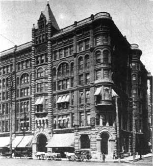
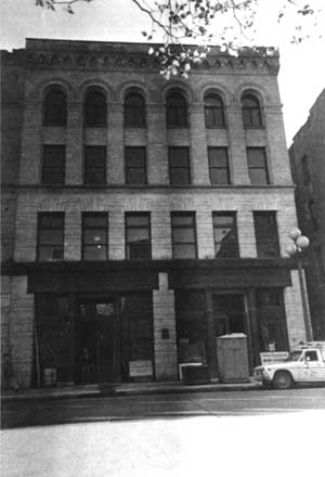
(left) The Pioneer Building, built in 1892, is an outstanding example of the turn-of-the-century architectural complex that comprises the Pioneer Square-Skid Road Historical District. During the early 1970s, the NPS considered puchasing the building as the site of the park's Seattle Unit. (William Speidel, Seattle Underground, page 14)
(right) Several stampeders and a pack train are shown in this photo which was taken near Canyon City, along the Chilkoot Trail, in the late summer of 1897. (Frank La Roche photo (unnumbered), Special Collections Division, University of Washington)
Part I: The Making of the Park
1. A Brief Gold Rush History
Native Use of the Area Before the Gold Rush
Europeans Eye the Chilkoot and White Pass Corridors
Skookum Jim's Discovery
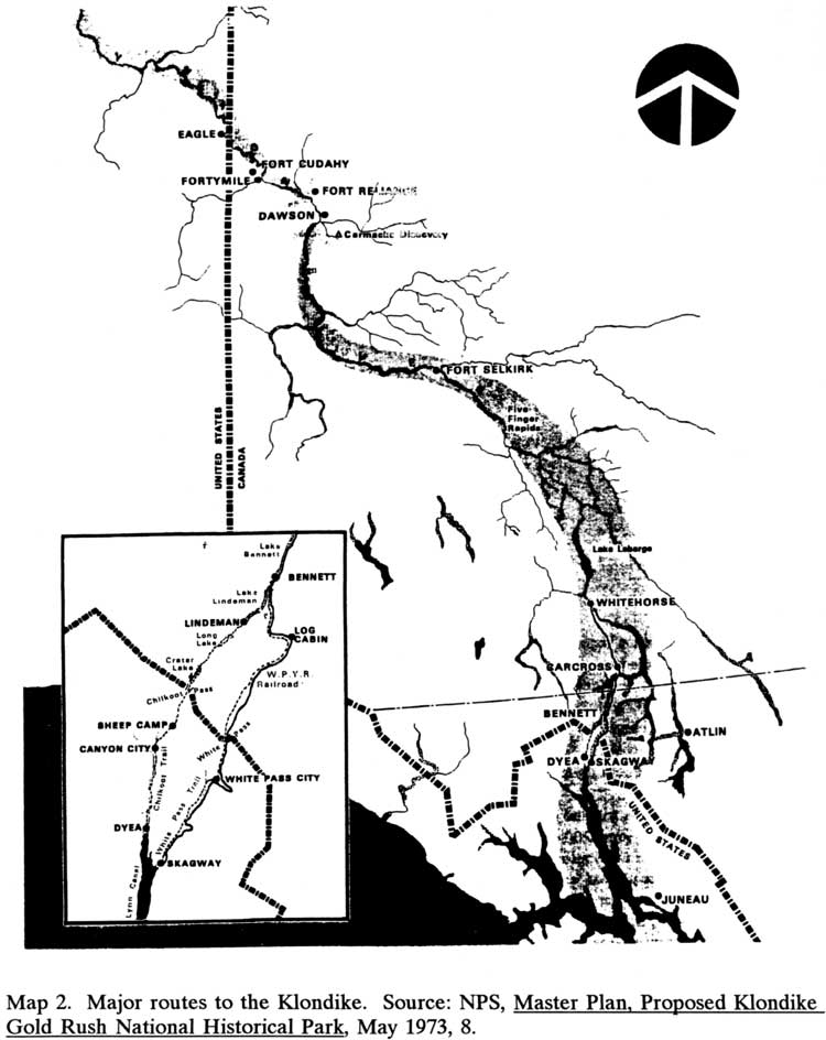
Routes to the Gold Fields
Transportation Improvements
2. Skagway After the Gold Rush
Skagway's Economy, 1900-1960
Post-Gold Rush Use of Dyea and the Chilkoot Trail
Highway Construction in the Skagway River Valley
The Yukon-Taiya Project
NPS Activities in the Skagway Area, 1933-1960
3. State and Federal Agencies Show an Interest
State Work Crews Reopen the Chilkoot Trail
Federal Officials Evaluate the Skagway Area's History
Chilkoot Trail Improvements
A National Park is Considered
Skagway Tourism Growth
The Chilkoot Pass Marker Dedication
The Yukon-Taiya Commission
Canadians Begin Managing the Chilkoot Trail
The Skagway Alternatives Study
Preserving the White Pass Depot
4. Authorizing the Park
The International Park Proposal
The Park Master Plan
The International Advisory Committee
Canadian Park Developments, 1971-1973
The Yukon-Taiya Commission Concludes Its Work
The Fate of the Pullen Collection
The Skagway-Carcross Road
Congress Introduces a Park Bill
Skagway Preservation Efforts
The Role of the National Park Foundation
Chilkoot Trail Activities, 1972-1976
The Environmental Statement and Affiliated Studies
The Park Bill Becomes Law
Part II: Management of the Alaska Units
5. General Park Administration, Skagway
Getting Started
The Land Purchasing Program
The Richard Sims Superintendency
Clay Alderson Takes Over
Parkwide Planning Efforts
6. The Building Rehabilitation Program
Initial Construction Plans
The NPS Reassesses Its Building Program
The Skagway Historic District Plan
Completing Emergency Stabilization Work
A Leasing Plan is Developed
Completion of the Headquarters and Visitor Center
Moore House Activities
Initial Building Leases
Mascot Saloon Rehabilitation
The Park Exhibit Package Takes Shape
Itjen House Rehabilitation
A Maintenance Facility is Constructed
Recent Rehabilitation Projects
7. Community Relations
Master Plan Implementation Issues
Preservation Outreach Activities
Creation of a City-NPS Cooperative Agreement
Skagway Area Campground Assistance
Proposed Railroad Equipment Purchases
Proposed Skagway Building Purchases
The NPS Acquires an Administrative Site
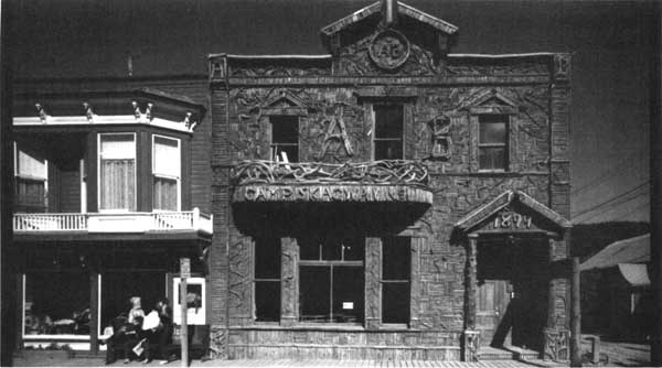
NPS Activities at the Arctic Brotherhood Hall
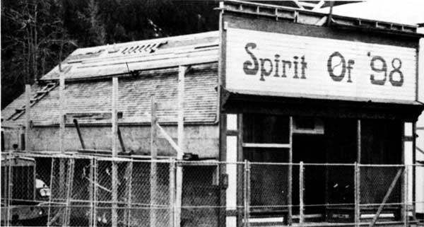
Trail of '98 Museum Assistance
Management of Vacant Lots Along Broadway
The Revived Historic District Commission
City and Park Visitation
Broadway Traffic Questions
Updating the National Historic Landmark Nomination
Proposals for Acquiring the Rapuzzi Collection
Gold Rush Centennial Activities
Community Attitudes Toward the National Park Service
8. Administering the Dyea Area
The 1978 Cooperative Agreement
The Dyea Cemetery Relocation
Chilkoot Trail and Dyea Landmark Nomination
Preserving Long Bay
Initial Planning Efforts
Dyea NPS Improvements
The 1979 Archeological Survey
The Dyea Land Acquisition Plan
The West Creek Hydroelectric Project
Interpretive and Ranger Activities
Revising the Cooperative Agreement
The Grazing Issue Is Resolved
The Dyea Development Concept Plan
Historical and Archeological Research, 1984-1988
Lands Issues and Campground Activities, 1988-1992
The 1991 Land Protection Plan
General Management Plan Issues Pertaining to Dyea
9. Chilkoot Trail Management
Ranger Activities
Trail Use and Facility Development
Maintenance Activities
Interpretive Measures
Boundary and Ownership Proposals
The Mahle Native Allotments
Concessions Management Issues
Resource Management Activities
Canadian Trail Planning
10. The White Pass Trail Unit
Early Development Plans
Proposed Energy Projects
Archeological and Interpretive Concerns
Ownership and Management Issues
Managing the Unit's Historical Resources
Development and Preservation Projects
Part III: Management of the Seattle Unit
11. Establishing the Seattle Unit
The Revitalization of Pioneer Square
The NPS Shows an Interest
An Interpretive Site is Acquired
Preparing the Visitor Center for Public Use
12. Operation of the Seattle Visitor Center
Site Development
Budget and Staff Growth
Interpretive Program Development
Outreach Activities
Cultural Resource Management
Appendices:
A. Budget and Visitor Figures for the Alaska Units
B. Staff List for the Alaska Units (and Chilkoot Trail NHS, Canada)
C. Budget and Visitor Figures for the Seattle Unit
D. List of Staff at the Seattle Unit
Index (omitted from the online edition)
LIST OF MAPS
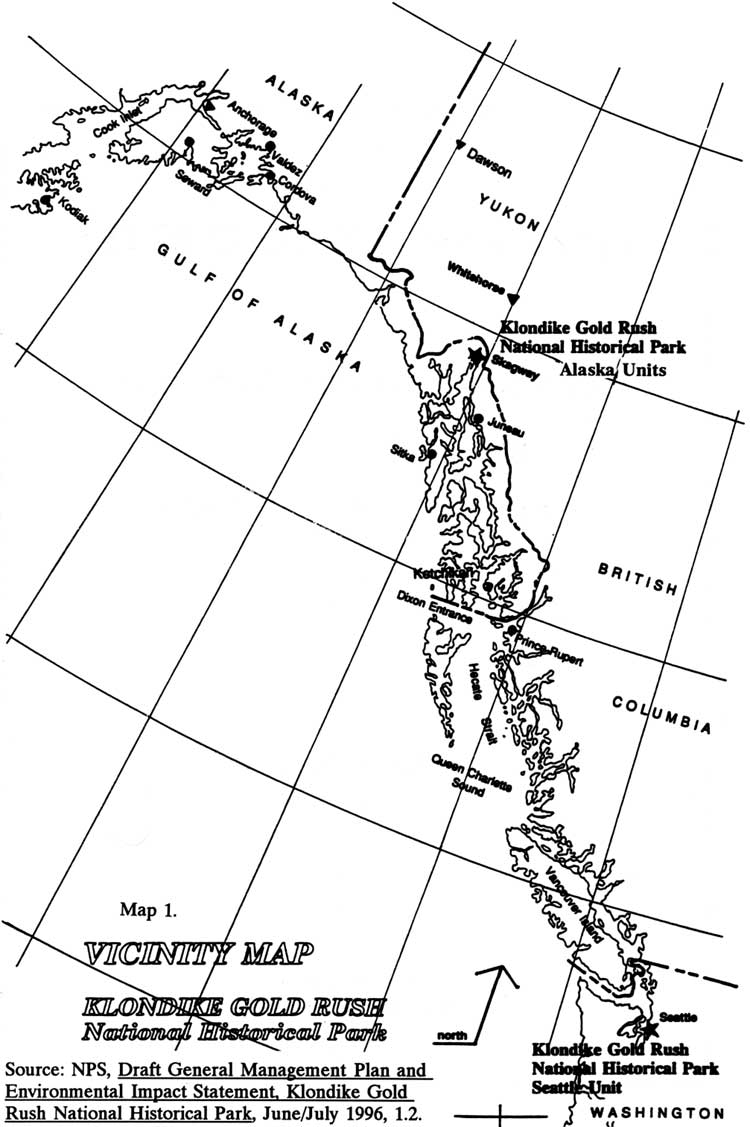
Map 2. Major routes to the Klondike
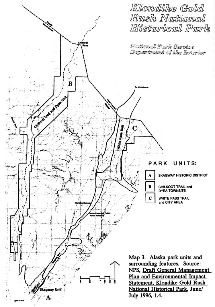
Map 3. Alaska park units and surrounding features
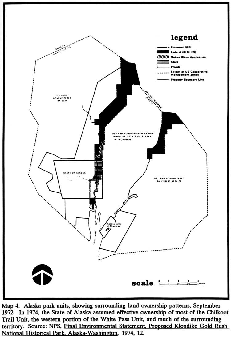
Map 4. Alaska park units, showing land ownership patterns, September 1972
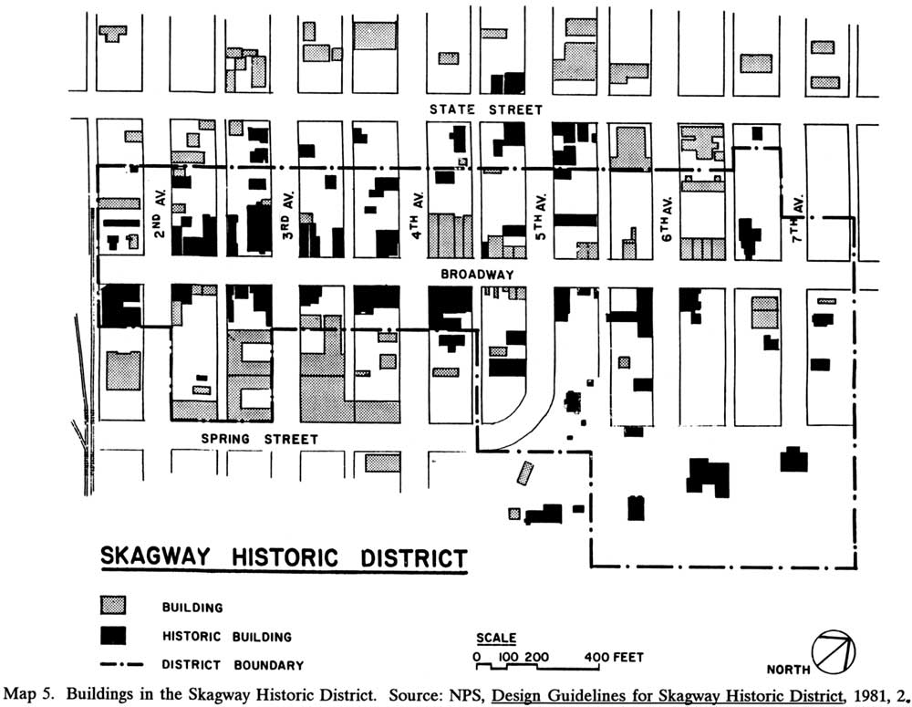
Map 5. Buildings in the Skagway Historic District
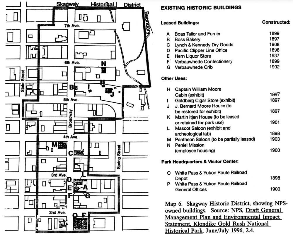
Map 6. Skagway Historic District, showing NPS-owned buildings
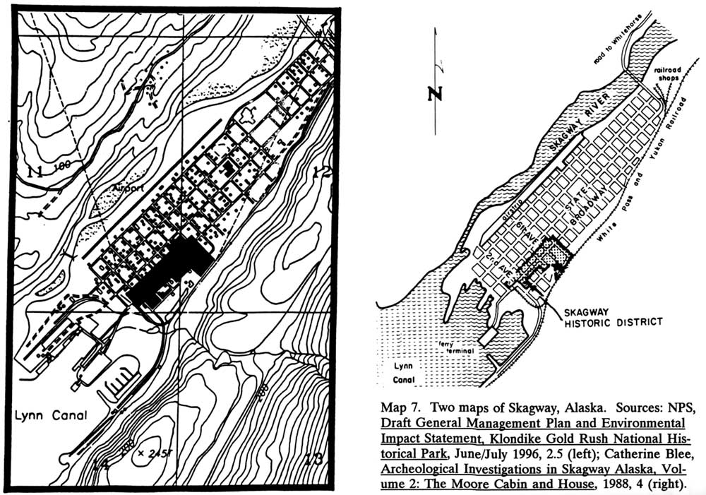
Map 7. Two maps of Skagway, Alaska
Map 8. Dyea as it probably appeared in 1898
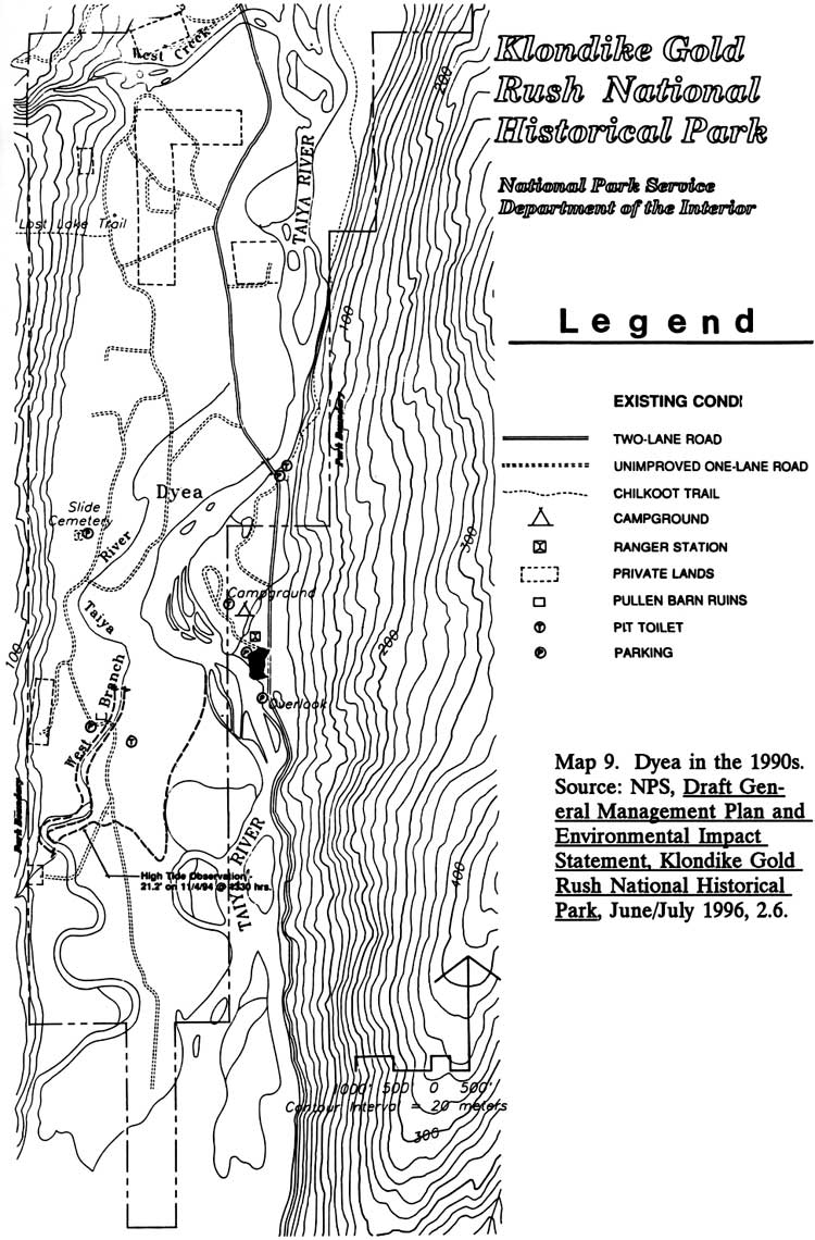
Map 9. Dyea in the 1990s
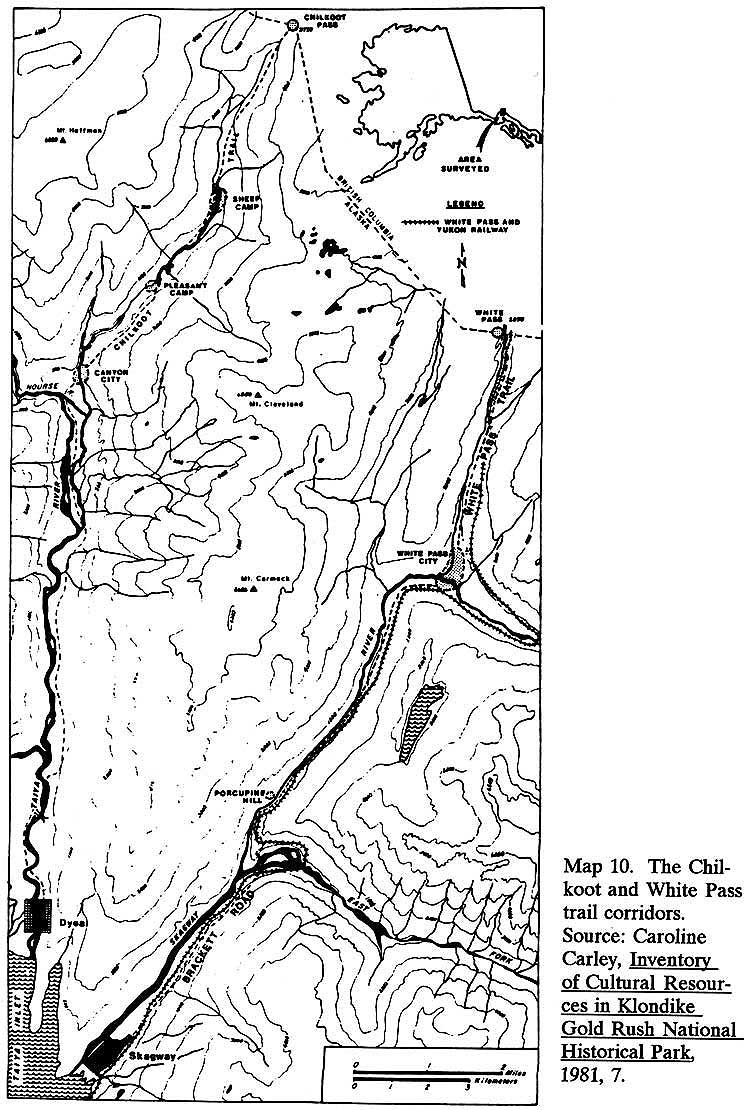
Map 10. The Chilkoot and White Pass trail corridors
Map 11. The Klondike-Seattle Unit and the Pioneer Square Historic District
LIST OF TABLES
Table 2. Potential Uses for Skagway NPS Buildings
Table 3. Chronology of Construction Activity, Skagway NPS Buildings
Table 4. Chilkoot Trail Visitor and Support Facilities
LIST OF PHOTOGRAPHS
Photo 2. Army troops marching in Skagway during World War II.
Photo 3. Hosford Sawmill, 1971.
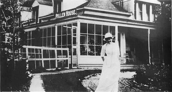
Photo 4. Harriet Pullen at the Pullen House.
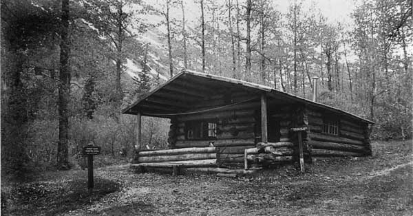
Photo 5. The Sheep Camp Shelter, constructed in 1963.
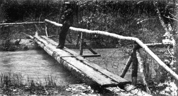
Photo 6. Footbridge along the Chilkoot Trail, 1968.
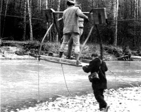
Photo 7. Taiya River cable crossing, September 1971.
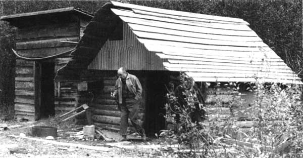
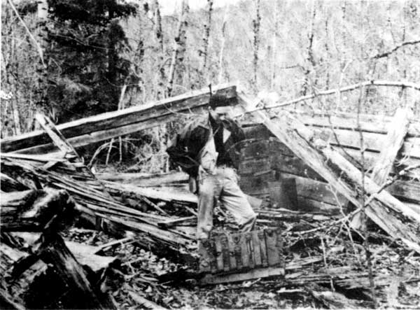
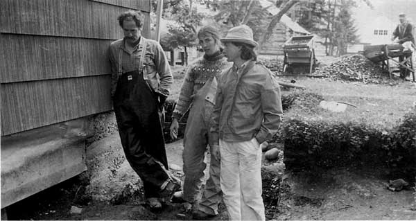
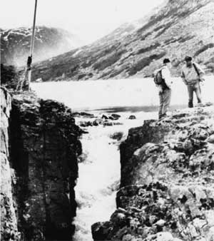
Photo 8. Mike Leach, Canyon City ruins, 1967.
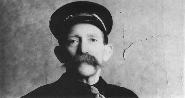
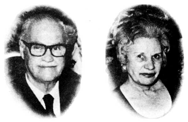
Photo 9. Skagway promoter Cyril A. (Cy) Coyne and his wife May.
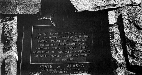
Photo 10. Centennial plaque, just south of Chilkoot Pass.
Photo 11. Reps. Ralph Rivers and Roy Taylor, August 1, 1965.
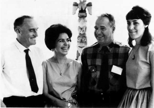
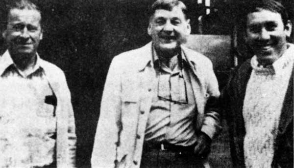
Photo 12. NPS officials Alfred Kuehl, Robert Luntey, Merrill Mattes and Bailey O. Breedlove.
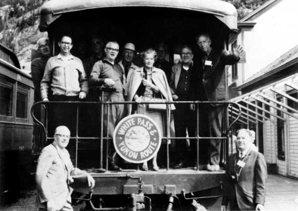
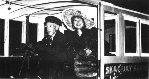
Photo 13. The NPS Advisory Board on a WP&YR observation car at Bennett, B.C.
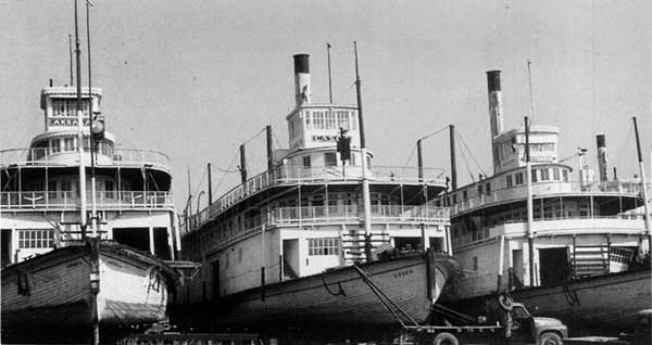
Photo 14. Three WP&YR steamboats at drydock in Whitehorse, Y.T.
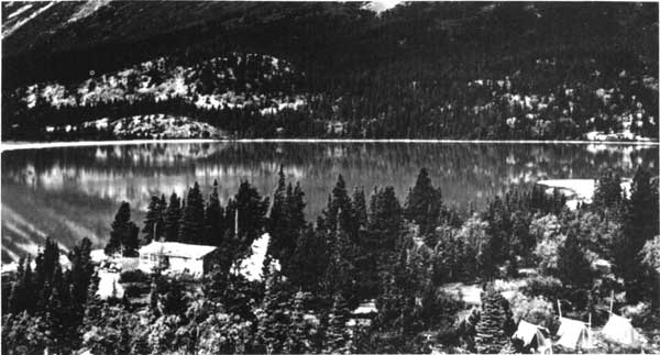
Photo 15. Upper Cabin at Lindeman City, September 1969.
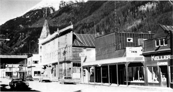
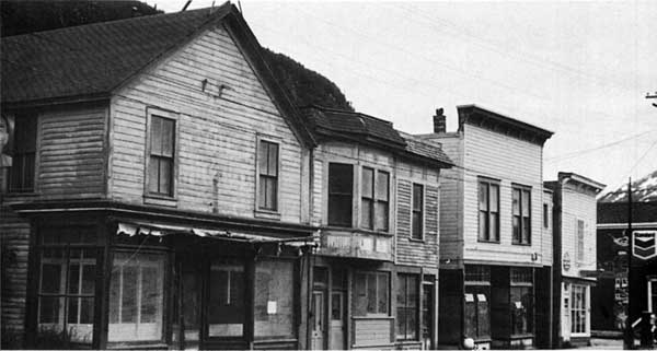
Photo 16. Broadway Street, Skagway, looking north from Third Avenue, 1969.
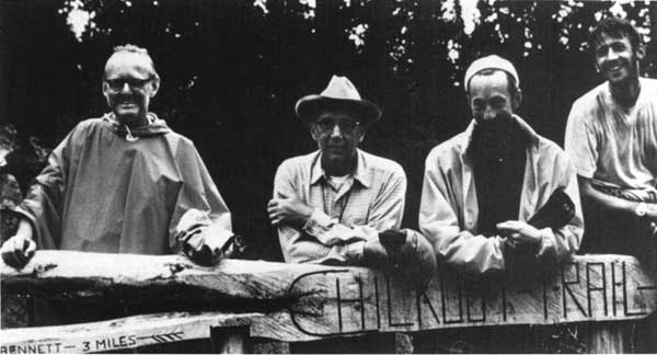
Photo 17. Four participants in the Labor Day weekend hike of 1969.
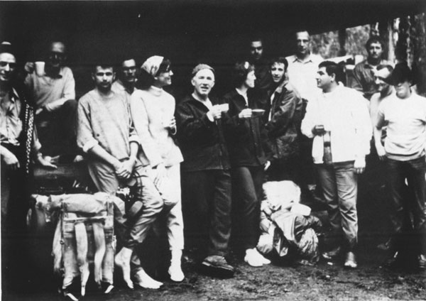
Photo 18. Group shot of Labor Day weekend hike participants.
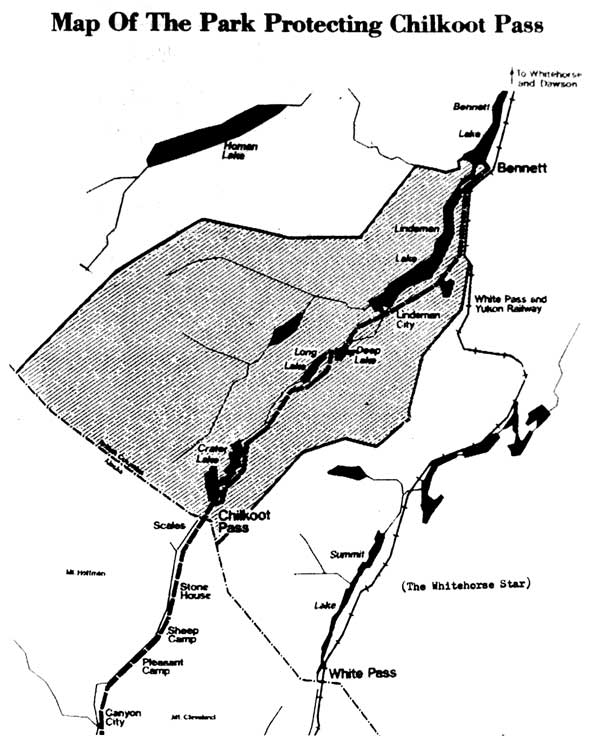
Photo 19. Map showing proposed Canadian-government Chilkoot park, 1973.
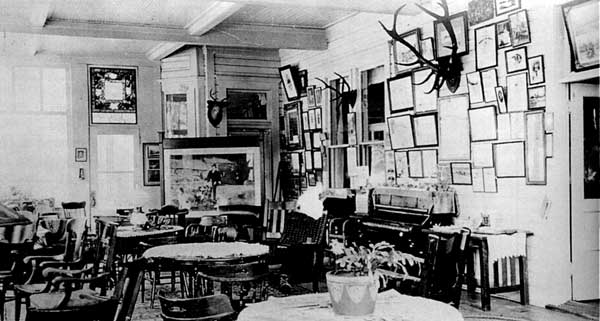
Photo 20. Interior of Pullen House, showing the museum collection.
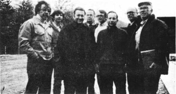
Photo 21. Group of federal and state historical officials visiting Skagway, June 1973.
Photo 22. NPS delegation during a Skagway visit, June 1974.
Photo 23. Regional and park NPS officials, seen during an October 1975 visit.
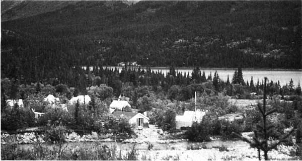
Photo 24. Lindeman Lake warden's camp, at the mouth of Moose Creek.
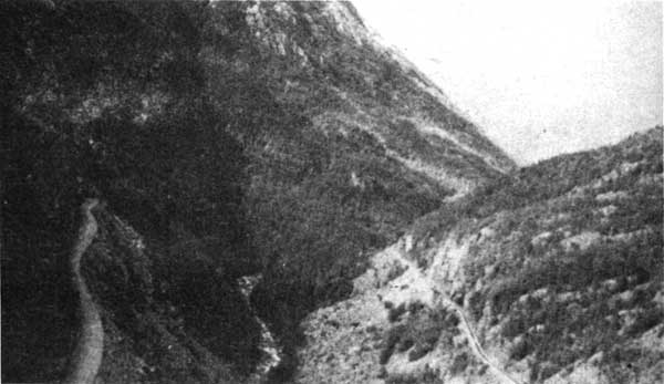
Photo 25. Skagway River Valley looking north, 1973.
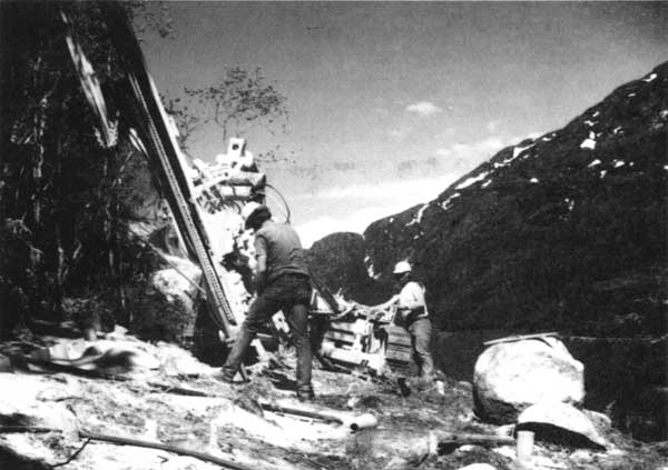
Photo 26. Klondike Highway construction personnel at work.
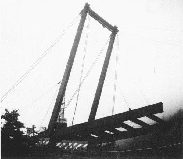
Photo 27. Captain William Moore Bridge under construction.
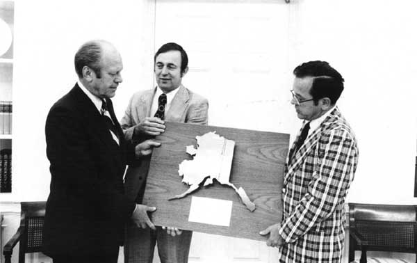
Photo 28. President Gerald Ford, Rep. Don Young, and Sen. Ted Stevens, July 1975.
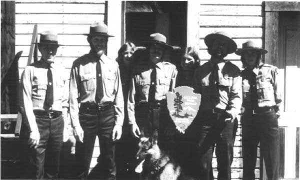
Photo 29. The park's first (1977) group of interpreters and rangers.
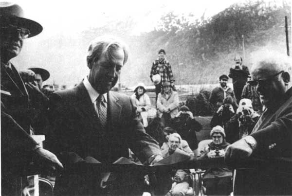
Photo 30. Richard Sims, Russell Dickenson, and Marvin Taylor at the 1984 depot dedication.
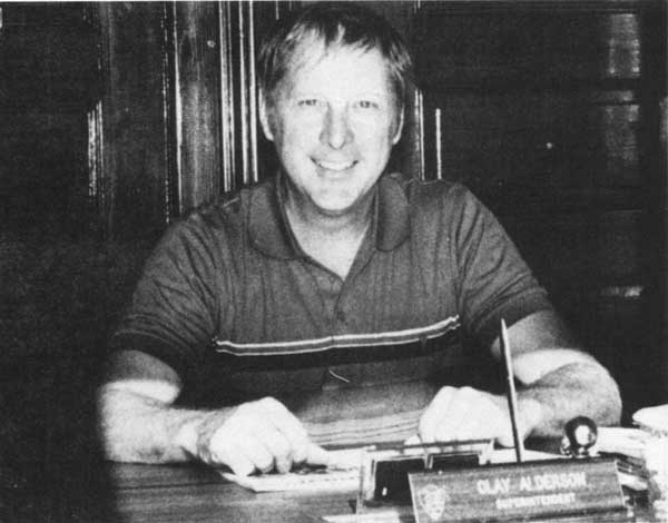
Photo 31. Superintendent Clay Alderson, shown in 1986.
Photo 32. Mascot Saloon Complex and adjacent buildings shown prior to rehabilitation.
Photo 33. The Pullen House, as seen in 1983.
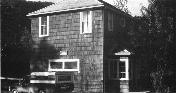
Photo 34. The Arctic Brotherhood Hall, the park's temporary visitor center.
Photo 35. Rehabilitation of the Boss Bakery building in 1985.
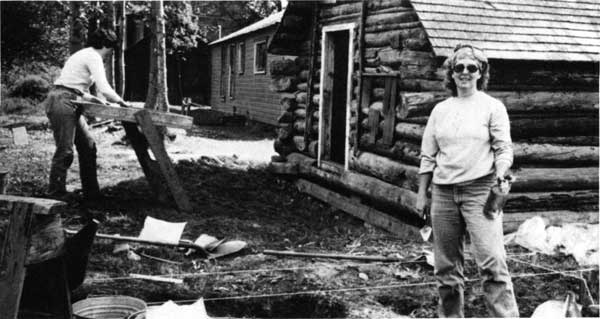
Photo 36. NPS archeologists Cathy Blee and Marianne Musitelli, working at the Moore Cabin.
Photo 37. The 1987 archeological crew at the Peniel Mission.
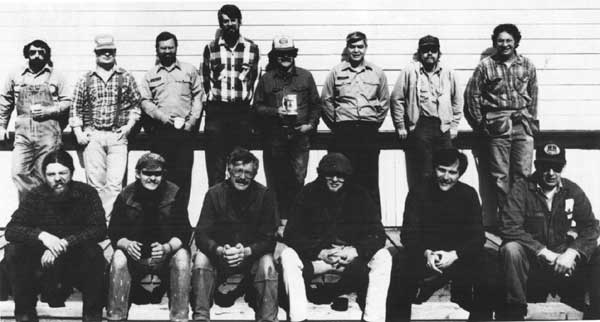
Photo 38. The park's construction and maintenance crew, 1984.
Photo 39. The railroad depot and administration building in 1977, prior to rehabilitation.
Photo 40. The depot and administration building as it looked after 1984.
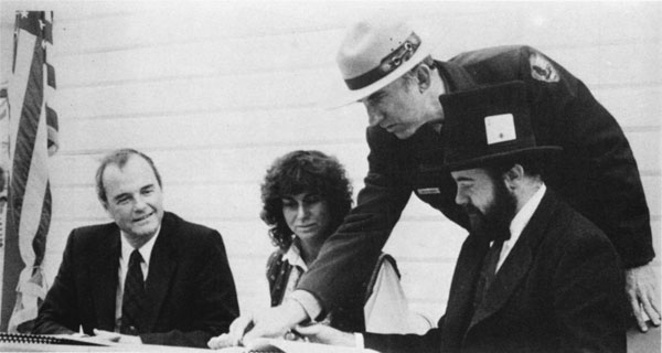
Photo 41. Jeff and Diane Brady signing their historic property lease, 1986.
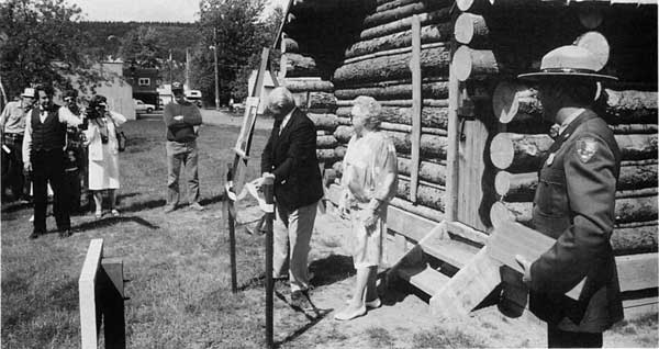
Photo 42. Dedication ceremony for the refurbished Moore Cabin, July 1987.
Photo 43. The Peniel Mission in 1983, prior to rehabilitation.
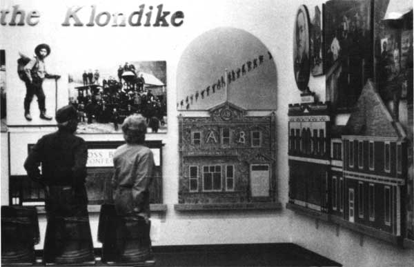
Photo 44. The visitor center exhibits, shortly after their 1991 installation.
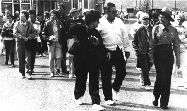
Photo 45. NPS interpreter Alice Cyr leading a walking tour down Broadway.
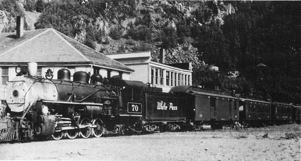
Photo 46. WP&YR locomotive #70 in front of the Skagway depot.
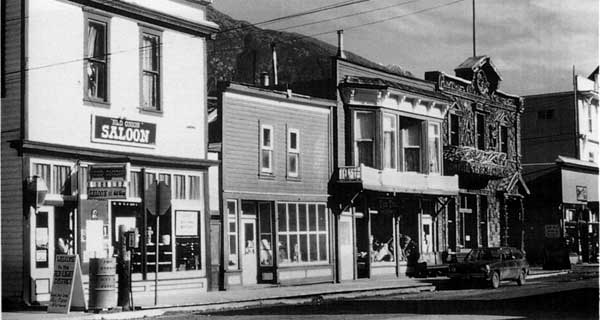
Photo 47. Red Onion Saloon and Trail Bench Gift Shop.
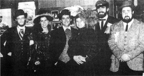
Photo 48. A group of Skagway tourism promoters, 1982.
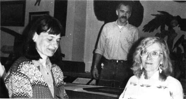
Photo 49. Trail of '98 Museum directors Glenda Choate and Judy Munns.
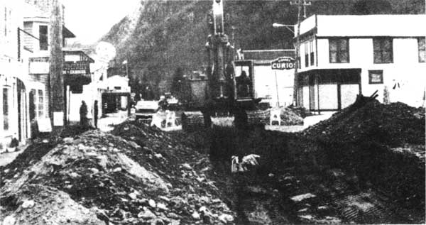
Photo 50. Broadway Street being excavated in the fall of 1983.
Photo 51. George Rapuzzi with Jan Wrentmore, 1984.
Photo 52. John McDermott, first head of the Skagway Historical Commission.
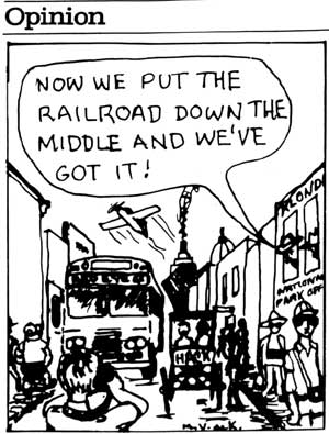
Photo 53. A 1983 cartoon dramatizing overcrowding along Broadway.
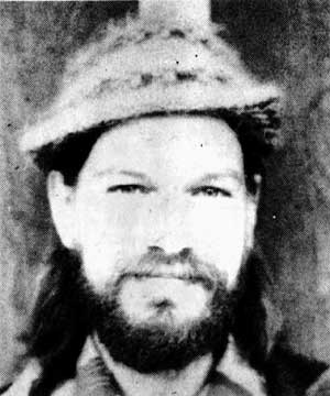
Photo 54. Willard "Skip" Elliott, who fought the NPS's 1980 Land Acquisition Plan.
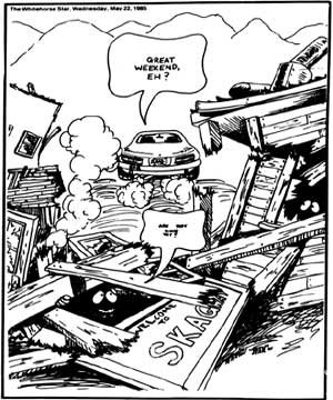
Photo 55. Many Yukoners visit the Skagway area during Victoria Day weekend.
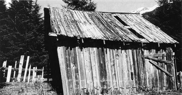
Photo 56. The Pullen Barn, in Dyea, remained standing until the winter of 1982-83.
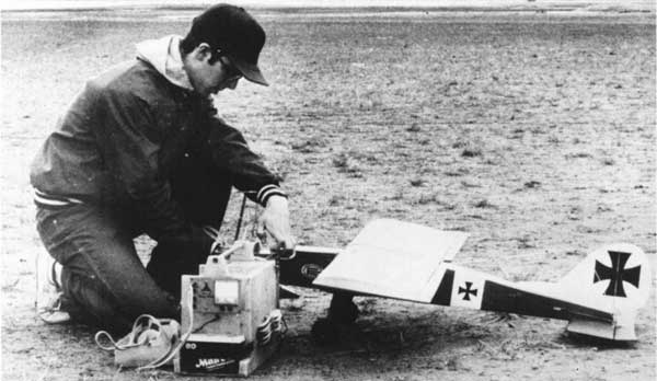
Photo 57. A remote control flying enthusiast on Dyea flats.
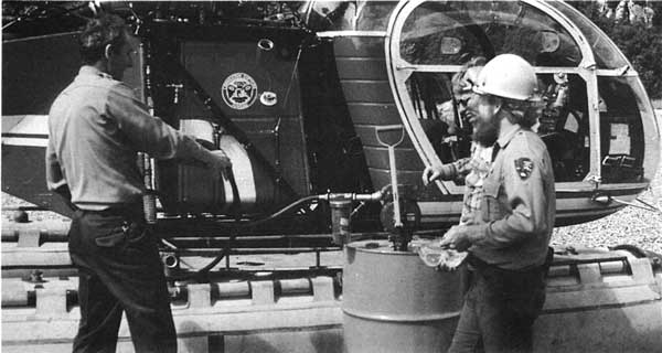
Photo 58. Hauling fuel and other supplies to the Sheep Camp ranger station, 1979.
Photo 59. A cache of canvas boats near the top of Chilkoot Pass.
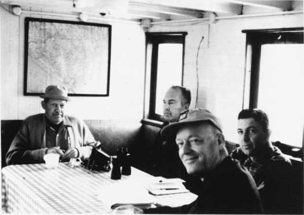
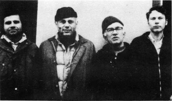
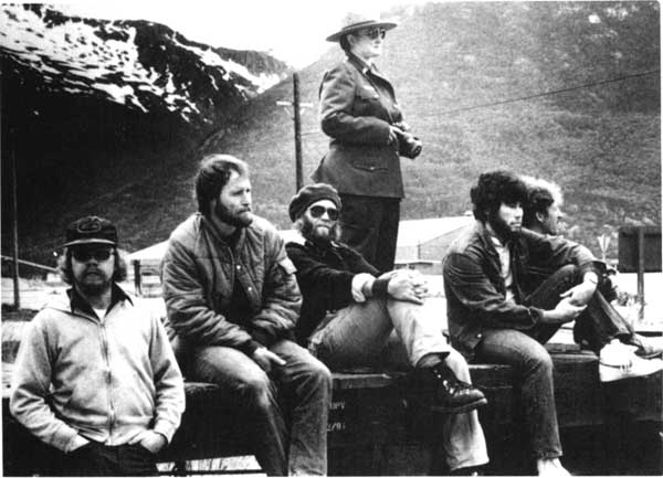
Photo 60. Longtime trail crew members Roy Nelson, Bruce Hill, Jerry Watson, and Pat Moore.
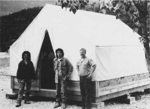
Photo 61. One of several wall tents which were installed along the Chilkoot in 1993.
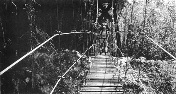
Photo 62. Suspension bridge at 11 mile, completed in 1982.
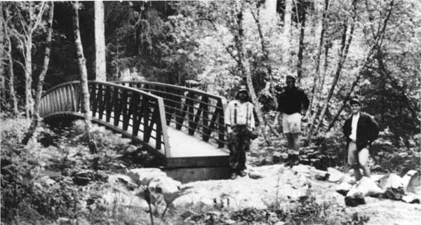
Photo 63. Steel truss bridge at 1-1/2 mile, completed in 1991.
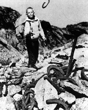
Photo 64. Scattered horseshoes along the trail near Stone Crib.
Photo 65. Log bridge at 6-1/2 mile, completed in 1982.
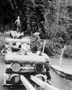
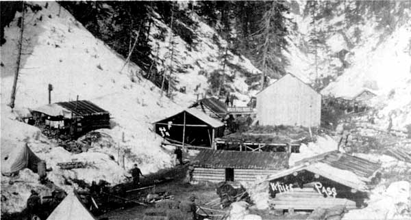
Photo 66. White Pass City, as it looked in 1898.
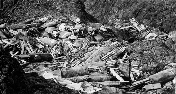
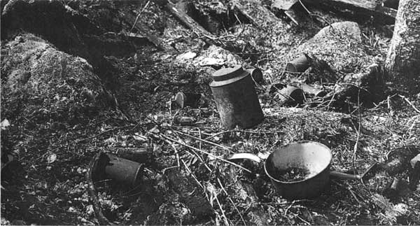
Photo 67. Scattered artifacts at the White Pass City site, 1979.
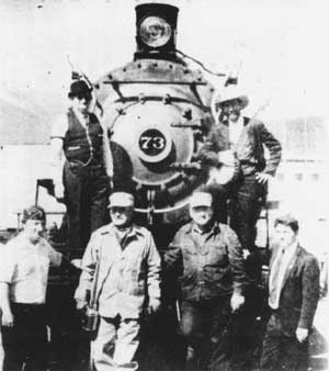
Photo 68. WP&YR locomotive #73 seen in 1982, shortly after it was restored.
Photo 69. Outflow of Goat Lake, site of a proposed hydroelectric project.
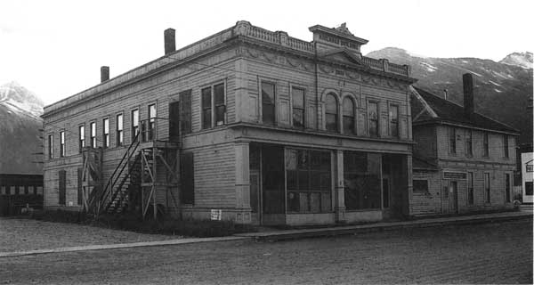
Photo 70. Early photo of the Pioneer Building, erected in 1892.
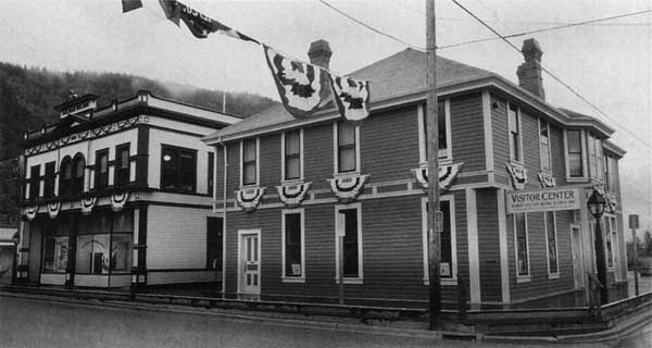
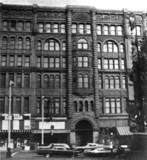
Photo 71. The Pioneer Building as seen in the early 1970s.
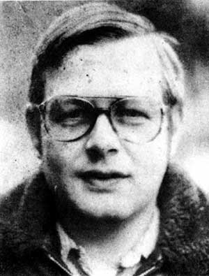
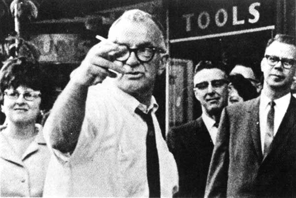
Photo 72. William C. Speidel, a local journalist and historian, in a mid-1960s photo.
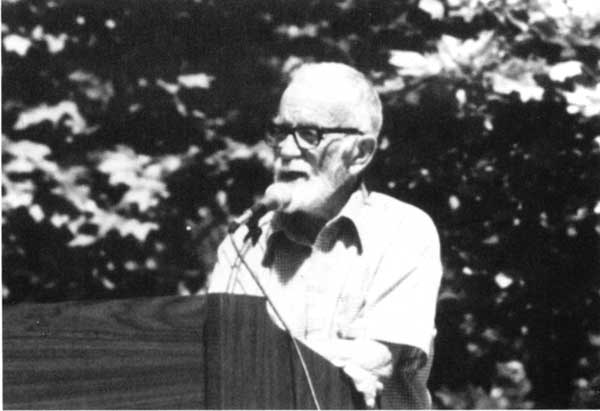
Photo 73. Speidel speaking at the park's June 1979 dedication.
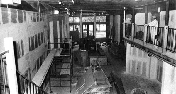
Photo 74. Reconstruction work was well underway on the Seattle Unit's interior, May 1978.
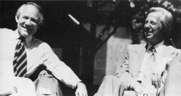
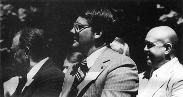
Photo 75. Rep. Joel Pritchard and NPS official Russell Dickenson at the 1979 dedication.
Photo 76. NPS staffers posed at the Seattle unit, shortly before it opened to the public.
Photo 77. NPS officials James "Rocky" Richardson, Charles Gebler, and Glenn Hinsdale.
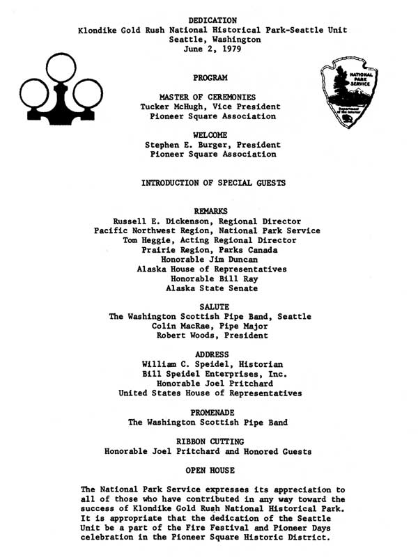
Photo 78. The program for the Seattle Unit's dedication, held June 2, 1979.
Photo 79. Exterior restoration of the Union Trust Annex facade, March 1978
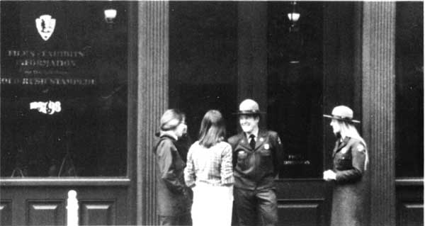
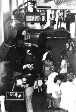
Photo 80. Visitors viewing the unit's exhibits on opening day, June 2, 1979.
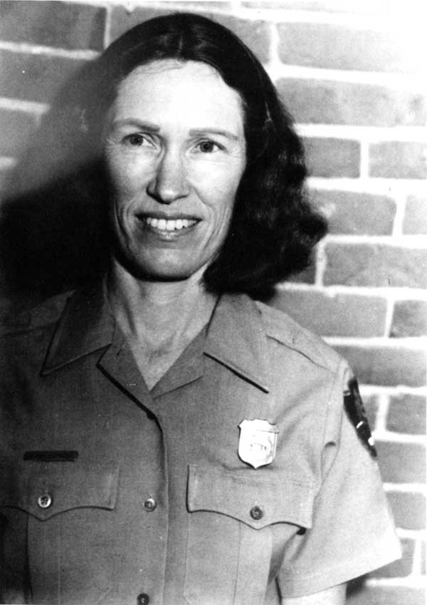
Photo 81. Elaine Hounsell, the Seattle Unit's first superintendent.
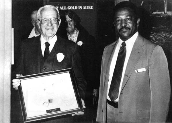
Photo 82. NPS Director William Penn Mott and Superintendent Willie Russell, 1986.
Cover design by Wyndeth Davis, NPS.
Printed on contract from the Government Printing Office, Seattle, Washington.
| <<< Previous | <<< Contents>>> | Next >>> |
adhi/contents.htm
Last Updated: 24-Sep-2000