
|
Geological Survey Bulletin 104
The Glaciation of the Yellowstone Valley North of the Park |
THE YELLOWSTONE GLACIER
The glacier occupying the mountain valleys of the Yellowstone has for convenience of reference been called the Yellowstone glacier. The ice stream had its source in the confluent ice sheets that covered the northwest portion of the National Park, and flowing northward overrode the lesser peaks about the boundary of that reservation and sent a great ice stream down the valley of the Yellowstone. This glacier, reenforced by a confluent stream from Bear gulch, completely filled the upper valley and extended far up on the mountain sides, completely covering such minor elevations as Cinnabar, Sphinx, and Dome mountains as it flowed northward to the low and broad valley below Yankee Jim canyon. This valley it occupied as far north as Mill creek, a total length of 36 miles from the park boundary. The width varied from 3 to 6 miles, and the depth in Yankee Jim canyon and the valley above it was 3,000 feet. As the névé fields of this great glacier were within the Yellowstone Park they will not be discussed in this paper.
In both the upper and lower of these two valleys this trunk glacier received tributary streams of ice. In the upper valley an ice sheet crept down from the mountainous region to the east, coalescing with another stream of ice from the park that pushed northward between Sepulchre mountain and Electric peak and filled the valley of Reese creek. In the lower valley the main glacier was reenforced by numerous tributary glaciers flowing westward down the great mountain valleys of Sixmile, Emigrant, and Mill creeks, whose united force deflected the northern end of the Yellowstone glacier westward against the foothills of the Gallatin range. The névé fields of these eastern tributary glaciers were the broad and high mountain summits of the Snowy range, each of the larger mountain gorges penetrating this rugged region, having been the bed of a glacier. The evidence shows that the névé fields of these tributary glaciers were of considerable extent and were confluent with those forming the head of the Boulder glaciers.
LIMITS OF GLACIATION.
In mapping the areas occupied by these ancient ice streams it has been found difficult to define the exact limits of the ice upon the mountains east of the Yellowstone, owing to the number of tributary glaciers and the gradual change from glacial to nonglacial topography, while the drift is generally of the same material as the rock upon which it rests. On the other hand, the drift deposits of the valley are readily studied, and the western limit of the drift is sharply outlined by the bowlders of gneiss and granite resting upon the rocky slopes of volcanic breccias. The gradually decreasing altitude at which this marginal drift occurs as we go northward from the park shows a rapid thinning of the glacier north of Yankee Jim canyon.
CINNABAR VALLEY.
Both the Cinnabar valley and the surrounding mountain slopes present many interesting evidences of glacial occupancy.
Bear gulch and Sheep mountain.—On the east the tributary glacier of Bear gulch has left a trail of rhyolite blocks from a hill some 8 miles above its mouth, showing that the ice crowded around this corner of the mountain, occupied what is now the head of Eagle creek and merged into the main stream as it overrode the flanks of Sheep mountain. It is a noticeable fact that the slopes of this mountain are abundantly strewn with erratics, particularly about the base, where the slopes merge into the bench made by the basalt and travertine sheets. The foot of these slopes is somewhat heavily mantled with drift, the bowlders being of moderate size and consisting chiefly of gneiss and granite, with many of rhyolite from Bear gulch; this detritus is arranged in crescentric loops with small alluvial flats behind them. The bench at the base of the mountain slope is but mildly glacial and free from bowlders. A till-like material is found in spots, mantled by gravels, and alluvium from the mountain slopes has largely covered the original glacial deposits if any were present. Owing to the frequency of the small recent faults which have broken and disturbed the bench glacial evidences are largely obscured. Rhyolite drift from the bluffs of Bear gulch forms a train encountered between the bluffs and the ranches of Eagle creek, and none was found south of this road (i.e., between the wagon-road and Bear gulch). The erratics generally are gneissic, occurring in clusters, and very abundant between Eagle creek and Bear gulch. A very considerable accumulation of massive bowlders upon the basalt bench north of the mouth of Bear gulch is supposed to be the work of the receding glacier.
Sepulcher mountain.—The west side of the valley evidences the conflict of the ice streams from the Yellowstone canyon and the Gardiner with the lesser stream coming down Reese creek, which by their union formed the trunk glacier of this valley. The upper slopes of Sepulcher mountain are littered with numerous erratics, the lower slopes in places mantled with glacial gravels and sands or carved into typical glacial hillocks by the abrasion of the ice. The drift accumulations of the mountain flanks are most conspicuous within the borders of the park. West of Gardiner the slopes attract attention by their rounded, mammillary forms, which, upon examination, are seen to be the result of erosion and not due to a covering of drift. The stage road from Gardiner to Cinnabar crosses a typical portion of this area in which the volcanic breccia composing the hilly slope is but scantily covered by drift, yet the topography is strongly morainal in its contours.
The valley bottom.—The immediate valley bottom contains much drift, which in the lower levels is of course terraced by alluvial action. The town of Gardiner is built upon such a bowlder-covered terrace, the erratics being chiefly gneiss. Chadborn's ranch to the north is built upon a well-defined moraine of great granite bowlders that outline the northern limit of the Sepulcher mountain moutonnée forms. The valley bottom in this vicinity evidences various stages in the retreat of the ice sheet. North of Hoppe creek the stage road follows a depression with a level bottom some 125 yards wide between two ridges of bowlder drift.
In general the valley has been subject to considerable glacial erosion during the maximum extension of the ice, and the deposits of drift mark phases in the retreat of the ice. Mention should be made of the large deposits of glacial gravels forming kame-hills about the debouchure of Reese creek. The drift is all from the head of this lateral valley and brought by a branch ice stream pouring down the valley from the Sepulcher-Electric divide. From Cinnabar station to Cinnabar mountain the valley bottom on the west is wholly alluvial.
Cinnabar mountain.—The Cretaceous spur of coal-bearing rocks that terminates in the upheaved beds of Cinnabar mountain presents no special features of interest, though drift-covered hills of glacial gravels that accumulated at the base of Cinnabar mountain while the ice was crowding over its summit seem to prove that stagnant portions of the ice filled this place while the main current pushed through the gorge to the north or over the mountain top. Bowlders of gneiss and andesite resting upon the stratified beds prove that the ice passed over the summit.
From Cinnabar mountain to Yankee Jim canyon the course of the Yellowstone is northwestward, and that the northward-pushing glacier was deflected by the high mountains northeast of the river is evidenced by the drift carried from the Cinnabar mountain. The mountain slopes on the east side of the river show considerable evidences of glacial abrasion, benching, and the usual erratic blocks, but were not studied with the same detail as those to the west, which promised more definite and important results, but the drift shows that the ice overrode the slopes to a height of about 3,000 feet above the present stream.
The western side of the canyon, north of Cinnabar, to the gorge called Yankee Jim canyon, presents a different type of glacial erosion.
The present canyon of Cinnabar creek is a post-glacial cut in a bench of granite whose surface presents fine examples of glacial polishing and scoring. A short distance northward the lower slopes are formed of the breccias which have been eroded by the ice. Seen from the slopes of Dome mountain this hilly area presents a peculiarly mammilated appearance. The hills formed of dark volcanic breccia of augitic rocks which when traversed is found to form rough craggy masses with a generally hummocky topography, there being no drainage and sharp basins lying between. It is a combination of glacial topography with post-glacial settling or land slides. Glacial gravels cap many of the knobs, especially east of the road, but erratics are rare. A peculiar feature of the northern end of this area where it runs into the basin at the south end of Yankee Jim canyon, is the fact that these hills run into ridges which are prolonged by glacial gravel. This gravelly drift shows blue quartzite, granite, and many varieties of andesite, but no basalt or rhyolite could be found.
A peculiar, tarn-like lake occupies one of the peculiar depressions in this foothill area, but is not dammed by glacial gravels. The slopes above these hills form the flank of a small elevation known as Sphinx mountain, whose glaciated summit, capped by numerous erratics, is 2,400 feet above the river. The andesitic breccias and basaltic flows forming the southern slopes of the mountain have been eroded by the ice into the characteristic knob and sink contours with very little small drift, though bowlders of granite with rarer erratics of sedimentary origin are abundant on flanks and summit. The eastern slopes are somewhat benched, and the northern slope shows a considerable accumulation of detritus forming glacial hummocks resting upon the rocky flanks.
Cinnabar basin.—Cinnabar basin is an elevated mountain park drained by the northern fork of Cinnabar creek. The valley of the main creek is a narrow cut with rocky walls and presents no points of interest in this connection, though evidencing the extent of post-glacial erosion in the walls of its inner gorge. The basin on the other hand is a preglacial valley greatly modified by its occupancy by ice and filled by glacial detritus. Looking down upon it from the surrounding mountain walls its smooth contours, pockets, hummocks, and rounded knolls and sinks show very clearly the work of the glacier in producing the present condition. Of the two streams which drain it the larger heads in a glacial amphitheater under the bold walls of the main summit of the range, and flows through a trenched channel; the other heading in a smaller mountain amphitheater, filled with hummocks of drift, meanders through a broad marshy area flanked by drift hills and gravel flats, and has not cut through the alluvium and drift which fill the valley bottom. These streams uniting form the north fork of Cinnabar creek. A transverse moraine has deflected this stream, where it joins Cinnabar creek, and forced the waters to cut a channel through gneiss, thus retarding the down-cutting of the stream above.
Transportation of bowlders to a higher level.—The high mountain ridge that forms the western wall of Cinnabar basin was covered by the ice to a height of 8,000 feet, the drift terminating abruptly at that elevation. The bowlders of this locality evidence an interesting example of the transportation of material from a lower to a higher level. At 7,400 feet the bowlder drift contains, besides the usual types of granite, gneisses, etc., many blocks of limestone and Dakota conglomerate, whose only source is Cinnabar mountain. None of these bowlders occur at lower levels, and as there is but one source it proves a movement of the ice over Cinnabar mountain westward. These bowlders are five and a half miles west of and 350 feet above their highest possible source. Bowlders of pink quartzite and shaly Cretaceous sandstone occur on these same slopes at a higher level. These bowlders furnish absolute evidence of the crowding of the glacier westward by the bend in the valley. As the constricted river gorge could hold but a small part of the glacier, the ice was forced to override Cinnabar and Sphinx mountains and filled Cinnabar basin, leaving a record of its margin as high as 8,000 feet on the western slopes. These western slopes which were not ice covered in turn deflected the ice stream, which in its course northward gouged out the beautiful little glacial valley followed by the trail from Cinnabar basin to the lower Yellowstone. At the south end of this cut the hammocks are of glacial drift. Two lakelets occupy depressions in its bottom, being confined by drift, but detritus is not abundant, consisting of scattered erratics, mostly of gneiss, with a few of andesite upon the adjacent slopes of volcanic breccia. The northern end of the cut is occupied by a small stream called Teepee creek, heading in a lakelet fed by a clear spring of water. The creek is actively cutting down a gorge in the mountain side, but does not follow the old course of the ice, which here crowded around the shoulder of the ridge separating Cinnabar basin from Tom Minor.
YANKEE JIM CANYON.
Yankee Jim canyon presents a very perfect and striking example of the eroding power of ice and of glacial sculpture.1 It is a narrow gorge cut by the Yellowstone in metamorphic gneisses, through which the river rushes in a torrent of beryl green quite unlike the placid stream above. The glacier which once filled this canyon and overflowed its walls has broadened it and rounded, planed, and polished its sides from bottom to top. The eastern wall, formed by the sides of a low, rounded knob known as Dome mountain, shows striated surfaces and ice-worn bosses dotted with erratics almost to its summit. On the west the slopes above the polished surfaces of the immediate canyon wall are ice worn and are carved into typical glacial ridges and moutonnées, with a general bench structure to a height of 8,000 feet, or 3,000 feet above the river. Indeed, knowing the activity of disintegrating agencies in a climate where frost is an almost nightly visitor during the summer months and the winters are long and rigorous, it is surprising to find these evidences so fresh.
1A charming description is given by Sir Archibald Geikie; see Geological sketches.
Erratics of gneiss are conspicuous wherever the surfaces have permitted their lodgment, and dot the ice-worn bosses at every altitude, so that it is certain that the glacier was 3,000 feet thick at this place and proves that this ancient glacier of the Yellowstone was of greater magnitude than has been ordinarily supposed.
The extreme erosion at this point of its course by the old glacier was due no doubt to a considerable contraction in its width, coincident with a narrowing of the valley bottom more than one-half, whereby a large part of the ice was forced to rise upward and override the higher slopes.
The morainal ridges of drift, the ice-worn bosses, and the erratics in the sag east of Dome mountain prove that a considerable portion of the ice, unable to crowd through the gorge, found an independent entrance into the broad lower valley of the Yellowstone. The sag itself shows considerable accumulations of detritus, forming benches and elongated ridges running north and south. Erratics were observed as high as 8,100 feet upon the spar east of this sag. Their absence above proves this to be the limit of glaciation.
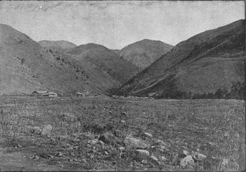
EMIGRANT VALLEY.
Before passing through the lower canyon, the so-called gate of the mountains, to the broad and low valleys of the lower course, the Yellowstone flows through a broad valley, encompassed by mountains upon every side, a grand and beautiful intermountain basin, 30 miles long and from 3 to 6 miles wide. On the west the slopes rise gradually to the castellated crests of the Gallatin range; on the east the high pinnacle of Emigrant peak overshadows the valley, while the spires of Mount Cowen and its neighbors form a serrated wall, shutting in the northeastern part of the valley. Broad alluvial bottoms, with interosculating channels and islands bright with cottonwoods, mark the river's course. The broad terraces on either side are cut by numerous tributary streams issuing from their mountain gorges, supplying occasional farms, whose bright stretches of grain and tilled fields intensify the contrast between the fertile valley and the barren wilderness of the surrounding mountain slopes.
The geological observations hitherto made in this valley led the earlier geologists to suppose it to be the bed of an extinct lake, and the lake beds preserved beneath a protecting sheet of basalt show that such was once the case. A later episode in the history of the valley, and one that has given it its present surface, was the extension of the Yellowstone glacier northward, filling the southern half of the valley and depositing the glacial detritus, covering the higher levels and the gravels of which the great alluvial terraces are built.
The glacial stream confined within the narrow gorge of Yankee Jim canyon and the adjacent mountain slopes spread out and filled the broad bottom of this valley, depositing much of the detritus which the ice had transported from the mountains. These morainal accumulations are most interesting upon the eastern side of the valley, where considerable areas are covered by drift hills and kames, with abandoned channels of subglacial streams, and a chain of morainal lakelets add their charm to this peculiar scenery.
Upon the west side the immediate valley bottom is formed of alluvial terraces and the detritus of streams from the mountains, while the adjacent slopes are bowlder strewn and marked by a very striking and peculiar system of terrace lines.
Mountain canyons.—As the structural geology of the mountainous region to the east of this broad valley was studied by Mr. J. P. Iddings, I am indebted to him for notes upon the glaciation of the deep gorges which held large ice streams tributary to the trunk glacier of the Yellowstone. These glaciers pushing out and across the valley left their drift upon the extreme western margin of the glaciated area near Fridley's. All these mountain valleys show in their rounded slopes and ice-worn rocks and their general broadening that they have been sculptured by the ice streams they once held. (See Pl. III.) That these streams were of considerable size and thickness, is proven by the height to which the ice-worn bosses and ice-borne erratics have been found upon the mountain slopes. At the head of Sixmile creek a granite bowlder was found resting upon volcanic rocks at a height of 9,500 feet, thus proving that the glacier not only filled the great amphitheater at the head of this stream, but overrode its high encircling walls.
Morainal heapings.—The southern part of this great intermountain Valley is covered with a superficial deposit of glacial drift that marks the area occupied by the ice. On the east side of the Yellowstone these morainal accumulations extend from the mouth of Yankee Jim canyon northward beyond the debouchure of Mill creek, interrupted only by the terraced drainage cuttings made by Sixmile and Emigrant creeks. As a whole this material is heaped into a tumultuous assemblage of knobby or mammillary hillocks with correspondingly sharp depressions, and the material is both unassorted and of kame-like stratification.
Morainal lakes.—A noticeable feature of the topography of this part of the valley is a chain of lakelets lying in a well defined depression between the base of the mountains and the drift-strewn summit of the basalt table. The largest of these bodies of water is known as Duck lake (see Pl. II), and, with its companion lakelets, belongs to the type of lakes due to dams of morainal material. This is perhaps most plainly shown in the case of the middle lakelet whose scalloped lobate form is due to the fact that the lake fills several adjacent morainal hollows. The drift is mainly small and partially assorted, forming typical kames.

|
| PLATE II. DUCK LAKE, A MORAINE-DAMMED SHEET OF WATER |
East of these lakes a lateral moraine composed of quite large bowlders and more angular débris, largely of blocks 2 to 10 feet across, forms a prominent ridge running northward along the mountain side west of the stream tributary to Duck lake. It is the work of the ice as it spread out into the valley from the narrow bed of the canyon above and consists of fragments from the walls and slopes of Yankee Jim canyon.
Duck lake itself is a pleasing sheet of dark blue water, oval in outline, and forming an agreeable change to the eye after traveling over the monotonous moraine. The water is somewhat opaline at the windward side, the northern shores being gravelly beaches, showing a high water line some 2-1/2 or 3 feet above the present level of the lake (in September). At the south end the shores are muddy and form the termination of a somewhat extensive marshy bottom that fills the depression between this lake and the smaller body of water to the south. The large drift is much more abundant immediately north of Duck lake than it is farther away.
North of Duck lake the wagon road follows a shallow, alluvial flat, separated from the bed of Duck lake by a train of detritus brought down by small streams from the adjacent mountain slope. Beyond this flat the kames attain their most characteristic development, consisting of gravels and sand rudely assorted and forming hillocks 15 to 20 feet high, capped by cobbles and bowlderlets chiefly of gniess and separated by sharp sinks and kettle holes. The road follows a gentle grassy depression formed by a glacial stream running to the northwest. This channel once held a good sized stream whose waters were burdened with silt and sand, with which it built up the terraced sides of the present grassy draw. That it is not an old channel of Sixmile creek is evident from its situation and the fact that such a stream would not desert so well formed a channel, and, furthermore, by the presence of an area of hummocky drift hills separating this old creek bed from the present drainage channels of Sixmile creek.
Sixmile creek at present flows in its old bed. A newer channel, now dry, being found on a terrace above the present creek marked by a line of cottonwoods and evidently occupied for many years. The broad gravel flat which now carries the water has been made by a stream much larger than the present creek, being in fact large enough to accommodate the Yellowstone itself. Between this channel and the basalt table to the west there is an area of morainal drift of some interest. A terrace about a quarter of a mile wide separates these morainal hills from the immediate gravelly flat of the creek, and the moraine terminates in the rear of this terrace in a steep bowlder slope very difficult to climb. The summit of the moraine is fairly level, thickly strewn with basalt bowlders from the basalt sheet to the west, with occasional erratics of gneiss and limestone. The bowlders average 2 to 3 feet in diameter and some 2 or 3 feet apart, resting upon smaller cobbly material. Small sandy benches occur occasionally, marking the site of small marginal streams. The north slope of this moraine is gently undulatory and knobby, while the southern slope is free from knobs and sinks, being a fairly level surface falling gently to the southwest, toward the old glacial stream channel heading in the moraine near Duck lake and holding a small alkaline lakelet. There is a noticeable decrease in the size of the bowlders as we go westward over this moraine. Between Sixmile and Emigrant creeks the moraine is a very gently accentuated knobby area, the hummocks rising but a few feet high, with many sandy level areas and a general inclination to the west of the entire area.
North of Emigrant creek the country is nearly similar to that just described, being but mildly morainal, the drift mainly under 12 inches in diameter and the larger bowlders being half buried in the smaller gravelly débris. Large bowlders are, however, frequently seen, with typical erratic form, striated sides, and beautifully polished, glistening surfaces. One fine intermorainic hollow was crossed that evidently served at one time as a temporary channel for a subglacial stream. This channel is 75 yards wide and heads in the drift hills. Beyond this channel the hummocks to the north are very rough and form a strip of country extending northward to a second subglacial channel heading in these hummocks and but 25 to 50 yards wide. Beyond here the hills are gently contoured, but typical in form and extend to the broad depression holding the lakelet shown upon the map. This depression is part of the glacial flood plain. Beyond the lakelet a narrow strip of moraine extends parallel to the river, nearly to the mouth of Eightmile creek, being separated by a broad, sandy terrace from another area of morainal débris, forming the hummocky lands lying at the base of the mountain slopes just south of the debouchure of Mill creek.
|
| PLATE III. MOUTH OF EMIGRANT GULCH, SHOWING GLACIATED MOUNTAIN GORGE OPENING INTO YELLOWSTONE VALLEY |
Basalt tables.—The central part of the valley is occupied by a mesa of lake beds capped by basalt. This forms two separate areas, of which the largest is on the east side of the river and extends from Point of Rocks northward to the mouth of Sixmile creek. The table is about 6 miles long and 3 miles wide, its summit being about 250 feet above the surface of the river. The top of this mesa shows occassional bare surfaces of the basalt generally as low domes of rock, 10 to 50 feet wide and 50 to 100 feet long, the basalt being smoothed and striated, the groovings running parallel to the river. These domes of rock are generally scantily scattered with bowlders. The summit of this basalt table shows in its striated and polished surfaces and its low moutonnée contour that it has been subjected to considerable glacial erosion. The retreating ice sheet has strewn its surface with bowlders and smaller glacial drift.
A thin mantle of drift, however, generally conceals the surface of the basalt. At the northern end the slopes are thickly scattered with bowlders of granite, black mica schist (rare) and occasional blocks of creamy white limestone, while a large proportion of the drift consists of basalt bowlders. The northern and western edges of the mesa are surmounted by sharp ridges of drift that rise 15 to 20 feet above the undulating sinks and swells of the general surface. A train of bowlders forms a ridge crossing the table to the southeast, and the general surface is paved with cobbles, the space between filled with small drift. In the central part of the table the bowlder ridges are well defined, running north and south with long narrow grassy depressions between. These hollows form a conspicuous feature of the summit; being filled with sand and alluvium and well grassed they form excellent pasture grounds that extend for a mile or two south, running into a confused heaping of drift with knobs and with small and disconnected sandy flats between.
The character of the drift covering the basalt table has already been indicated in the preceding paragraphs. The large bowlders which are particularly abundant upon the northern portion of the table contain a considerable variety of material in which basalt, identical in all respects with the rock beneath the drift, predominates. Bowlders of gneiss and schists are abundant, and occasional blocks of white quartzite and of pitted paleozoic limestone are very conspicuous. The glacial striae show a movement down the main valley.
Glacial stream channels.—The existence of considerable streams flowing from the ice front is established by the many channels and sandy terraces associated with them, which cut across the drift hills or head within the morainal area. Besides these channels, formed by temporary streams flowing from the ice front, the streams from the east, notably from Sixmile and Emigrant gulches, have not always occupied their present beds, but in glacial times flowed in channels subsequently abandoned upon a recession of the ice or its complete disappearance. Thus the present wagon road from Findley to Chico follows a well defined and broad water course, cut in the sandy moraine and heading in a broad sandy plain at a level with the summit of the moraine and some 75 feet or so above the present bed of Emigrant creek. All traces of the stream channel end in this sandy terrace, which was the flood plain of the creek at the time the Emigrant gulch glacier had retired within the walls of the gulch. This channel was subsequently abandoned because silting up afforded an easier outlet for the water in the present course which has been cut down and forms the present channel of the creek.
Two small channels produced by subglacial streams have already been noted in describing the moraine north of Emigrant creek, but such channels are numerous. One of the largest, a rather shallow waterway with sandy terraces cutting the glacial flood plain and running north parallel to the road from Chico to Mill creek. Two cut deeply in the moraine south of Elbow creek, and others occur in the moraine area south of Sixmile creek. The deflection of Sixmile creek to the northward into the valley is caused by the accumulations of drift.
The largest of these glacial stream channels is probably that which lies back of the basalt table, a broad river bed heading in a low divide in the moraine above Duck lake, and extending down to the Yellowstone opposite Boettlers. It opens out into the great alluvial or gravel flat of Sixmile and Emigrant creeks, above which the moraine ridges rise with steep scarp slopes.
Another very marked channel lies east of this last and runs parallel to it, heading in a sandy terrace flat some 75 feet above and near the north end of Duck lake. This glacial (or subglacial) stream channel is one-third of a mile wide in its broadest part, with flat sandy bottom showing no water channeling. Near Duck lake the side walls of the coulee show longitudinal ridges or embankment-like heapings of bowlders. The floor of the depression is usually entirely of sand, but as the head of the ancient channel is approached the sand becomes coarser and grades into fine gravel which in turn becomes larger nearer Duck lake. In the lower part of the coulee bowlders are quite rare, but become more plentiful near the head. As is the case with the other ancient channels noted this one heads in sandy flat or plain in the moraine.
Drift deposits.—Upon the western edge of the river there is only a narrow strip of valley between the river and the foothill slopes, and this is entirely occupied by alluvial terraces from Tom Minor creek to Big creek. From Daileys to the northern limit of the drift, near Eightmile creek, the moraine covers the higher portion of the valley bottom above the alluvial terraces, presenting the usual types of conical hills of drift with an abundance of bowlders, many sandy flats and deserted subglacial stream channels. As already stated, the margin of the drift is readily traced upon the volcanic breccias forming the bare rocky hillsides which inclose the valley on the west. On the ridge north of Rock creek there is a well defined drift-covered bench at 7,740 feet. On both sides of Big creek the upper limit of the glacial detritus is about 6,800 feet. North of here the elevation rapidly declines until west of Fridleys the drift covers the low triangulation hill, beyond which it is limited to the valley bottom.
Terraces.—In the southern part of the valley these drift-strewn hillsides are characterized by a remarkable terracing of the slopes particularly prominent about the debouchure of Dry creek. The great terraces of Tom Minor basin and the equally definite terraces of Rock creek and Big creek, also lie within the limits of the drift and are coincident with the occupancy of the valley by the Yellowstone glacier. Several significant facts lead to this belief: These great benches are best marked where tributary valleys join the Yellowstone; they occur only upon the western side of the old glacier, and near its margin; they always occur within the bowlder-strewn area, and never above the limit of the drift, and they are cut in horizontally bedded volcanic breccias. The size of these benches will be appreciated by a look at the map showing their development about Big creek—a locality where they attain a very prominent development. On the north side of Big creek such a terrace forms a beautiful flat-topped grassy open bench, a mile wide. The surface has a slight gradient toward Big creek, and also to the east, passing imperceptibly upward into the mountain slopes in the rear. Bowlders are very abundant upon the eastern portion of this bench, and on the slopes immediately above it, but are rare west of the first fork of Big creek. This fork and the one to the west, have cut deep trenches in the bench, exposing sections showing that it is formed of andesitic breccia covered by drift, the latter being seen to be as much as 100 feet thick in certain places. The bench is continuous eastward to the valley of the Yellowstone; seen from the higher slopes to the south it is a broad flat, with the slope above it faintly lined by two narrow terrace-like markings, of which the uppermost corresponds to the upper limit of the glacial drift. No such bench was detected upon the spur south of Big creek; but granite bowlders resting upon the basaltic volcanic breccia show that the upper limit of the drift has about the same elevation.
Similar benches are extremely prominent in the basin of Tom Minor creek, and occur, though of much less extent, in the sides of the valleys of Rock, Dry, and Stricklin creeks. The Rock creek benches, though less extensive than those of Big creek, bear a similar relation to the drift. At this place the uppermost bench is the best defined, and corresponds to the upper limit of glacial detritus. The surface is fairly level, with pit-like hollows and occasional knobby hillocks rising above it, the general surface being covered with fine gravel and sands and occasional bowlders, in marked contrast to the bare, driftless slopes above. Below this beach the slopes show rugged steeps of breccia, proving considerable post-glacial erosion, though drift is abundant, both as bowlders upon well defined rocky benches and as ridges and groups of hills formed of glacial gravels. On the south side of Rock creek there is a narrow bench scoring the mountain slope and continues for several miles, though cut by drainage channels. This bench marks the upper limit of glacial drift, 7,800 feet, and is generally emphasized by a channel-like depression on its rear surface.

|
| FIG. 1.—Glacial terraces of marginal area, valley of the Yellowstone (Geikie). |
Striated valley slopes.—Associated with the great terraces just mentioned is a wonderfully fine series of terrace lines scoring the slopes below the limits of the drift. Back of Dailey's thirteen beautifully marked steps can be counted on the slopes west of the valley as shown in Fig. 1. It is at once apparent that these terrace lines are not part of a system of lake terraces. Their lack of horizontality, their lack of relation to other terraces puts this beyond doubt, and shows that they owe their origin to some other agency, either the ice sheet itself or marginal streams. These benches occur about the debouchure of Stricklin creek, where the higher lines form prominent scorings upon the slopes. They are all grassed and show no precipitous scarp. Their connection with the great benches of Tom Minor, Big creek, etc., was a subject of inquiry, and it was found that the higher terrace lines about Dry creek follow the slopes around and run into the great benches of Big creek. Such at least appears to be the case when seen from the edge of the basalt table east of the river. The lower terrace lines do not show in the Big creek canyon, in fact would not be expected to, but the slopes about the debouchure of Big creek show definite and well marked terrace lines, only less prominent than those of Dry creek. To the south the higher bench lines show very markedly on the slopes south of Big creek, though uneven and lacking the beautiful uniformity of the Big creek benches. The slopes up to 400 feet above the river are generally hummocky hills, of breccia, with intervening sinks, resembling in a general and distant view a mammillated surface, in which the hummocks are quite large. Granite bowlders are abundant, and occur up to 10 feet in diameter. North of Dry creek the lower benches fade out in these slopes, the higher lines, corresponding to the faint lines seen on the slope north of Big creek, forming a prominent grassy bench above the mammillated contours of the breccia foothills and below the steep mountain slopes. This bench expands into a fig-shaped area on the south side of Stricklin creek.
These strongly marked terraces, which form such prominent features of the slopes inclosing the valley on the west, have no counterpart on the east side, where the moraines show an entirely different phase of glacial activity.
While these terraced slopes characterize the southern portion of the morainal area west of the river, where the valley bottom is low and occupied by alluvial terraces, the valley widens out north of Dailey's, and the morainal drift covers a gradually lessening portion of the foothill slopes, until west of Fridley the margin of the drift lies at the foot of the slopes.
In general, the morainal areas of the valley bottom are similar to those found upon the eastern side of the valley. Rolling hummocks of unassorted drift predominate, while there are many ridges of morainal gravel having a north and south trend with channel depressions between. There is a considerable variety of bowlder drift largely gneissic, but containing also some sedimentary material.
The basalt table of the eastern portion of the valley is represented here by much smaller and detached portions of the same sheet, also covering lake beds which, in this case, are shore deposits. This northern portion of the basalt sheet forms a narrow table north of Van Horn's, a mesa whose summit is a quarter of a mile broad, extending from Sheep creek north to the marsh back of Fridley. The level top is scantily strewn with drift, usually all small, only two large erratics being found, both at the extreme northern end. The drift is mainly andesitic, though white quartzite is prominent in the detritus covering the south end of the table.
The northern part of the morainal area shows a somewhat prominent terracing of the surface in general, though the upper benches are quite rolling. Large erratics are not very abundant, and are generally, though not always, found on knolls formed of smaller bowlders. There are many sandy alluvial flats and shallow basin areas, having no connection whatever with existing drainages. About a mile north of Fridley's the terrace bluff is cut by an old river channel, a distinctly marked waterway, with general northerly course and an elevation of 170 feet above the present wagon road. A morainal ridge with rolling surface lies between it and the terrace scarp to the east. Westward a bank of water-assorted gravel marks its borders. The surface of a higher terrace 230 feet above the river shows a drift moraine modified by water.
Foothill canyons.—A most curiously interesting feature of the drift-covered area is the presence of transverse canyons cut in the breccias directly across the slopes of the foothills. Their constant relation to the ice margin suggests that they had their origin during the period of glacial occupancy of the valley. They are of considerable length, sometimes presenting several miles of unbroken walls. Their general direction is a most striking anomaly in the general structure and topography of the neighborhood, for the canyons cut across the slopes sometimes in apparent indifference to deeply trenched drains and rocky spurs alike.
In descending, the foothills which lie at the base of the Gallatin range west of Fridley and form the western boundary of this beautiful mountain valley, a remarkable tranverse cut or gorge is encountered just before reaching the hummocky surface of the valley bottom. This gorge is cut directly across the slope in the rudely bedded volcanic breccias with their intervening sheets of basic lavas. The walls are generally sharply defined, vertical, or nearly so, and show fine exposures of the rocks above a sloping pediment of talus blocks. In height the wall varies considerably, but frequently rises over 100 feet above the bottom of the canyon. The width varies also, but is usually from 50 to 200 yards from wall to wall, the bottom being more or less narrowed by the talus slopes which encroach upon it, and in places completely cover it. One more or less continuous cut was followed from the mouth of the second gulch south of Eightmile creek, south about 5 miles to Stricklin creek. Sometimes there are two or even three parallel canyons, in which case the highest is the largest and longest.
A peculiarity of these canyons is that they can not be seen from the valley, and when approaching the foothill slopes would not be noticed even upon close inspection until actually encountered. They form admirably sheltered refuges for the cattle pastured upon the neighboring hills, and have in the past served the same purpose for bands of bighorn and buffalo, both of which have been slaughtered here in great numbers, as is proven by the numerous skulls.
Only the very largest of the foothill stream channels cut across the upper canyon, while the smaller gulches open into it, the opposite wall being unbroken or marked by a slight depression. This peculiarity is best illustrated by giving my notes upon a portion of this canyon, which was followed for the purpose of ascertaining its extent and its origin.
Entering the north end of the gorge, at the mouth of the gulch south of Eightmile creek, it is at once evident that we are in a cut of most unusual structure. It is about 100 yards wide from wall to wall, the rocky ledges being 40 to 50 yards above its bottom, with sloping bases of talus loosened by frost from the vertical faces above.
The canyon bottom is fairly level between these talus slopes, and generally soiled and grassed, but varies much in width; at first it is narrow, some 25 to 30 yards across, but farther south it widens to 100 yards or more, extending as far as the mouth of the first gulch, cutting the slopes and western wall. This gulch is the bed of a stream, now dry, belonging to the normal drainage system of the foothills, and is the trunk of a ramifying system of deeply trenched little channels draining the slopes to the west, but all dry at this time of the year. The stream channel opens into the transverse canyon we have followed, but does not cross it, and in time of flood its stream must of necessity find its outlet through the canyon northward. Opposite the debouchure of this dry drainage way the east wall is unbroken, and about 100 feet high, a little less than it is farther north.
South of the lateral gulch just noted the canyon continues unbroken, but the walls approach nearer together, the bottom is filled with talus, and progress is difficult. The walls are here neither so high nor so precipitous as to the north. Half a mile to the south the walls recede, and the canyon bottom widens out to 150 yards, having a flat alluvium bottom, in the middle of which a rocky butte stands up some 15 feet high, like an island, in the flat. A sag in the eastern wall, some 10 feet above the alluvial flat, has at some time permitted the escape of the pent-up waters poured into this part of the canyon by a considerable gulch cutting the slopes a short distance west. It is this gulch which contributed the alluvial material forming the flat. The main canyon cutting extends up to and runs into the mouth of this gulch—a significant fact, if the drainage marginal to the ice sheet had anything to do with the cutting of this transverse canyon.
Following around this deflection of the canyon we observe that the foothill drain has not cut across the transverse canyon, its east wall being here 200 feet high, but has deflected it.
South of this gulch the canyon, though continued the same direction, is detached from the part already followed, and opens out to the main valley by a sag in the east wall. To the south the talus has filled up the canyon bottom, so that there is a rise of 50 feet. The walls are here only about 40 yards apart, and the talus forms inclosed basins of the canyon bottom. The west wall is a sheer face of breccia and basalt 125 feet high, with talus slopes overgrown with grass; the east wall is not so high, but as usually the case forms the highest part of a slope running gradually, often steeply down to the general slope of the morainal area. Here this slope was found to be cut by a smaller canyon parallel to and quite like the larger one which was followed, though it is but 25 feet deep and runs out in the knobby drift area to the north.
Throughout the length of the canyon so far examined, some three miles, there is a noticeable absence of stream gravel in the canyon bottom, except where quite clearly brought down by lateral gulches. Glacial drift is often entirely absent; sometimes occurs scantily in the canyon bottom, and very rarely was found on the immediate slopes west of the canyon. The next gulch to the south is the third thus far encountered, and the channel of a stream draining a considerable area of the slopes to the west for several miles back, in which it has cut a gorge 300 to 400 feet deep. At the mouth of this gulch the east wall of the transverse canyon is breached by a broad depression opening into the valley. To the south the canyon continues, but is rather narrow, and the walls, 100 feet or so in height, are flanked by much débris, often completely filling up the bottom of the gorge. About a mile to the south the canyon opens out into a flat some 200 yards, more or less, in diameter, the basin being separated from the main valley by a low sag in the east wall some 15 feet above the flat. South of this flat the canyon divides about a pillar of rock some 25 feet high and uniting continues, with walls somewhat diminished in height, to the first creek channel north of Stricklin creek, where it opens out into a gravel terrace with steep bowldery scarp 135 feet high. This dry creek is the largest drain thus far encountered, and it opens out into a well-defined alluvial cone, sloping gently to the east, and running into a flat that is part of an old river channel, and confined by morainal hills of drift, 25 to 30 feet high, on the east. Curious to see if the transverse canyon continued farther south, the alluvial flat was crossed and a continuation of the same canyon found and followed to Stricklin creek.
Relations of canyons to drift.—The relation of this transverse canyon to the glacial drift is most pertinent. It was noted— First. That the slopes west of the canyon were bare of drift, and had not been covered by ice—this was positively established; in only one instance was any drift observed west of the cutting, and the bowlders formed a strip but a few yards wide.
Second. Drift is generally absent from the canyon itself and, if present, only in small amount.
Third. The slopes east of the canyon are heavily mantled with drift, both in the form of bowlders and as smaller material.
Fourth. This drift comes from the east, being gneiss and white talcose rock from the Snowy range, hornblende andesites, and sedimentaries.
Observations of the slopes east of the canyon were made at various points, and always showed the drift extending up to the very edge of the east wall of the canyon.
The larger drift was often found to be arranged in morainal ridges, running parallel to the canyon walls, and passing gradually into the more common knobs and sinks. As already stated, the slope east of the canyon is frequently trenched by shorter and smaller parallel depressions cut in the breccia. The morainal drift of the valley generally forms typical drift hills, rarely 25 to 40 feet in height.
Origin of transverse canyons.—After a careful study of these cuttings in the field I am still in doubt as to their origin. A recent faulting at first seemed most probable, and a resemblance to the fault fissures in the travertine and underlying basalt east of the river about Gardiner made this seem probable. Yet this type of canyon would not result from normal faulting, which would produce a single fault scarp. The bottom is, moreover, filled in a manner rather incompatible with this theory.
On the other hand the temporary character of streams flowing about the margin of ice sheet, scarcely warrants the belief that the canyon has been cut by such streams, even if aided by the drainages of the adjacent slope. The work necessary to cut down 100 or more feet across these transverse slopes, and through hard basalts and indurated, though easily eroded breccias, is not very onerous, and is easily performed to-day even by very small streams, but seems nevertheless to require more time than the existence of marginal streams could supply.
Glacial flood plain.—North of the limits of the drift, the valley bottom is filled with the glacial flood plain, largely terraced by the Yellowstone, but still retaining areas of its original surface. This plain has an elevation of 150 feet above the Yellowstone and opposite the mouth of Eightmile creek is an almost absolute level, the upward slope toward the moraine being very faint, as shown by a hand level, which gave a rise of only 8 feet or so in a mile. This is perhaps the most typical part of the morainal apron to be found in the valley. It is a flat extending from Mill creek to the Yellowstone opposite Chicory. An old glacial channel runs into it from the south, and the plain extends as far as the hot spring near Chico. On the west side of the river the alluvial gravels of Eightmile and of Trail creeks have obscured in part the great morainal apron, but its level surface appears north of Chicory, forming the great bench crossed by the wagon road and above the railroad terrace. The most striking view of the termination of the moraine is obtained from this plain, near Hayden—the foreground, of level hay fields, with water courses intensified by low groves of willow; a plain beyond, extending to the abrupt slope of the moraine front, whose sharp crested line of hills forms the background. Approaching the moraine, the surface of the plain is seen to be covered with rounded and smooth cobblestones, evenly distributed at some distance from the moraine, but arranged in channels near the hummock hills.
The moraine front rises abruptly as steep hills, with bowlder strewn fronts, no bowlders being seen on the overwash plain. No sand is seen on the surface of these moraine hummocks. The wagon road up the valley enters the moraine before crossing the middle branch of Eightmile creek, and passes an intermorainic hollow or channel, 250 yards wide, between the two ranges of terminal moraine hills, a second chain of hills being crossed by the road before reaching the modern channel of Eightmile creek.
Alluvial terraces.—North of the moraine of the Yellowstone valley, and beyond the immediate apron forming the moraine front, the valley is filled with morainal gravels, in which the river has cut well defined terraces. The best examples of river terracing occur within the morainal drift area, especially about Fridley. Immediately back and west of that settlement the valley presents series of alluvial terraces, the highest 160 feet or so above the river, but the moraine forms well defined terraces, with rolling hummocky surface at 170, 190, and 230 to 240 feet above the town.
Opposite the railroad station called Chicory there are three well marked river terraces at 25, 50, and 150 feet, respectively, the uppermost being the morainal apron or flood plain. The same terrace appears on the west side of the river, to the north of Eightmile creek.
In the lower valley, local ice streams from Elbow, Barney, Pine, and Deep creeks formed moraines extending down their canyons and forming prominent ridges about the debouchure of the creeks, particularly Pine creek, where the moraine comes down to the road. As a whole, however, this eastern side of the valley shows no terracing, but is an apparently gentle, continuous slope from the base of the mountain down to the river edge.
This lower valley is really very beautiful, with grand mountains on the east, fertile farms, and abundant water supply. Seen from a limestone knob standing up from the plain near the mouth of Deep creek, the valley to the south is a flat, alluvial plain, a few groves of cottonwoods marking the river's meandering course, and lines of trees showing where the plain is crossed by tributary streams from the mountains. The valley bottom slopes up from the river on the east side almost imperceptibly, till 1,000 to 1,200 feet above the Yellowstone, the slope really being formed by adjacent alluvial cones. At the foot of the mountains a heavy growth of pine timber darkens the slopes, extending up the mountain sides as far as the trees can obtain foothold, and dotting the rugged buttresses and crags of the lower part of this "Rough-enough" range.
The alluvial cones or foothill slopes show no benches nor definite morainal ridges save that already noted at Pine creek. They are without doubt largely formed of morainal gravels washed down when small local glaciers occupied the mountain gorges. Between Pine and Deep creeks these alluvial trains with definite morainal ridges reach far up into the mouths of the canyons. Where Deep creek debouches from the mountains the slopes show several well defined benches formed of great granite bowlders; but the benches do not extend more than one-sixth of a mile beyond the canyon, running out in the uppermost part of a perfect alluvial cone.
The high mountains east of the lower valley are deeply trenched by narrow canyons that are almost free from glacial detritus. This is easily explained by the torrential character of the drainages which carried the débris down and banked it up at the mouths of the canyons in the high bowlder benches just noted. These fade rapidly into the heads of steeply sloping broad cones of alluvial gravels and long wash slopes.
On the west side of the river the valley bottom is well terraced and bounded by gentle hills in which there are no large streams. These slopes are generally bare and grassy, occasional pines emphasizing a rocky outcrop or defining the basin at the head of some small dry drainage way.
Below the valley the river flows between steep rocky walls of upturned sedimentary rock, showing a most beautiful section of the Paleozoic beds. The river is cutting down its bed slowly at present, and flows in a number of interosculating channels, separated by numerous islands green with grain or covered by groves of stately cottonwoods.
Discussion of evidence.—It is apparent from an inspection of the accompanying map, upon which the outline of the drift has been indicated, that the glacier which occupied the valley bottom, great as it was, and coming from that great center of dispersion, the Yellowstone park, was a very local ice stream. Yet its influence upon the topography, and, to some extent, the scenery of the area covered by it, warrants this extended account of its work.
In the upper mountain valley the glacial detritus is very small in amount, in fact only insignificant deposits have been left in certain sheltered positions, though the retreating ice dropped bowlders pretty generally over the entire area covered. The work of the ice in this part of the field was mainly that of erosion. The amount of this erosion it is impossible to tell. Upon the granites and gneisses the ice has left an unmistakable record of its power to plane and polish, but the volcanic breccias show only the broader features of the erosion performed by ice, the rock not being suitable for the preservation of the finer features of such work, but probably yielding somewhat readily to the plucking action of the ice.
In the lower valley we have direct evidence of an advance of the trunk glacier as far north as Fridley, in the glacially planed surfaces of the basalt sheets found in the center of the valley. It is supposed that horizontal rock layers, such as these, do not present the most favorable conditions for glacial erosion and striation, yet these surfaces afford well preserved evidences of both in their low, rounded, and polished domes of rock, and their north and south striæ, which must have been formed by a somewhat thick sheet of ice moving northward. In support of this we have the presence of basalt bowlders, undoubtedly from this valley sheet, in great abundance, north of the eastern table. These bowlders are generally well glaciated, for the rock being very hard and resisting weathering well, preserves such traces in an excellent condition.
As these bowlders occur for several miles northward from the basalt table, and at elevations almost equal to that from which they come, it is evident they have been plucked and carried forward beneath the ice, and they form further and confirmatory evidence that the ice stream, thinned as it must have been at this point, was still capable of doing a considerable work. It is evident that these basalt bowlders, like those torn and transported from Cinnabar mountain, originated and were transported wholly beneath the ice, and were not frost-riven fragments from peaks and arétes projecting above the ice. They thus afford a demonstration of the efficiency of the ice stream as an erosive agent. It should be remembered in this connection that the fall of the valley is only some 200 feet from the mouth of Yankee Jim canyon to the extreme border of the drift, some 18 miles, and that the glacier, crowded between the mountain slopes and in the gorge of Yankee Jim canyon, expanded out to at least twice that width in this broad valley.
The quartzite drift and limestone bowlders found on the basalt tables, may evidence a pushing westward of the tributary glacier of Emigrant creek, following a recession of the valley glacier. At any rate the absence of these forms of drift south of this part of the valley is certainly significant. It is to such an advance that we must ascribe the morainal heaping on the eastern basalt table, though the ridges and accompanying intervening channel-like vales may conform indirection to the movement of the ice stream, as has been in the ease in the ridge moraine of the Boulder glacier. It is believed that the great benches or terraces of Big creek, Rock creek and Tom Minor creek are not of glacial origin, and that the coincidence of the drift limit with their borders possesses no especial significance. The narrow bench lines striating the slopes about the mouths of Stricklin and Dry creeks, are in part at least (see Fig. 1) the work of streams marginal to the ice.
| <<< Previous | <<< Contents >>> | Next >>> |
bul/104/sec2.htm
Last Updated: 14-Jul-2009