.gif)

GRTE-N-1
|
Research Report GRTE-N-1
The Elk of Grand Teton and Southern Yellowstone National Parks |

|
EFFECTS ON HABITATS
The effects of elk and other animals on habitats in valley and mountain areas were assessed from vegetation measurements, recorded notes at feeding sites, and general field observations.
Valley Areas
Measurements on shrubs and grasses were obtained from elk wintering areas within the bunchgrass-shrub type. Percent utilization of bunchgrasses was determined from permanent 100-plant sample units by the ungrazed plant method (Roach, 1950). Condition and leader use measurements on shrubs followed methods described by Cole (1963). Between 25 and 50 shrubs were sampled on each permanent unit. Measurements were made in May or June and additionally in October or November if domestic livestock grazing had occurred during the summer or fall. Data from 1967 were from Houston (1968a). Averages were rounded to the nearest five units.
Shrubs
Average leader use in shrub sample units in Grand Teton was 70, 35, 55, 55, 40, and 35 percent from 1962 through 1967, respectively (Table 17). Proportions of severely hedged plants averaged 80, 75, 30, 35, 10, and 10 percent over these same years. These values reflect the end effects of combined use by elk, comparatively smaller numbers of mule deer (Odocoileus hemionus) and moose (Alces alces), and on some units, domestic cattle. Total use on shrubs was apparently greater prior to or during the severe 1961-62 winter. The 1962-63 winter could be classed as comparatively mild; 1963-64, average; 1964-65, severe; 1965-66 and 1966-67, average by snow depths alone (Table 1). The absence of crusting actually made the 1964-65 winter less severe than indicated.
| Year | Number Sample units |
Percent Leader use |
Percent Severely hedged |
| 1962 | 6 | 70 (50-80) | 80 (50-100) |
| 1963 | 10 | 35 (10-90) | 75 (15-95) |
| 1964 | 11 | 55 (10-90) | 30 (10-70) |
| 1965 | 10 | 55 (20-90) | 35 (5-85) |
| 1966 | 10 | 40 (5-80) | 10 (5-25) |
| 1967 | 10 | 35 (10-85) | 10 (5-30) |
Lighter leader use and progressive improvements in shrub conditions have apparently occurred over the series of less severe winters since 1961-62. Permanent sample units were not established on Douglas rabbitbrush because this shrub was in abundant supply and appeared able to withstand very heavy use.
Periodic summer inspections showed cattle began to forage on upland slopes of the bunchgrass-shrub type after vegetation on sagebrush flats started to cure. This occurred from the first week of August to the first week of October between 1963 and 1967. Utilization of bitterbrush by cattle on an area sampled by two units averaged 80, 40, 60, 30, and 5 percent from 1963 through 1967. On another area, their use on bitterbrush amounted to 50 percent of the available leaders in 1963; 5 percent in 1964, 1965, and 1966; none in 1967. Cattle use on serviceberry was usually lower than on bitterbrush, ranging from 5 to 10 percent on most sample units. Use up to 70 percent occurred on one unit which sampled an area which was grazed through October and early November of 1964. General reductions in livestock use of shrubs and grasses on these important wildlife winter ranges were achieved after 1964 by moving cattle to fenced, irrigated pastures before the vegetation on sagebrush flats fully cured.
Grass
Utilization of cured bluebunch wheatgrass on five Grand Teton sample units used by wildlife alone averaged 25 percent (10 to 40 percent) from 1963 to 1967 (Table 18), Yearly utilization on individual units ranged from 0 to 70 percent. Utilization on three other units which sampled wildlife wintering areas that were also used by cattle averaged 65 percent (45 to 75) over the same period. Utilization on individual units ranged from 15 to 80 percent. Cattle accounted for 40 to 85 percent of measured grass utilization.
Average utilization of cured bluebunch wheatgrass on the refuge between 1964 and 1967 was 70 percent (65 to 75) on three units which sampled areas within 1 mile of feed grounds, 50 percent (35 to 70) on four units between 1 and 3 miles distant, and 20 percent (15 to 40) on four units between 4 and 5 miles distant (Table 18). The 1963-64 through 1966-67 winters were not particularly severe and the utilization differences between sample units and years mainly resulted from differences in elk distributions or the numbers of animals freeranging off feed grounds.
| No. of sample units |
Location | Years |
Remarks | ||||
| 1963 | 1964 | 1965 | 1966 | 1967 | |||
| 5 | Grand Teton | 20 | 25 | 10 | 25 | 40 | Wildlife only |
| 3 | Grand Teton | 45(?) | 75(65) | 65(30) | 65(40) | 75(30) | Wildlife and cattle ( ). |
| 4 | Refuge | -- | 15 | 15 | 20 | 40 | 4-5 miles |
| 4 | Refuge | -- | 55 | 35 | 35 | 70 | 1-3 miles |
| 3 | Refuge | -- | 75 | 65 | 70 | 70 | Within 1 mile |
The comparatively light (less than 30 percent) to moderate (30 to 55 percent) utilization of bluebunch wheatgrass by wildlife on sample units within Grand Teton and more than 1 mile from refuge feed grounds partially illustrate the abundant food sources available to the elk. Forage production of highly and moderately preferred elk food plants on a 56,300-acre portion of the winter range was calculated at 28.9 thousand dry weight tons in 1967 by Houston (1968a). After adjustments for allowable use on important forage plants, from 9 to 12 thousand tons were considered potentially usable as an elk food source. Elk were estimated to remove from 3 to 4.5 thousand tons of this food source in addition to consuming about 2.1 thousand tons of baled hay on feed grounds during the 1967-68 winter (Houston, 1969 writ. comm.).
Most Grand Teton and refuge sample units were on south, east, or west slopes where variable moderate (30 to 55 percent) to heavy (60 to 80 percent) utilization could be expected if the greater portion of the elk herd did not concentrate on feed grounds from January through March. This was partially illustrated from calculations by Houston (1968a) which showed average utilization on the eight sample units greater than 1 mile from refuge feed grounds increased from about 30 to 60 percent with only a 15 percent increase in elk freeranging between 1965-66 and 1966-67 winters.
Vegetation on some slope areas within 1 mile of feed grounds has probably received consistent heavy utilization for many years. Bluebunch wheatgrass and Douglas rabbitbrush plants continue to persist on coarse soils, though their vigor, density, and forage production is reduced from that on more distant sites. Vegetation on most sampled slope areas 1 mile or more from feed grounds has probably received mostly light to moderate, but occasionally heavy, utilization. Results from clipping studies by Houston (1968a) show that total grass and shrub production on slope areas within 1 mile of feed grounds averaged about 50 percent (25 to 70) of site potential; 1 to 3 miles, about 60 percent (41 to 78); 4 to 5 miles, about 75 percent (50 to 105). Bluebunch wheatgrass production averaged about 35, 50, and 70 percent of potential within these respective zones. Douglas rabbitbrush production on most sample areas exceeded that on site potential units and was indicated to increase with reduced grass production.
Needle-and-thread and Sandberg bluegrass occurred in mixtures with bluebunch wheatgrass and Douglas rabbitbrush on fine textured soils. Proportions of these appeared to increase as bluebunch wheatgrass decreased on heavily grazed sites. Such biotic disclimaxes were most prevalent within 1 mile of feed grounds, but also occurred on ridgetop and upper slope areas throughout the winter range. These conditions, as well as the reduced vigor and densities of bluebunch wheatgrass on coarse soils adjacent to feed grounds, may have resulted from spring as well as winter grazing. An average of 55 percent (48 to 58) of the bluebunch wheatgrass plants on the sample units within 1 mile of feed grounds had their new spring growth grazed from 1964 to 1966. Comparative averages for units between 1 and 3 miles distant were 25 percent (15 to 32); 4 and 5 miles, 10 percent (8 to 12). An average of 20 percent (16 to 23) of the bluebunch wheatgrass plants on slope sample units within Grand Teton had their new growth grazed between 1963 and 1966. Plants which had been closely cropped during the winter seemed to be selectively regrazed for their new growth in spring.
Effects
Old homestead sites and pastures that had not been used by livestock for the past 10 to 30 years were still evident on elk wintering areas within Grand Teton Park and the refuge. Vegetation contrasts along old fence lines and terrace steps on slopes showed sites that had once been very heavily grazed. Present vegetation stands on these and comparisons with ranges still being used by both elk and livestock suggested that elk use alone had permitted general improvements in plant density and vigor on bottomland, swale, and most slope areas. Possible exceptions were ridgetops and adjoining upper slope sites that occurred throughout the winter range and upland slopes and flats adjacent to refuge feed grounds. The vegetation on these sites appeared to be maintained as a biotic disclimax. This term was considered to apply to the arrested development of vegetation to its climatic potential as well as retrogressions from higher to lower successional stages.
Upper slopes were delineated as areas which were kept free of snow by wind action or first thaws. These varied from an approximate one-third of the top to base distance on some steep south exposures to being nonexistent on north exposures. Other major portions of different slope exposures which were usually snow covered through the winter are collectively called slope areas. These and swales were principally bunchgrass-shrub vegetation. The predominant vegetation on bottomland areas was the valley meadow type.
Records on habitat use, the food habits study, and notes taken at elk feeding sites showed that certain plant species on bottomland, swale, and slope areas, which were usually partially or completely covered by snow, were the main food source for most free-ranging elk from about mid-November through March. Forest parks or coniferous forest types with understories of sedge and shrubs appeared to be ecological equivalents to bottomland and swale areas for small groups of wintering elk. The duration and intensity of elk use on these different areas varied with snow depths, crust conditions, the extent to which the animals pawed feeding craters or used forage sources. More productive areas, such as bottomlands and swales, appeared to be used in preference to drier slope areas for as long as possible.
Observations on the main refuge and Grand Teton winter ranges suggested that the animals that were not artificially fed would usually use bottomland and swale areas predominantly from mid-November through January. Depending upon previously mentioned conditions, east, west, north or south slope exposures would be variously used from February through March, or the animals might remain longer on, or return to, bottomland or swale areas. The development of crust conditions on one slope exposure caused shifts to others or into forest types when these were available. Changes in snow structure, crust conditions, or depths with February, March, or April thaws allowed animals to move over snow to new forage sources or re-use areas.
Vegetation on ridgetop and adjoining upper slope sites, which remained snowfree because of wind action or first thaws, appeared to be too limited in supply and too easily obtained to represent a food source that ultimately determined elk numbers. Such sites were estimated to make up from 4 to 8 percent of major winter range complexes and 10 to 20 percent of their total slope and ridgetop areas. Consistently heavy winter and/or spring use of ridgetop and upper slope vegetation with variable animal distributions and weather conditions suggested that free-ranging elk would continue to maintain biotic disclimaxes on these areas with relatively low population numbers. Bergerud (1967) also did not consider the most accessible forage on exposed slopes to be a limiting factor for free-ranging caribou (Rangifer tarandus).
Under the winter conditions of the study area, free-ranging elk did not seem to be able to progressively deplete their main plant food sources on slope areas that were usually snow covered. This was partially due to protection afforded by snow, but other factors seemed equally important. These were: an apparent adaptation of native forage plants to contend with periodic heavy winter use; the elks' variable use of different slope exposures; the presence and alternative use of more abundant and preferred food sources on bottomland and swale areas; and finally, death and reproductive rate adjustments in the elk population. It appeared that food sources on slope areas could be the most limited during certain winters, but this would depend upon the extent that other areas could not be used.
Free-ranging elk also seemed unable to progressively deplete their grass and grasslike plant food sources on bottomland areas, or the grasses and shrubs which represented their main winter food within swales. Inspections, which included the most heavily used bottomlands and swales adjoining feed grounds, suggested that the overall utilization of herbaceous vegetation by elk on such areas was limited to light or moderate levels by the necessity of pawing snow to obtain forage. This limit on utilization resulted from a hardening and spacing of pawed feeding craters comparable to that reported by Pruitt (1959). Shrubs, which had more favorable moisture relations in swales and were also protected by snow accumulations, appeared able to withstand periodic heavy use and recover in interim years.
Elk did consistently overuse some willow stands on bottomlands and contribute to their being replaced by other vegetation. The replacement of willow by grasses and grasslike plants and aspen by coniferous forest or herbaceous vegetation were successional processes which appeared to be mainly directed by climate and changing moisture or soil conditions for the different plant species. Elk participated in these processes by accelerating the replacement of seral willow and aspen in late succession stages or when stands were reduced to remnant status. These biotic effects, when palatable seral vegetation reached successional stages where it did not recover from periodic heavy use or was reduced to the extent that it no longer represented a food source that limited elk numbers, appeared inevitable. The rate of succession for late stages of seral vegetation could conceivably be slowed if elk numbers were held at levels which reduced the intensity of their effects, and if other biotic agents and/or invading or competing vegetation did not reestablish either the same or a more accelerated rate of change. More extensive stands of early successional stages of willow and groves of uneven-aged aspen in deeper snow zones appeared to be able to recover from the periodic heavy use they received by elk and other wild ungulates. The biotic effects of elk on different successional stages of willow were similar to those reported for moose by Houston (1968b).
Mountain Areas
Vegetation measurements were obtained from elk summering areas within the herbland type. Sampled areas were inside and outside two 5-acre exclosures at about 9,000 feet and on other sites. The two exclosures were on ridgetop sites on Red Creek and Chicken Ridge areas in the central mountain region in southern Yellowstone Park. Exclosure sites had been selected to sample areas used by large numbers of summering elk. Equally high numbers used the north end of Big Game Ridge within Yellowstone Park. The Red Creek Ridge area received relatively greater June through July elk use and was most intensively studied.
Plant and Ground Cover
Percent plant canopy cover (Daubenmire, 1959) and bare ground were measured on four sample units on top of Red Creek Ridge. A fifth unit was measured. inside the exclosure. Measurements were made in August of 1962. Appendix II shows a summary of results. Plant cover totals exceed 100 percent because of overlapping plant crowns.
The exclosure and YG1 units were on comparable ridgetop sites which were bordered by extensive slope herblands on the south, east, and west and adjoined swales of the subalpine meadow type on the north. The meadow and ridgetop sites were favored June-July bedding and loafing areas for groups of over 200 elk. The YG4 and 5 units sampled adjacent herbland slope areas that had been extensively disturbed by pocket gophers. On the YG4 unit, mounds or casts occurred within 23 of the 25 square yard plots and 13 were freshly dug; on the YG5 unit, 20 of the 25 plots and 14 were fresh. Plants had their canopy cover partially reduced by elk utilization. The measurements mainly reflect the predominance of forbs within the herbland type and illustrate the intensity of pocket gopher activities on some sites.
Grass Condition
Five sample units were established to measure the condition and relative densities (Cole, 1963) of Idaho fescue plants on ridgetop sites inside and outside the Red Creek exclosure (Table 19). Units Y1 and 2 and Y3 and 4 were paired. The two outside units were within about 50 feet of the exclosure fence. Measurements showed the effects of elk grazing in maintaining Idaho fescue plants in a fair to poor condition. Densities were not appreciably different. Leaf height differences on outside units reflected current use. Comparable conditions occurred on limited sites at low elevations. These were on areas adjoining natural licks and limited ridge and slope areas that bordered forest parks which were used by large numbers of elk in spring.
| Plot No.: Location: No. plants: |
Y2 Exclosure 50 |
Y1 Outside 50 |
Y4 Exclosure 50 |
Y3 Outside 50 |
Y5 Outside 100 |
| Percent HC and CE1 | 30 | 54 | 40 | 66 | 32 |
| Condition class2 | Good | Fair | Good | Poor | Good |
| Density index3 | 14.7 | 12.8 | 11.5 | 12.6 | 5.5 |
| Maximum leaf height (inches) | 4.0 | 2.9 | 4.2 | 2.4 | 2.4 |
1Hollow center (HC) and clump edge (CE) plants.
2 Rating from percent of hollow center and clump edge plants in sample.
3 Average distance in inches between sample point and closest plant.
Unit Y5 was located about 150 feet from the Red Creek exclosure on the next closest comparable ridgetop site. The measurements suggested that the principal effects of elk on Idaho fescue plants away from the immediate vicinity of bedding sites and the exclosure was to reduce leaf heights. Cropped portions of plants indicated at least 47 percent had been spring grazed.
Use of Key Plant Species
Grazed plants in 100-plant samples (of each) of two key grasses and one forb were tallied to measure the intensities of spring and summer elk use on herbland sites. Mountain brome, slender wheatgrass, and agoseris were selected on the basis of food habits studies. Grass plants were tallied as spring grazed if cropped leaf ends showed they had been used during early growth periods, as summer grazed if evenly cropped leaves or culms showed they had been used at a mature stage. Forbs were considered summer grazed if any portion of the plant was used. Tallies were made during late August and September when vegetation was mature and larger elk groups had dispersed from subalpine areas. Results from permanently established units that sampled slope areas south of the Red Creek exclosure are shown in Table 20.
Spring use on the key grasses varied between years. Summer use was uniformly low. Moderate intensities of summer use occurred on agoseris. Sample units and field observations on other subalpine areas showed these same plants were less heavily used than on the Red Creek sites. Summer use of 100-plant samples of mountain brome, slender wheatgrass, and agoseris on the most heavily used portions of Chicken Ridge in 1964 was 19, 10, and 34 percent, respectively. Two agoseris units on the north portions of Big Game Ridge had 6 and 9 percent use this same year.
| Years and use period |
Slender Wheatgrass | Mountain Brome | Agoseris |
| 1964 | |||
| Spring | 58 | 50 | |
| Summer | 8 | 2 | 31 |
| 1965 | |||
| Spring | 37 | 25 | |
| Summer | 12 | 4 | 36 |
| 1966 | |||
| Spring | 27 | 16 | |
| Summer | 11 | 2 | 31 |
| 19671 | |||
| Spring | 45 | 44 | |
| Summer | 14 | 6 | 40 |
1 From Houston (1968a).
The relatively heavy spring use of mountain brome and slender wheatgrass in 1964 provided an opportunity to assess the short term effects of such use. September measurements of 150 plants showed the average height of spring grazed mountain brome plants was 17.5 inches as compared to 19 inches for ungrazed plants. Spring grazed heights for slender wheatgrass on the sample unit averaged 13.5 inches in comparison with 15 inches for ungrazed plants. All ungrazed plants produced seedheads. About 2 percent of the spring grazed mountain brome and 8 percent of the slender wheatgrass plants did not produce seeds.
Vegetation Trends
Eleven "loop frequency" range transects (Parker, 1951) that were established in 1959 were remeasured in 1965. Transects were inside and outside Red Creek and Chicken Ridge exclosures. Sampled sites outside exclosures received relatively greater elk use than subalpine areas as a whole, because the transects were adjacent to ridgetop bedding areas and/or close to exclosure fences. Comparatively light use occurred within exclosures by some elk entering on snowbanks or breaking down fences. Results from comparing loop hits on vegetation are shown in Table 21. Comparable transects are grouped. Hypotheses of similarity between 1959 and 1965 measurements could not be rejected for ridgetop transects 1 and 2E. Chi-square values led to rejections of similarity at the 0.2 level for S5 and S11 measurements; at the 0.1 level for RT9; at the 0.05 or 0.01 levels for all others.
| Transect No.1 |
Grass hits | Perennial forb hits |
Other hits2 | 1959-65 trend | ||||
| 1959 | 1965 | 1959 | 1965 | 1959 | 1965 | Grass | Perennial forbs | |
| RT1 | 12.0 | 13.5 | 45.0 | 55.5 | 43(34) | 31(21) | +1.5 | +10.5 |
| RT2E | 32.0 | 30.5 | 39.0 | 48.5 | 29(24) | 21(7) | -1.5 | +9.5 |
| RT3E | 2.0 | 23.5 | 22.0 | 34.5 | 76(61) | 42(21) | +21.5 | +12.5 |
| S4 | 8.5 | 25.0 | 28.5 | 31.0 | 63(52) | 44(22) | +16.5 | +2.5 |
| S5 | 8.5 | 17.0 | 31.5 | 35.5 | 60(45) | 47.5(33) | +8.5 | +4.0 |
| S6E | 8.5 | 13.5 | 23.0 | 40.0 | 68.5(45) | 46.5(28) | +5.0 | +17.0 |
| S7E | 6.0 | 12.0 | 21.0 | 55.0 | 73(55) | 33(14) | +6.0 | +34.0 |
| RT8 | 15.0 | 23.0 | 12.0 | 20.5 | 73(40) | 56.5(12) | +8.0 | +8.5 |
| RT9E | 13.5 | 26.0 | 15.5 | 9.5 | 71(42) | 64.5(30) | +12.5 | -6.0 |
| S10 | 9.0 | 22.5 | 16.0 | 19.0 | 75(39) | 58.5(36) | +13.5 | +3.0 |
| S11E | 16.0 | 9.0 | 13.0 | 21.0 | 71(32) | 70(40) | -7.0 | +8.0 |
1 RT - ridgetop; S - slope; E - exclosure. Comparable transects
2 Litter, rock and bare ground hits with latter shown in ( ).
Effects
Vegetation on the heavily used Red Creek ridge site sampled by the RT1 transect has not changed significantly since 1959, but slight increases in perennial forbs may have occurred. Plant densities on RT2E may have been close to site potential in 1959 and large changes did not occur under protection from elk grazing. Transect RT3E sampled a swale ecotone with herbland which was probably extensively disturbed by pocket gophers in 1959 (61 bare ground bits). Grasses and forbs significantly increased under protection from elk and an apparent reduction in gopher activity.
Herbland slope transects 4, 5, 6E, and 7E apparently had a sparser perennial plant cover in 1959. Total perennial vegetation had increased on all sites by 1965, but forbs to a greater degree within the exclosure areas. Ellison (1954) reported that selective heavy grazing of forbs by domestic sheep in the herbland type favored increases in certain grass species.
Comparisons between the ridgetop and slope transects on Chicken Ridge were complicated by extensive pocket gopher digging within the exclosure. Gopher digging outside the exclosure appeared slightly less extensive. Both grass and perennial forb densities increased on the ridgetop transect used by elk between 1959 and 1965. Perennial forbs may have slightly decreased on the RT9E transect as a result of gopher activity within the exclosure. As on the Red Creek herbland, grasses increased while perennial forbs showed little change on the S10 slope transect. Grass may have decreased as a result of gopher activity on sites sampled by the S11 exclosure transect.
More bare ground was present when the Red Creek transects were established in 1959. Bendt (1960) reported pocket gopher numbers were at high levels. Excluding the near site potential transect, bare ground and annual forb hits on ridgetop sites decreased from an average of 52 hits in 1959 to 22 in 1965; on slope sites, 50 to 28 hits. On the gopher disturbed Chicken Ridge transects, bare ground and annual forb hits increased from an average of 46 to 53 hits on ridgetop sites and 42 to 56 on slope sites. The comparisons suggest that improvements (by reductions in bare ground or annual forbs) have apparently occurred with reduced gopher activity on Red Creek ridge sites. By these same criteria, downward trends occurred from combined elk and pocket gopher, or gopher use alone, on Chicken Ridge.
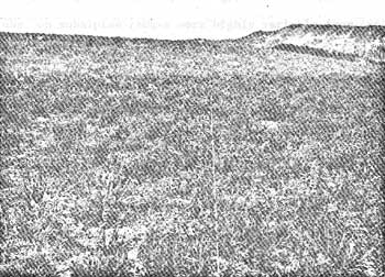
Photographs of ridgetop transect areas in 1959 show the vegetation had the appearance of a low canopy of perennial forbs. This is illustrated by the RT1 photo (Figure 12). Photos of slopes, as illustrated by the S4 transect (Figure 13), had the typical aspect of the herbland type, However, closeups of the different transect areas showed pocket gopher mounds were prevalent in the interspaces between larger plants. The appearance of ridgetop rather than herb land vegetation may have contributed to the general reports of subalpine ranges being in a deteriorated condition in 1959. Persons who constructed exclosures or visited sites reported that, in addition to the indicated heavy elk use and pocket gopher activity, Mormon crickets (Locustidae) and grasshoppers (Arididae) were abundant within the short vegetation on ridgetop areas.
 |
| Fig. 12. Ridgetop photo. |
 |
| Fig. 13. Herbland photo. |
Interpretations of elk effects on individual species could not be realistically made because the 100 3/4-inch loop hits on each transect did not give adequate samples. Differences between total hits on groups of species that were preferred spring and/or summer foods were examined as a possible indicator of relationships.
From 1959 to 1965, dandelion, agoseris, potentilla, aster, and fleabane species increased a total of 14.5 hits on the RT1 transect. Comparable increases on the RT2 and RT3 transects within the Red Creek exclosure were 12.5 and 19.0 hits. Totals for potentilla, aster, fleabane, slender wheatgrass, and mountain brome plants were 16.5 and 12.5 hits on the S4 and S5 transects. This compared with totals of 12 hits each for the S6 and S7 exclosure transects. The data from Red Creek suggest that elk did not prevent their more preferred forages from increasing on ridgetop or herbland sites and protection alone did not favor substantial increases in preferred food species. By contrast, the Chicken Ridge data showed the pocket gopher, which appeared able to cause decreases in either grass or perennial forbs, may be a major contributor to vegetation changes on subalpine ranges. The apparent recovery of ridgetop and slope vegetation on Red Creek after the gopher population high in 1959 would suggest that vegetation changes by gophers, with complementing influences from elk, Mormon crickets, and grasshoppers, were temporary.
Plant growing conditions, pocket gopher activity, and intensities of elk use on subalpine ranges were highly variable from 1962 through 1966. The measurements on or adjacent to elk bedding or loafing sites and close to exclosures show the animals maintained what could be considered biotic disclimaxes. Effects over subalpine ranges as a whole appeared to be limited to comparatively light use of current forage growth during the study period.
It seems certain that particular combinations of biotic and weather influences will periodically cause these subalpine ranges to appear in what could be interpreted as a deteriorated condition. These interpretations should be tempered with ecological considerations. Subalpine vegetation has evolved over long periods of time by natural selection processes. Selection pressures would have had to result in vegetation having the capacity to contend with the periodically harsh subalpine environment and native animal life. Since the subalpine areas studied were not being subjected to influences that could be considered unnatural, it seemed unlikely that their variable appearance or temporary vegetation changes represented a departure from natural relationships.
Other Areas
The effects of elk on vegetation and the general condition of subalpine ranges on the portions of Big Game Ridge south of Yellowstone Park have been variously interpreted. Beetle (1952) considered this area to be in "the poorest condition class." This classification may have partially resulted from interpretations that herbland vegetation should be predominantly grasses or sedges (Beetle, 1962). Anderson (1958) considered gullied upper slopes to be badly depleted, but recognized the presence of unstable soils. Croft compiled a report from an August 18-23 inspection trip in 1955 (Croft and Ellison, 1960). He concluded ". . . the destruction of vegetation and soil . . . is largely a result of excessively heavy use by elk," The report also suggest elk were responsible for flood damage and mud-rock flows.
The northern portion of Big Game Ridge inside Yellowstone Park was routinely covered during this study. Southern portions could be seen from the top of Chicken Ridge. These were visited for comparison purposes during late summer or fall periods. Aerial flights also sampled both areas. The subalpine portions of northern Big Game Ridge may have escaped an 1885 fire. Upper slope areas were covered by the most dense herbland stands encountered on the study area. Summer elk densities were higher, in relation to the amounts of herbland, than on other ridge areas.
Upper slope areas on the southern portion of Big Game Ridge were a series of sparsely vegetated drainage head gullies and slopes. Soils were derived from residual sandstone and shale formations. These drainage head conditions may have resulted from the 1885 or earlier fires removing dense herbland vegetation (comparable to that on northern portions) and later high intensity fall or spring rains causing gullying and soil losses. They may also exist primarily as a result of unstable or sandy soils occurring in a harsh drainage head situation and not have been caused by fire.
A distinct pioneer or post-fire type of perennial vegetation does not appear to have evolved in the subalpine zone. Annual forbs may serve as ecological equivalents until perennial vegetation again reoccupies sites. The establishment of dense stands of perennial vegetation on porous sandy soils may not be possible or may require an extremely long period of time on harsh ridgetop and upper slope sites at high elevations (9,500 to 9,800 feet). Actively moving clay soils will probably eventually stabilize and support a denser vegetation cover.
Drainage head areas on south Big Game Ridge and other portions of the study area commonly retained snowbanks into July. Vegetation within these was normally absent or very sparse. Such areas were snowfree in August and could be misinterpreted as illustrating elk effects. Scattered upper slope areas with stable soils and lower slopes had stands of subalpine vegetation comparable to the northern portions of Big Game Ridge and other Yellowstone areas.
 Top
Top
Last Modified: Tues, Jan 20 2004 10:00:00 pm PDT
http://www.cr.nps.gov/history/online_books/fauna8/fauna5.htm
![]()