|
The Pony Express Stations of Utah in Historical Perspective
|

|
THE STATIONS (continued)
Wheaton Springs (Winston Springs)
Utah No. 6 Contract Station
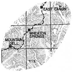 |
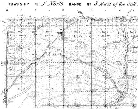
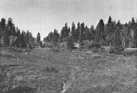
Location: SE1/4NE1/4 Section 5, Township 1 North, Range 3 East, Salt Lake Meridian. Eight miles from East Canyon. The information on the Wheaton Spring Station is limited to the cadastral record and recent on site—investigations. A spring and corral are shown on the 1881 GLO survey plat (See Figure 11). |
|
| Figure 11. 1881 Cadastral Plat - Wheaton Springs. (click on image for a PDF version) |
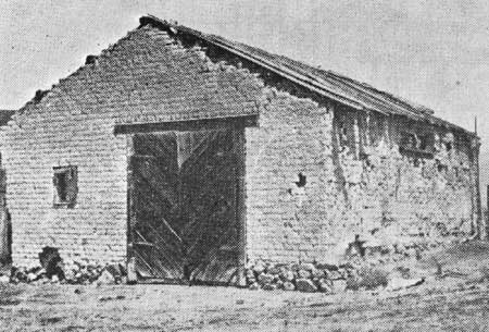
No evidence remains today (See Photo 8). Test excavations will be necessary to precisely locate the station site.
|
| Photo 8. Wheaton Springs Station (BLM photo 1978). |
Mountain Dale (Mountain Dell, Big Canyon, Hanks)
Utah No. 7 Contract Station
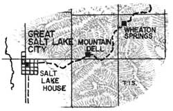 |
Location: NE1/4SW1/4 Section 33, Township 1 North, Range 2 East, Salt Lake Meridian.
Eight and three-quarter miles from Wheaton Springs.
A vandalized monument in the NW1/4 of the NW1/4 of Section 36 presently marks the location of the assumed station site. The daughter of George Edwin Little, Express rider, relates the following story which presents evidence suggesting the station site may have been located elsewhere.
One day father was bringing in the mail from the east to the station at Mountain Dell (Dale). There was a heavy snow storm came up, and crossing over Little Mountain, the snow became so heavy and deep that his horse gave out and he had to leave him. He took his pocket knife and cut the mall pouches open putting the mall inside his shirt. Then he broke trail over to Mountain Dell, arriving there about 3 o'clock in the morning. The next morning, he rode a horse bareback to Salt Lake and delivered the mail to the Old Salt Lake House which was the home station. Ephraim Hanks (station keeper), his stepfather, rode back up to the canyon next morning and brought in the horse which seemed none the worse for the ordeal. [25]
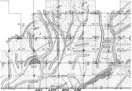
Upon checking the USGS quad map, it can be seen that Little Mountain Summit is west of the presently marked station site, in section 36. It should be noted that the roads do not go over Little Mountain, but do go over Little Mountain summit. The 1881 survey plat shows the currently marked location as Cook's house and barn. West of the summit, however, in Section 33 (See Figure 12) the surveyor records a cabin at the mouth of what is now named Freeze Creek. This site, incidently, is about equidistant between the Salt Lake House and Wheaton Springs. It should be also noted the name "Mountain Dale" appears on the 1861 Mail contract. Granted, that Mountain Dale has been a long standing name in its present geographic location, but could Mountain Dale, the name given to the Hanks station site, have been unknowingly changed by later historians and writers?
|
| Figure 12. 1881 Cadastral Plat - Mountain Dale. (click on image for a PDF version) |
Salt Lake House
Utah No. 8 Contract Station
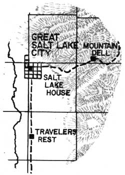 |
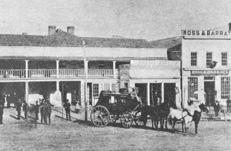
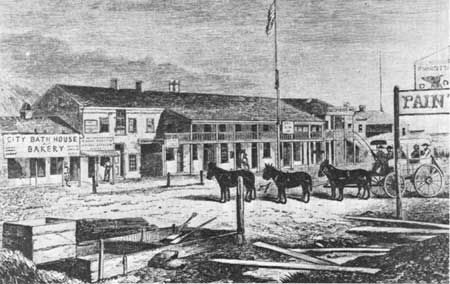
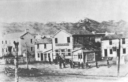
Location: NW1/4NW1/4 Section 6, Township 1 South, Range 1 East, Salt Lake Meridian. Nine miles from Mountain Dale. This station, similar in construction to Brigham Young's Beehive House, stood where the Salt Lake Tribune Building now stands, at 143 South Main (Figure 13). Because of recent street beautification, the monument has been moved to the south. According to Sir Richard Burton, the station was one of the better facilities along the Overland Trail for food and lodging. Horace Greeley and Mark Twain were among the guests (See Photos 9 & 10). |

|
| Figure 13. 1875 Cadastral Plat - Salt Lake House. (click on image for a PDF version) |
|
| Photo 9. Salt Lake House (Courtesy of the Utah State Historical Society). |
|
| Photo 10. Circa 1860 artists rendering of the Salt Lake House from Sir Richard Burton's "City of Saints" (Courtesy of the Utah State Historical Society). |
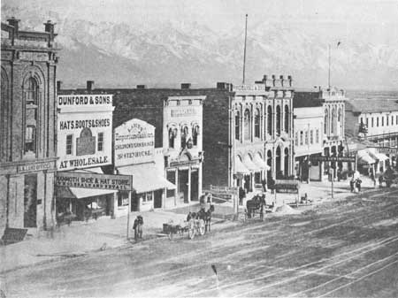
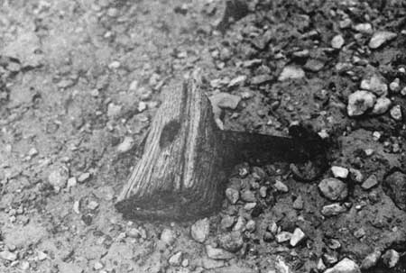
When the telegraph came to Salt Lake City in October of 1861, the first office was located on the northeast corner of First South and Main Street (Photo 11); about 1870 the office was moved (see Photo 12). The Batchelder's (Goodyear Patent) ramshorn as well as at least two types of glass insulators were used on the telegraph line (See Photo 13 and Figure 14). One of the glass insulators is plain and unmarked; the other is the Mulford and Biddle embossed helmet type.
|
| Photo 11. Salt Lake City's first telegraph office located on the northeast corner of First South and Main Streets (Courtesy of the Utah State Historical Society). |
|
| Photo 12. Circa 1870, the telegraph office was moved to the east side of Main street between First and Second South. Note the U.S. Land Office in the Godbe Building. Photo by Charles R. Savage. (Courtesy of the Utah State Historical Society). |
|
| Photo 13. Batchelder's "Ramshorn" insulators are constructed of metal and vulcanite Indian rubber (Goodyear Patent 1861). Such insulators were often preferred over glass since the Indians sought the latter for use in manufacture of glass beads, projectile points, etc. (BLM photo 1978). |
|
| Figure 14. Batchelder's hard rubber insulator (Goodyear's patent). |
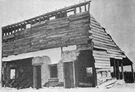
Trader's Rest (Traveler's Rest)
Utah No. 9 Contract Station
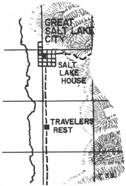 |
Location: Lot 2, Township 2 South, Range 1 East, Salt Lake Meridian. Nine miles south of Salt Lake House. Constructed of adobe, the station apparently was only used for a short time (See Figure 15). In later years, the structure was covered with wood siding and a false front and re-converted into a business (See Photo 14). More recently it served as a garage. |

|
| Figure 15. Travellers Rest. |
|
| Photo 14. Trader's Rest Station building after conversion to a business building and prior to being razed (from the Charles Kelly collection, Utah State Historical Society). |
Trader's Rest was located on State Street about two miles north-northwest of Union Fort. The area was called Lovendahl's Corner after Swen Lovendahl, an early settler. [26]
Rockwell's (Orin Porter Rockwell's)
Utah No. 10 Contract Station
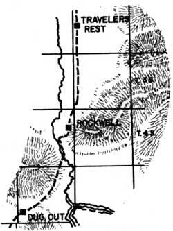 |
Location: SW1/4NW1/4 Section 15, Township 4 South, Range 1 West, Salt Lake Meridian. Ten miles south of Trader's Rest Station. Rockwell's Station was named after the operator Orin Porter Rockwell. Rockwell earlier served as Brigham Young's bodyguard (1830's) and was a Danite (member of the Mormon protection group, organized in Missouri to protect against terrorist activities). On September 9, 1850, Rockwell was appointed Territorial Marshall. The 1856 survey plat (Figure 16) shows the old road missing the location thought by some to be the station (just across from the prison). It plats a house and springs about three quarters of a mile south. This had been the location of Rockwell's Station. The 1901 survey shows a stable had been added (See Photo 15). |

|
| Figure 16. Rockwell's T. 4 S., R. 1 W., Sec. 14 1856 Survey. (click on image for a PDF version) |
|
| Photo 15. Stable at Rockwell's Station (from the collection of Joseph H. Porath; Courtesy of the Utah State Historical Society). |
| <<< Previous | <<< Contents>>> | Next >>> |
ut/2/sec2a.htm
Last Updated: 18-Jan-2008