|
BIG HOLE
Commemoration and Preservation: An Administrative History of Big Hole National Battlefield |

|
Chapter Four:
Administration under Yellowstone National Park, Early Years (1936-1956)
"History as Well as Scenery"
In June and July of 1933, under authority vested by the Federal Reorganization Act of 1933, President Franklin Delano Roosevelt consolidated all national parks, monuments, memorials, military parks, and eleven military cemeteries under Park Service jurisdiction. This consolidation almost doubled the number of areas in the national park system and marked a critical transition in Park Service history: the agency acquired a significant presence in the East, as well as the West, and assumed primary federal responsibility for the preservation and interpretation of America's cultural heritage. [1] Concurrently, New Deal emergency funding substantially in excess of regular appropriations allowed the Park Service to expand dramatically upon the infrastructure, staffing, and educational programs at many of the new sites. Through this concentrated and aggressive program of development, national monuments and other historic sites gained a degree of parity with the natural parks. As mandated and in a role that it embraced, the service turned to "history as well as scenery." [2]
The development of Big Hole Battlefield National Monument contradicts these general trends. The monument was western, isolated, and rarely visited. Increased funding and a heightened NPS presence offered little political advantage to an agency seeking to expand its appeal to a broad audience and its sources of funding to the eastern states. The monument was also thematically isolated from the Revolutionary War and Civil War sites that made up the vast majority of the 1933 acquisitions. Interpretation of eastern sites allowed the Park Service to take full advantage of public knowledge and interest, a rich body of literature, and the academic training and interests of those in the Historical Division of the Branch of Research and Education. In contrast, the Indian Wars remained poorly documented and poorly understood, not only by the general public but also by Park Service historians. [3]
At Big Hole, lack of knowledge of the details of the battle, the participants, and the larger war melded with discomfort with those facts that were known. Historian Hal Rothman argues that "the average American" easily understood the importance and recognized the value of Colonial Williamsburg, Gettysburg, the Statue of Liberty, and other popular eastern sites. In a process sped and underscored by Park Service focus on American achievement, these sites became "cultural validators," part of the "iconography of democracy." [4] In contrast, Big Hole Battlefield represented what Yellowstone Superintendent Roger Toll described as a discreditable chapter in American history, where even the bold drama and popular appeal of Manifest Destiny were unable to mask the tragedy of a pre-dawn assault on a sleeping village.
Other factors also conspired to check Park Service enthusiasm for Big Hole Battlefield. In order to protect the integrity of the park system from an onslaught of marginal properties, the Branch of Education defined three types of historic sites that properly belonged in the federal system: places that offered an outline of the major themes of American history; places with strong connections to the lives of famous Americans; and the locations of dramatic episodes in American history. [5] This question of significance and appropriate jurisdiction would greatly affect monument funding, interpretative efforts, and land acquisition during the early years of NPS tenure. In the absence of resolution, Big Hole would languish through the 1930s without a finalized master plan for comprehensive development and therefore without an effective claim to Depression-era emergency funding or to the labor force provided through the Emergency Conservation Work (ECW) plan. [6]
As the Forest Service worked with Yellowstone personnel to facilitate the transfer of authority and to devise an immediate course of action for better site development and interpretation, Superintendent Toll reported to Director Arno Cammerer that "the first question to be determined is whether or not this battlefield is properly classified as a national monument." While Toll maintained that the site represented an important chapter in the United States' treatment of western tribes, he lacked "sufficient data to determine whether or not the Big Hole Battlefield is one of the two or three most important sites of the Indian wars" and deferred to the National Park Service Historical Division, Branch of Education, to evaluate its national significance. If NPS historians found the site representative of one of the outstanding events of American history, Toll averred, then the NPS had an obligation to appropriate "sufficient funds . . . to maintain the area in a creditable manner." Two immediate needs were an expanded land base that would include the Nez Perce camp site as well as sufficient land for camping and parking beyond the battlefield proper and a seasonal custodian/ranger to maintain it. [7] If the Historical Division declined to assign national significance to the site, then Toll recommended that arrangements be made with the State of Montana for establishment of a state park. [8]
Toll died in an automobile accident soon after his visit to Big Hole Battlefield National Monument. Upon his death, the historical evaluation of the battlefield and the initiation of active Park Service administration stalled. In June 1937 (nearly four years after the transfer of authority to the Park Service), Yellowstone Superintendent Edmund B. Rogers and Assistant Regional Landscape Architect Howard W. Baker inspected the battlefield with Ranger Marshall Ramsey. Baker filed a report to the Chief Architect.
Baker was not surprised to find the area in considerable need of cleanup work. More dead trees had fallen and some of these deadfalls had destroyed sections of the wire and lodgepole picket fences that surrounded portions of the area. In contrast, the log museum and caretaker's cabin were in good condition. Ramsey reiterated the Forest Service's offer of the cabin to the NPS and Baker recommended that "these accommodations will serve very nicely for the present time." As for boundaries, Baker suggested that an NPS historian "familiar with Indian history" visit the area and make a recommendation. [9]
The following summer, Acting Regional Historian Edward A. Hummel visited the battlefield in company with Hugh Peyton, assistant chief ranger of Yellowstone National Park. (In 1938, Peyton served as Big Hole Battlefield National Monument's first seasonal ranger since the area's transfer to the national park system. [10]) Hummel and Peyton recommended boundaries for a minimum area of 200 acres and a maximum area that would include "practically all of the battlefield and all points of interest associated with the battle." Hummel and Peyton only hinted at the potential difficulty of acquiring private lands within the maximum area, stating that the minimum area was entirely within the national forest. [11]
During the winter of 1938-1939, NPS Director Arno Cammerer and his advisors determined that the battlefield lacked national significance and therefore recommended the more modest boundary expansion to the Secretary of the Interior. [12] As a result, on June 29, 1939, President Franklin Delano Roosevelt signed Presidential Proclamation No. 2339, expanding the monument boundaries from 5 acres to 200 acres, including "public lands within the Beaverhead National Forest . . . contiguous to the said national monument and . . . necessary for the proper care, management, and protection of the historic landmarks" (see Appendix A [13]). As defined by Cammerer and Hummel, the additional 195 acres provided the minimum acreage necessary for effective administration and incorporated "the major portion of the battlefield and a sufficient buffer strip to allow adequate protection and provide a site for utility buildings." The expanded acreage also included a spring within the east 495 feet of the northeast quarter of Section 23, providing an adequate water supply. [14] Counter to the Historical Division's recommendations for maximum land purchase, these 195 acres did not include the Nez Perce Encampment Area or a development site of sufficient size to support a new residential complex and headquarters building. Acting Secretary of Agriculture M. L. Wilson, on behalf of the Beaverhead National Forest, concurred in the transfer of land, noting that the proclamation would add "certain [if not all] essential historical features to the present Monument area." [15]
Despite Cammerer's decision, in a November 1939 report, Yellowstone National Park Resident Landscape Architect Sanford "Red" Hill (assisted by Yellowstone Chief Ranger Hugh Peyton and Yellowstone Assistant Naturalist W. E. Kearns) recommended that the newly defined 200-acre monument again be expanded to include an additional 200 acres of private land; these recommendations accorded generally with the original maximum boundary recommendations submitted to the Director by Regional Historian Hummel. [16] This acquisition would permit infrastructure development on a hillside south of the battlefield, allowing visitors a panoramic view of the battle scene and freeing the battleground "of all evidence of development." The land acquisition would also incorporate "the most important part of the battle," the Nez Perce Encampment Area, within the monument boundaries. Only through this inclusion, Hill argued, "could the real story be presented to the people." Failure to acquire the encampment and development sites and initiation of a development plan on the basis of the smaller 200-acre tract, Hill warned, would result "in a very poorly planned national monument" beneath the Service's standards of interpretation and development. [17]
Specifically, Hill had four recommendations. First, the government should purchase the Nez Perce Encampment Area and make it a focal point of interpretation. Second, the NPS should remove Forest Service structures from the area of retreat and retrenchment of the U.S. Army (the Siege Area); the past emphasis on this area, dating to the establishment of the soldiers' monument and continuing through the Forest Service's tenure, contributed to the false impression that the battle took place "on about an acre of land." Moreover, the Forest Service development threatened to "dominate the area" and afforded a poor view of the battlefield, hampering interpretive efforts. Third, the government should purchase the bluff overlooking the battle scene, south of the existing boundary, as a construction site for a headquarters building and residential complex. Finally, the NPS should reconstruct the Nez Perce village or encampment, based on careful research and first-hand information from Nez Perce veterans. Together these changes would "provide the complete story of the Big Hole battle in an interesting and logical manner [and] the necessary Government buildings and facilities needed to handle this area [would] become very insignificant to the whole picture." Former Yellowstone Park Historian Aubrey Haines reports that the owner of the Encampment Area facilitated implementation of the plan when it offered to donate the acreage to the National Park Service. [18]

|
| Boundary expansion proposal, 1939. This was the chosen alternative. |

|
| Boundary expansion proposal, 1939. This was the more expensive of two alternatives. |
Hill's recommendation that the Nez Perce village be re-created anticipated the NPS Interpretive Division's focus on reenactments and "living history dramatizations," both significant components of the system-wide interpretive program by the 1960s. It also represented the Park Service's early interest in memorializing Nez Perce participants in the battle, by encouraging and facilitating the predominantly non-Indian monument visitors' "imaginative entry" into the peaceful pre-attack Nez Perce camp site. [19]
By February 1940, the Branch of Plans and Design and the Historical Division developed a preliminary master plan based on Hill's recommendations. While Regional Director Allen agreed that the resulting plan was "the best . . . so far submitted" he reminded Thomas Vint, Chief Architect, Branch of Plans and Design, and Ronald F. Lee, Supervisor of Historic Sites, that their proposed Big Hole development plan ignored the plan of action approved by the Director, whereby the minimum acreage would be acquired in recognition of the site's limited significance. It also suggested a degree of development that would preclude eventual state management thereby compelling the NPS to assume "indefinite" responsibility for the battlefield. Despite an inclination simply to "remind the Region of the Director's instructions and plan of action and [request] that they comply with them without further elaboration," Allen instead deferred to Vint and Lee: "if either Mr. Vint or Mr. Lee consider the area of enough importance to follow the ideal plan of the technical representatives, the initiative must be taken by their Branches." [20]
If the Branch of Historic Sites or the Branch of Plans and Design assumed the initiative, they did so quietly and slowly. In his preliminary approval of the 1942 Master Plan for Big Hole Battlefield National Monument, Yellowstone National Park Superintendent Rogers confirmed that all development plans for the monument were to be "predicated on the decision to restrict all development within the existing boundaries of the area." Recommendations, however, "to extend the boundaries, as proposed by the Branch of Plans and Design and the Branch of Historic Sites to include the entire battlefield area" would remain a matter of record. [21]
Despite this apparent stalemate, debate over Big Hole Battlefield National Monument's boundaries continued to define all substantive discussions of monument development and interpretive efforts. In 1945, Region II Director Lawrence C. Merriam classified Big Hole Battlefield National Monument as a Class 2 area: "areas which need boundary revisions, and for which the information relating thereto is complete enough so that only minor field work, if any, is needed before recommendations can be prepared." Hummel and Hill's recommendations of six years earlier, Merriam argued, provided the information needed for expedient adjustment. Only a survey was "necessary in order to accurately establish the proposed boundary lines and ownership of the tracts involved." [22] Director Newton B. Drury, who had succeeded Cammerer in 1940, disagreed, citing the need for "studies necessary to thoroughly evaluate the historical significance of the area . . . before boundary studies could be resumed." Again the process stalled. [23]
The effects of this continued disagreement and continued study on Big Hole development were dramatic. The New Deal era was one of unprecedented growth of the national park system. Under the auspices of the Emergency Conservation Work (ECW) plan, five federal programs provided an abundance of low-cost, skilled and unskilled laborers to federal land-management agencies. By 1940, emergency appropriations to the Park Service totaled $218 million, almost twice the $132 million in regular appropriations. NPS staffing increased accordingly, with a dramatically expanded cadre of historians, museum specialists, and landscape architects charged with developing a comprehensive vision for each unit and integrating that vision with specific plans and specifications for development. In the absence of a comprehensive development plan, Big Hole Battlefield National Monument was unable to capitalize on these opportunities. Seasonal ranger Warren L. Anderson alluded to this failure in 1952, when he complained that the primary directional sign to the monument appeared "homemade, crude . . . National Monuments generally have such signs finished in rustic and emplaced in cement and stone." The pattern of neglect continued through Service-wide World War II restrictions on construction materials, manpower, and visitation. In 1950 Yellowstone Superintendent Edmund Rogers reported that "since taking over the area in 1933 the Park Service has not been able to make any important developments and has relied on the Forest Service for many favors." [24]
A master plan for Big Hole Battlefield was not approved until 1962 and would not be implemented until 1963. In the interim and in the absence of clear directive, Yellowstone National Park provided a "seasonal ranger historian on a short-term basis" and miscellaneous technical support as needed. [25] To frequent requests from visitors for better signage, an expanded museum facility, improved site interpretation and curation, and increased protection of the Encampment and Twin Trees areas, the Park Service consistently replied: "at present there are not sufficient funds available to do anything in this area other than to keep it clear and in as good physical condition as possible. The National Park Service will continue to do all it can to prevent vandalism and protect the historical features of the area." [26] The impact of disagreement of the merits of the site and the inevitable impacts upon funding and physical development went unstated. This stop-gap response defined the first 20 years of NPS administration.
Administration and Physical Development
From 1939 until 1963, the responsibility for keeping the national monument clear and in good condition fell to the seasonal ranger, generally assigned to duty in early June and relieved of duty in mid-September. The ranger reported monthly to the Yellowstone chief ranger's office, detailing weather conditions and fire danger; maintenance efforts; assistance from "cooperating agencies"; naturalist services (interpretive efforts); travel patterns; and miscellaneous special projects, including museum acquisitions. While the chief ranger's office officially solicited applicants "qualified to advance the historical research and interpretive program for the monument," it also recognized the ranger's more immediate responsibility to complete routine maintenance tasks "in an excellent manner." [27] In a representative letter, Yellowstone Acting Superintendent Fred T. Johnson informed new hire Warren L. Anderson of the conditions of his employment. Anderson would find an old "but comfortable" house, equipped with a shower but without electricity or phone service. The nearest phone was at the Wisdom Ranger Station and could be used during Anderson's weekly trips to town for supplies, or as needed for administrative tasks. Anderson would be responsible for all public contact work with the monument visitors and also for the care of the museum collection, and the general maintenance of the area. (Much of his time, Anderson would soon learn, was spent painting signs, digging latrine pits, and pulling weeds from the trails.) All questions were to be directed to the Yellowstone chief ranger's office. Anderson could also expect "occasional inspection trips" during the summer months. Despite the routine nature of many of the tasks and the ultimate authority of the chief ranger's office, the Park Service considered the assignment "an important one since the ranger is largely on his own and an experienced man is selected who has had field experience and is thoroughly dependable." [28]
| 1938 | Hugh Peyton |
| 1939 | Floyd Henderson; Julius Roller |
| 1939-40 | Julius A. Roller |
| 1941 | Anton Nisson; Walter Kittams |
| 1942 | Seasonal Ranger Ralph Scudder |
| 1944-45 | Samuel M. Beal |
| 1946 | Dan S. Nelson |
| 1947 | Michael Sedar |
| 1948-50 | Fred W. Warders, Jr. |
| 1951 | W. Ted Hackett |
| 1952 | Warren L. Anderson |
| 1954 | Michael Sedar |
| 1955-58 | Charles E. Martin |
| 1959 | Robert L. Burns |
With the exceptions of Samuel M. Beal, Fred W. Warders, Jr., and Michael Sedar who each served for two seasons (1944-1945; 1949-1950; 1947 and 1954, respectively), the seasonal ranger position provided a rapidly revolving door to promotion and other assignments within the National Park Service. The lack of continuity was most obvious each spring, when the new rangers devoted time to "a study of all historical events pertaining to the Battlefield." Suggested reading lists were drawn from Yellowstone history files, a compilation of "references to the Nez Perce Indians, Chief Joseph, and the Big Hole National Monument," collected in the years following the 1933 transfer to the Park Service. [29]
Beaverhead National Forest personnel assisted the rangers by providing access to Wisdom District historical and administrative files. Additional "favors" from the Forest Service included use of the telephone line at Wisdom, storage space during the winter months for the national monument's limited artifact collection, and seasonal access-road maintenance and improvements. The Park Service also frequently benefited from loan of a truck, office supplies, and short-term laborers as needed. It responded with both frequent and effusive thanks for the Forest Service's "manifestations of interest and good will" and also with a long-term commitment to data collection at the USFS weather station constructed on the monument grounds. [30] In hopes of a monument of which they "could be proud" and in continuation of a policy first articulated at the time of transfer to the Park Service, Beaverhead National Forest Officials "help[ed] things along in every way" that did not conflict with administration of adjacent Forest Service lands. [31]

|
|
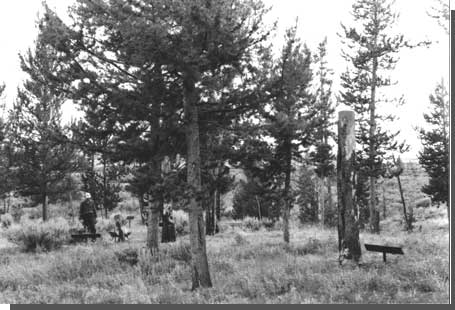
Log museum built by the U.S. Forest Service and inherited
by the National Park Service. Courtesy National Park Service, Big Hole NB, n.d. |
Visitation
Throughout the 1940s and early 1950s, seasonal rangers estimated annual visitation at between 2,500 and 4,000, or "ten cars on Sunday and an average of three on week days." Rangers described the majority of visitors as local residents, living within a radius of 50 miles and generally interested "in the history of the West and the struggle between the Indians and the white settlers for supremacy." Their visits lasted approximately one hour, during which time they visited with the ranger, quickly toured the small museum, and walked the trails through the Siege Area. Substantial numbers were also fishermen and hunters, drawn to the Beaverhead National Forest and to the North Fork of the Big Hole River and its tributaries Ruby and Trail creeks. "As there was no admission fee charged and no regularly operated checking station for the area" these estimates of visitor numbers and demographics were based upon voluntary visitor registration and approximate counts. And they did not include early and late season visitation, when the NPS maintained no presence at the battlefield. In June 1955, for example, seasonal ranger Charles E. Martin reported that "appearances indicated that there were many visitors even before the Monument opened [on June 14]." Visitation increased through the early 1950s, a trend that the seasonal rangers attributed to increased "organized tour" patronage by school and fraternal groups and to improved all-season roads to the monument that not only facilitated access by an increased number of out-of-state tourists, but also extended the visitor season through the spring and fall months. [32]

|
| Big Hole Road, Bitterroot National Forest. The narrow, twisting road over Gibbon Pass limited visitor use of Big Hole Battlefield National Monument in the 1940s and 1950s. Courtesy U.S. Forest Service, n.d. |
| 1938 | 2,345 |
| 1939 | 3,875 |
| 1940 | 3,875 |
| 1941 | 4,000 |
| 1942 | 0 |
| 1943 | 0 |
| 1944 | 1,190 |
| 1945 | 1,576 |
| 1946 | 2,462 |
| 1947 | 2,688 |
| 1948 | 2,941 |
| 1949 | 3,000 |
| 1950 | 3,272 |
| 1951 | 4,180 |
| 1952 | 4,644 |
| 1953 | 5,535 |
| 1954 | 6,300 |
| 1955 | 5,100 |
| 1956 | 6,300 |
Through the 1950s, local organizations also assumed responsibility
for monument publicity, publishing hours of operation, travel
conditions, and synthesizing details of the battle in local newspapers.
They also appear to have assumed at least partial responsibility for
directional signs to the isolated site. In 1952, W. M. Stone, Secretary
of the Beaverhead Chamber of Commerce, informed Seasonal Ranger Anderson
of placement of a road marker on the Bitterroot-Big Hole road, 27 miles
from the battlefield. The sign "was ordered and paid for by the
chamber," which hoped to place additional markers in time for the 1953
season. [33] Yellowstone Chief Naturalist
David Condon encouraged this assistance, arguing that the signing of the
approach roads was properly the responsibility of regional civic
organizations who realized the most economic benefit from increased
visitor use. [34]
Those who successfully located the monument complained "consistently" of the lack of camping and picnicking facilities and the limits to the interpretive signage and museum collection. These visitors were also cited in monthly reports as having voiced interest "in the full details of the action that took place" and having "express[ed] regret" that the Nez Perce Encampment Area was not included within the monument boundaries so that a complete picture of the battle could be reconstructed. These paraphrased criticisms suspiciously mimicked the chief ranger's office's position on the value of boundary expansion. It is not clear, however, whether the monthly reports were written in deliberate attempt to support and substantiate existing management goals or whether public understanding of the battle and concern over its proper presentation drove official NPS interpretation and land-acquisition efforts. [35]
Interpretation
Within the confines of this limited land base, the Park Service attempted to expand upon the interpretive presentation and museum collection. Both efforts focused on the need to avoid a myopic presentation of the battle, either as geographically imposed by the emphasis on the Siege Area or as imposed by a thematically and temporally limited artifact collection. Although there is little documentary evidence of a formal plan for interpretive development, Yellowstone personnel, including the Chief Ranger, the Assistant Chief Ranger, the Chief Naturalist and the Resident Landscape Architect, directed all curatorial and interpretive efforts (with technical support and direction from the Branch of Historic Sites and the Branch of Interpretation).
In 1941, Resident Landscape Architect Frank Mattson urged that the site be interpreted not as Custer Battlefield was interpreted, with focus on the immediate military details, but rather as "one event in a chain of events; a bead on a chain of beads." This analogy effectively described not only historically related events, but also a geographic linkage of historic sites, most notably Big Hole Battlefield; Bannack, Montana; Virginia City, Montana; and Yellowstone National Park. Together, the chief ranger's office maintained, these four sites in southwestern Montana, roughly linked by State Highway 91, allowed the NPS to interpret "the story of the ejection of the Indian and the colonization of the West." [36]
At Big Hole, effective implementation of Mattson's recommendations demanded significant modification from the "physical planning standpoint." Most obviously, this entailed wholesale removal of facilities from the Siege Area "where the [visual and interpretive] picture is materially restricted." It also required modification to signage, interpretive text, monumentation, and ranger presentation. [37]
In 1941, the NPS distributed a brief four-page leaflet documenting the history of the Nez Perce flight and of the Battle of the Big Hole. Through inclusion of maps and panoramic view photographs, the brochure was also designed to expand upon visitors' visual understanding of the progression of the battle and therefore to mitigate the closed view provided at the siege site. [38] With minor revisions to historic text but without revision of interpretive focus, this leaflet was reproduced until 1955.
The 1955 brochure folder led with "BIG HOLE BATTLEFIELD NATIONAL MONUMENT, Scene of tragic battle of the Indian Wars of the 1870's that were part of the winning of the American West" and followed with description of "one of the more dramatic and tragic episodes during the long struggle in the United States to confine the Indians to the ever-diminishing reservations and to force them off the land wanted by the whites." Although the national monument was first established, the leaflet noted, "as a memorial to the soldiers who risked and gave their lives here," it also served as a "memorial to the fortitude of the Indians." [39] This tacit attempt at Big Hole Battlefield to present the story through both education and commemoration is representative of the challenge facing the Park Service – to develop a site "where people came to be informed, not as shrines where people came to worship." It is also representative of the demands and expectations of those who visit sites of violent conflict. "Commemoration," NPS historian Robert Utley notes, "has always been a powerful motive, perhaps the most powerful, for preserving historic places. People approach these places not only as vestiges of the past, as vehicles for enlightenment, but also as shrines, as temples for veneration." [40] At Big Hole Battlefield National Monument, rangers reported, local residents "return[ed] year after year as they would to the graves of their ancestors." Within the constraints of the confined geographic boundaries and the less tangible emotional boundaries imposed by visitors' efforts to secure the battlefield as sacred ground, the Park Service attempted to present the historical intricacies and the military details of the battle and of the era in a balanced manner.
The brochure formed only one component of this educational program. Rangers "contact[ed] personally as many of the visitors as possible," conducting them through the site, "answering questions" and "telling stories of general historical interest." Interpretive trails, developed during the USFS administration yet reconstructed and maintained by NPS personnel, included trails leading from the museum to the Siege Area and the "old soldier trail" leading to the howitzer pit above and outside the boundaries of the monument. In contrast to the view provided at the museum site and forested Siege Area, the cannon pit offered "an excellent view of the battlefield and the valley."" [41]
The walking tour was augmented with a series of signs, marking known points of conflict. Through the early 1940s, the Park Service manufactured and placed 75 "rustic" interpretive signs, which differed from the USFS black and white signs in style but do not appear to have differed in text: in 1944 Ranger Beal requested additional "rustic-style" signs, while quoting from USFS interpretive efforts. As late as 1946, Yellowstone Chief Ranger Maynard Barrows recommended development of a sign program because "many of the old markers are misleading in text."" [42]
The most substantive revision to the USFS signage program was not realized until the 1950s. In 1953, after 14 years of documented and confirmed visitor confusion "that the Nez Perce were encamped on and all fighting occurred in the area known as the battle siege area," seasonal ranger Anderson lobbied for installation of an overlook marker on the brow of the hill overlooking the Nez Perce Encampment Area." [43] As modified by the Yellowstone chief park naturalist and as approved in 1955, the sign read:
Just beyond the willows is the meadow where the Nez Perce Indians were camped at the time of Col. Gibbon's surprise attack at dawn, August 9, 1877. No distinction between women, children, and warriors was made by the troops. Within 20 minutes the Indian camp appeared to be in possession of the soldiers. The Indians quickly recovered from their shock and soon made the soldier's position untenable. Gibbons ordered a retreat to this wooded point where the troops remained under siege." [44]
Memorialization of the Indian dead proved as difficult as presentation of the "whole picture" within an inadequate land base. Soon after the 50th anniversary of the battle, Ranger in Charge Ted Hackett noted a small stone monument erected without the knowledge or the permission of the National Park Service. The wording on the monument, Hackett argued, suggested that the monument was "erected or cause [sic] to be erected by indians [sic] or an association sympathetic with the indians [sic]." Regional Historian Merrill J. Mattes was certain that Mr. Thain White of Dayton, Montana, had sponsored the monument. White had assisted McWhorter in the staking of both the Bear's Paw and Big Hole battlefields in the 1930s and had written on the Nez Perce flight." [45] In December 1950, White informed Mattes that he
wished to put my little bit of work toward the future keep of that ground; which is to mount a bronze tablet about 8 by 10 inches in size saying this: 'In memory of the Indian infants, women, old men and children who were killed and wounded near this battlefield, August 9, 1877.'
Mattes, although "expressing sympathy for the desire to memorialize the indian [sic] victims" informed White that any plans for monumentation would have to be reviewed by Regional Director Howard Baker. In placing the monument surreptitiously, White had disregarded this procedure. Despite the fact that White had violated federal regulations, Acting Regional Director John S. McLaughlin advised that the monument be left intact, pending formal justification for the memorial, its design, and its text, and subsequent approval by the Director. The Park Service was aware of the public-relations hazards inherent in public dispute over the monument placement and text and also of the need for increased recognition of the Nez Perce." [46] Officially unsanctioned, the monument remained in place until the 1980s when it was removed to the museum and presented as a relic of historic attempts to commemorate the Indian dead." [47]
Lack of a coherent and defined management plan and interpretive program is suggestive not only in the paucity of management documents and in the reuse of USFS signage, but also in the lack of fanfare for the 75th anniversary of the battle. In late July 1952, Seasonal Ranger Warren L. Anderson reminded his immediate supervisor, Assistant Chief Ranger Stanley McComas, that August 9 was the 75th anniversary of the Battle of the Big Hole. "I wonder," he wrote, "if there are any plans for the publicity of the anniversary?" Anderson recommended submittal of a "broadside" to papers within a hundred mile radius, "especially to those in the Bitterroot Valley."" [48] No response from the chief ranger's office appears in the record.
Curation
The Park Service did not formally establish guidelines for collection acquisition, care, and use until the 1967 publication of the Museum Handbook. As established in the handbook, a "well-managed collection" met five basic criteria: "its specimens are selected purposefully, they are readily available for study, they are well preserved, they are accompanied by adequately organized data, and they are used to their potential in the park program." Prior to the 1960s, however, NPS curators generally had the advantage of a clear and formal statement of a unit's natural and cultural significance as defined in the enabling legislation. Beginning in 1925, when Director Mather restricted the subject matter of park museum collections to the park story, and as formalized in a 1939 policy memorandum establishing the scope of museum exhibits, the Service defined unit significance (whether natural/geographic or historical/thematic) as the foundation criterion for all acquisition efforts. At Big Hole Battlefield, acquisition efforts therefore closely followed discussion over the significance of the site. Funds and formal guidelines for the more prosaic tasks of purchase, care, and presentation, proved more difficult to secure." [49]
In 1944 and 1945, Seasonal Ranger Samuel Beal made the first concerted effort to collect artifacts for the monument museum. Beal "barraged" newspapers in Dillon, Butte, Anaconda, Deer Lodge, Hamilton, Darby, and Salmon with requests for information and donations of artifacts related to the battle specifically, to Nez Perce culture in the second half of the 19th century, and to western military regiments. Yellowstone park personnel, including Chief Ranger Maynard Barrows and Chief Naturalist Max Bauer, supported this effort, providing a truck "for the purpose of making these collections," display cases designed by Yellowstone staff, "some funds for expenses," and (belatedly) a lock for the museum door, which until 1947 was nailed shut during the unmanned winter months." [50] Bauer directed Beal to accept anything "that will help tell the story of the conflict," including military and Nez Perce artifacts from the general period of the battle. Upon completion of the collection effort, Beal had acquired a number of guns either used in the battle or representative of those that would have been used, empty shells and miscellaneous Nez Perce artifacts collected at the battlefield site and also from the larger Big Hole and Bitterroot regions. During the winter when the monument was closed, District Forest Ranger, Earl M. Walton displayed part of the collection at the Wisdom Ranger Station. Additional pieces were displayed at the Basin Mercantile Company and the Wisdom Public Library. [51]
Management of Cultural and Natural Resources
From the early years of Park Service administration at Big Hole Battlefield National Monument rangers integrated cultural- and natural-resource management. In 1947, the Park Service prohibited grazing within the monument boundaries. "In an area of 200 acres," Chief Ranger Barrows argued, "it seems that all grazing should be prohibited if we are going to preserve original conditions" – as they defined the cultural rather than the historic scene. [52] Efforts for further restriction continued through the 1950s, with continued (and unsuccessful) attempts to fence the monument "as a protection against cattle grazing in the surrounding forest. Much damage has been noted, not only to the area in general, but to the battlefield in particular."
|
| Siege Area. Photo by George A. Grant, July 30, 1951. Courtesy National Park Service, Big Hole NB. |
Park Service officials continued to debate the merits and advisability of visitor and administrative facilities that encroached upon the Siege Area, threatening physical integrity and disturbing the historic scene. Similarly, they resisted the frequent requests for expansion of campground and picnicking facilities, arguing that the battlefield was of historical rather than recreational importance, and that the Park Service should encourage visitors to seek camping and picnicking facilities on the Forest Service land that adjoined the monument to the east and west. Facilities remained limited to a small six-unit campground dating to the Forest Service tenure. This campground was later determined to be inconsistent with the master plan for development and was removed. [53]
Beyond the land base, cultural resources recognized and protected by the Park Service were limited to the lodgepole pine, riddled with bullets during the prolonged siege of the entrenched soldiers and savaged by the pine beetle blight of the 1910s and 1920s. In 1935, Forest Service officials "topped" the dead and dying bullet-scarred trees, creating a false and unhealthy natural environment while attempting to preserve cultural relics. By the 1950s, these trunks, most as tall as 10', were also collapsing. "The most urgent of all recommended projects," wrote Seasonal Ranger Ted Hackett, "is the preservation of the numerous standing tree trunks that are the remains of the trees which stood during the battle. These bullet-scarred tree trunks are one of the few evidences of the historic battle, and their presence creates an atmosphere that takes the visitor back to the time of the battle." In an effort to preserve the trunks, the Park Service cemented the root bases. While these efforts preserved the trees as artifacts, they also created unhealthy and unnatural forest conditions and a visual scene markedly different from that at the time of the battle. By the 1980s, the Park Service and Forest Service would cooperate on "reconstruction" of the Siege and Horse-Pasture areas to more natural and historically accurate growth patterns. [54]
Transition to Mission 66
In September 1949, while en route between Yellowstone National Park and Big Hole Battlefield National Monument, Assistant Chief Ranger B. R. Finch "was interested to find" that 18 miles of the road between Divide and Wisdom had been oiled and surfaced. An additional 18 miles, he learned, were to be surfaced by the spring of 1950. Soon, a new, paved, all-season highway would pass directly west of the national monument, connecting Wisdom with the Bitterroot and Missoula valleys and placing the monument on a primary thoroughfare between Glacier and Yellowstone national parks. "If and when such a highway is constructed," Finch noted, "the present improvements at the monument will be entirely inadequate to withstand the impact of increased visitor use . . . [The battlefield] will not remain an isolated area visited only by a few people during the summer months."
Specifically, Finch noted that the present parking area would accommodate only 20 cars. Enlargement of the parking area was not feasible without expansion of the monument boundaries. Second, if the monument became accessible year round, a permanent ranger position would have to be established; increased personnel would require increasing housing facilities on an expanded administrative site. Finally, expansion of the land base for purely administrative reasons provided an opportunity to acquire additional land of historical significance.
For years, the adequacy of 200 acres to effective and accurate interpretation had been debated. The adequacy, however, of existing space and infrastructure to the logistical demands of a high volume of visitors had never before been at issue. Despite this changing impetus for a "reorientation of . . . thinking as to boundaries, development, and future disposition," [55] Finch's final recommendation echoed Superintendent Toll's advice of fourteen years earlier. "Unless the Park Service is willing to make the necessary improvements, it would seem logical to turn the area over to the State of Montana." [56]
In response to Finch's memorandum, Yellowstone Superintendent Rogers assigned Regional Historian Mattes, a representative of the Landscape Division, and Finch to yet another comprehensive evaluation of the national monument's historical significance, current conditions at the site, and likely impacts of the new highway development. Armed with this data, Merriam hoped to achieve "general agreement" on a "definite program of action." [57]
Mattes, Yellowstone Resident Landscape Architect Mattson, Finch, and Yellowstone Chief Naturalist David Condon visited the battlefield on September 14, 1950. In response to the visit and subsequent study, and with the concurrence of the Yellowstone Superintendent and Region II officials, this team reiterated that the battlefield was representative of a phase of western history that had gained significance with the passage of time and that it was suitably located and sufficiently endowed with elements of high drama to interpret that story. Paraphrasing Mattes, Superintendent Rogers wrote:
It is true that the Big Hole Battlefield National Monument up to the present time has been a marginal area in respect to its use by the public but it actually is the historic site where the interpretation of the story which encompassed much of the West can be told. For this reason we think to round out the National Park Service preservation of significant western historical areas and to best tell the western Indian story. [58]
Still others remained skeptical that the battlefield had that much merit. In 1954, despite Mattes "comprehensive evaluation," Big Hole battlefield was included in a report of the Advisory Board on National Parks, Historic Sites, Buildings, and Monument's Survey Team charged with identification of Park Service units of state rather than national significance. Big Hole Battlefield was one of 7 "substandard" properties proposed for Congressional disestablishment. [59] In the wake of the Survey Team's report, five national monuments and a recreation area were transferred by act of Congress from the National Park Service to their respective states or to another federal agency. Two of the units had been inherited from the Department of Agriculture or the War Department in 1933 and had therefore not been subjected to prior NPS evaluation of their appropriate place in the Park Service system. In every case, both the National Park Service and the receiving party supported the transfer of authority and public and political opposition was minimal. [60]
|
|
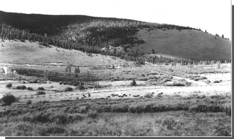
View of battlefield and horse pasture on Battle Mountain.
Note the water flume trestle and the grazing cattle. Photo by George A.
Grant, July 30, 1951. Courtesy National Park Service. |
In company with these divested sites, Big Hole Battlefield National Monument was an inheritance from the U.S. Forest Service and the War Department. Historically, the isolated site had received few visitors (restricting the impact of interpretive efforts). In contrast, however, to the divested units, local and Park Service response to the proposed action was immediate and a strong argument had been made for national significance. Montana's congressional delegation, Governor Hugo Aronson, and the Beaverhead Chamber of Commerce protested, noting in part that "the battlefield is one of the most important tourist attractions in the area." Mattes, Rogers, and Baker also formally recommended to the Director that the monument be retained in the national park system, on the basis of its important association with western expansion. [61]
By November 1955, the immediate threat of disestablishment had dissipated. Yellowstone Superintendent Rogers reported that "now that the status of the monument has been established, it is imperative that plans for development and protection be made." These boundary recommendations were presented in Big Hole's first Mission 66 prospectus. Roughly defined, they included purchase or administrative transfer of the Nez Perce Encampment Area, the Howitzer Capture Area, and the Horse Pasture/Twin Trees Area (excluded from Hill and Mattson's 1939 maximum boundary recommendations), and adequate land for "public use and orientation from which visitors may obtain a panoramic view of the entire battlefield." [62]
Finally, in October 1959, four years after Rogers reported the status of the monument secure, the Advisory Board on National Parks officially recognized the national historical significance of the monument, under the subtheme "Military and Indian Affairs" of Theme XV, Westward Expansion and Extension of the National Boundaries to the Pacific, 1830-1898. Approval of a final development prospectus and congressional revision of the boundaries, based upon this formal determination of national significance, dominated the years between 1959 and 1963.
| <<< Previous | <<< Contents>>> | Next >>> |
adhi/chap4.htm
Last Updated: 22-Feb-2000