Cameron Creek Trail

 
Upper Cameron Basin
Upper Cameron Basin from Cameron Creek

Jim Patterson

Description
Trail Conditions
Camping
Special Concerns
Safety
Map
Photos


Notices:

  • Higher sections of this trail are subalpine and require bear canisters. The trees in this area are too small to properly hang your food.
 

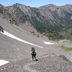
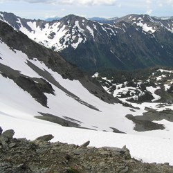
Description

Ecosystem type: Montane forest and subalpine meadow
Trail tread types: Low maintenance
General elevation trend: Moderate to steep
Unique features: Engleman Spruce, high country meadows
Level of difficulty: Moderate
Distance: 7.1 miles from Three Forks to junction with Cameron Pass Trail
Elevation change: 2100 feet to 4200 feet
Best Season: Late June through October


Camping

Permits/Reservations: For the most up to date information on how to obtain a Wilderness Permit, visit our Wilderness Backpacking Reservations page.
Food Storage Method: Bear canisters are required in the subalpine high country where food cannot be hung at least 12 feet high and 10 feet out from the nearest tree trunk.
Campsites: Three Forks, Lower Cameron, Upper Cameron
Toilet Facilities: None. Bury waste 6-8" deep and 200 feet from water sources and campsites. Please pack out toilet paper.
Water Source: Cameron Creek and nearby streams. Always boil, filter, or chemically treat your drinking water to prevent Giardia infection.
Stock: Allowed. See Stock Use for more information and check our Trail Conditions page to see if the trail is currently stock accessible.


Special Concerns

Leave No Trace: Practice Leave No Trace during your stay to help protect park resources. Camp in pre-existing bare ground sites only.
Fires: Fires are not allowed above 3,500 feet.
Wildlife Precautions: Properly secure your food to protect the wildlife and yourself.
Safety: When traveling on snow, bring an ice axe and know how to use it.


Safety

  • Always carry the 10 Essentials: map, compass, flashlight, knife, matches, nylon cord, extra food and water, and rain gear with warm clothes.
  • Map & compass navigation skills may be necessary in places along this trail. Snow may cover higher reaches of this trail in any season, so know how to navigate without a trail for guidance.
  • Let someone know where and when you are taking your hike. Make emergency plans for them to follow if you do not return.
  • Watch the weather before and during your hike. Storms move quickly. Always check weather forecasts before your trip and watch the weather closely during your trip.
 
Cameron Pass
Summer view of Upper Cameron Basin and Cameron Pass.  This steep section of scree can be dangerous.  The north side of the pass is often icy until August. Crampons, ice axe, and rope are often necessary to traverse safely.
 
Cameron Pass with snow looking North
Cameron Pass with snow looking North. An ice axe and crampons were required to traverse the steep north side of the pass when this photo was taken in early July.

Jason Bausher


Last updated: October 19, 2023

Park footer

Contact Info

Mailing Address:

600 E. Park Avenue
Port Angeles, WA 98362

Phone:

360 565-3130

Contact Us