Shown are the survey trips, with names of clusters to be surveyed on each trip, along with the number of days (including the training day) that each survey trip is expected to take and the relative difficulty of the trip. An overview of all the clusters can be found on the KML file map. This is a Google earth map and you must have Google Earth loaded on your computer for this to work.
Survey Trip Comparison
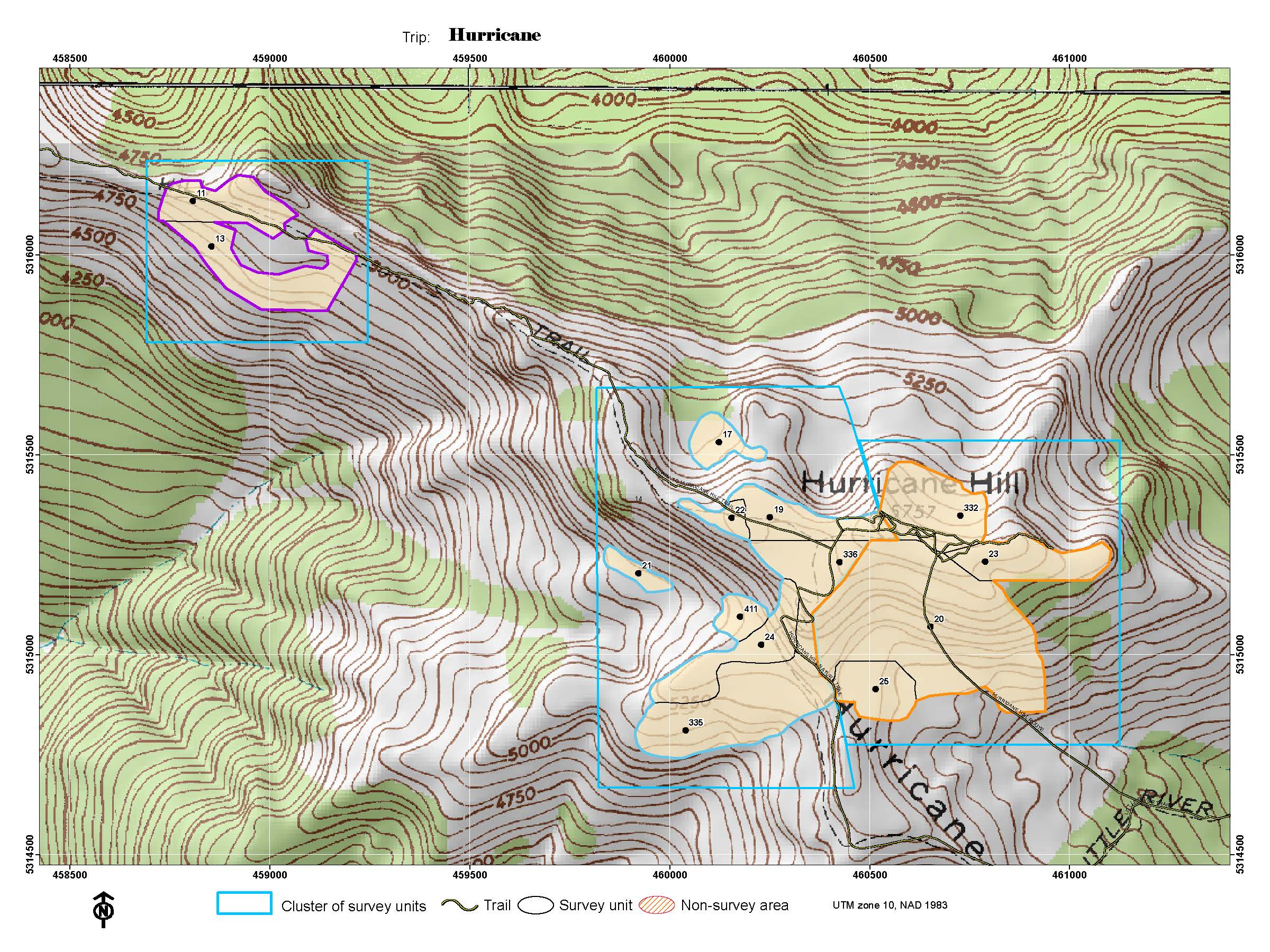
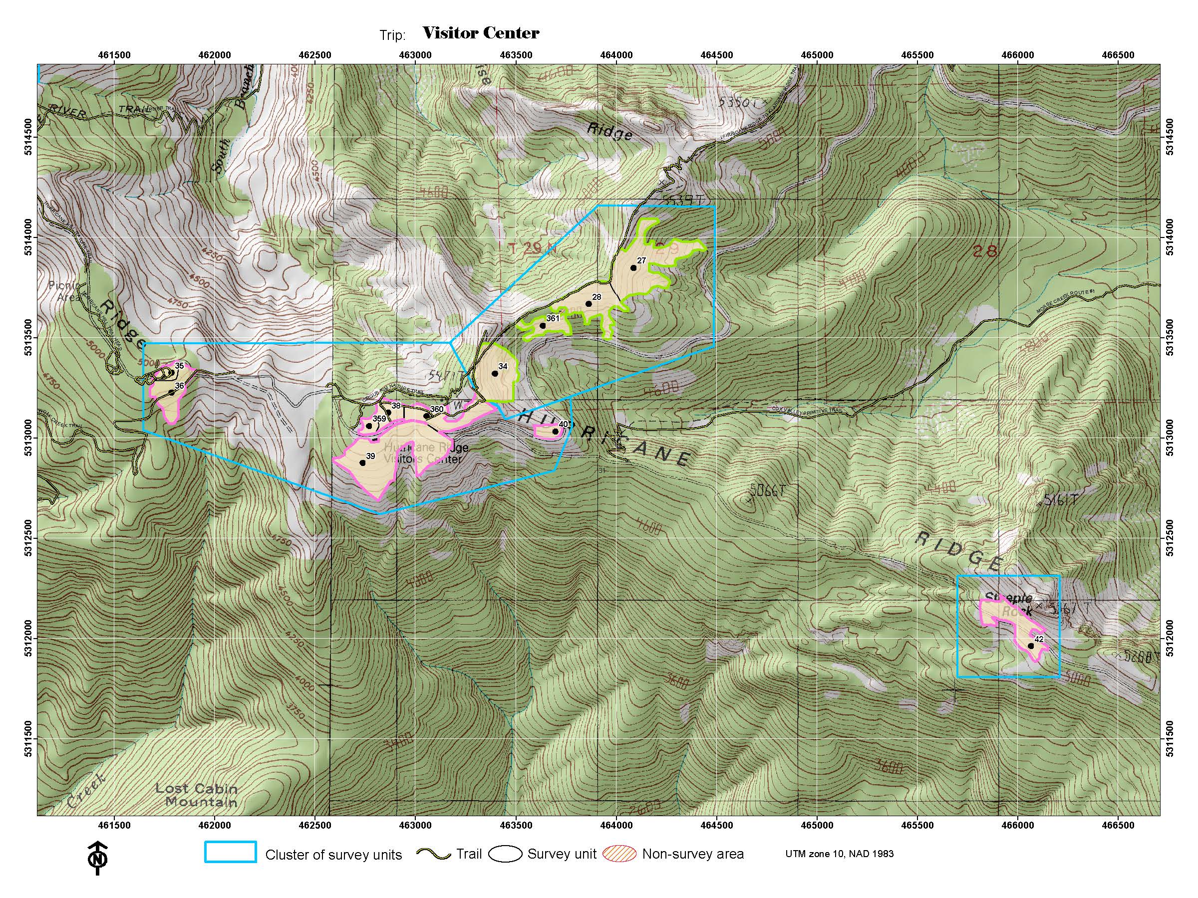
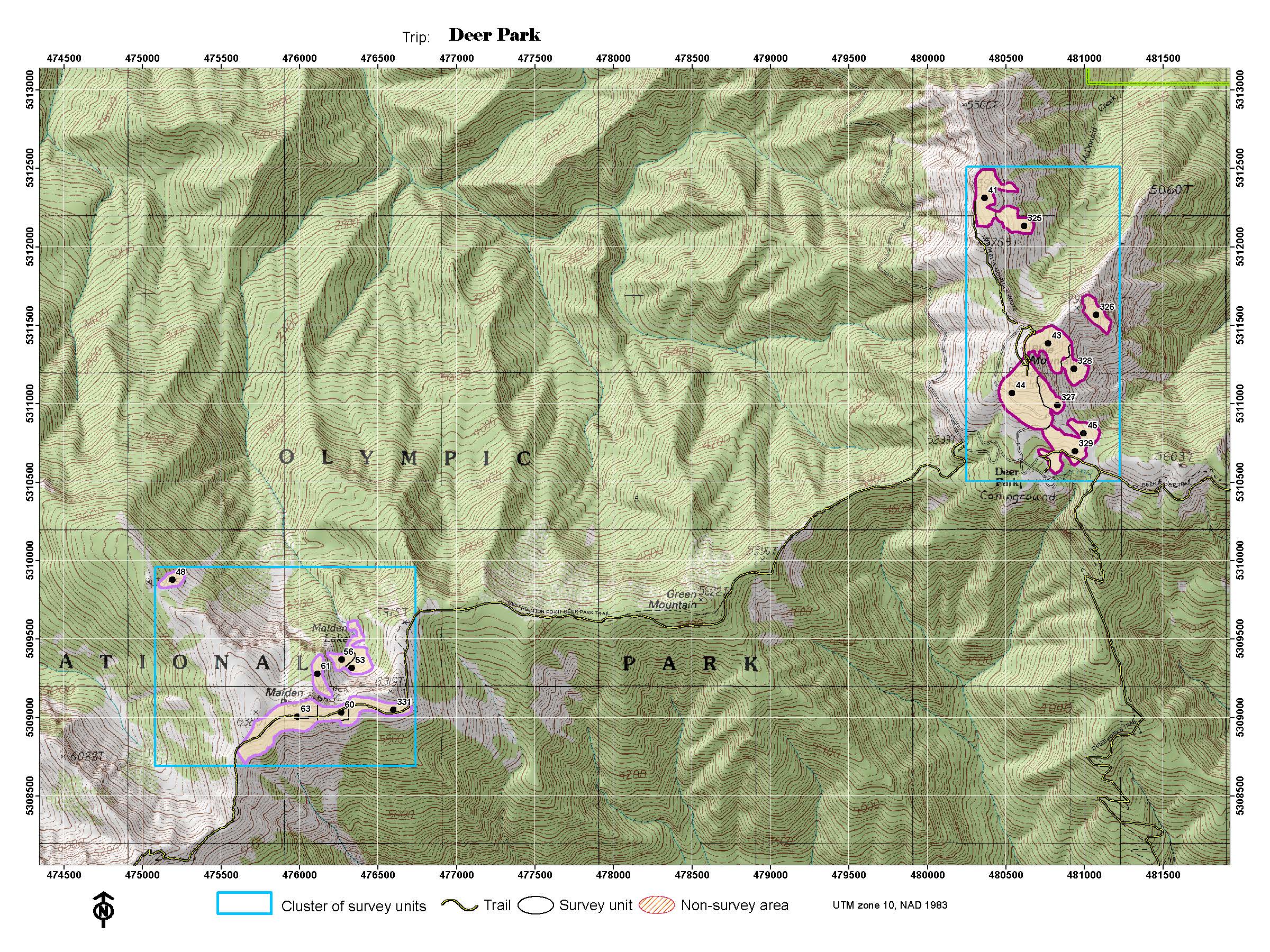
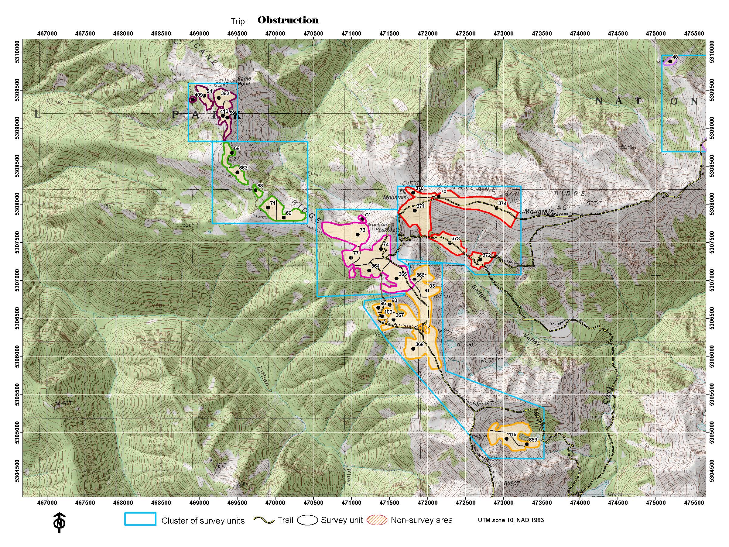
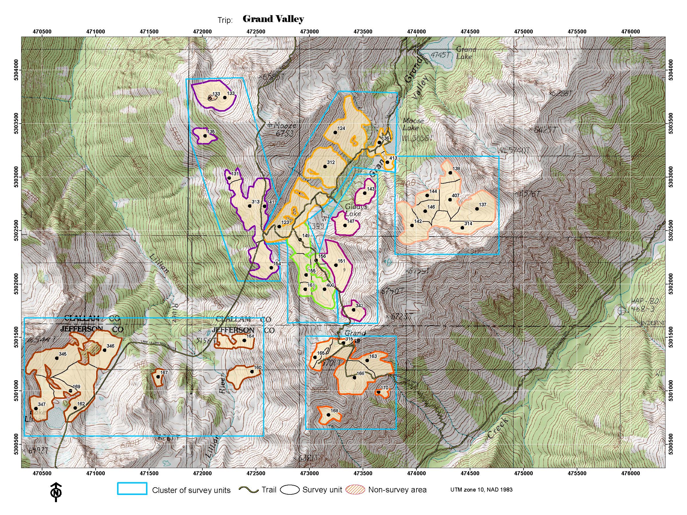
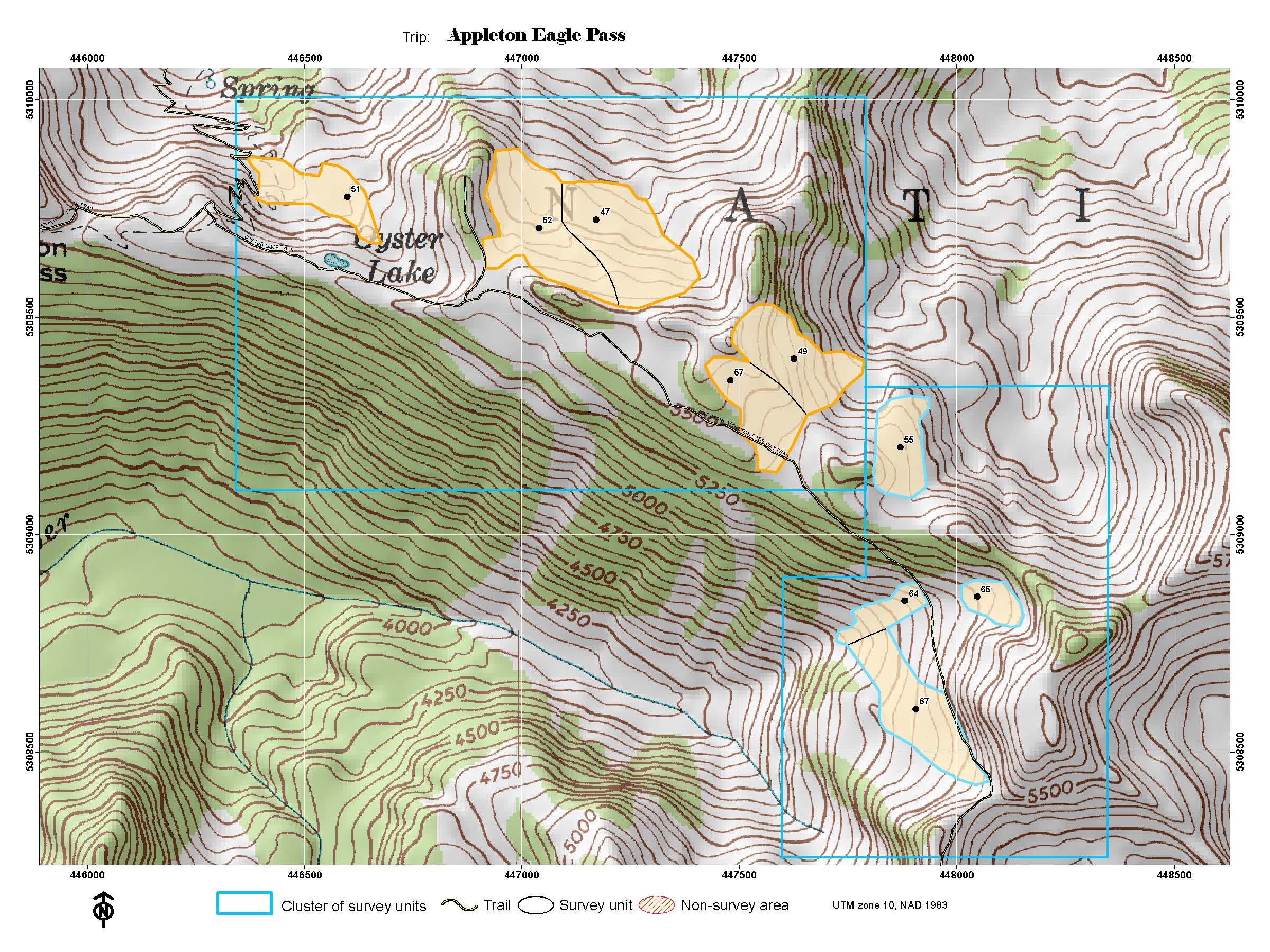
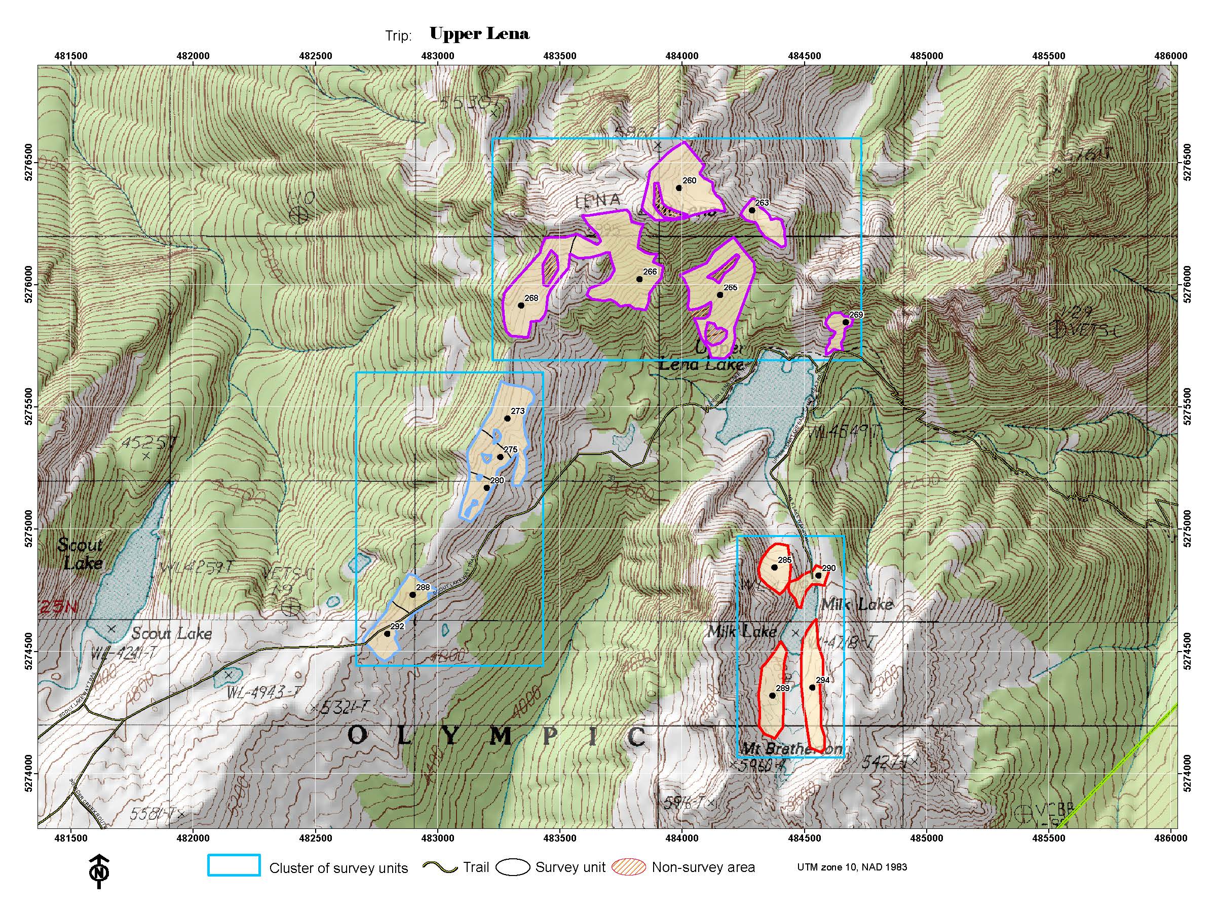
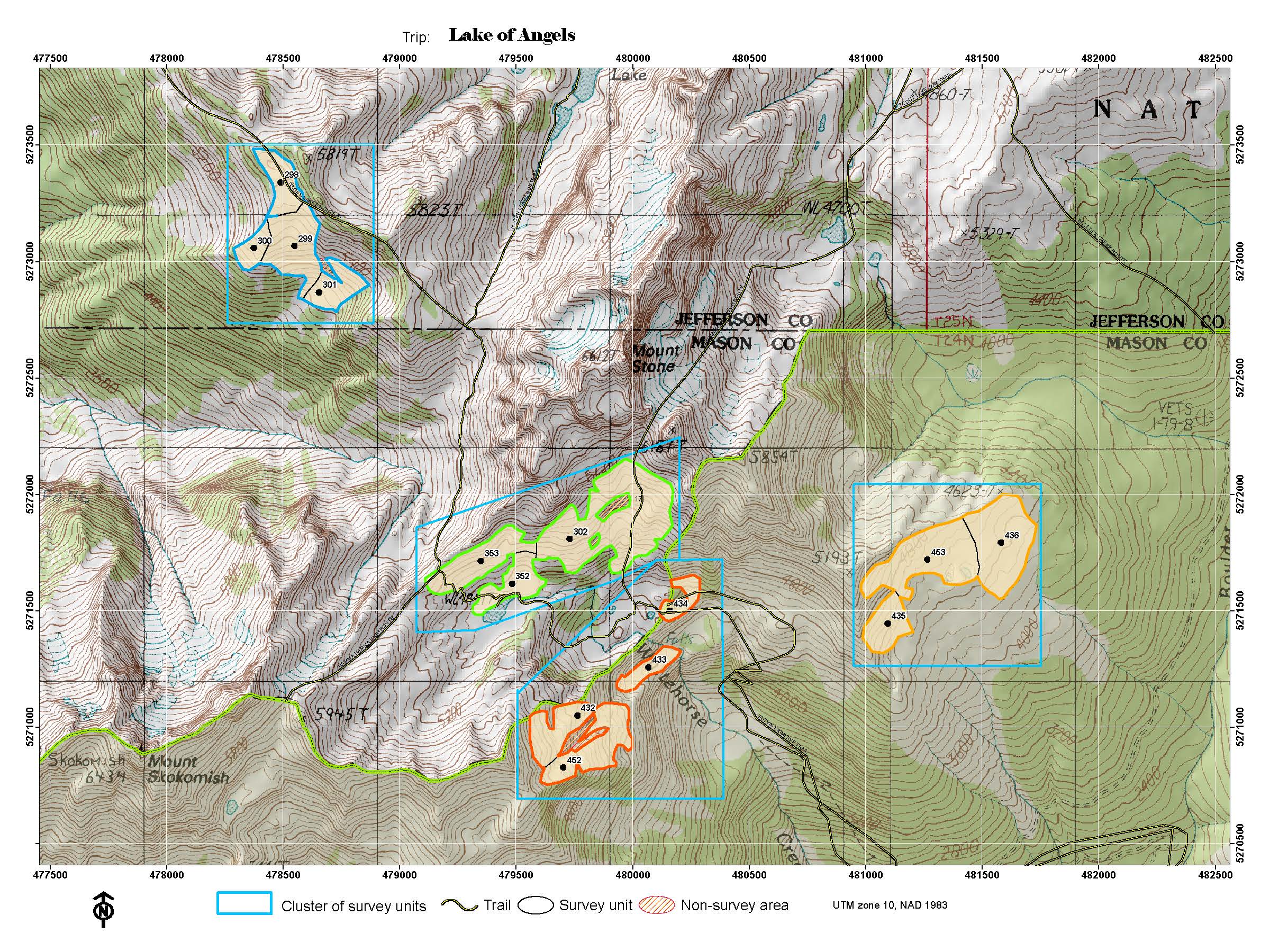
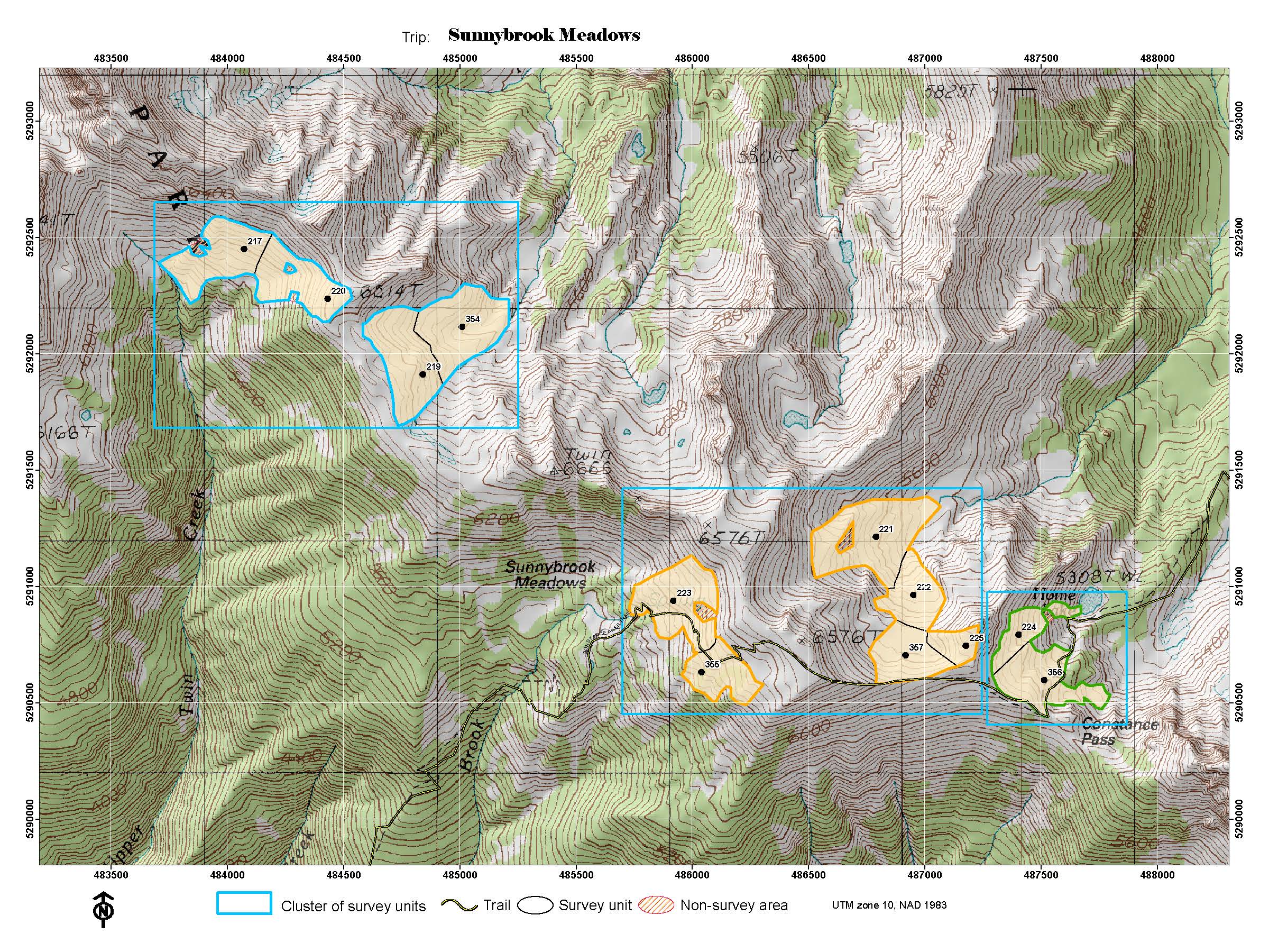
A topographic map of each of the survey trips can be accessed by clicking on the Survey Trip in the first column. Clusters in the core of the program will be surveyed annually, sometimes more than once per year. Others will be surveyed occasionally as time and personnel permit. Some areas can be surveyed via day hikes or from a front country campground. These surveys may take fewer than 5 days and it may be possible to survey these areas over two or more weekends. Two trips are on lands administered by Olympic National Forest.
| SURVEY TRIP |
CLUSTERS TO BE SURVEYED ON TRIP |
WORK PERIOD |
DIFFICULTY |
FREQUENCY OF SURVEY |
COMMENTS |
| Hurricane Area |
Hurricane West, Hurricane East, Elwha |
3-4 days |
Medium |
annual |
Day trips |
| Visitor Center |
Visitors Center, Sunrise, Steeple |
3-4 days |
Med -Low |
annual |
Day trips |
| Deer Park |
Maiden Peak, Deer Park |
4 days |
Medium |
annual |
Car camp |
| Obstruction Area |
Eagle Point, Obstruction, Marmot Flats, Badger Valley, Lillian |
5 days |
Low-High |
annual |
Day trips |
| Grand Valley |
Upper Moose, Upper Grand East, Grand Pass, Moose/Gladys Valley, Moose/Gladys Ridge, Grand View |
5 days |
Medium-High |
annual and occasional |
Groups of 4-6 only |
| Appleton / Eagle Pass |
Appleton Pass, Eagle Pass |
5 days |
Medium |
annual |
|
| Upper Lena Lake Area |
Lena, Scout Lake, Milk Lake |
5 days |
Medium-High |
annual |
Best for groups of 4-6 |
| Lake of the Angels |
Lake of the Angels, Stone |
5 days |
Moderate/ high |
annual |
Access route is very steep |
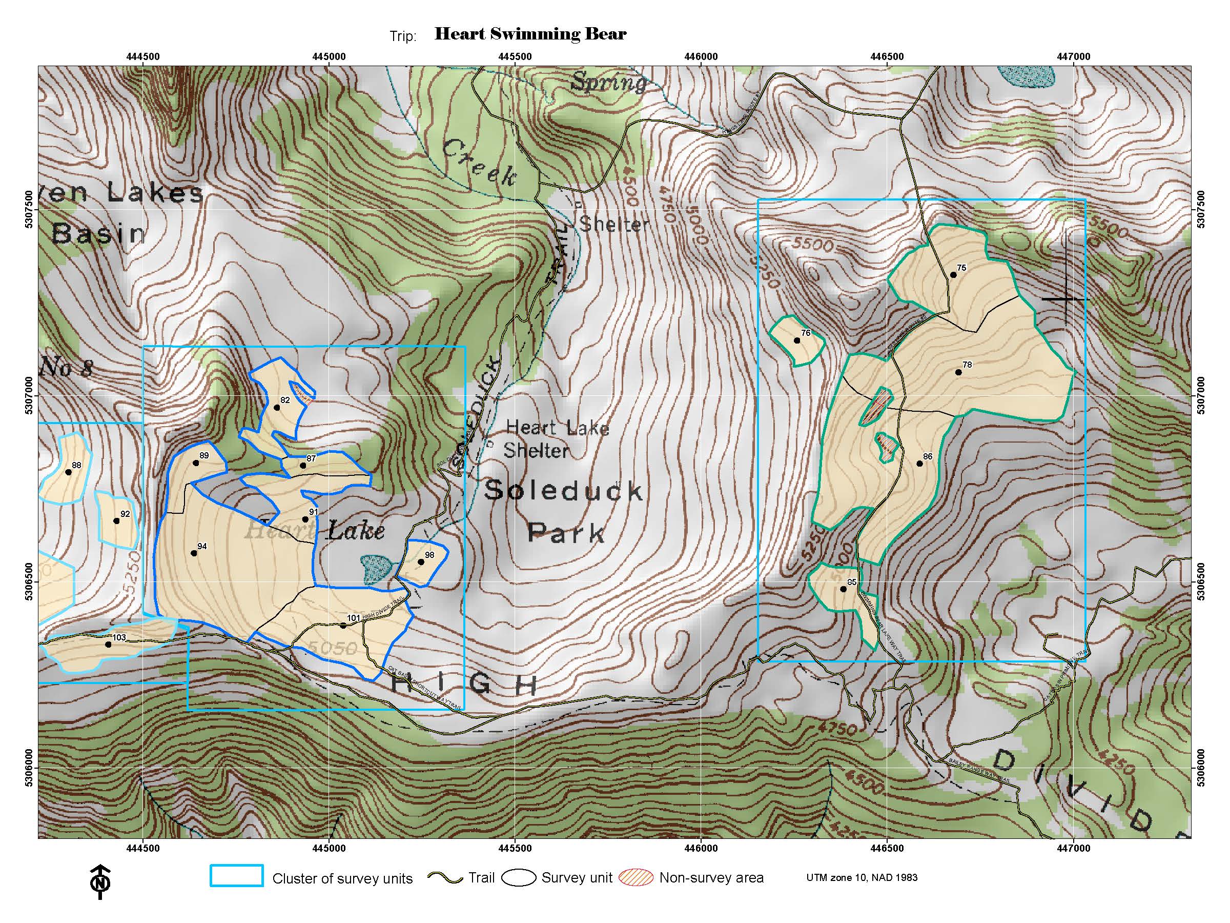
| Heart / Swimming Bear |
Heart Lake, Swimming Bear Lake |
5-6 days |
Medium |
annual |
|
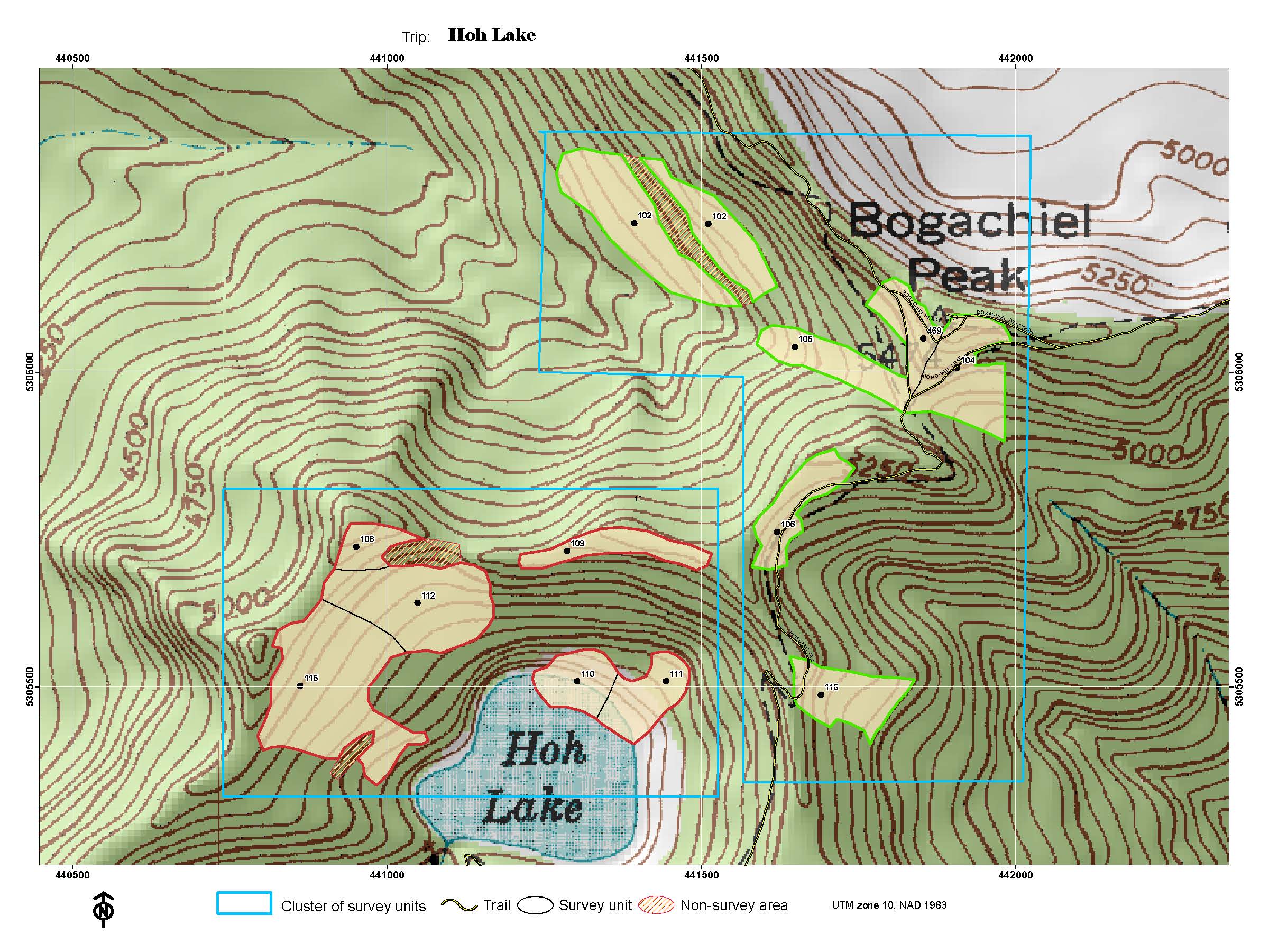
| Hoh Lake |
Bogachiel, Hoh Lake |
5-6 days |
Medium |
annual |
|
| Royal Basin |
Upper Royal, Royal, Shelter Rock, Deception (occasional) |
5-6 days |
Low-High |
annual |
|
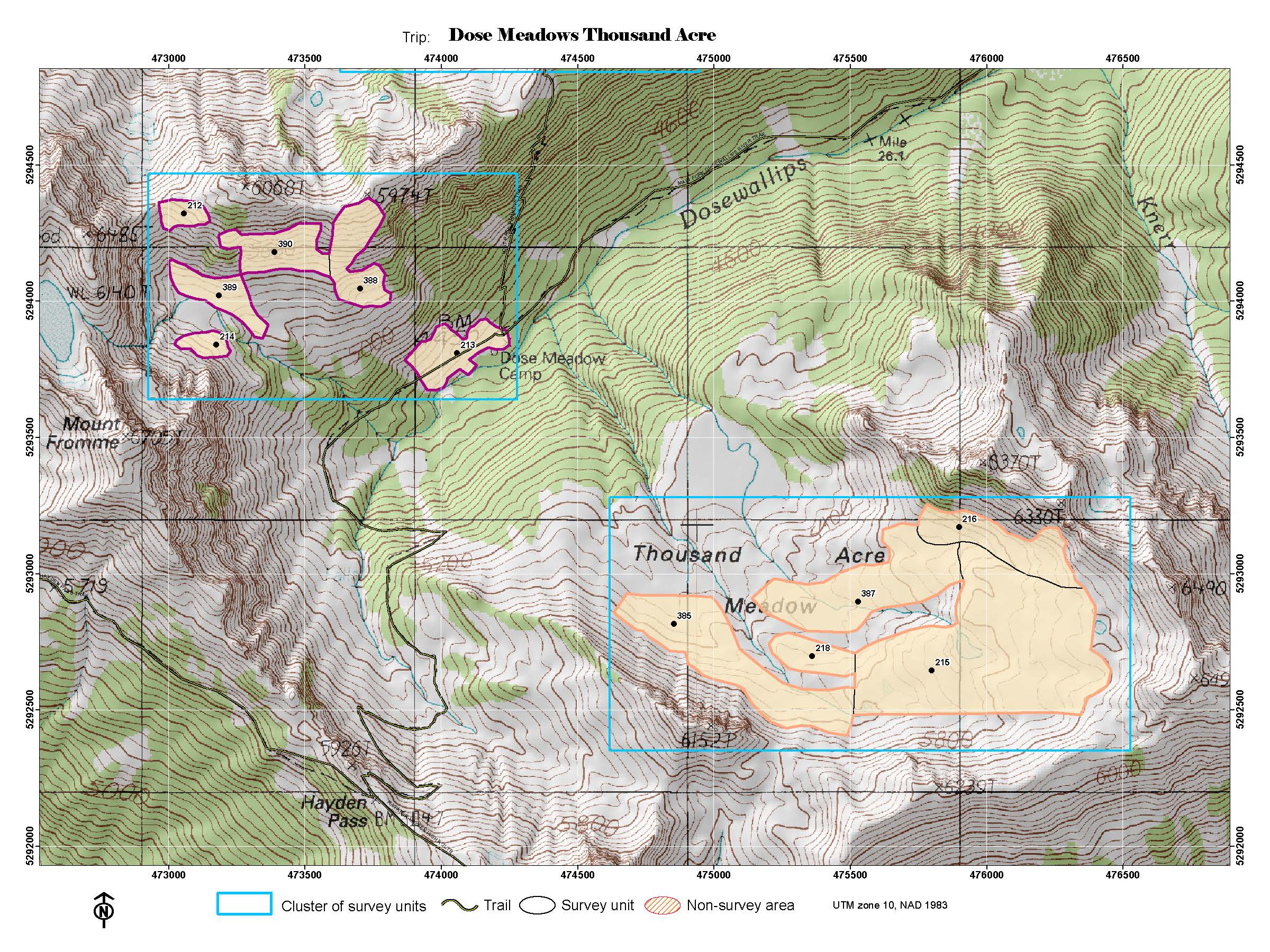
| Dose/ 1000-Acre Meadows |
Dose Mdws, 1000-Acre |
8 days |
Medium |
annual |
|
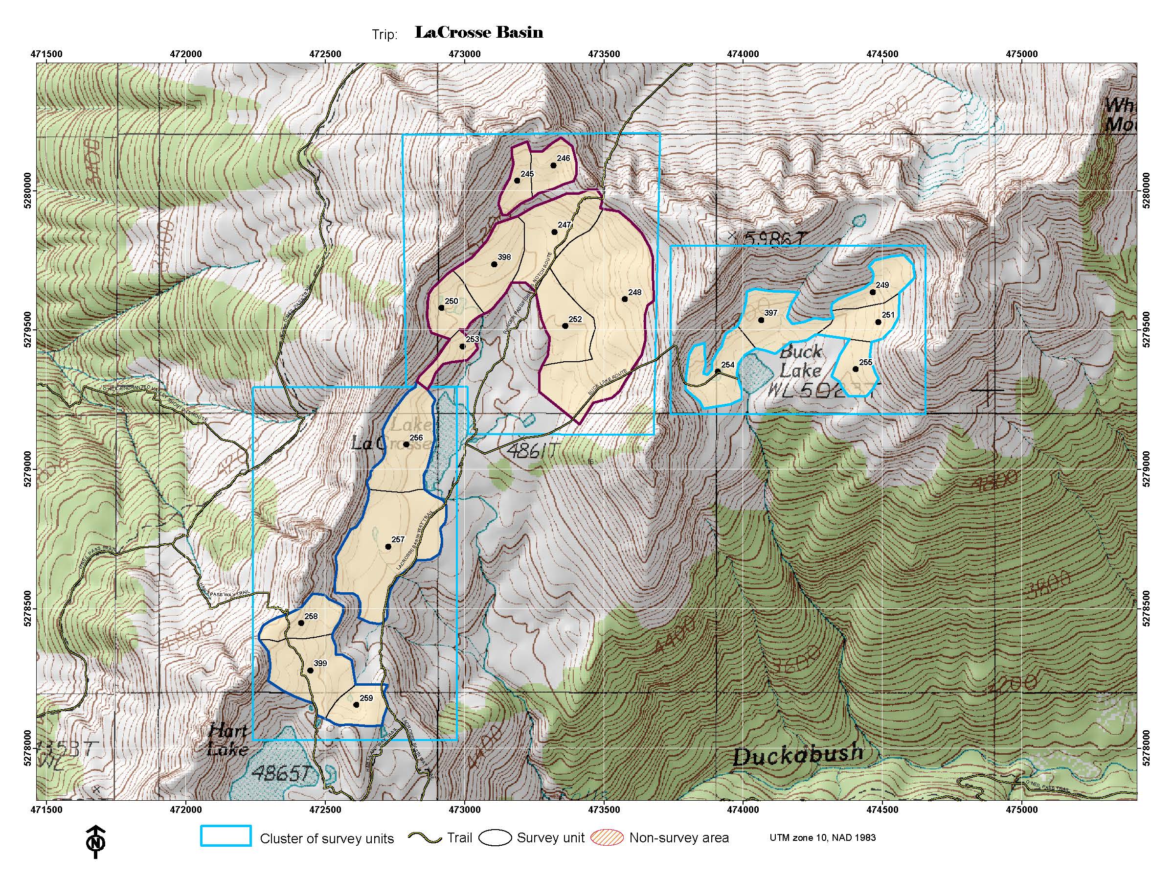
| LaCrosse Basin |
Lacrosse Basin, Buck Lake, Marmot Lake |
8 days |
Medium |
annual |
Best for groups of 4-6 |
| Klahhane Ridge |
Mt. Angeles, Klahhane |
4 days |
High |
occasional |
Day trips |
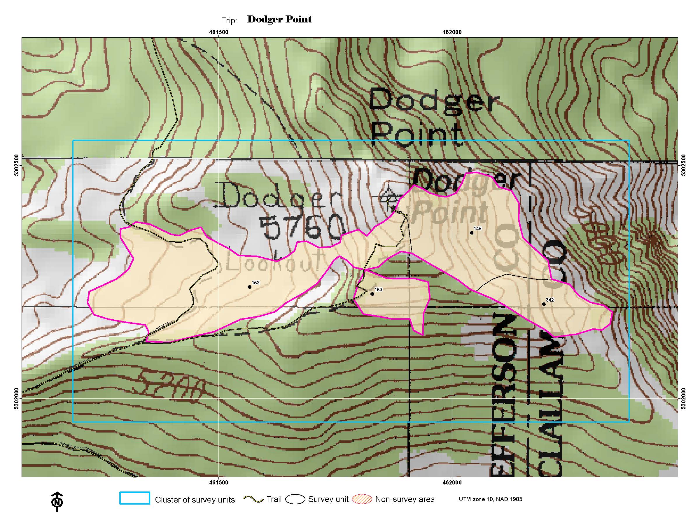
| Dodger Point |
Dodger Point |
4-5 days |
Medium |
occasional |
17 mile 1-day hike in |
| Seven-Lakes Basin |
Lunch Lake, High Divide |
5 days |
Medium |
occasional |
|
| Silver Lake |
Silver Lake/ Mt Townsend |
5 days |
Medium |
occasional |
Forest |
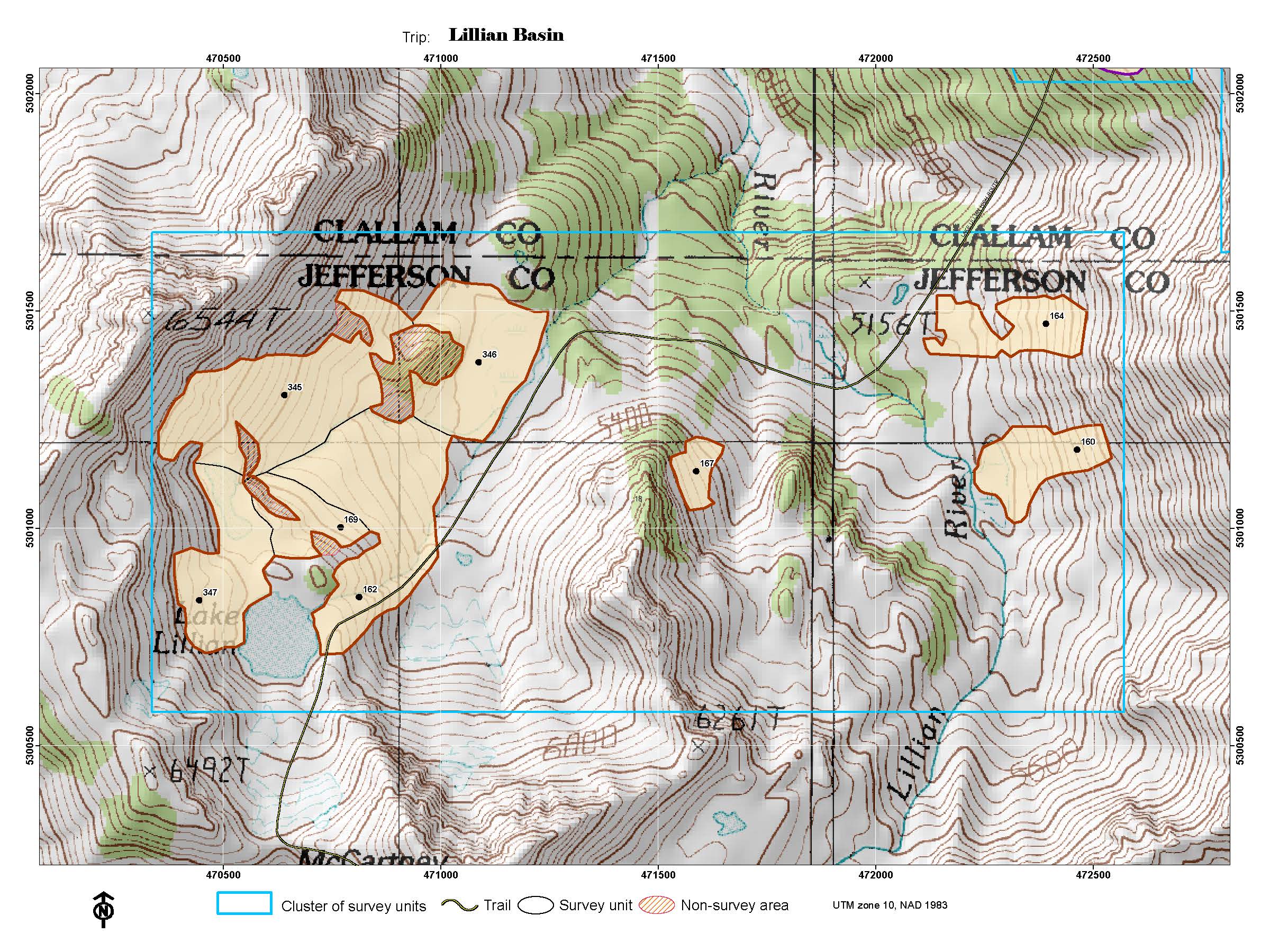
| Lillian Basin |
Lillian Lake |
5-6 days |
High |
occasional |
|
| Marmot Pass |
Marmot Pass, Buckhorn, Copper (incidental) |
5-6 days |
Medium |
occasional |
Best for groups of 4-6; Forest |
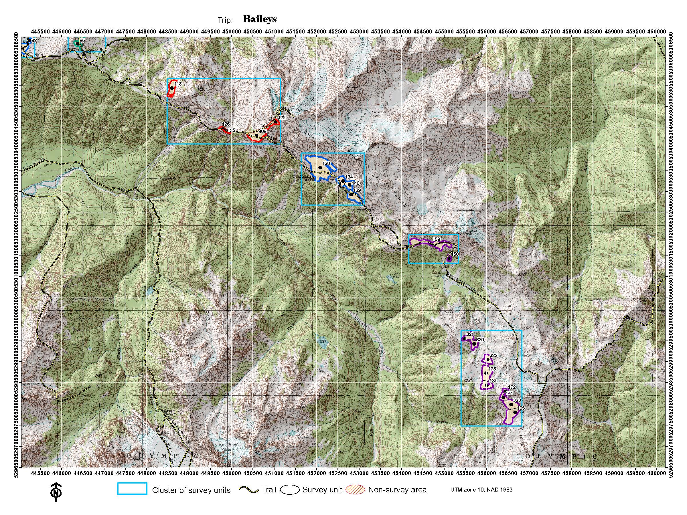
| Baileys |
Cat Peak, Mt. Carrie, Ferry (occasional) |
8 days |
High |
occasional |
|
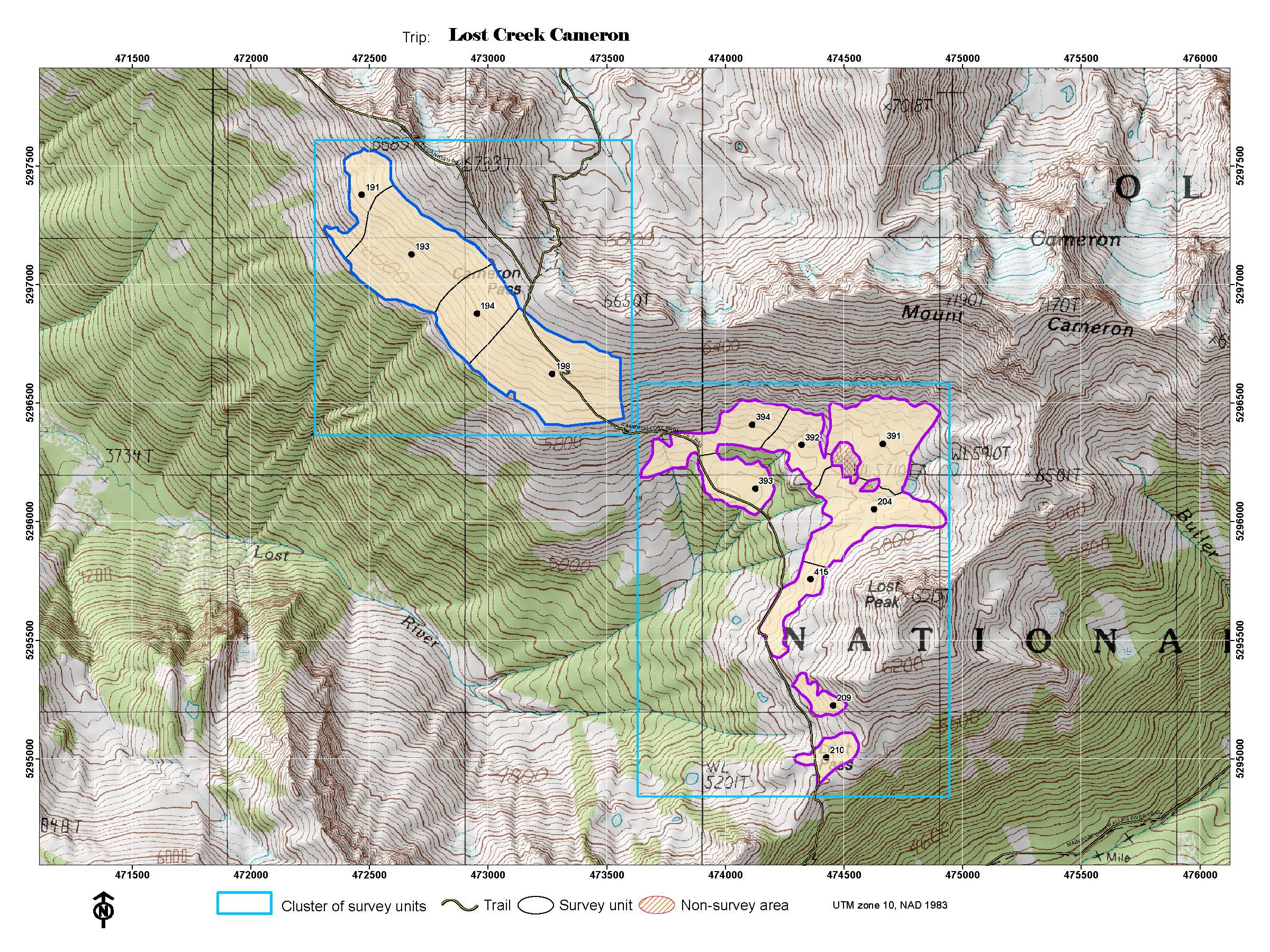
| Lost Creek/ Cameron |
Lost Creek, Cameron Pass |
8 days |
Medium |
occasional |
|
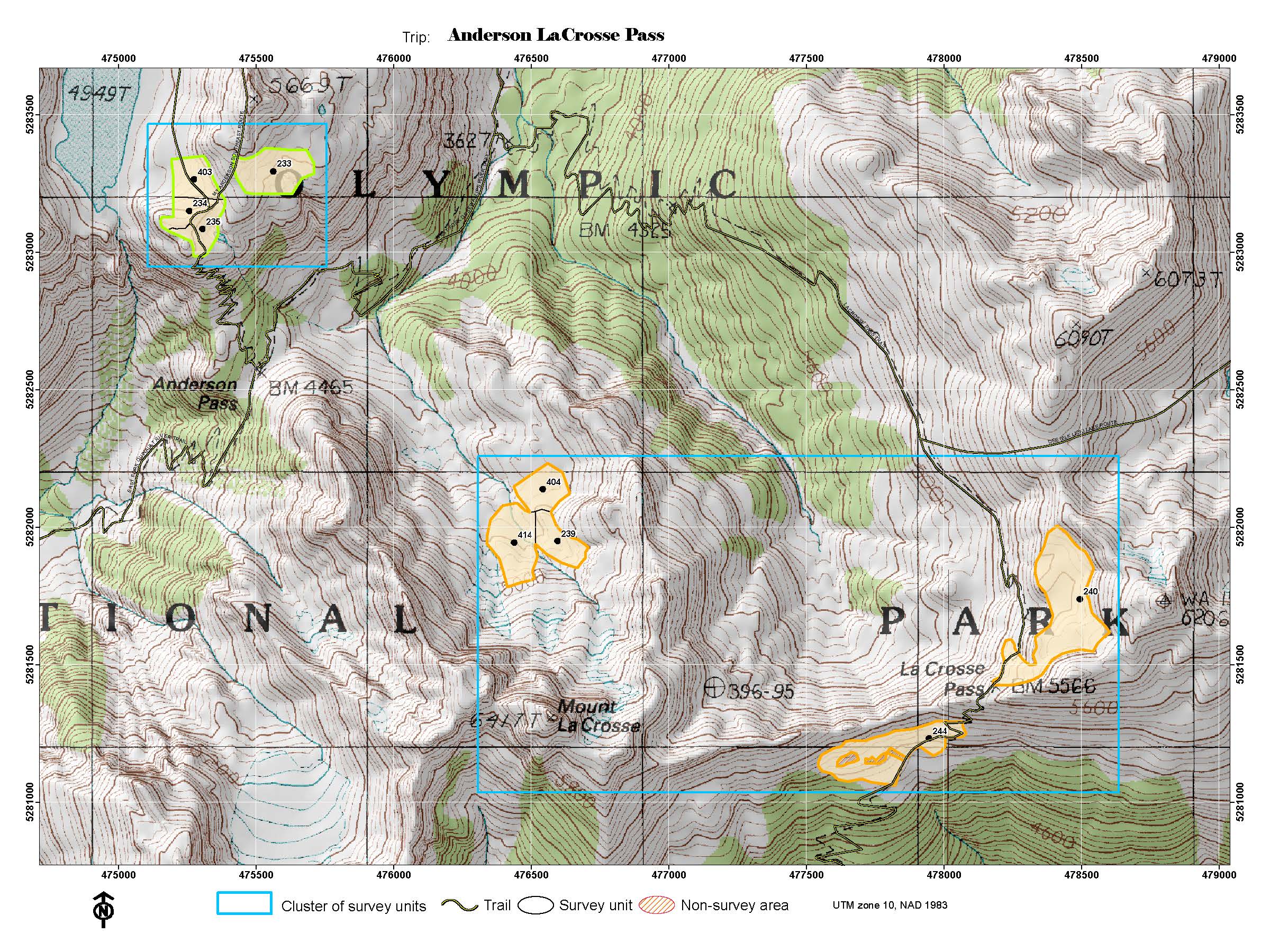
| Anderson Pass / LaCrosse Pass |
Anderson, LaCrosse Pass |
8 days |
High |
occasional |
|
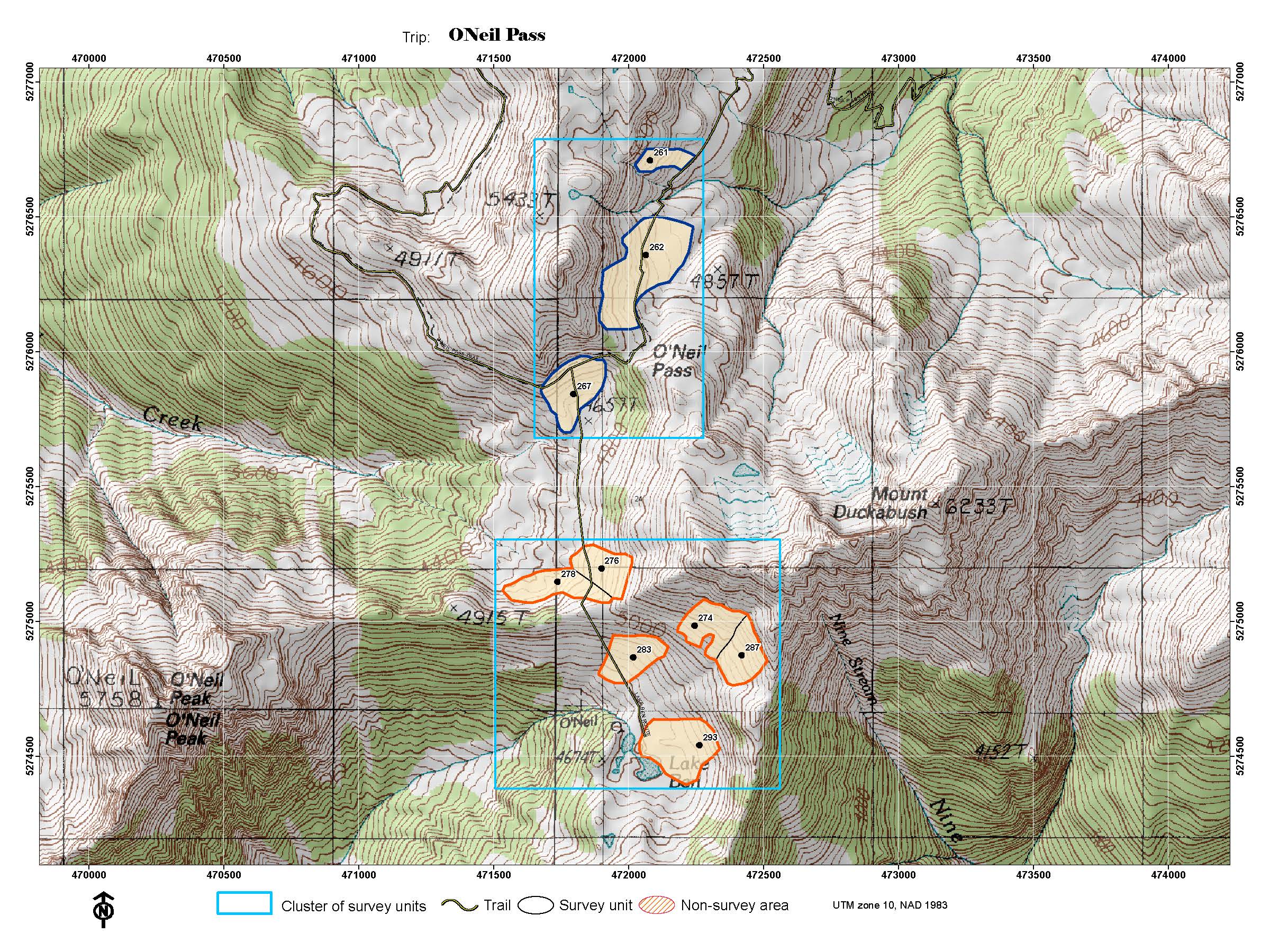
| O'Neil Pass |
O'Neil Pass, O'Neil Basin |
8 days |
Medium |
occasional |
|
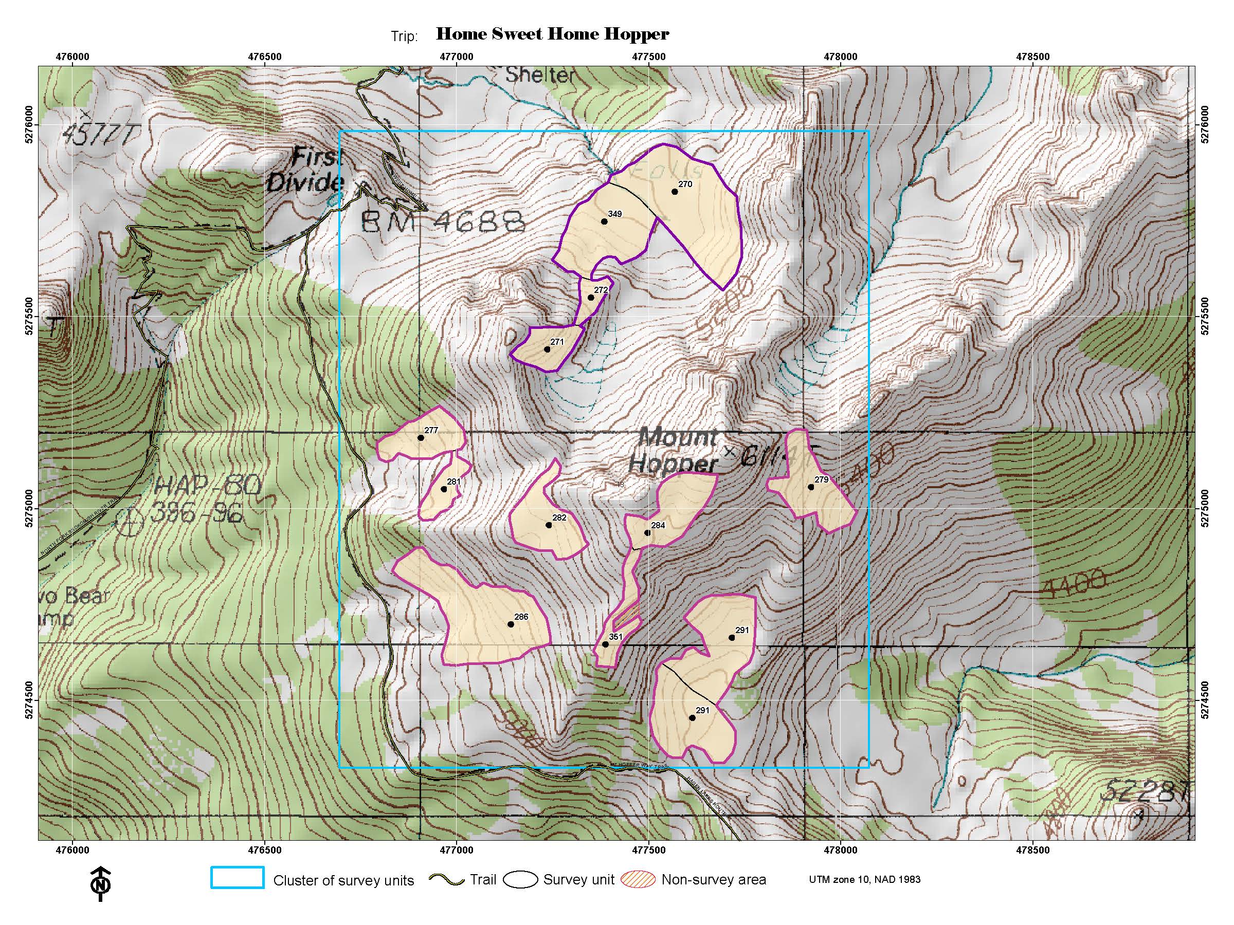
| Home Sweet Home / Hopper |
Home Sweet Home, Hopper |
8 days |
High |
occasional |
|
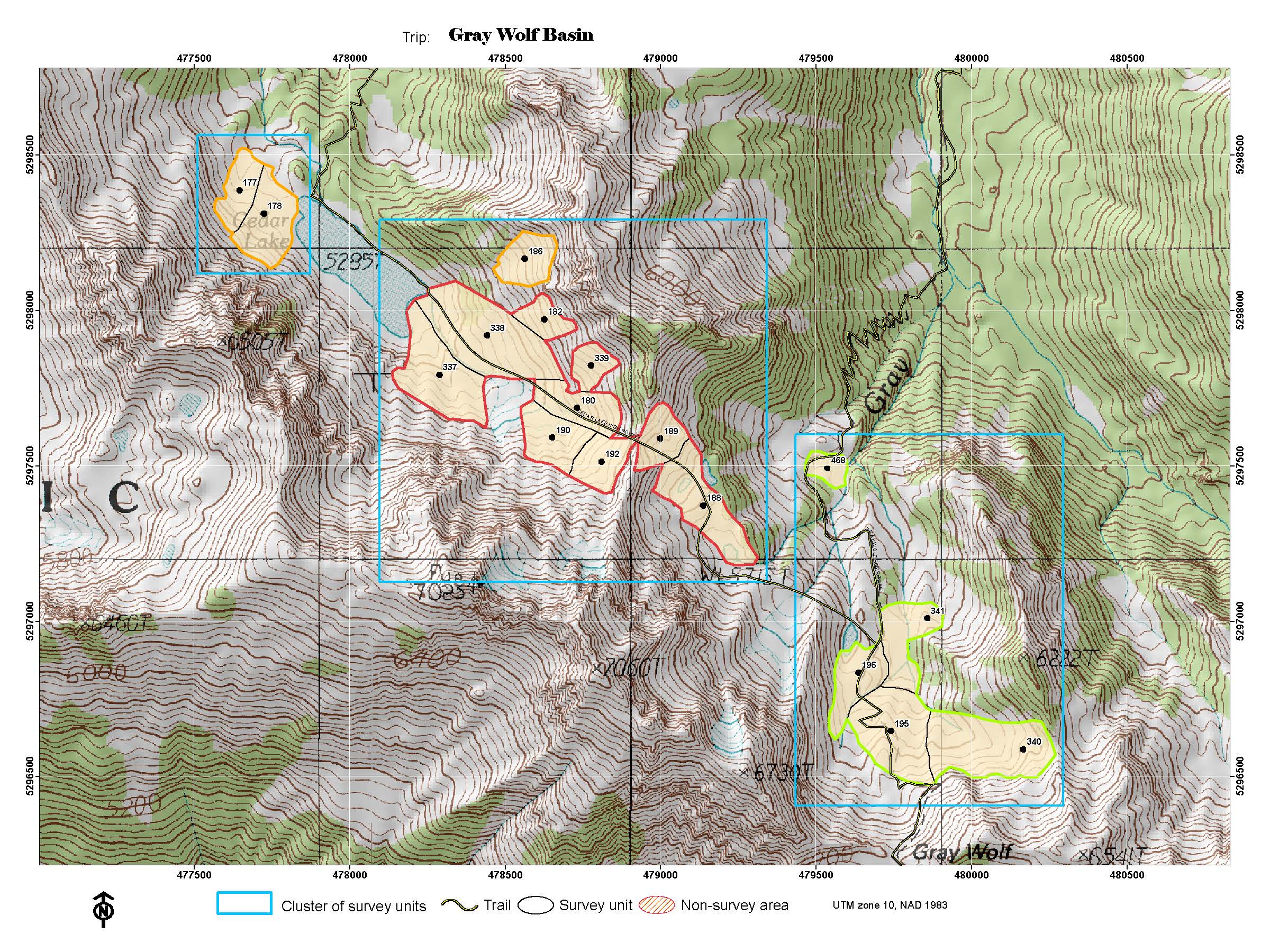
| Gray Wolf Basin |
Gray Wolf, Cedar Lake, Cedar South |
8 days |
Medium |
occasional |
Best for groups of 4-6 |
| Sunnybrook Meadows |
Mystery, Sunnybrook, Home Lake |
8 days |
High |
occasional |
|
| Skyline / Seattle |
Skyline, Lake Beauty, Mt. Seattle |
8-10 days |
High |
occasional |
>40 miles of hiking |
r>
|
|