Last updated: February 19, 2025
Place
Ohio and Erie Canalway National Heritage Area
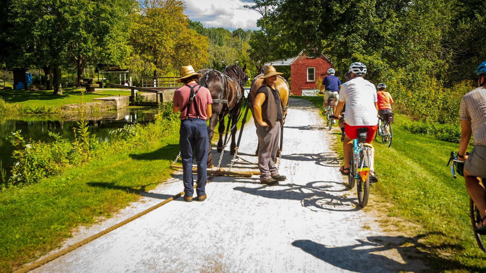
Photo Courtesy of Tim Fitzwater, Canalway Partners, and the Ohio and Erie Canalway Coalition
Quick Facts
Location:
Cuyahoga, Summit, Stark, Wayne, and Tuscarawas Counties in Northeastern Ohio
Significance:
The Ohio and Erie Canalway National Heritage Area spurred economic development across the nation by creating an inland connection for goods from Lake Erie to the Ohio River, known as the heartland of America to the eastern seaboard. This development fueled westward expansion, a national market economy, a booming industrial manufacturing sector, and the settlement of towns, villages, and cities along the canal.
Designation:
National Heritage Area
The Ohio and Erie Canalway National Heritage Area was designated by Congress in 1996 to preserve and celebrate the culture, history, and heritage of this resource which changed the nation. The Canalway Partners and the Ohio & Erie Canalway Coalition both serve as the coordinating entity for the heritage area.
When the Ohio and Erie Canal was built between 1825 and 1832, there were only 22 states at the time. Nineteenth-century Ohio was geographically isolated from the economic prosperity of the east by the Appalachian Mountains. A lack of transit routes made obtaining and exporting goods and services difficult. Upon its completion in 1832, the Canal connected Lake Erie and the Ohio River to the Erie Canal, creating a vital transportation route between the East Coast and the Gulf Coast, allowing resources to flow more freely across Ohio and the nation. It is known for providing “routes of prosperity.”
The creation of this inland water transportation system was a key point in the nation’s journey to becoming self-reliant on resource development, rather than relying on European trade routes. The Ohio & Erie Canal attracted pioneers, immigrants, and entrepreneurs to the region, leading to interconnected and thriving communities blossoming with opportunity for new business and industry. As the rise of railroads led to decreased use of the canal for transportation, industrial development continued on the canal's banks to harness its hydroelectric power.
In March of 1913, Ohio experienced a great flood, considered to be the second deadliest flood in the United States and the most devastating natural disaster Ohio ever experienced. The Ohio and Erie Canal was damaged beyond repair and ultimately abandoned. While this hurt local communities, their tenacity was unwavering. Community members knew the vitality of this region would be long-lasting if they worked to connect people back to their shared history of the Canalway. Today, the canal is still used for transportation, but this time for hiking, running, and cycling along the Towpath Trail, a recreation path that follows the old Canalway route and continues to connect the region's communities.