Comparative Aerial Photos and Figures

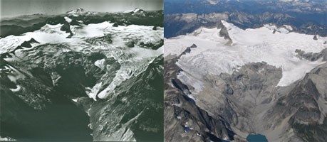
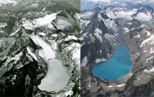
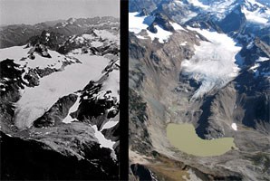
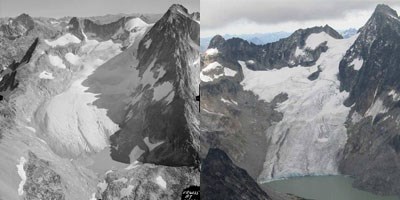
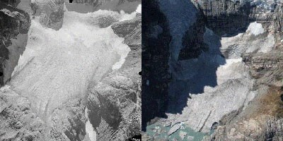
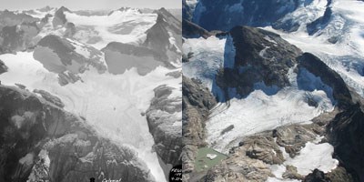
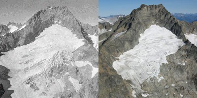
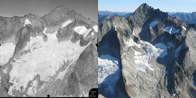
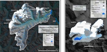
Eight pairs of North Cascades photographs are featured here, with a final figure outlining glacial change on Klawatti Glacier and in the Thunder Creek Valley. Each photographic pair consists of a mid-20th century and an early-21st century photograph taken from approximately the same location. The 1967 and 1958 images were photographed by Austin Post as part of a comprehensive glacier inventory. The corresponding 21st century images were taken by John Scurlock, a local North Cascades pilot and photographer. The comparative photographs clearly show substantial changes in glacier area, and thickness.
 
Figure 17
Figure 17.  View to the west of Inspiration Glacier in fall 1967 (left, by Post) and in fall 2005 (right, by Scurlock).  Note the ice loss on the North Lobe of Inspiration Glacier.
 
Figure 18
Figure 18.  View to the west of Silver Glacier in 1958 (left, by Post) and 2006 (right, by Scurlock).  A map made in 1913 shows that the glacier covered the lake.
 
Figure 19
Figure 19.  View to the south of South Cascade Glacier in 1958 (left, by Post) and 2003 (right, by Scurlock).
 
Banded Glacier 1960-2008
Figure 20.  Banded Glacier in 1960 (left, by Post) and 2005 (right, by Scurlock).
 
undefined
Figure 21.  Borealis Glacier in 1960 (left, by Post) and 2005 (right, by Scurlock).
 
Colonial Glacier in 1960 and 2005
Figure 22.  Colonial Glacier in 1960 (left, by Post) and 2005 (right, by Scurlock).
 
Buckner Glacier comparison
Figure 23.  Buckner Glacier in 1960 (left, by Post) and 2005 (right, by Scurlock).
 
Forbidden Glacier
Figure 24.  Forbidden Glacier in 1960 (left, by Post) and 2005 (right, by Scurlock).
 
Figure 20 and 21
Figure 25 - Thunder Creek Watershed and Figure 26 - Klawatti Glacier

Last updated: August 11, 2017

Park footer

Contact Info

Mailing Address:

810 State Route 20
Sedro-Woolley, WA 98284

Phone:

360 854-7200

Contact Us