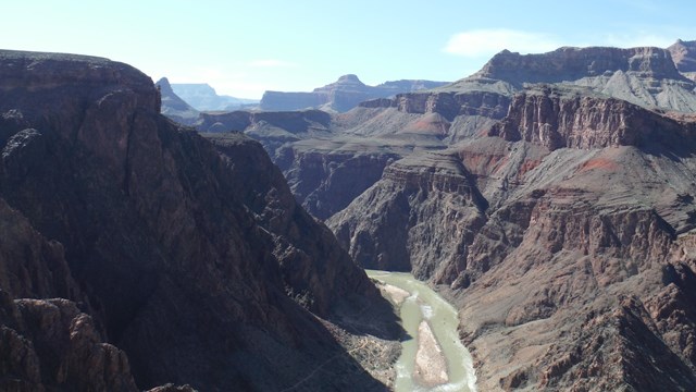
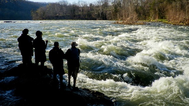
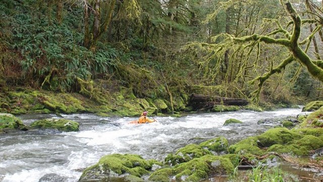
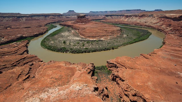
|
River
|
County
|
Reach
|
Length (miles)
|
Year Listed/ Updated
|
|
ORVs
|
Description
|
Other States
|
|
Albertson Brook
|
Atlantic, Camden
|
Confluence with Nescochaque Creek
to Pa. Railroad
|
7
|
1982
|
|
R, W, H, O
|
See Mullica River comments.
|
|
|
Alquatka Branch
|
Burlington
|
Confluence with Mullica to headwaters
|
2
|
1982
|
|
R, W, H, O
|
See Mullica River comments.
|
|
|
Back Creek
|
Cumberland
|
Back Creek Point to Husted Landing
|
6
|
1982
|
|
S, R, G, F, W, H, C, O
|
See Delaware River comments.
|
|
|
Ballanger Creek
|
Ocean
|
Confluence with Mullica to Route
9
|
3
|
1982
|
|
R, W, H, O
|
See Mullica River comments.
|
|
|
Bass River
|
Ocean
|
Confluence with Mullica for 2 miles
|
2
|
1982
|
|
R, W, H, O
|
See Mullica River comments.
|
|
|
Batsto River (Pine Barrens River
System)
|
Burlington
|
Mullica River to Hampton
|
20
|
1982
|
|
S, R, W, H, C, O
|
Since the earliest days of the European
settlers, the forested interior region of southern N.J. known
as the Pinelands, has been recognized for its large quantities
of water. The most important abiotic element of the Pinelands
ecosystem is water, considering its availability and characteristic
chemistry. Water is stored in the extensive sand aquifers
below the surface. This ground water supports 89 percent of
the flow in the Pinelands streams, discharging primarily through
the swamps and marshes.
Hydrologic-(A distinctive characteristic
of the nationally unique Pinelands are the surface waterways.
Most of the region is drained by rather closely spaced and
somewhat parallel streams flowing to barrier bays along the
Atlantic Ocean or south to the Delaware Bay. No point in the
Pinelands is more than 1.5 miles from a surface water body.
Streams in the Pinelands are typically slow moving and shallow
due to very low topographic gradient. The unusual brown or
so-called tea colored appearance of the stream waters results
from the abundance of an organic iron complex, which is derived
from the oxidation of iron ions dissolved in groundwater and
mixed with decomposing plant by-products at the surface. These
rivers are also important because they help to maintain the
quality of the adjacent barrier bays which in turn maintain
the aquatic nursery and spawning areas of the region. In addition,
the fact that most streams and the groundwater aquifers in
the Pinelands are still low in nutrients (or unpolluted) makes
these areas (and the region) unusual.
Wild-(Rivers and river segments flow
through an area which is the most extensive wildland tract
in the Middle Atlantic Seaboard region.)
Historic-(System includes river-related
National Register sites such as Batsto Village and National
Historic Districts such as the Double Trouble area.)
Recreation-(System is in unique proximity
and accessible to significant urban population centers in
Philadelphia, PA, Trenton, NJ, Camden NJ, and Wilmington,
DE. Certain river segments are unique in that they are canoeable
the entire year.)
Scenic-(System includes hardwood
forest streams, bog-freshwater marsh areas and white cedar
streams. These areas are 3 of the top 4 Pinelands landscapes
most preferred by the public as scenery.)
Cultural-(River and river segment
corridors include representative and unique Pinelands old
streambank industries. These river areas, identified as the
most preferred of all Pinelands cultural landscape types,
include Sim Place, Quaker Bridge, Hampton and numerous other
cranberry bogs.)
Botanic-(System includes representative
examples of all the significant Pinelands aquatic vegetation
types including White cedar swamps, bogs, cranberry bogs and
freshwater marshes. The characteristic pattern of this vegetation
is directly linked to stream flow quantity and quality. These
areas serve as the habitat for at least 4 rare or endangered
plant species.)
|
|
|
Beaver Run
|
Burlington
|
Confluence with Wading River to headwaters
|
3
|
1982
|
|
|
|
|
|
Berrys Creek
|
Bergen
|
Confluence with the Hackensack River
to south of Route 3
|
2
|
1982
|
|
R
|
See Hackensack River comments.
|
|
|
Cedar Creek
|
Ocean
|
Route 9 crossing to the dam above
Double Trouble
|
6
|
1982
|
|
W, O
|
|
|
|
Cedar Creek
|
Ocean
|
Transmission line crossing above
Double Trouble dam to Bamber Lake
|
5
|
1982
|
|
H, O
|
|
|
|
Cedar Creek
|
Ocean
|
Lanoka Harbot to Bamber Lake
|
14
|
1982
|
|
C, O
|
|
|
|
Cedar Creek
|
Cumberland
|
Mouth to south of Cedarville
|
5
|
1982
|
|
S, R, G, F, W, H, C, O
|
See Delaware River comments.
|
|
|
Cedar Creek
|
Ocean
|
Bamber Lake to headwaters
|
2
|
1982
|
|
H, O
|
|
|
|
Chamberlain Branch
|
Ocean
|
Bamber Lake to headwaters
|
5
|
1982
|
|
H, O
|
|
|
|
Cohansey River
|
Cumberland
|
Delaware Bay to Rogap Run
|
16
|
1982
|
|
H, O
|
Historic-(Segment includes the Greenwich
National Historic District, a town which contributed to development
of middle colonies through shipping and trade.)
Wild-(Segment flows through one of
the most inaccessible and undisturbed salt marshes in the
section.)
|
|
|
Daniels Branch
|
Ocean
|
Confluence with Cedar Creek to headwaters
|
2
|
1982
|
|
H, O
|
|
|
|
Dark Branch
|
Ocean
|
From confluence with Maple Root Br.
to headwaters
|
2
|
1982
|
|
R, O
|
See Toms River comments.
|
|
|
Deep Run Brook
|
Burlington
|
Confluence with Batsto River to headwaters
|
4
|
1982
|
|
S, R, W, H, C, O
|
See Batsto River comments.
|
|
|
Delaware River (Delaware River/Bay
System)
|
Salem, New Castle
|
Delaware Bay to Salem Nuclear Power
Plant
|
4
|
1982
|
|
S, R, G, F, W, H, C, O
|
The Delaware River-Bay System represents
an example of undeveloped rivers in a regionally unique estuarine
area. The area in total is composed of several distinct subareas
which in combination form a highly exemplary, productive and
important river mouth estuarine system. The area is the least
developed of 16 similar identified areas in the northeast.
Geologic-(The main segment of the
Delaware River is an outstanding and unique example of a high
order drowned river mouth.)
Cultural-(Rivers and river segments
include remnants of the once productive and unique Middle
Atlantic fishing industry.)
Recreation-(System is accessible
and in unique proximity to high concentrations of urban populations
in Wilmington, DE, Philadelphia, PA, and Camen NJ.)
Wild-(River and river segment corridors
are virtually undeveloped and remote.)
Hydrologic-(The Delaware River segment
is a unique, sparsely developed, high order, tidal river area.)
Wildlife-(Areas within and adjacent
to the river corridors are important nesting, feeding, migrating,
and wintering sites for waterfowl along the Atlantic flyway.)
|
DE
|
|
Dennis Creek
|
Cape May
|
Mouth to headwaters in the Great
Cedar Swamp
|
8
|
1982
|
|
S, R, G, F, W, H, C, O
|
See Deleware River comments.
|
|
|
Dividing Creek
|
Cumberland
|
Mouth to Tom's Bridge
|
10
|
1982
|
|
S, R, G, F, W, H, C, O
|
See Deleware River comments.
|
|
|
Factory Branch
|
Ocean
|
Confluence with Cedar Creek to headwaters
|
6
|
1982
|
|
W, O
|
|
|
|
Fishing Creek
|
Salem
|
Storm Inlet to Alloway Creek Neck
Road
|
3
|
1982
|
|
S, R, G, F, W, H, C, O
|
See Deleware River comments.
|
|
|
Forked River, North Branch
|
Ocean
|
Garden State Parkway to the headwaters
of the Cave Cabin Branch
|
7
|
1982
|
|
O
|
Botanic-(Within and representative
of the unique Pine Barrens area. Corridor includes Bottomland
Hardwood Forest and Evergreen Shrub Bog, including stands
of significant and rare Atlantic white cedar.)
Wild-(Huge undeveloped expanses of
ecologically significant salt water tidal marsh are within
and adjacent to the area.)
|
|
|
Great Brook
|
Morris
|
Confluence with the Passaic River
to Silver Lake
|
5
|
1982
|
|
O
|
See Passaic River (segment from route
78 to Osborn Mills) comments.
|
|
|
Great Egg Harbor River
|
Camden
|
New Brooklyn Lake backwater to the
Pa. - Reading R.R. crossing
|
6
|
1982
|
|
R, O
|
Recreation-(Unique proximity to significant
urban population centers in Philadelphia, Trenton, Camden
and Wilmington.)
THE SEGMENT FROM WILLIAMSTOWN-NEW
FREEDOM ROAD TO THE PENNSYLVANIA RAILROAD RIGHT-OF-WAY WAS
ADDED AS A COMPONENT OF THE NATIONAL WILD AND SCENIC rivers
SYSTEM ON 10/27/92.
|
|
|
Great Egg Harbor River
|
Atlantic
|
Great Egg Harbor Bay to south of
May's Landing
|
10
|
1982
|
|
W, O
|
Wildlife-(Corridor is a portion of
the habitat for eight rare and/or endangered species of birds.)
Botanic-(Within and representative
of the unique Pine Barrens area. Corridor includes Bottomland
Hardwood Forest and Evergreen Shrub Bog, including stands
of significant and rare Atlantic white cedar.)
Wild-(Huge undeveloped expanses of
ecologically significant salt water tidal marsh are within
and adjacent to the area.)
THE SEGMENT FROM THE MOUTH OF PACTONG
CREEK TO THE MILL STREET BRIDGE WAS ADDED AS A COMPONENT OF
THE NATIONAL WILD AND SCENIC rivers SYSTEM ON 10/27/92.
|
|
|
Great Egg Harbor River
|
Atlantic, Gloucester, Camden
|
Weymouth to the Atlantic City Expressway
|
24
|
1982
|
|
R, O
|
Recreation-(Unique proximity to significant
urban population centers in Philadelphia, Trenton, Camden
and Wilmington.)
Botanic-(Within and representative
of the unique Pine Barrens area.)
THE SEGMENT FROM LAKE LANAPE TO THE
ATLANTIC CITY EXPRESSWAY WAS ADDED AS A COMPONENT OF THE NATIONAL
WILD AND SCENIC rivers SYSTEM ON 10/27/92.
|
|
|
Great Swamp Branch
|
Atlantic
|
Confluence with Nescochaque Creek
to reservoir at Myrtle Avenue
|
3
|
1982
|
|
R, W, H, O
|
See Mullica River comments.
|
|
|
Hackensack River
|
Bergen, Hudson
|
Penn Central R.R. crossing to south
of Route 3
|
3
|
1982
|
|
R
|
Recreation-(The closest, sparsely
developed river within a metropolitan population center of
approximately 8 million persons.)
|
|
|
Hope Creek
|
Salem
|
Mouth to headwaters
|
4
|
1982
|
|
S, R, G, F, W, H, C, O
|
See Deleware River comments.
|
|
|
Hospitality Brook
|
Burlington
|
Confluence with West Branch to Wallow
Bogs
|
1
|
1982
|
|
|
|
|
|
Lamington-Black River
|
Somerset, Morris, Hunterdon
|
Confluence with the West Branch Raritan
River to Randolph
|
25
|
1982
|
|
R
|
Recreation-(The closest, sparsely
developed river within 50 miles of a population center of
approximately 8 million.)
|
|
|
Landing Creek
|
Atlantic
|
Confluence with Mullica to Indian
Cabin Road
|
4
|
1982
|
|
R, W, H, O
|
See Mullica River comments.
|
|
|
Little Hanken Run
|
Burlington
|
Confluence with West Branch to Wallow
Bogs
|
2
|
1982
|
|
|
|
|
|
Long Brook
|
Ocean
|
From confluence with Toms River to
headwaters
|
2
|
1982
|
|
R, O
|
See Toms River comments.
|
|
|
Mad Horse Creek
|
Salem
|
Mouth to headwaters of Little and
Turners Fork Creeks
|
7
|
1982
|
|
S, R, G, F, W, H, C, O
|
See Deleware River comments.
|
|
|
Manumuskin River
|
Cumberland
|
Confluence with Maurice to Pa. Reading
Seashore Lines
|
4
|
1982
|
|
C
|
See Maurice River comments.
|
|
|
Maple Root Branch
|
Ocean
|
From confluence with Toms River to
confluence with Dark Branch
|
2
|
1982
|
|
R, O
|
See Toms River comments.
|
|
|
Maurice River
|
Cumberland
|
Shell Pile to 3 miles north of Laurel
Lake area
|
14
|
1982
|
|
C
|
Cultural-(Segment flows through and
includes unique buildings and activities related to the oyster
harvesting and processing industry.)
|
|
|
Mullica River
|
Atlantic, Camden, Burlington
|
Great Bay to headwaters
|
48
|
1982
|
|
R, W, H, O
|
Botanic-(Area includes representatives
of all significant features of Pine Barrens natural phenomenon.)
Wild-(Within an area which is the
most extensive wildland tract in the Middle Atlantic Seaboard
region.)
Recreation-(Unique proximity to significant
urban population centers in Philadelphia, Trenton, Camden
and Wilmington.)
Historic-(National Register village
at Batso.)
|
|
|
Musconetcong River
|
Hunterdon and Warren
|
From Penwell Mill Impoundment to
Bloomsbury Impoundment
|
14
|
1995
|
R
|
S, R, F, H, C
|
Outstanding recreational opportunities
include: fishing, canoeing, rafting, tubing, swimming, photography
and art. The river is also included as a water trail in the
NJ Trail Plan. The main stem of the river is a trout maintenance
water in a Category I watershed with trout production tributaries.
Within the watershed area there are many 18th & 19th century
historic sites listed in the National and State Registers.
|
|
|
Nacota Creek
|
Atlantic
|
Confluence with Mullica to confluence
with Mattix
|
3
|
1982
|
|
R, W, H, O
|
See Mullica River comments.
|
|
|
Nantuxent Creek
|
Cumberland
|
Mouth to upstream from Newport
|
6
|
1982
|
|
S, R, G, F, W, H, C, O
|
See Deleware River comments.
|
|
|
Nescochague Creek
|
Atlantic
|
Confluence with Mullica to Great
Swamp Branch and Albertson Brook Branch
|
5
|
1982
|
|
R, W, H, O
|
See Mullica River comments.
|
|
|
Newbolds Branch
|
Ocean
|
Confluence with Cedar Creek to headwaters
|
2
|
1982
|
|
H, O
|
|
|
|
Oranoaken Creek
|
Cumberland
|
Mouth to headwaters in Bear Swamp
|
9
|
1982
|
|
S, R, G, F, W, H, C, O
|
See Delaware River comments.
|
|
|
Oswego River, East Branch
|
Burlington
|
E & W Br. to Sim Place reservoir
|
12
|
1982
|
|
O
|
|
|
|
Oswego River, West Branch
|
Burlington
|
E & W Br. to near Rt. 563
|
13
|
1982
|
|
O
|
|
|
|
Passaic River
|
Morris, Essex
|
Two Bridges to Rt. 80
|
8
|
1982
|
|
O
|
Botanic-(Segment flows through a
relict marsh and swamp portion of Lake Passaic, the large
glacial lake of the Wisconsin period.)
|
|
|
Passaic River
|
Morris, Essex
|
Cook's Bridge to the Morris Turnpike
|
5
|
1982
|
|
R
|
Recreation-(Segment is extremely
accessible by public roads and is in unique proximity to high
concentrations of urban populations within the NY metro area.)
|
|
|
Passaic River
|
Morris
|
Route 78 to Osborn Mills
|
6
|
1982
|
|
O
|
Botanic-(Segment is adjacent to the
Great Swamp, a National Natural Landmark and National Wildlife
Refuge.)
|
|
|
Penn Swamp Branch
|
Burlington
|
Confluence with Batsto River to headwaters
|
3
|
1982
|
|
S, R, W, H, C, O
|
See Batsto River comments.
|
|
|
Pine Creek
|
Atlantic
|
Confluence with Mullica to reservoir
below Weekstown
|
1
|
1982
|
|
R, W, H, O
|
See Mullica River comments.
|
|
|
Roberts Branch
|
Burlington
|
Confluence with Skit Br. to headwaters
|
2
|
1982
|
|
S, R, W, H, C, O
|
See Batsto River comments.
|
|
|
Salem River
|
Salem
|
Salem to 2 miles upstream from Courses
Landing
|
17
|
1982
|
|
S, R, G, F, W, H, C, O
|
See Delaware River comments.
|
|
|
Skit Branch
|
Burlington
|
Confluence with Batsto to headwaters
|
3
|
1982
|
|
S, R, W, H, C, O
|
See Batsto River comments.
|
|
|
Sleeper Branch
|
Atlantic
|
Confluence with Mullica to reservoir
below Route 206
|
5
|
1982
|
|
R, W, H, O
|
See Mullica River comments.
|
|
|
Springers Brook
|
Burlington
|
Confluence with Deep Run Brook to
Indian Mill Brook
|
4
|
1982
|
|
S, R, W, H, C, O
|
See Batsto River comments.
|
|
|
Stow Creek
|
Salem, Cumberland
|
Mouth to south of Pickles Mill
|
14
|
1982
|
|
S, R, G, F, W, H, C, O
|
See Deleware River comments.
|
|
|
Toms River
|
Ocean
|
Central railroad bridge to the bridge
crossing northeast of Cassville
|
8
|
1982
|
|
R, O
|
Recreation-(One of the most popular
canoeable streams within the Pine Barrens.)
|
|
|
Tupehocken Creek
|
Burlington
|
Confluence with West Branch to headwaters
|
3
|
1982
|
|
|
|
|
|
Wading River
|
Burlington
|
Confluence with Mullica to E &
W Branches
|
11
|
1982
|
|
R
|
|
|
|
Wallkill River
|
Sussex
|
Hamburg, NJ to the Merrits Island,
NY area
|
14
|
1982
|
|
O
|
See Wallkill River, NY comments.
|
NY
|
|
Webbs Mill Branch
|
Ocean
|
Confluence with Chamberlain Branch
to headwaters
|
4
|
1982
|
|
H, O
|
|
|
|
West Branch
|
Burlington
|
Confluence with Wading River to Tulpehocken
Creek
|
5
|
1982
|
|
|
|
|
|
West Creek
|
Cumberland& Cape May
|
Mouth to Pickle Factory Pond
|
5
|
1982
|
|
S, R, G, F, W, H, C, O
|
See Deleware River comments.
|
|
|