Cougar Rock Campground - Closed for the Season. Estimated to open for the season May 24, weather permitting. Typical season is late May-early October. Reserve a campsite at Recreation.gov. NOTE: From May 24 - September 2, 2024, timed entry reservations are required to enter the Paradise Corridor between 7:00 am and 3:00 pm, which includes Cougar Rock Campground. Cougar Rock Campground reservations can be used instead of a timed entry reservation to enter the Paradise Corridor after 1:00 pm the first day of your reservation and at anytime during the remainder of your stay. First-come, first-served camping permits can also be used in lieu of a timed entry permit. Cougar Rock Campground reservations provide access to the Paradise Corridor only; they do not provide access to the Sunrise Corridor.
White River Campground - Closed for the Season. Estimated to open for the season June 21, weather permitting. Typical season is late June-September. First-come, first-served only. NOTE: From July 4 - September 2, 2024, timed entry reservations are required to enter the Sunrise Corridor between 7:00 am and 3:00 pm, which includes White River Campground. Once you get aWhite River Campground first-come, first-served (FCFS) permit, it can be used instead of a timed entry reservation to enter the Sunrise Corridor anytime during the remainder of your stay. FCFS permits can be acquired before 7 am or you may need a Sunrise Corridor Timed Entry Permit if you want to try to acquire a FCFS between 7 am and 3 pm. There is no guarantee that a FCFS permit will be available even if you get a timed entry permit. White River Campground permits provide access to the Sunrise Corridor only; they do not provide access to the Paradise Corridor.
Ohanapecosh Campground - Closed for the Season. Estimated to open for the season June 14, weather permitting. Typical season is June-early October. Reserve a campsite at Recreation.gov. NOTE: Ohanapecosh Campground is located outside of both the Paradise and Sunrise Corridors and will not require a timed entry reservation to access in 2024. However, a Ohanapecosh Campground reservation or permit cannot be used instead of timed entry reservation to enter either the Paradise Corridor or the Sunrise Corridor. If you wish to visit sites within the Paradise or Sunrise Corridors, please make a timed entry reservation or time your visit for either before 7 am or after 3 pm, when timed entry reservations to enter the Paradise and Sunrise Corridors are not required.
Campgrounds at Mount Rainier
Click on the campground name for a map of the campground. It is especially important to view the Operating Hours of the campgrounds in between seasons to confirm open status.
Yes, for the Paradise Corridor ONLY. See Timed Entry FAQs for details.
No. Cannot be used to access either the Paradise or the Sunrise Corridors.
Yes, for the Sunrise Corridor ONLY. See Timed Entry FAQs for details.
No. Cannot be used to access either the Paradise or the Sunrise Corridors.
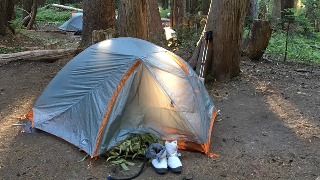
There are no electrical, water, or grey water hookups in any of the campgrounds.
*Tent pads vary in size and some larger tents may not fit.
Reserving a campsite
Reserve sites at the Cougar Rock and Ohanapecosh Rock Campgrounds by visitingRecreation.gov. For first-come, first-served sites at Cougar Rock and Ohanapecosh, pay at the campground office window.
White River Campground is first-come, first-served ONLY. To secure a campsite, use the Recreation.gov Mobile App Scan and Pay. Find and set up up camp at an unoccupied site then go to the campground kiosk where you will find a QR code.Use the app to scan the QR code and then pay when you regain connectivity. If you cannot download the app, cashless (debit or credit card) payments are accepted in White River Campground “iron ranger” kiosks. Going cashless helps eliminate theft and fraud, while decreasing administrative costs. NOTE: White River Campground does not have cellular service. Please download the Recreation.gov app before coming to the park.
If you plan to use the group sites at Cougar Rock or Ohanapecosh campgrounds between Memorial Day weekend and Columbus Day, you must make reservations.
NOTE: Marijuana on Federal lands: Mount Rainier National Park would like to provide clarification regarding the use and possession of marijuana on Federal lands. Washington State law, which allows for limited recreational marijuana use under certain conditions, has no bearing on Federal laws which continue to identify marijuana as a Schedule I illegal drug, and prohibit its use. More information posted on current conditions page.
Campground Regulations
Campsite Limits
Camp in designated campsites only. Sleeping in vehicles outside of campgrounds is not permitted.
Campsites are limited to a maximum of 6 persons (or immediate family) and two tents.
All vehicles must be parked within the designated campsite parking area and not beyond the barriers or on vegetation.
There are special sites designated for group tent camping.
Camping is limited to 14 consecutive days in any developed campground within the park and no more than 28 days total in any designated campground within the calendar year.
Length of Stay
A 14-day camping limitation applies to all camping.
Check out time is noon.
Fires
Keep fires small and within the closed grating provided.
Do not burn trash or leave trash in the grate.
Do not leave fires unattended.
Buy It Where You Burn It! Firewood brought in from other areas may contain invasive insect species that pose a serious threat to Mount Rainier National Park's resources... Please leave your firewood at home.
- Buy firewood near where you will burn it: that means the wood was cut within 50 miles of where you'll have your fire.
- Wood that looks clean and healthy can still have tiny insect eggs, or microscopic fungi spores, that will start a new and deadly infestation. Always leave it at home, even if you think the firewood looks fine.
- Aged or seasoned wood is still not safe. Just because it is dry doesn't mean that bugs can't crawl onto it!
- Tell your friends not to bring wood with them- everyone needs to know that they should not move firewood.
Firewood may be purchased from private wood concessionaires at the Longmire General Store, Cougar Rock, Ohanapecosh, and White River Campgrounds. See campground bulletin boards for more information.
Do not collect firewood, branches, twigs or cones. As these materials decompose they nourish the trees and preserve the quality of the forest.
Pets
Dogs, cats and other pets must be caged, on a leash (no longer than 6 feet) or otherwise under physical restraint at all times.
Pets may not be left unattended or tied to trees.
Pets are not permitted in amphitheaters or buildings, or on vegetated areas or trails.
Pets are permitted only in parking lots and roads open to vehicles.
All vehicles (cars, trucks, RVs, tent-trailers and utility trailers) must be parked on the gravel or paved area of your site and not beyond the barriers.
If you plan to leave your vehicle for more than 24 hours but will be staying in the park, inform the campground ranger of your plans so that your vehicle will not be considered abandoned property.
No utilities or connections of any kind are available.
Bicycles, Motorbikes, Roller Skates, Skateboards
Bicycles and motorbikes may be operated in the campground on roadways only, in the same direction of travel as other vehicles.
Motorcycles must be licensed for street use and drivers must have an operators license.
Travel on trails with bicycles or motorbikes is not permitted.
The use of wheeled vehicles (such as skateboards, roller skates, roller blades, scooters, etc.) is not permitted in the park.
To preserve the natural features of the park, driving nails into trees and creating ditches around tents are not permitted.
Do not feed any wildlife (including birds) in the park. Human food can cause digestive problems and can result in an animal's death or in injury to you. Keep Wildlife Wild!
Picking or cutting flowers, gathering or digging plants and trees are not permitted. Collecting rocks or other materials is prohibited.
Sanitation
RV sink drains must empty into containers which may be emptied into service sinks or toilets only.
Do not use water fountains or spigots for cleaning purposes. Wash dishes in a container at your campsite. Dump used water in camp sink located at the restrooms.
RV dump station located at the Cougar Rock campground is CLOSED for 2021 season until further notice.
Quiet Hours
Quiet hours are between 9 p.m. and 7 a.m. Keep noise to a minimum at all times and show respect for others.
Generator Hours
Generators may only be used between the following hours: 8 a.m. to 10 a.m., noon to 2 p.m., and 5 p.m. to 7 p.m..
Loop E of both Cougar Rock and Ohanapecosh campgrounds are closed to generator use at all times.
Thefts
Prevent thefts and protect your valuables. Do not leave valuables in your vehicle. Report suspicious persons or vehicles to a ranger.
Services
Service Station
Gasoline and automobile repairs are available in local communities outside the park.
Laundry and Showers
Laundry facilities are located outside the park in Ashford and Packwood. There are no public shower facilities in the park.
Supplies
Limited supplies are available at the National Park Inn at Longmire, Sunrise Lodge, and in the communities of Ashford, Packwood, Eatonville and Enumclaw. Ice is available at Longmire and in Ashford and Packwood.
Interpretive Programs
Ranger-led walks, talks, and campfire programs are scheduled daily from mid-June to early September. See park bulletin boards at visitor centers, ranger stations, and campgrounds for details.
Church Services
Services are available in surrounding communities. Inquire locally for schedules.
Group Campsites
Groups of 12 or more are permitted only in specific group sites.
Group sites are designed for tent camping only. RVs are not permitted in group sites.
At campgrounds throughout the park, parking is limited. Those using group campsites may need to consult the campground ranger to arrange additional parking.
Cougar Rock Campground Group Sites
Site 1 has a maximum capacity of 30 people.
Site 2 has a maximum capacity of 40 people.
Sites 3, 4 and 5 have a maximum capacity of 25 people per site.
A maximum of 5 parking spaces is available at each group site. Additional vehicles must park in the picnic area.