
USGS Photo Mount Rainier is an episodically active composite volcano, also called a stratovolcano. Volcanic activity began between one half and one million years ago, with the most recent eruption cycle ending about 1,000 years ago. Over the past half million years, Mount Rainier has erupted again and again, alternating between periods of high volume and low volume eruptions. The eruptions built up layer after layer of lava and loose rubble, eventually forming the tall cone that characterizes composite volcanoes. At one time, lava flows on opposite sides of the mountain probably projected more than 1,000 feet (305 meters) above the present summit at Columbia Crest which rises 14,410 feet (4392 meters) above sea level on the rim of the recent lava cone. The upper portion of the volcano's cone was likely removed by explosions and landslides. Mount Rainier's extensive glacier system then carved the volcano's cone into its current craggy form. Mount Rainier also sits on a subduction zone where colliding continental and oceanic plates cause regular seismic and geothermal activity. A subduction zone is an area where one continental plate is being forced underneath another into the earth's mantel. Mount Rainier experiences about 20 small earthquakes a year, making it the second most seismically active volcano in the northern Cascade Range after Mount St. Helens. 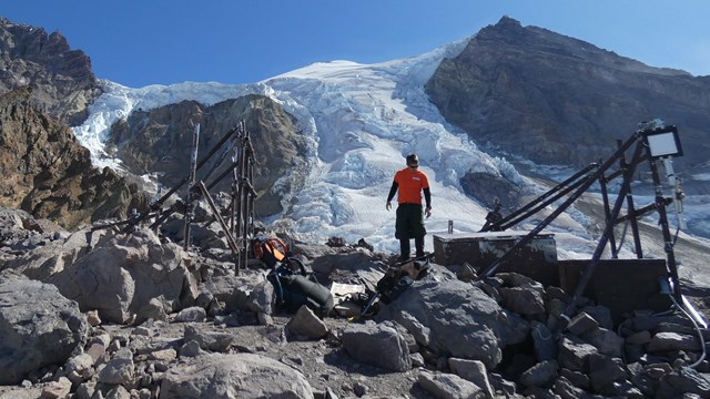
Seismicity
Seismicity is the study of earthquakes. Earthquakes are monitored on Mount Rainier as one way to track volcanic activity. 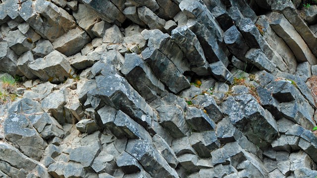
Volcanic Features
Mount Rainier is a volcano and many volcanic features can be found in the park. 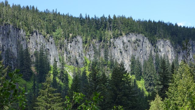
Geologic Formations
Explore Mount Rainier's geologic history through this selection of geologic formations. 
Hazards of Mount RainierMount Rainier, the highest (14,410 feet / 4392 m) volcano in the Cascade Range, towers over a population of more than 3.3 million in the Seattle Tacoma metropolitan area, and its drainage system via the Columbia River potentially impacts another 500,000 residents of southwestern Washington and northwestern Oregon. Mount Rainier is the most hazardous volcano in the Cascades not only in terms of its potential for eruption, but also the risk of producing major debris flows even without eruption. The potential hazards posed by Mount Rainier led to its inclusion as one of the sixteen volcanoes worldwide to be designated Decade Volcanoes. The Decade Volcano initiative is part of a United Nations program aimed at better utilizing science and emergency management to reduce the severity of natural disasters. Mount Rainier was chosen to be studied because it is representative of one or more volcanic hazards: it is geologically active as evidenced by surface manifestation of heat (geothermal activity), it has had recent volcanic events (last eruption was about 150 years ago), and it is likely to erupt again, based on past history; its location poses significant hazards to a heavily populated area; it is a well known volcano (a number of research publications have been written on it); it is politically and physically accessible for study; and its volcanic geology is well exposed. In 1992 National Park Service staff participated with other agencies and individuals to develop a science plan through the National Academy of Sciences, for organizing the needed research to evaluate the hazards and risks associated with Mount Rainier and for developing communication efforts of the risks for appropriate planning activities. The science plan was published in Mount Rainier Active Cascade Volcano and is available in the park library. Several studies related to geologic hazards are being conducted by the USGS, other federal and state agencies, and academic institutions. Additional Mount Rainier Volcano Information:Mount Rainier Volcano - USGS description, history, and news. |
Last updated: August 12, 2025