An official website of the United States government
Here's how you know
Official websites use .gov A
.gov website belongs to an official government
organization in the United States.
Secure .gov websites use HTTPS A
lock (
) or https:// means you've safely connected to
the .gov website. Share sensitive information only on official,
secure websites.
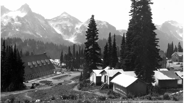
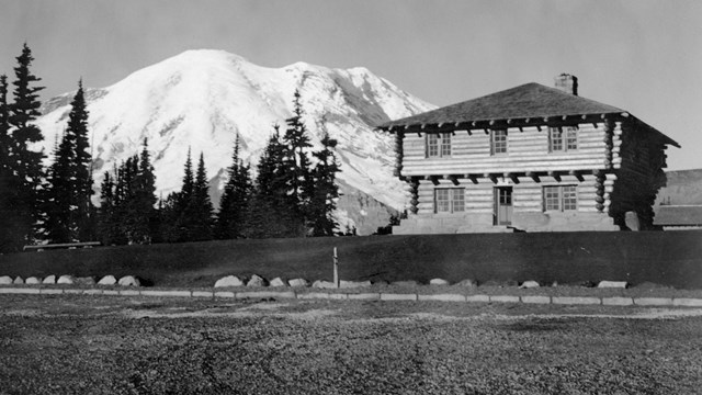
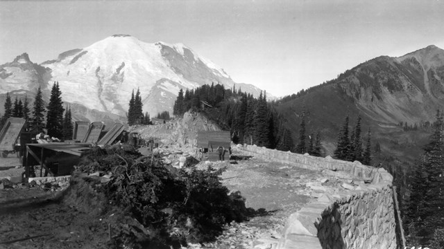
The Paradise Inn in 1940-41. The Inn contributes to the National Historic Landmark District as well as being independently designated a National Historic Landmark for its architectural style.
Mount Rainier National Park Archives
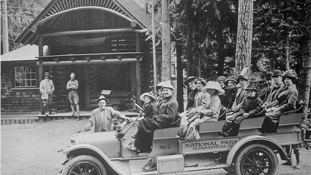
Beginning in the late 1920s, the master plan for Mount Rainier was the first and most complete national park master plan to be developed and implemented in the National Park Service. The park was treated as a synthetic whole – not a group of fragmented locations – and this consistent design can still be seen in the buildings, roads, bridges, trails, and developed areas. No other park has preserved as much of an intact example of park planning from this period as Mount Rainier National Park which is why it was designated a National Historic Landmark District in 1997.
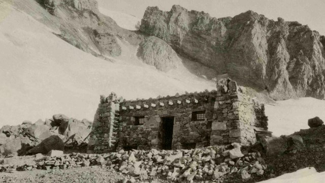
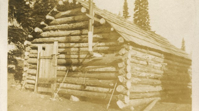
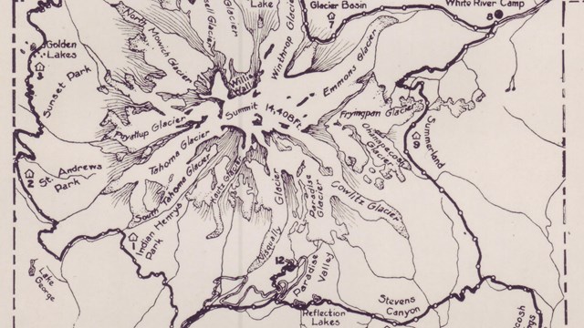
The Mount Rainier Historic Landmark District encompasses all of the park roads, historic developed areas, and historic backcountry structures and makes up 3% of the park’s area. While some portions of the district are discontiguous, or disconnected from other areas, the main historic corridor is tied together by a system of park roads that connects all major developed areas of the park and includes the Wonderland Trail (a 93-mile loop trail system around the mountain) and two spur entrance roads in the northwest corner of the park (Carbon River and Mowich Lake roads). The discontiguous part of the district are 13 backcountry cabins and shelters, four fire lookouts, and Camp Muir, a climbing basecamp located high on the mountain. These backcountry historic areas and trails are also part of the park's designated wilderness, which includes approximately 97% of the park.
Most of the buildings in the historic district and some of the structures were previously listed in the National Register of Historic Places in 1991. Some buildings are also independently designated National Historic Landmarks for their architectural significance. Within the historic district there are historic buildings, structures, and objects:
Buildings, such as houses, ranger stations, and visitor centers, are constructed to shelter any form of human activity.
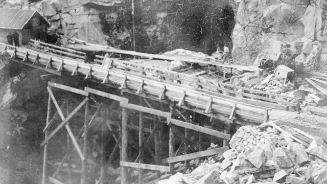
Structures are constructed to serve some human activity, such as roads, bridges, trails, and entrance arches. Structures are distinguished from buildings in that they are usually made for purposes other than creating shelter.
Objects differ from buildings and structures by being primarily artistic in nature or are relatively small scale and simply constructed. Although they can be movable, objects may be associated with a specific setting or environment.
A stone marker for Mather Memorial Parkway (SR410) at the junction with Sunrise Road is a contributing "object" in the Mount Rainier Historic Landmark District.
NPS Photo
Each of the buildings, structures, or objects is also defined as contributing or non-contributing. Contributing means it adds to the historic associations or qualities of the area, while non-contributing means it does not. A building, structure, or object can be non-contributing because it was not present during the period of significance, or has been altered, disturbed, or changed enough to no longer possess historical integrity, or does not independently meet the National Register criteria.
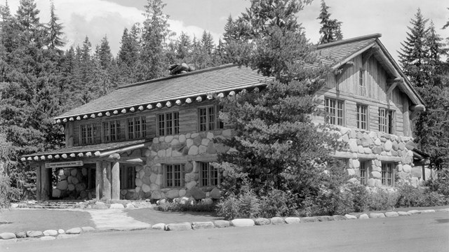
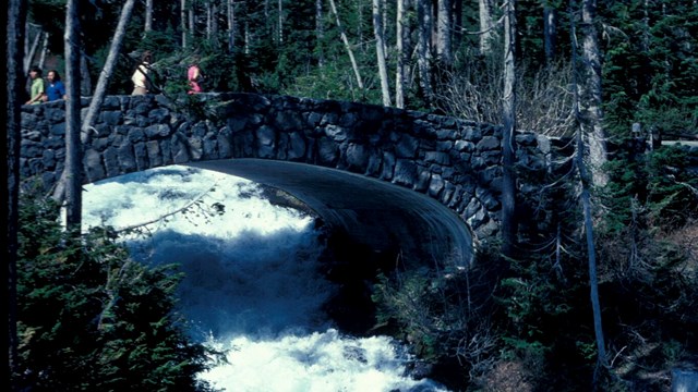
In addition to the overarching Mount Rainier National Park historic district, many of the developed areas in the park are independently recognized as historic districts as described in the sections below. A historic district possesses a significant concentration or continuity of sites, buildings, structures, or objects united historically or aesthetically by plan or physical development. At Mount Rainier, in addition to being part of a cohesive master plan, historic districts follow the aesthetic of National Park Service (NPS) Rustic style architecture. Designers selected massive logs and glacial boulders as the building materials best suited for integrating new structures with their natural settings. Entrance stations, administration buildings, employee residences, and even comfort stations were all built to blend with their natural surroundings. Roads curve with the landscape, highlighting views while bridges frame waterfalls. For many people, this impressive architectural style contributes to the special sense-of-place quality which makes national parks a distinctive part of the American landscape.
Each of the park’s historic districts has its own period of significance when the majority of the area was developed or constructed. The Mount Rainier National Park Historic Landmark District’s overall period of significance is from 1904 to 1957.