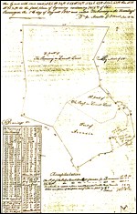
So, how do archeologists find all the cool stuff they dig up? First, they form a set of research questions that they want to answer. For example, What did the landscape look like in Colonial times? Or, How did the lines of battle progress during the Battle of Monocacy? Or, Are there unique resources in this area that might be harmed if a construction project is undertaken here? Once researchers determine their research questions and establish goals for their study, there's a lot to do before they go out to the field. First, they have to do a lot of historical research on the area and people they are studying. This might include talking to those who have lived there over the years, looking at old photographs, reading diaries and journals, reviewing wills and court documents, and looking at land records. Then, armed with the information they've gathered, archeologists study the physical landscape to determine where archeological resources might be located, and what the best methods might be to answer their research questions. This planning must also consider the time it will take to conduct the study, how many people are available, and what funds are on hand. 
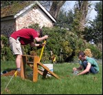
What Field Method Should Be Used? Many field survey techniques are available to archeologists, so choosing the right one depends on many factors, including time, field conditions, research questions, the size of the area to be studied, the amount of funding available, and other things. At Monocacy, techniques employed have included pedestrian surveys and controlled surface collection, systematic metal detecting, gradiometer surveys (a gradiometer is a complex machine which detects magnetic variations below ground), backhoe trenching, shovel test pits (STPs), and excavation units (EUs). Researchers conduct what are known in archeology as "Phase I," "Phase II," or "Phase III" investigations. Phase I research involves limited systematic testing of an area to assess what specific locations might be of interest for more detailed investigation. Phase II excavations are follow-up investigations at those areas identified in Phase I, and usually focus on determining their time period and use. Phase II investigations also determine whether an archeological site is eligible for listing on the National Register of Historic Places, an inventory of things that are of national historical significance. Phase III investigations are large-scale excavations aimed at full data recovery. Both Phase I and Phase II investigations have been undertaken at Monocacy National Battlefield. All archeological investigations must be carefully structured and documented so that every aspect of the recovered data can be understood and analyzed. It is also important that methods and results be reproducible, to facilitate future research. 
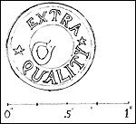
Once the Artifacts are Recovered, Are We Done? No! In fact, much of the detail work is just beginning. All artifacts excavated must be "provenienced." This is a fancy way of saying that we know exactly where they came from. For example, an artifact's provenience might be: Now that we have documented where each artifact came from (and there are over 45,000 for the Best Farm alone), they need to be cleaned, numbered, and cataloged. Cataloging is a painstaking process in which all the attributes of an object are recorded,including its type; what it's made of; when it was manufactured or used; its size, color, and or weight; or any other special characteristics, among other things. Finally, all this information is entered into a database and the GIS for analysis. Artifacts are bagged and grouped by provenience and then placed in a curatorial storage facility for safekeeping. 
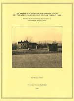
Getting the Word Out Of course, asking the right questions is the key to a good research design. So the next step is to analyze the historic data and the archeological data we've gathered to see what we learned. This analysis involves looking at the types of artifacts, their relationship to each other and to the landscape, the features (such as post holes, foundations, middens, etc.) that were found, etc. Were our questions answered? Were new questions raised? Do we need to employ different techniques to improve our results? Maps and GIS play a big role in these analyses, and once the data are interpreted, the archeology staff produces a report to explain what was found and make recommendations for future study. Information is provided to the archeological community via technical reports and peer-reviewed journals, and to the general public via popular publications, interpretive programs, and the internet. Then the process starts all over again on the next project! |
Last updated: June 9, 2020
