
NPS / K. Lewandowski Mojave National Preserve has miles of adventures to explore. Not every road within the Preserve is suitable for standard passenger cars. The majority of our off-pavement roads require high clearance and 4WD. This section is an introduction to sights along the primary roads in the Preserve. It is strongly recommended to check current road conditions prior to beginning your adventure at Mojave National Preserve. 1.6 Million Acres to Choose From... Mojave is a massive preserve. With so much room to roam, you'll want to plan ahead so you know you'll have enough gas, water, and food to survive on your own. Attractions are far apart and may require a 4WD vehicle. Come prepared for rugged desert adventure.
Cima Road is an 18 mile paved road that connects Interstate 15 to Cima, California. Cima Road passes through a forest of Joshua trees (Yucca brevifolia jaegeriana). Sadly, many of Joshua Trees seen on this road burned in the August 2020 Dome Fire. Essex Road is a paved road and is the gateway from Interstate 40 to Hole-in-the-Wall and to the Providence Mountains State Recreation Area (home of Mitchell Caverns). To reach Hole-in-the-Wall simply travel 10 miles north on Essex Road, make a right, and then travel and additional 10 more miles on Black Canyon Road. Providence Mounatains State Recreation Area (Mitchell Caverns)
Kelbaker Road is a 56 mile road and is one of the primary paved roads in Mojave National Preserve. This road connects Interstate 15 in Baker to Interstate 40. Beyond the Preserve, Kelbaker Road continues further south connecting to Route 66, Amboy, and eventually Joshua Tree National Park and Twentynine Palms.
Ivanpah Road is a 27 mile road that connects Nipton Road to Lanfair Road.
Lanfair Road is a 19 mile that connects to Ivanpah Road and ends on Route 66 in Goffs, California. Together these two roads are 46 miles. Ivanpah and Lanfair Roads are paved at the north and south ends. The middle 15 miles are rough, rocky dirt roads, that are not suitable for 2WD. Check road conditions before attempting to cross in a standard passenger vehicle. Nipton Road is a paved road leading from I-15 to the desert town of Nipton (which is currently for closed and for sale).
You have reached the end of the alphabet if you are on Zzyzx Road! This is 4-mile road and is located 6 miles west of Baker off Interstate 15. Zzyzx Road is suitable for all vehicles. This road ends at the California State University Desert Research Center, which is private property. All buildings at Zzyzx are on private property that is home to the California State University Desert Studies Center. This is an operating educational campus and is closed to the public. Zzyzx is not a ghost town.
Black Canyon Road goes from Essex Road to Cedar Canyon Road. This road is only paved between Essex Road and Hole-in-the-Wall Campground. Beyond the campground this road is passable to 2WD, but we encourage 2WD visitors to use the paved roads whenever possible. 
Camping
Camping is in tents, RVs, vans, and more but prepare for possible crowds on weekends. 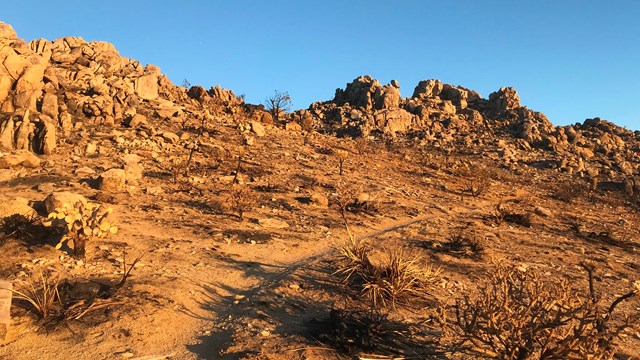
Established Trails
Explore our established trails! 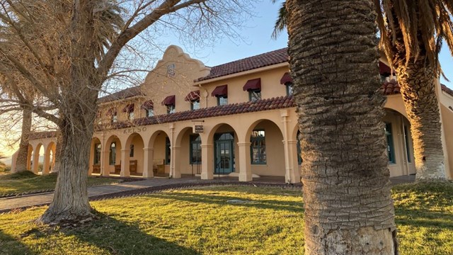
Visitor Centers
There are two visitor centers in the preserve. See what's open and operating hours before you head down the long lonely road. 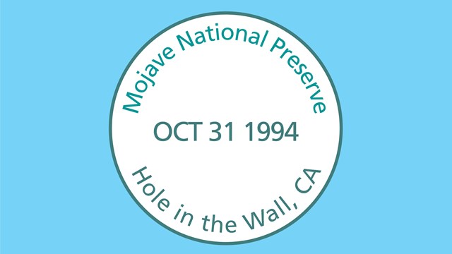
Passport to Your National Parks
Stop by one of our visitor centers, or download an editable stamp PDF sheet |
Last updated: November 21, 2024